
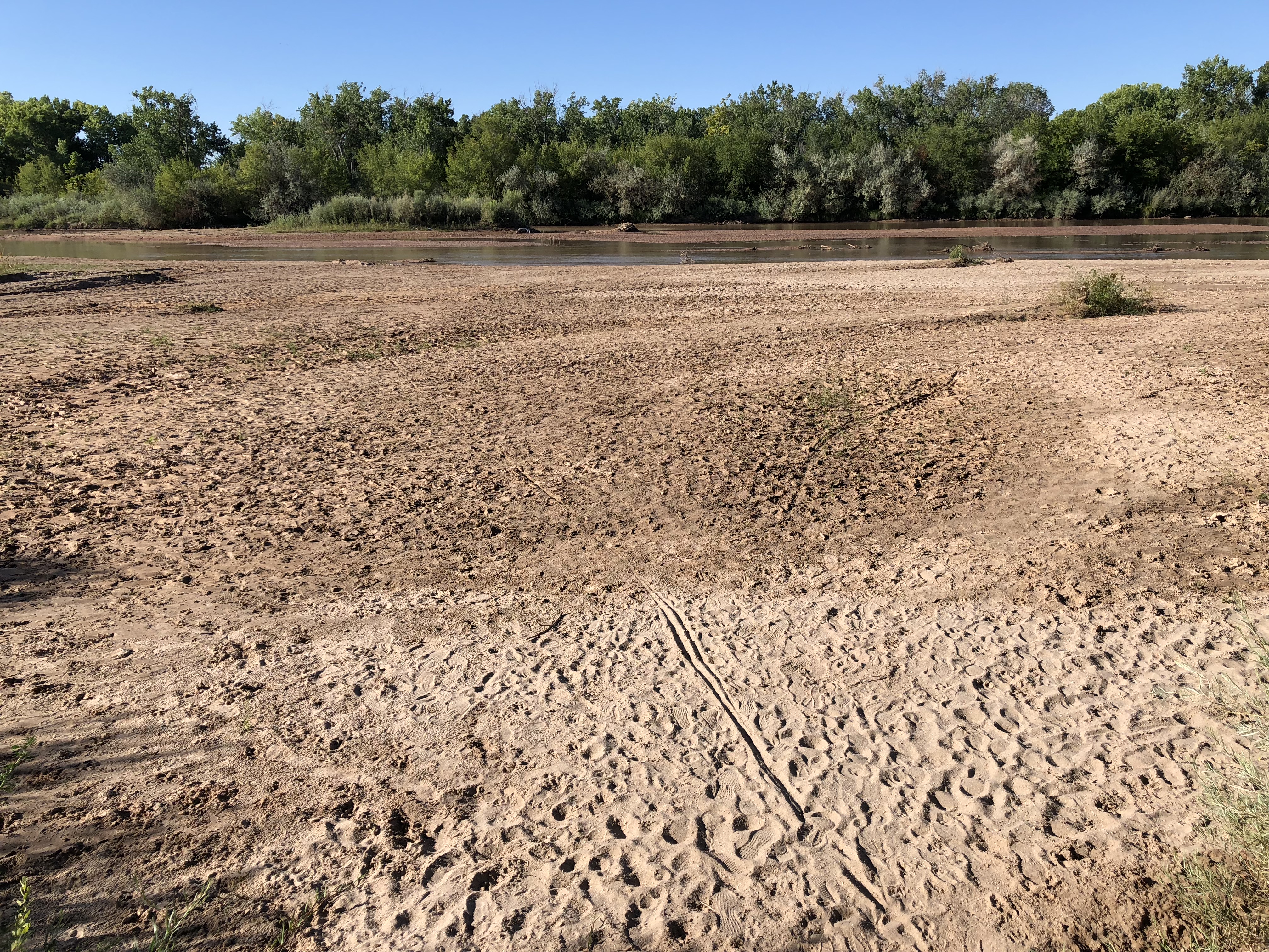
I went on a bike ride this morning to get a look at the Rio Grande through Albuquerque. Flows dropped below 100 cubic feet per second Thursday evening for just the second time since we moved here in 1990. Flows this low are hard to measure – we didn’t get a numerical picture of just how bad things are until the USGS river measurement people calibrated their Central Avenue gauge Friday morning.
The other time we had flows this low during my tenure as an Albuquerque resident was September 2013 (I remember it well, I was covering the heck out of the river for the Albuquerque Journal at the time). But it’s worth looking back in time, because the flows we’re seeing this year, which are freaking me out, used to be a nearly annual affair. Here’s a plot of annual minimum flow, based on USGS data:
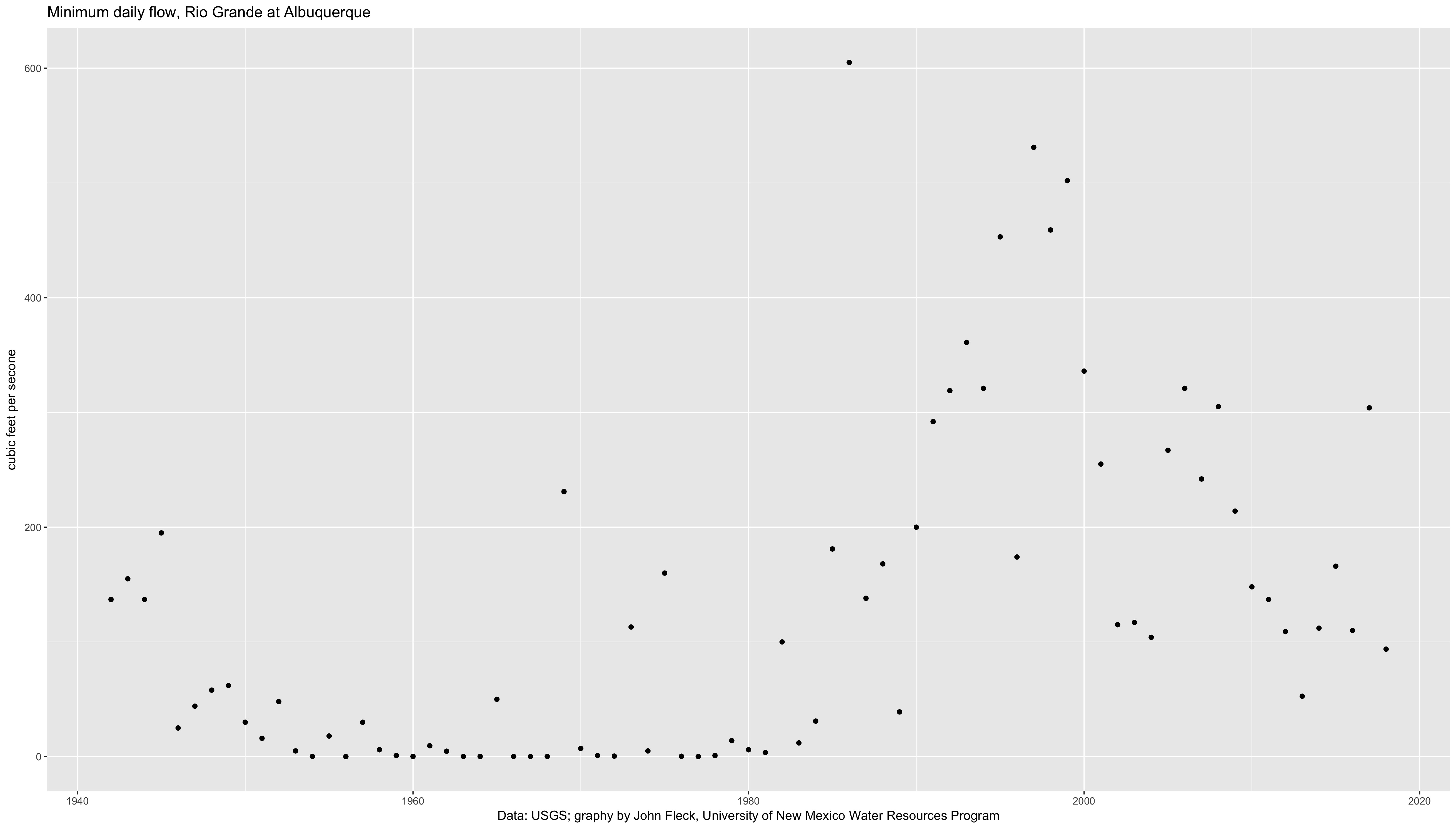
Annual Rio Grande low flows
This is a classic result of what I’ve come to call “an institutional hydrograph”. A hydrograph is a graph of flow on a river over time. In its normal form, it responds to seasons, weather, and climate. But in its institutional form, it responds to rules and policies and norms of human behavior in managing the river.
Those zero-flow points on the left half of the graph are institutional. From the mid-1940s to the early 1980s, we dried the river through Albuquerque almost every year. I phrased it that way on purpose – not “the river went dry” but “we dried the river”. If you look at upstream gauges, there was water in the Rio Grande, flowing into the central valley where Albuquerque sits. But the irrigation agency that provides water to this valley’s farmers diverted it all, running its ditches full, so that by the time the Rio Grande reached Albuquerque, it was dry.
I’m hazy on some of the history, but by the time I started paying attention to the Rio Grande in the 1990s, a combination of community environmental values and the strictures of the Endangered Species Act had triggered changes in irrigation management. As a matter of policy we now leave water in the river. So for my generation of river-watchers, this is a really striking thing to see:
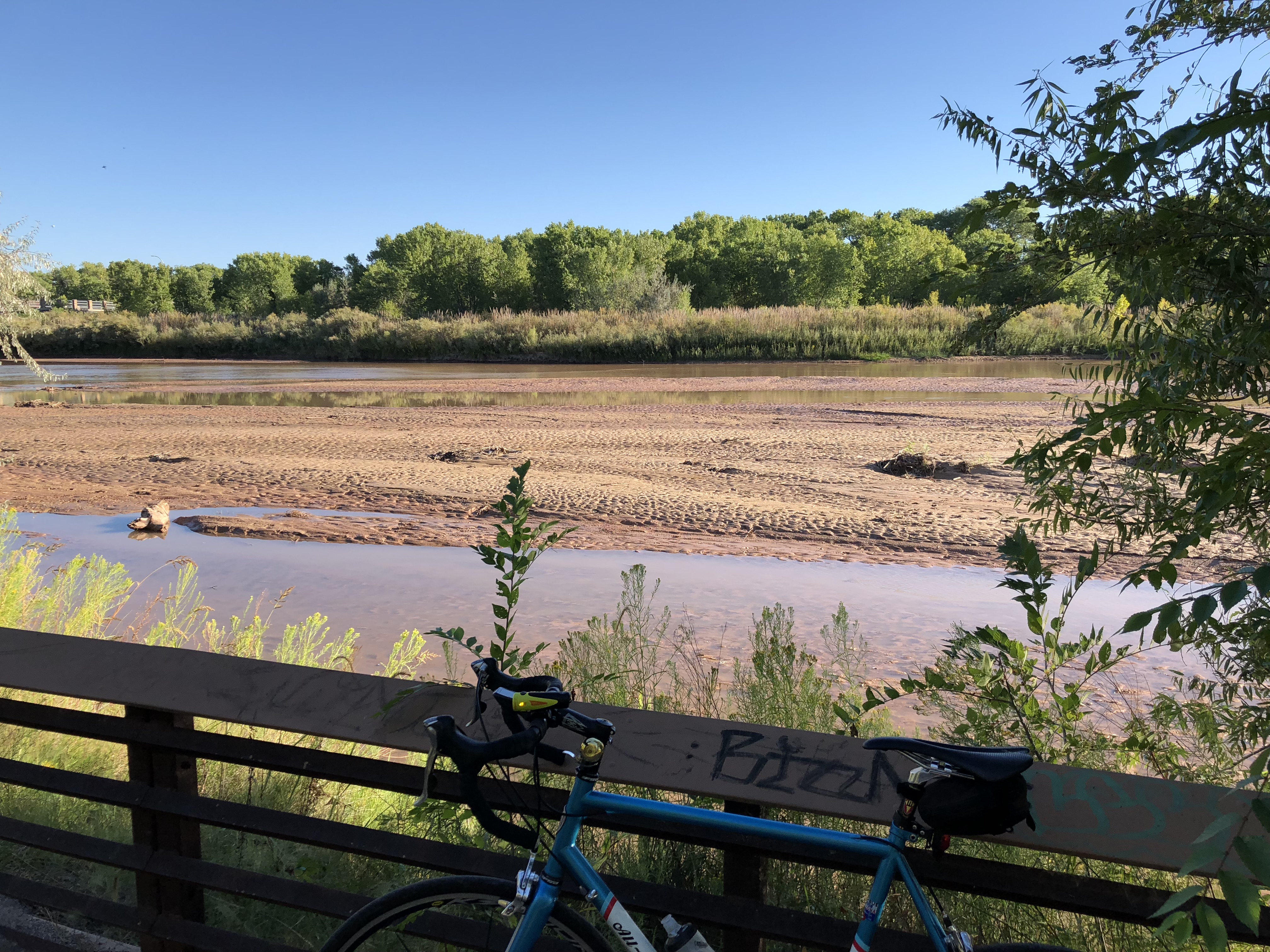
Rio Grande south of Albuquerque’s Central Avenue Bridge, Sept. 15, 2018, by John Fleck
John:
In the 40s the State Engineer gave up his administration of MRG and abdicated it to t he MRGCD which began providing water to every TD&H..They did this with attention to supply. When I was named Natural Resource Trustee the MRGCD was diverting 600,000 acre feet. I appeared before the Board one evening and pointed this out and was called every name in the book. They did curtail their diversions but the goose was already in the garden.The 40’s were low flow times but domestic and municipal demand was low so who was paying attention. Now we have low flow and not enough water to go around. So, rather than terminate the use of those parties who got water illegally in the 40’s they have begun protesting every transfer out of the district. Those allowances are still illegal and should be curtailed. The MRGCD will say the legislature gave them all of the water that they reclaimed and that statute is unconstitutional for, as you know, the beneficial use of water shall be the basis the limit and the measure of the right to to use water. The MRGCD is a quasi-governmental organization which by definition is not a beneficial user of water. They are a storer and conveyancer of water and that does not give them water rights.
Yeah, when I was growing up in Albuquerque we moved to near the Alameda Bridge around 1962. The river south of the bridge dried totally and completely every summer – this was “normal.” I’m saying dry sand from bank to bank, not a hint of moisture. Older teens & those even a bit older would have beach parties in the riverbed down around the Calabacillas Arroyo junction.
Yep. My first visit to Albuquerque was in Aug. 79 and it was dry. Then moved there April 81 and it was then too. Both show on graph. As newcomer then I thought was normal.
Well I have alway refered to the Elephant Butte Reservoir not as the place we send our surplus water but as the place we send our water to dry.