
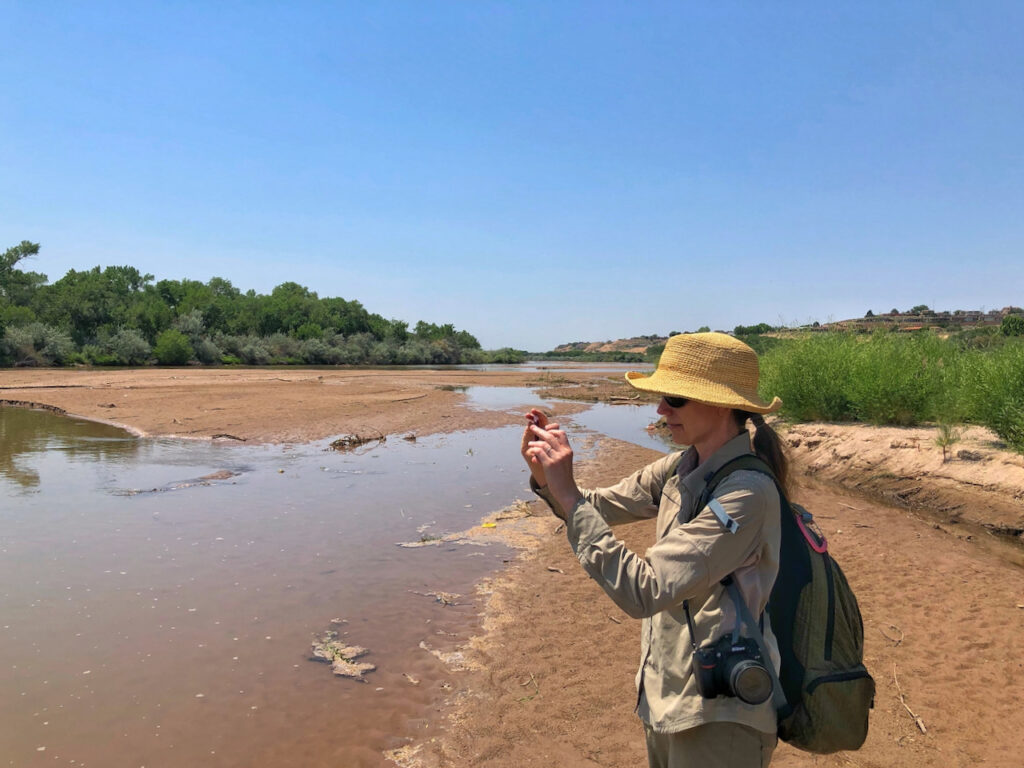
Mary Harner, University of Nebraska at Kearney: field work on the Oxbow reach of the Rio Grande in Albuquerque, June 16, 2021
We’re having a moment right now on central New Mexico’s Rio Grande as we gird for a drying river through the Albuquerque reach for the first time since 1983. Expect drying to first start showing up below the Rio Bravo bridge sometime in July, between the bridge and the Albuquerque wastewater treatment plant, where the outfall re-wets the river down in the far south valley.
In recent years low flow-year drying has been routine in the stretch south of here, between the metro area and Elephant Butte Reservoir. But not here in town, at least since 1983.
UNM Water Resources Program student Annalise Porter has “adopted” the gauge at San Antonio, 90 miles south of here, which has been a painful but illuminating choice. Here it is last year at this time:
Rio Grande in San Antonio/Hwy 380, New Mexico this morning. Damn. I didn’t expect it to be *bone* dry like that. The sand/dirt looks like it’s never seen water at all. (1/4) pic.twitter.com/uotlWLhrft
— Annalise (she/her) (@annalisemporter) June 27, 2020
Last year the gauge first hit zero May 31. A bit of luck this year in the form of Memorial Day weekend rain, combined with (maybe) some clever river management by the humans (more research needed), has kept it from drying there so far. But luck and cleverness have just about run their course. We now expect drying down there soon.
I’m headed back out to the river this morning with my UNM Water Resources Program colleague Becky Bixby and our pal Mary Harner from the University of Nebraska. I first met Mary back in the late 1990s, when she was doing her doctorate at UNM studying the ecology of what we here call “the bosque” – the riverside woods through the city.
We’ve stumbled into a strategy for the bearing of witness, each picking spot on the river to watch – Annalise the San Antonio Bridge, Becky with another of our students the Los Chavez stretch near Los Lunas, my repeat photography at the Central Avenue Bridge. Becky, Mary, and I keep ending up out at the Oxbow, a bit of wetland sheltered by a bluff on the river’s west bank right in the middle of town.
Becky’s a wizard with the ecosystem at the tiniest of scales – the diatoms (a kind of algae – I call it “Becky goo”) that live in quiet waters on the edges of systems, life at the base of the food chain. As the water gets low, the Becky goo at the boundary between Oxbow wetland and river gets super interesting. (If you look closely at the picture of Mary above, you can see the bits of Becky goo clinging to the water’s edge.)
Mary’s leading us on a fascinating collaboration, and while she’s been here this week we’ve been brainstorming the paper that we hope to emerge diving into the human-river relationship, and the landscape change along its margins, over the last century. Mary and her collaborator Emma Brinley-Buckley (an amazing artist-scientist) have brought an incredible set of data visualization and communication skills to the effort (Albuquerque river nerds – OK, all river nerds – check out their work on the middle Rio Grande). But as much as we can accomplish with archives and digitized aerial imagery, there’s no substitute for getting out and getting our shoes muddy.
Look! Each generation seems to have to learn the lessons of history.
In 1861 the Rio was dry from Socorro the El Paso,
In 1865 The Rio was dry for 6 weeks.
In 1892 the Rio was dry
I 1894 the Rio was dry by June 5th
In 1896 the Rio was dry by June 1
In 1908 the Rio was dry below Rincon
In 1910 Yeo reports there was no water in the Rio on September 26
1913 EBD was finished and little water south as reservoir was filled
From 1956 through 1957 the Rio was virtually dry.
In 1979 at trial in Jicarilla v. ADQ & OSE & USBR, attorneys for defendants claimed EB would never spill. In mid 90s it spilled several time taking with it all of San Juan Chama water in the recreational pool because that water floated on top of the native RG water.
HAGD
Conclusion
You gotta be pretty tough to live in the RG Valley. The list above doesn’t even touch on the diluvian floods that wiped out San Marcial and Tome. The Tome floods were reported in the NYT.
Do you have info on the water table? Effects on vegetation near to and further from the river bed?
BEMP has information on the water table from a number of measuremet sites. It can be generally defined, when the river is flowing, by drawing a line from the elevation of the river and the water level in the nearest riverside drain.
Bill is right that the river dried many times historically. The significant changes to River and reservoir operations in the last twenty years including the multi-use of San Juan Chama Project (SJCP) water have masked that historic reality.
Also, as to right now, looks to me like mrgcd is releasing its 2021 SJCP to meet its farmers needs and, perhaps, hold river flows until monsoon rains arrive. Not sure how much of that water remains.