Closing in on a post-2026 Colorado River management deal (some terms and conditions may apply)

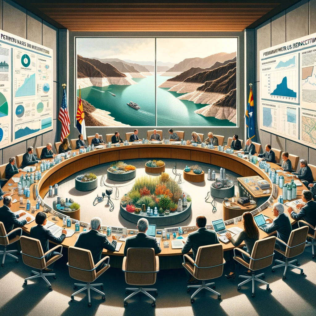
DALL-E thinks we need a very large table for this, suggesting a broad need for “collective agency” to go along with our “collective action”.

The news out of last week’s Colorado River Water Users Association is that, behind the scenes, a deal is taking shape with the potential to bring Colorado River Basin water use into balance with water supply.

The deal would eliminate the “structural deficit”, and creates a framework for a compromise over the Upper Basin’s Lee Ferry delivery/non-depletion obligation.

This is huge. But so are the caveats – in terms of both the challenges remaining for a deal, and the definition of the problem we are trying to solve.

The U.S. Lower Basin states – California, Arizona, and Nevada – have converged on a set of numbers to permanently reduce their use on a year-in, year-out basis by a minimum of 1.25 million acre feet per year, eliminating the “structural deficit” – the year-in, year-out gap between inflows and outflows that has drained Lake Mead over the last two decades.

California and Arizona seem to have found a path to a compromise (the details of which have not been made public) after the early-2023 cage match that seemed to place us on the path to interstate litigation, with six states arguing for sharing the pain and California insisting on a priority administration that would have largely placed the burden of the impact of climate change on Arizona.

If separate negotiations with Mexico lead to additional reductions south of the border (which is how this has played out in the last two rounds of basin scheming), total durable, permanent Lower Basin reductions on the order of 1.5 million acre feet a year appear to be within reach.

If more cuts than that are needed to balance the system, the Lower Basin states at CRWUA made it pointedly, publicly clear that they are asking the Upper Basin states to share in the additional pain.

Implicit in that final point is the opportunity for a version of what we used to call the “Grand Bargain” – a Lower Basin concession that the river’s flow may not be sufficient to deliver 82.5 million acre feet per year. That would require even deeper cuts in the Lower Basin. To avoid interstate litigation over a Colorado River Compact delivery shortfall, the Lower Basin is offering a “Modest Bargain” of a sort – an Upper Basin contribution of water matching in some way (it’s not clear in what proportion to the additional Lower Basin cuts) in return for the Lower Basin not wading into a legal fight over the meaning of Article III(d) of the Colorado River Compact.

To the extent that this moves from the meeting rooms and hallway conversations of CRWUA to public view, the seven states need to come together on something that can be put down in writing, publicly, by (I think) March in order for the Bureau of Reclamation wizards to begin the modeling work. So this is on a very fast track.

This is a very big deal, and very good news. But….

Some terms and conditions may apply

There are a bunch of caveats.

The final AZ-CA-NV split of the 1.25-ish million acre feet is not fixed, but it is close, converging on a set of numbers that make sense, respecting some of California’s senior priority status, but not insisting on it as thoroughly as the state’s proposal of last February.

Suffice to say that the remarkable Lower Basin use numbers this year – currently at 5.8 million acre feet for the three U.S. states, the lowest total U.S. draw on Lake Mead since the modern record-keeping regime began in 1964 – shows that cuts like this are totally doable without wrecking the economies of the three states.

If we don’t have three-state numbers yet, we’re a lot farther from figuring out how each of the three states will divvy up the cuts among their users. This will be hard. Well for two of the states, anyway, Nevada just has one major user to do the divvying.

But will voluntary cuts of the scale needed be possible without the big inflow of federal cash that has helped so much this year? The precedent set by all the money sloshing around the Lower Basin right now poses a challenge.

And what of the Upper Basin’s relentless “it’s a Lower Basin over-use problem!” rhetoric over the last year. Now that the Lower Basin folks have basically said “Yup, and here’s what we’re gonna do about that”, have the Upper Basin folks painted themselves into a corner that makes the broader compromise needed on the next steps that much harder?

Who’s at the table right now?

All of this is predicated on a narrow definition of the problem we are trying to solve, which is basically a mass balance problem – figuring out how to match our use of water with the supply available, rather than over-using and draining the reservoirs. This is important! But it’s not the only thing.

This is a process dominated by the economically and politically powerful current water users. If we have a collective action problem here, we also have a “collective agency” problem. It is a system under which “agency” – the power to influence outcomes – is tightly controlled and narrowly distributed.

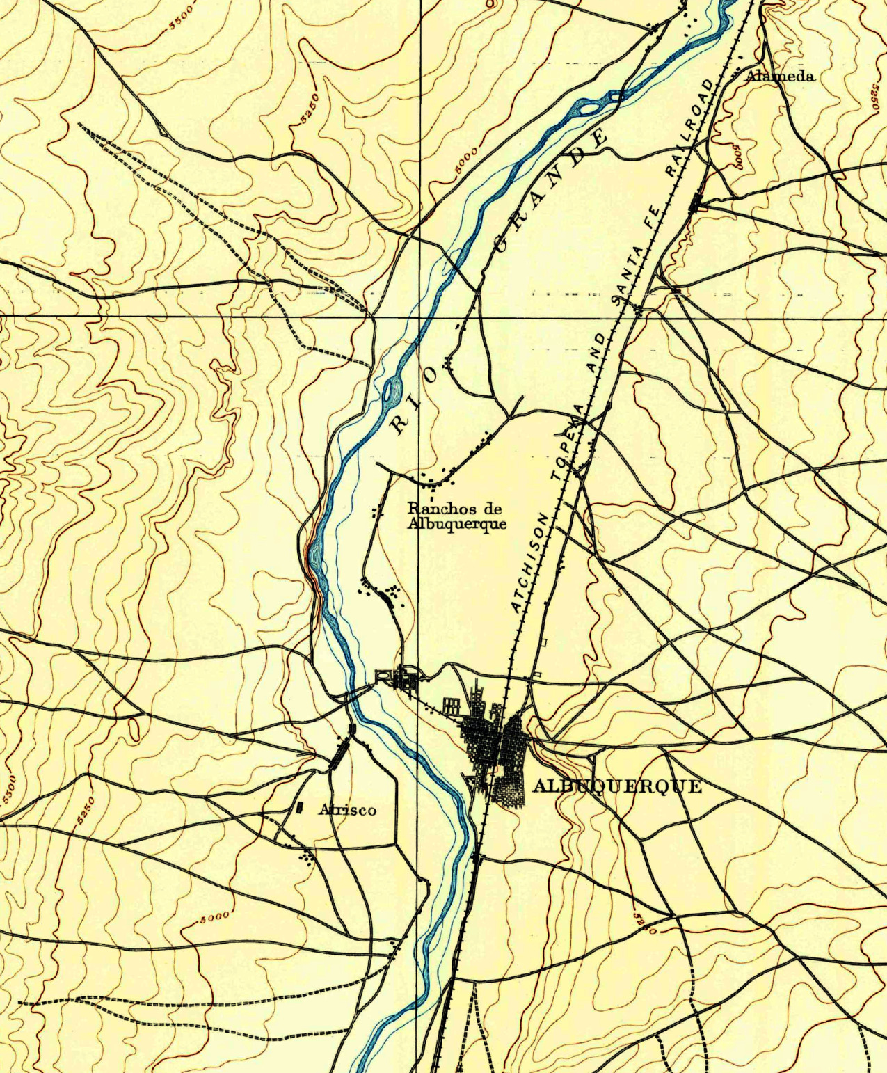
What about interests other than the big water agencies and their representatives in state government? This is clearly a state-to-state conversation right now, heading toward a desire for a seven-state proposal come March. In the last two rounds of this – the 2007 Interim Guidelines and the Drought Contingency Plan – the states’ proposals have carried the day.

What about the Colorado River Basin’s 30 Tribal Sovereigns? It’s not clear to me how their needs and interests are being incorporated into this process. In this regard, one is reminded of Neil Gorsuch’s dissent in this year’s Navajo decision, where he analogized to the tribe standing in line after line again and again at the DMV, only to be told that this isn’t the right line. Then which is?

What about non-water-consuming environmental values, which have similarly had a hard time figuring out which process might be the right one? The states could, in theory, act on behalf of those non-water agency interests in the deal they’re so furiously negotiating. Will they? Will the federal government step in and insist if the states don’t?

There was hope as we headed into the negotiation of the post-2026 river management regime that broader interests and values would be represented. It will be interesting to see what else beyond a seven-state proposal gets consideration in the discussions to come.

A note on sources and methods: I spent last week resting, looking at art, watching falling snow, reading a book (actually several), and not going to CRWUA. My deep thanks to my many friends who attended and filled me in what they heard and saw. All errors are mine. (Also, is that a Cocker Spaniel in the picture, a couple of seats to the chair’s left?)

Jardins du Nouveau Siècle

train tracks crossing a barren valley

Going across the Rio Grande River Valley on the Atchison, Topeka and Santa Fe Railroad between Vaughn and Belen, New Mexico. Jack Delano, 1943, Office of War Information

One of the first books Bob Berrens suggested I read when we began working together was Voltaire’s Candide. This has come in handy.

Candide is a bit of a romp, a picaresque in which our hero has all kinds of horrifying misadventures before settling down to tend his garden.

Il faut cultiver notre jardin.

Our forthcoming book Ribbons of Green: The Rio Grande and the Making of a Modern American City, is part of the University of New Mexico’s Press’s “New Century Gardens” series, a conceptual framework that sent us down the Voltaire translation rabbit hole.

The evolution of Albuquerque’s relationship with the Rio Grande involved a dramatic hydrologic alteration of the Rio Grande through the valley in which we live, the creation of an integrated system of flood control, drainage, and irrigation that, in an instant, changed the river and the communities relationship with it.

The common, and famous, translation of Voltaire’s line is that “We must cultivate our garden.” In our modern usage, “garden” carries a connotation of a bit of land around the house where we grow some flowers and vegetables and maybe a fruit tree. But in recent years translators have reached back to the French of Voltaire’s time to suggest a broader version, a tended landscape – “We need to work our fields,” or “We must work our land.”

Here is translator Burton Raffel:

Note that in Voltaire’s day the French word “jardin” meant “fields” or a place where one cultivated either medicinal plants or assorted vegetation from around the world. Indeed, until the nineteenth century the English word “garden” had the same meaning; the adjectives “flower” or “private” were still required to indicate the newer and now prevalent meaning. At the end of Candide the word Voltaire uses, jardin, has been regularly mistranslated (for our time) as “garden.”

The word “garden” played a lively role in the development of Albuquerque’s integrated system of flood control, drainage, and irrigation, a rhetoric at times bordering on the Edenic.

It was a fun bit of scaffolding from which to hang a book.

The Mystery of the Chinese Junk

With the book manuscript handed off to University of New Mexico Press, and fall semester (and grading) done, I’m taking some time off.

CRWUA, or not

I’m skipping CRWUA this year. Y’all seem to be doing fine right now on Colorado River stuff, and to the extent you’re not, I don’t feel like I’ve got much to contribute. As Jack pointed out last week, the reservoirs are up. Plus they haven’t found any new Lake Mead bodies lately. Water use is down, good job y’all.

The Mystery of the Chinese Junk

Cover of the Hardy Boys book The Mystery of the Chinese junk, with the brothers at the wheel of a motorboat.

The Mystery of the Chinese Junk

I’m putting up an away message on my work email, and I’ve squirreled away a few books to pass the time.

First on my list is The Mystery of the Chinese Junk, circa 1960, by “Franklin W. Dixon”. Frank and Joe buy an old Chinese junk. Danger and excitement ensue!

I had a hard time figuring out originals and updates and stuff, but I think the one I got from the library is the original.

Other reading for the break:

  • The Power Broker, by Robert Caro. Robert Moses tries to built stuff in New York City. Danger and excitement ensue!
  • The Secret Panel, by Franklin W. Dixon. Originally published in 1946, I think I’ve got the 1969 revised version, though it’s also got a 1974 copyright date. See above re danger and excitement.
  • The Death and Life of Great American Cities, by Jane Jacobs. Jacobs confronts Moses’ rebuilding of New York City. Danger and excitement ensue!
  • The Tower Treasure, by Franklin W. Dixon. I’m confused about the dates on this one, the cover suggests a recent re-release, but text looks old-timey, but who cares, it’s a Hardy Boys mystery! Danger and excitement are sure to ensue!

‘So Far, So Good’ for the Colorado River Watershed in 2023

An Inkstain guest post from Jack Schmidt, crossposted with encouragement from the Utah State University Center for Colorado River Studies

By Jack Schmidt | December 7, 2023

In Summary

By the end of November 2023, storage in the reservoirs of the Colorado River watershed had been reduced 1.73 million acre feet from the high of mid-July. We’ve used 21% of the gains from the exceptional 2023 runoff, a drawdown slower in the annual cycle than in it has been in all but one year of the previous decade. New policies to reduce basin-wide consumptive use may be working. To date, about one-third of losses were from Lake Powell and Lake Mead, one third from CRSP reservoirs upstream from Lake Powell, and one-third from other Upper Basin reservoirs. Losses in the combined storage in Lake Powell and Lake Mead specifically have been much less than in previous years.

Reservoirs are the ultimate buffer between water use and a water crisis, especially during extreme dry spells, such as occurred in 2002-04 and 2020-22. Although the runoff in 2002-04 was worse than the later event, the later one caused relatively more alarm, as reservoir storage was already low. Then the exceptional water year in 2023 provided the second largest runoff of the 21st century and restored some lost storage in the reservoirs. We still have a long way to go to return the reservoir system to full conditions (see blog post, Water Year 2023 in Context: a cautionary tale). There is an imperative to retain as much of the 2023 runoff as possible to create a buffer, especially if another dry spell occurs.

Some Context

The last time the basin’s reservoirs were completely full (in fact, a bit overfull) on July 15, 1983, they held 63.6 million acre feet (af) of water, as reported in Reclamation’s basin-wide reservoir database. Today, the maximum capacity of the reservoir system is a bit extended, due to completion of few new reservoirs (e.g., McPhee and Nighthorse). Reclamation’s database, although quite complete, and reporting the status of 42 reservoirs, does not include every reservoir in the basin (for example, Wolford Mountain, Stagecoach, and Elkhead reservoirs). The data as it stands is still useful for assessing the present condition of basin reservoir storage.

During the 21st century, 60-80% of all reservoir storage (not including storage on Lower Basin tributaries) has been in Lake Powell and Lake Mead, the two largest reservoirs in the United States. Further downstream on the mainstem river, 4-8% of the basin’s storage occurs in Lake Mohave and Lake Havasu. These reservoirs are typically maintained near full pool. Lake Havasu is operated to provide a stable pumping forebay for California’s Colorado River Aqueduct and for the Central Arizona Project, and Lake Mohave is operated to maximize hydroelectric power generation and to reregulate releases from Lake Mead. These four reservoirs – from Lake Powell to Lake Havasu — store water to meet the needs of the Lower Basin and Mexico. Because there are no significant withdrawals from Lake Powell or in the Grand Canyon, Lake Powell and Lake Mead can be considered one integrated reservoir unit, even though the reservoirs are in the Upper Basin and Lower Basin, respectively. The reservoirs upstream from Lake Powell provide storage for Upper Basin agriculture and trans-basin diversions and account for 16-32% of the total storage in the watershed.

The amount of water in a reservoir is a result of the difference between the amount of water that flows in, and the amount released downstream, as well as the amount that evaporates or seeps into the regional ground water. For ease of writing, “loss” here means the amount of reservoir storage decline—loss results from changes in reservoir inflows, reservoir releases, and evaporation.

How are we doing this year?

Conditions this year are “so far, so good.” Between July 13, 2023, when total storage reached its maximum — 29.7 million af — and November 30, 2023, storage declined by 1.73 million af (Fig. 1). The total gain in storage that occurred from the 2023 snowmelt runoff was 8.38 million af. We have now lost 21% of that original gain. Losses between mid-July and November 30 were only 68,000 af greater than the total losses between mid-July and October 31 (see blog post, Protecting Reservoir Storage Gains from Water Year 2023: how are we doing?), and 79% of the total reservoir storage gained in the 2023 runoff season remains.

Since mid-July, the loss in storage has occurred in three places:

Total storage in Lake Mead and Lake Powell between mid-July and November 30 has declined by 540,000 af;
Total storage in other Upper Basin reservoirs of the Colorado River Storage Project (Blue Mesa, Morrow Point, Crystal, Fontenelle, Flaming Gorge, Navajo) during the same period declined by 500,000 af; and,
Total storage in other Upper Basin reservoirs, such as Granby, Dillon, McPhee, Strawberry, Starvation, and Nighthorse, declined by 620,000 af.

figure 1

Figure 1. Graph showing reservoir storage in 2023 in three parts of the watershed, as well as the total storage. Note that most of the loss in basin-wide storage was due to decreases in storage upstream from Lake Powell.

The rate of loss this year is much lower than in any other of the previous ten years (except for 2014 when there were large monsoon season inflows), suggesting that current policies of reducing consumptive use may be working. I calculated the loss in each of the last ten years, beginning on the day of maximum basin storage (Fig. 2). Each curve in this graph represents the loss in storage from the peak of each year. For example, on November 20, 2020, reservoir storage was 4.42 million af less than the peak storage that had occurred on June 18, 2020. In contrast, storage on November 30, 2023, was only 1.73 maf less than the peak storage that occurred on July 17, 2023.

figure 2

Figure 2. Graph showing loss in basin-wide storage from the maximum storage of each year. Note that the losses in 2023 have been less than in any other year except 2014.


Management policy concerning where storage is retained and where storage is reduced appears to be in transition. In contrast to previous years, storage in Lake Powell and Lake Mead is being reduced very slowly (Fig. 3). Today, storage in these two reservoirs is only 544,000 af less than the mid-July peak, whereas storage in these reservoirs in 2020 was 2.85 million af less than the maximum storage of that year.


figure 3

Figure 3. Graph showing loss in the combined contents of Lake Powell and Lake Mead from the maximum storage in each year. Note that the losses in 2023 have been less than in any other year, indicating that the combined water storage in Lake Powell and Lake Mead remains relatively high.


Next week, Colorado River water users and managers will gather for the 2023 Colorado River Water Users Association meeting in Las Vegas. The river’s stakeholders are in the midst of negotiating new agreements on how to share the pain of water shortage during the ongoing Millennium Drought, and there is significant interest centered on this event.

Although we ought to feel good about our collective effort to retain desperately needed storage, we must remain vigilant to continue the hard work to reduce consumptive use. Today’s total watershed reservoir storage of 28.0 million af is the same as it was in early May 2021 in the middle of the 2020-2022 dry period (Fig. 4). Let’s hope for a good 2023/2024 winter and spring snowmelt.

figure 4

Figure 4. Graph showing reservoir storage in the 21st century in three parts of the watershed, as well as the total storage. Note that conditions on 30 November 2023, at the far right hand side of the graph, are similar to conditions in early May 2021 and less than during most of the 21st century.

Acknowledgment: Helpful suggestions to a previous draft were provided by Eric Kuhn.

Inkstain mailbag: Why “Ribbons” plural?

Image of text message reading: "Why 'Ribbons' vs. 'Ribbon'? I can't wait to read all about it."

reader mailbag, except it’s a “text bag”?

Alert reader T texted a question:

Why “Ribbons” vs “Ribbon”? I can’t wait to read all about it.

Thanks, T!

The title of our forthcoming book* Ribbons of Green: The Rio Grande and the Making of a Modern American City comes from a passage in the strange and wonderful book The Desert by John van Dyke.

The desert terraces on either side (sometimes there is a row of sand-dunes) come down to meet these “bottom” lands, and the line where the one leaves off and the other begins is drawn as with the sharp edge of a knife. Seen from the distant mountain tops the river moves between two long ribbons of green, and the borders and the gray and gold mesas of the desert.

So two ribbons, one on each side of the river.

Cover of Peter Wild's book about John van Dyke, with picture of mustached man and cactus

Peter Wild, who lovingly debunked van Dyke’s excesses

Published by Scribner’s in 1901, The Desert is a weird and wonderful book, a milestone in the 20th century cultural evolution of our attitudes toward deserts. Far from being frightening wastes, van Dyke suggested for the first time to a broad audience that deserts were kinda cool.

Its influence hasn’t seemed dented by the work of late 20th century scholars (see Peter Wild, image right) who figured out that van Dyke, umm, embellished his stories about his wanderings – that he mostly rode trains and stayed in railroad hotels rather than riding around on a horse living the desert up close.

I’ve always loved the “ribbons” passage because it touches on my childhood experiences of driving across the desert on epic summer car camping trips – the feeling as you drop down off a mesa toward a community tucked into a valley next to a river, from the brown and hot and and dry into the green and moist and cool.

That’s greater Albuquerque, y’all.

* The Book

As I’ve mentioned approximately 8 jillion times here, Ribbons of Green is being published by the University of New Mexico Press. My co-author Bob Berrens and I spin a yarn about how the modern metropolitan area spreading up and down the river valley from Albuquerque came to be in an institutional dance between people and river.

Coming spring 2025, we hope.

Reader Supported

Thanks as always to Inkstain’s supporters. If you’d like to join them, you can support my work here.

Ribbons of Green: A water book? A city book?

People board a city bus in downtown Albuquerque. Walter McDonald, 1969, courtesy Albuquerque Museum, object number PA1996.006.036

I have devoted an inordinate amount of time over these last few months thinking about two things: finishing the book, and dreaming about the dreamy freedom of my life after we handed over the manuscript to the University of New Mexico Press.

The book work, finishing the manuscript of Ribbons of Green: The Rio Grande and the Making of a Modern American City, which Bob Berrens and I have been working on for the last three years, has been a joy, but an intense one. We’ve been burning pretty hot. It’s the most ambitious project I’ve ever attempted, out at the edge of my skills.

My dream for The Time After was to dive into Robert Caro’s The Power Broker, a doorstop of a non-fiction tome. I still have to finish my semester’s teaching, and then Lissa and I booked a cottage for a few days in a remote, undisclosed location. My thinking was that Caro’s book – the subtitle is Robert Moses and the Fall of New York – would sweep me away to a new place and a different set of ideas.

Oh, John, you sweet, sweet child.

A water book? A city book?

Water basins at the water treatment plant near downtown Albuquerque. Brooks Studio, 1930. Courtesy Albuquerque Museum, object number PA1978.152.373

A friend who’s been living with my yammering about Ribbons of Green for those three years asked me over the weekend when I realized it was a city book. “I dunno, three weeks ago?” I replied.

It was reasonable to think I was writing a water book. That’s what I do. My friend, who’s been listening to me talk about it week after week, month after month, year after year, as we rode our bikes across the greater Albuquerque metropolitan area’s vast river valley, had known long before I had. Bob and I have written a city book.

This is, in retrospect, unsurprising, a return to my roots.

My first paid writing gig, in the spring of 1981, involved (among other things) sitting in Walla Walla, Washington, city council meetings trying to understand the functioning of a municipal government. I read proposed ordinances and talked to the mayor and listened as traffic engineers explained the decision process for installing stop signs and traffic lights.

I was trying to figure out how a city worked.

A couple of stops down the career track, I was sitting in the Pasadena, California, city hall, still trying to figure out how a city worked. Pasadena had a water agency. What’s up with that? In understanding a community, I came to realize, I could start with its water.

Jane Jacobs and Robert Moses

Chatting at a pub a couple of years ago with two water/planning students, I inadvertently won brownie points with a casual reference to “eyes on the street.” It’s a catch phrase from Jane Jacobs, who wrote The Death and Life of Great American Cities. I wasn’t trying to show off! Jacobs is in the water I’ve been swimming in my whole career, the idea that cities need to be treated as complex, emergent things. Moses, Jacobs’ bête noire, carried with him the Progressive Era optimism for rational planning by smart men. Moses built expressways. He didn’t give a shit about eyes on the street.

Ribbons of Green didn’t start out as an attempt to grapple with the contradictions and conflicts between Progressive Era enthusiasm for central planning and the messy realities of the evolution of a city, but that’s where we ended up.

Albuquerque emerged from the same early 20th century Progressive Era thinking that spawned Moses. To build a city, the Progressives needed to solve the problems posed by building that city on a river valley floor.

“Flood control, drainage, and irrigation” is a leitmotif in the book – the driving motivations behind the project needed to build a city here. But the smart men of Albuquerque’s Progressive Era management never accumulated the power Moses did, instead crashing headlong into the messy realities of emergent city-making Jacobs described. Those messy realities are the subject of Ribbons of Green.

Crucially for our book, it was always water management in service of city-making. My old realization that to understand a community, I could start with its water, seems to fit. So definitely a city book?

Definitely a water book

Yeah, but the city – a linked urban/surbuban/peri-urban/rural collection of communities stretching 160 miles along the Rio Grande Valley – is built now. It is, à la Jacobs, forever emerging, never done. But as climate change saps the Rio Grande’s flows, throwing into ever sharper relief the community values both shared and conflicting, what shall we do?

The water management institutions we built to create a city, the ones we describe in the book, remain the ones we have available to answer that question.

So definitely a water book.


Ribbons of Green: the Spandrels of Duranes

A railroad and a river dominate the 1888 topographical map of Albuquerque

I’ve been fiddling with some of the maps we’ll be using for our book Ribbons of Green: The Rio Grande and the Making of a Modern American City, trying to think about how to use this 1888 topographical map of Albuquerque and its surroundings.

It may work best unadorned – a river, a railroad, and a city in the making.

They came in that order, each creating the conditions that enabled the next. The Rio Grande has been here since time immemorial. We (the “we” of this book is complicated, but grant me the word for now, we can debate its applicability later) built villages around it, and the AT&SF drove west until it hit the river, then turned left to follow its amiable grade south before lunging west again toward the riches of California.

Spandrels of Duranes

With the end clearly in sight (the two authors and our fearless reader doing final read-throughs and redlines over the last week), we’re wrestling with one final disagreement.

It’s a writerly bit of business in the book’s conclusion that I wrote early on (you have to have some sense of where you’re headed), invoking “the spandrels of San Marco”, a literary flourish from the evolutionary biologists Stephen J. Gould and Richard Lewontin.

Their metaphor was architectural – the “spandrels of San Marco,” gorgeous mosaics found in the ceilings of St. Mark’s Cathedral in Venice. The mosaics are purposeful, they argued in 1979 in the Proceedings of the Royal Society of London. But the spaces in which the artists place them, curved corners filling spaces between architectural arches, are not.

“The design is so elaborate, harmonious, and purposeful that we are tempted to view it as the starting point of any analysis,” they wrote. “But this would invert the proper path of analysis. The system begins with an architectural constraint: the necessary four spandrels and their tapering triangular form. They provide a space in which the mosaicists worked.”

It’s in the midst of a passage on the Duranes Ditch, a lovely bit of green flowing through neighborhoods of Albuquerque’s North Valley. It would be hard to imagine designing a more elegant city park – long and lean, shaded with walking paths along a brook through 21st century neighborhoods, flowing green and cool during the hot desert summers.

Like the spandrels of Gould and Lewontin, the Duranes seems so elaborate, harmonius, and purposeful that it’s tempting to view it as the starting point for our analysis. But that would be wrong.

The Duranes, laid down in the 1700s and preserved as the community chose to create a Conservancy District to build levees, drain the swampy valley floor around Duranes, and consolidate the Middle Rio Grande Valley’s irrigation ditches, is one of our spandrels.

Consider Philip Harroun’s 1895 description of the Duranes: “Duranes ditch heads 3 miles above the old town of Albuquerque, passes below the town, and tails about 1 mile further down…. It has a common brush dam diverting about 11 cubic feet per second when at full capacity.”

Hidden behind the simple hydrologic description from Harroun, a U.S. Geologic Survey scientist who surveyed the valley’s irrigation works in the 1890s, is a rich, complex, and enduring water institution.

Hidden behind the simple hydrologic description from Harroun, a U.S. Geologic Survey scientist who surveyed the valley’s irrigation works in the 1890s, is a rich, complex, and enduring water institution.

It is a book about a community’s relationship with its river – Rio Grande shaping Albuquerque, and Albuqeurque shaping Rio Grande in return. In much the same way you cannot understand evolutionary biology other than a complex and ongoing interaction among organisms and their environment, we cannot understand Albuquerque absent an understanding of this complex, ongoing relationship of river and people. Our spandrels, the Duranes and the like, seem so purposeful, so meant to be, that it is hard to step back and understand the mix of path dependence and contingency that got us here.

The argument against the spandrels passage is that it may be a bridge too far, too much of a diversion at a crucial point in the narrative. It’s a tricky detour from the narrative flow, a test at the edge of my writerly chops. I can see this argument. The argument in favor of spandrels is that it’s an incredibly useful metaphor for what we’re trying to accomplish. I can see this argument, too. I wrote it!

We’ve got a couple more days until we hand the manuscript over to the University of New Mexico Press, and one last problem to solve.


How Albuquerque learned about the Endangered Species Act listing of the Rio Grande silvery minnow

The Rio Grande silvery minnow is kind of a big deal in understanding 21st century management of New Mexico’s Middle Rio Grande. So it was hilarious to me to look back at the initial public announcement of its 1994 Endangered Species Act listing.

The community first learned of it on page C6 of the Aug. 19, 1994 Albuquerque Journal. In the “Outdoor Notes” column:

The Rio Grande Silvery Minnow will officially become an endangered species today, reports the Fish and Wildlife Service.

The minnow is found in the Rio Grande between Cochiti Dam and the headwaters of Elephant Butte Reservoir, says Hans Stuart, public affairs officer for the service.

The listing means the agency will be working with water-management agencies to ensure the survival of the minnow is a consideration in their activities, Stuart says.

Anglers who use minnows from the Rio Grande for bait will need to recognize the species and return them to the river. Under the Endangered Species Act, the minnow is protected from collecting or harming. (emphasis added)

A note on methodology

OK, for Middle Valley water nerds, that’s kinda funny. “Anglers? The first thing the Journal thought to ask about was the impact on fishing?” But this is a great example of a methodological insight drawn from my own life as a newspaper guy writing stuff like that, which has become a methodological insight for my approach to the new book Bob Berrens and I are writing: Ribbons of Green: The Rio Grande and the Making of a Modern American City.

The first thing we do when confronted with the new is figure out how to conceptually slot it into the old. I’m pretty sure fishing was the last thing on the minds of the folks at those “water-management agencies”. But as a newspaper reporter, I was always struggled mightily to think, “What do my readers already know, and how can I hook this new thing into that old body of knowledge?”

This is admissible evidence that whoever was writing the “Outdoor Notes” column that day expected their readers would think of minnows as bait fish.

New Mexico’s Rio Grande Compact debt is likely to grow; El Vado Dam won’t be fixed for a long while yet; we might see a lot more Middle Rio Grande Valley farmers paid next year to fallow

A river with fall colored-trees in the background and a bridge.

Rio Grande at Albuquerque, November 2023

Finishing the new book has thrown me into a time warp.

We’re about to hand in a manuscript for a book that traces a century and a half of the evolution of Albuquerque’s relationship with the Rio Grande, leading up to now. But the now of the act of writing (November 2023) is different from the now that will exist when the book first emerges in 2025, and the now in which readers experience it in the years that follow.

This conceptual muddle is crucial for the book. We are trying to describe the process of becoming that made Albuquerque what it is. That process of becoming, we argue at some length, cannot be understood without understanding how we as a community came together to act collectively to manage our relationship with the river that flows through our midst.

But – and this is the crucial thing, because it explains why we are writing this book – the process of becoming is never done. We hope to help inform Albuquerque’s discussion of what happens next.

There’s less water. What do we do? We will never stop negotiating our complex relationship as a community with the Rio Grande.

I spent a delightful afternoon yesterday that stretched well into the evening, listening to a series of enormously consequential discussions of these issues at the monthly meeting of the board of directors of the Middle Rio Grande Conservancy District. One of the district’s senior folks recently pointed out how often, during the most difficult of discussions, they look at me sitting in the audience and see me grinning. Those most difficult discussions are the most fascinating to me.

I found myself leaning forward in my chair frequently, shifting my position to see the faces of the board members and staff as they wrestled with this stuff.

I grinned a lot.

Three things from yesterday’s meeting stood out. All three are things that would have merited a significant newspaper story back in my Albuquerque Journal days. This blog post is not that, but if you’re paying attention to Middle Valley water you should keep an eye out for these three incredibly important developing issues.

1) New Mexico’s Rio Grande Compact Debt is likely to rise

The Rio Grande Compact, an agreement among Colorado, New Mexico, and Texas to share the waters of the compact’s eponymous river, has a tricky sliding formula determining how much water each state is allowed to consume (through human use as well as riparian evapotranspiration), and how much it must pass to its downstream neighbor. It’s got some wiggle room – states can run a debt, as long as it doesn’t get too large and they catch up in subsequent years. But the changing hydrology of the Middle Valley has made it increasingly difficult for New Mexico to meet its downstream delivery obligations.

New Mexico is currently 93,000 acre feet in debt because of under deliveries in recent years. The hole’s likely to get a lot deeper this year, thanks to a big spring runoff (which increases New Mexico’s required deliveries) and a lousy monsoon (good summer rains can help make up a deficit – this year they did not). If our debt rises above 200,000 acre feet, bad things happen.

2) El Vado Dam reconstruction is taking a lot longer than it was supposed to take

El Vado Dam was built in the 1930s to store water for Middle Rio Grande Valley irrigators, allowing storage of spring runoff to stretch the growing season threw summer and into fall. But it’s kinda broken. Contractors working for the US Bureau of Reclamation began work a couple of years ago to fix it, with the expectation that it would take a couple of years. It is now widely understood that it may not be done and in operation again until 2027. Or later.

This would be devastating to the portion of irrigators in the Middle Rio Grande Valley that farm for a living. As our book will deeply argue, it’s critical to understand that this represents a minority of irrigated land in the valley. Much of the farming here is non-commercial, “custom and culture” farming, a supplemental income (or even, for the affluent, a delightful money loser) for people whose livelihood doesn’t depend on it. But for either class of irrigators, a lack of late summer and fall water makes things incredibly hard.

El Vado’s problems have not been publicly announced yet, but all the cool kids are talking about them. Expect something more substantive at December’s MRGCD board meeting.

3) Fallowing

We could see a substantial expansion of acreage fallowed, with a big chunk of federal money paid to irrigators to forego their water in the next few years. MRGCD has been building the institutional widget to do this for several years, with federal money flowing to irrigators to lay off watering their land for either a partial or full season as part of a federally funded program to generate water to meet Endangered Species Act requirements for our beloved Rio Grande silvery minnow. In 2023, that generated (in accounting terms, be skeptical of the four-digit precision) 3,615 acre feet of water.

For 2024, the MRGCD, working with federal money funneled through the state, will push for a dramatic increase. Price per acre will double, to $400 an acre for a split season (irrigate in spring and fall, but not in summer when demand is highest) and $700 an acre for a full season. It’s a voluntary program, so all depends on how much irrigators want to join in, but I can imagine a lot of people looking at the El Vado shitshow and taking the money.

There was a very confusing board discussion that involved an actual invocation of Roberts Rules of Order by the district’s legal counsel and a vote that I still don’t understand with people who support the program voting “no” and people who oppose it (I think) voting “yes”. If I was still a reporter I would have had to sort all of this out while an editor hovered barking about deadlines, but thankfully it’s just a blog that no one actually reads, written by an old guy in pajamas still working on his morning coffee and breakfast.

The bottom line is the possibility of the compensated fallowing of as much as 8,000 acres next year, ~15-ish percent of all irrigated land. I think. As I said it was a pretty confusing thing, and I’m not done with breakfast.


Protecting Reservoir Storage Gains from Water Year 2023: How are we doing?

A guest post by Jack Schmidt of the Utah State University Future of the Colorado River Project.

By Jack Schmidt

A few weeks ago, I posted a perspective demonstrating that we consumed or lost to evaporation the “gains” of Water Year (WY)2011, WY2017, and WY2019 within two years of each of those large runoff events. I cautioned that we should not feel smug about the wet year of WY2023. It is imperative for the Basin States, Tribes, and federal government to agree on ways to significantly reduce basin consumptive uses and losses lest we repeat the past and quickly consume the gains of WY2023. I also suggested that keeping track of the rate at which society consumes the increased reservoir storage from the WY2023 runoff season would be an easily communicated benchmark to track our ability to slow water consumption.

Another month of reservoir storage data are now available from the Bureau of Reclamation. How are we doing in conserving water?

The Details

Decline in reservoir storage occurs when reservoir evaporation and water released from reservoirs to meet consumptive use demands exceed inflows to those reservoirs.

During October 2023, total basin storage declined by 330,000 acre feet (af), of which the combined contents of Lake Powell and Lake Mead declined by 90,000 af. Most of the decline in basin storage was in reservoirs upstream from Lake Powell. To put these numbers into context, 330,000 af is more Colorado River water than the state of Nevada consumes in an entire year.

Since mid-July (when the snowmelt season ended) and 30 October reservoir storage declined by 1.6 million af, of which only 400,000 af was a decline in total storage in Lake Mead and in Lake Powell (Fig. 1). Most of that decline in storage—1.1 million af—was from reservoirs upstream from Lake Powell. To put these numbers into context, 1.6 million af is nearly as much Colorado River water as the states of New Mexico, Utah, and Wyoming have consumed annually, on average, during the 21st century.

The total decline in basin reservoir storage in these 3.5 months has been 20% of the “benefit” of WY2023. Let’s continue to keep track of the rate of decline in reservoir storage, lest we quickly overspend our surplus. Today, the contents of Lake Mead and Lake Powell are about the same as in late-June 2021, and we are far from recovering the system to the nearly full condition that existed in summer 1999. Although the wet year has taken the edge off the looming crisis of critical water shortage, we need to remember our long-term goal—continuing to work hard to conserve the bounty of WY2023.

Water use

Figure 1. Graph showing changes in reservoir storage between 1 January 2023 and 30 October 2023. The lowest reservoir storage occurred in mid-March and storage peaked in mid-July. Since the end of the snowmelt runoff season, storage has been declining. Data assembled from Bureau of Reclamation data.