
The U.S. Bureau of Reclamation sent around this updated map this afternoon on the progress of the Colorado River delta pulse flow (apologies for large file size, trying to offer up the highest resolution I can):
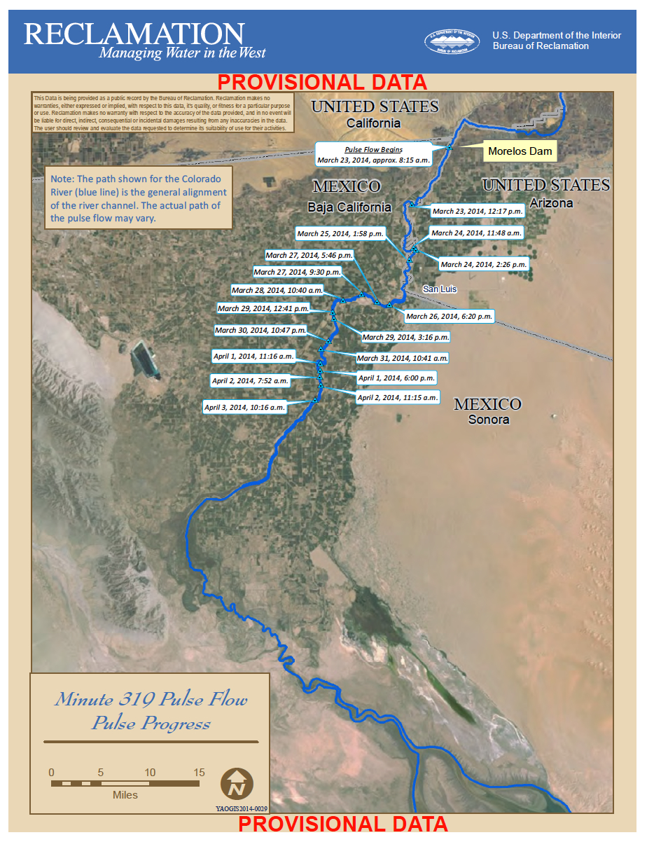
Updated Pulse Flow map as of 4/3/2013, courtesy USBR
John, 2 quick questions:
1) what is the consensus on when/if pulse-flow water should hit the gulf?
and
2) …is there going to be a Easy-Do Party to celebrate?
Chris – Jennifer Pitt had an interesting discussion yesterday about the pulse flow reaching the gulf:
http://newswatch.nationalgeographic.com/2014/04/03/will-the-colorado-river-delta-pulse-flow-make-it-to-the-sea/
“Will the pulse flow reconnect the Colorado River to the sea? We still don’t know. We don’t even know that we’ll be able to see it when it does. But scientists will be out there taking conductivity measurements, and will tell us if, and when, water at the river’s mouth becomes less salty as freshwater arrives.”
I’m back in Albuquerque, so the Easy-do-Party will be tame. 🙂
Where can I find the updated BLM pulse flow map? I tried to find it but the BLM’s site isn’t exactly the easiest to search.