
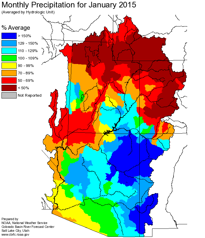
January precip
The Colorado Basin’s two primary reservoirs lost, on paper, a million acre feet of water because of January’s dry snowpack, according to the latest numbers from the U.S. Bureau of Reclamation. That’s the difference between what we expected to end the current water year with based on the January forecast, versus what the forecast looks like today, a month later. The Bureau’s monthly “24-month study” (it comes out once a month and projects conditions for the next two years, hence the name – pdf here) anticipates 1.162 million acre feet less water in Lake Powell than was expected just a month ago.
As currently forecast, that means Lake Powell is expected to drop 8 feet in elevation in 2015, while Lake Mead drops 7 feet.
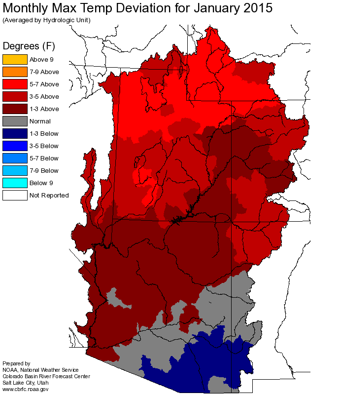
January temps
The reason? A warm, dry January. Click to embiggen the maps, but you can just squint and see what’s going on here with those maps that the climate pattern over the last month was not kind to the water-providing region.
For residents of the “but it’s been raining down here in Tucson” part of the basin, Tony Davis explains:
Total rainfall at Tucson International Airport from October through January topped 6 inches — 6.04, to be exact. That is the wettest for the period since 8.05 inches fell between October 2000 through January 2001. The normal for the period is 3.33 inches. The record, from back in 2014-15, is 10.79 inches.
In the Colorado River’s Upper Basin, however, snowpack levels on Feb. 1st were only 79 percent of normal, down from 100 percent of normal on January 1. The forecast for river runoff into Lake Powell for April through July dropped in the same period from 91 to 73 percent of normal.
it is a shame that those storms that went through CA recently did not drop more snow on the Northern Rockies.