
It is testimony to a lousy January and most of February that the spectacular snowstorm I drove home into over the weekend left the key watersheds that provide water to the Rio Grande and Colorado River still behind average for the year. The 9 inches of snow at my house was the most since December 2006, and snow was widespread across northern New Mexico and into Colorado:
Courtesy NRCS
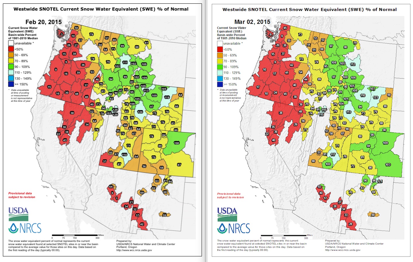
Two key basins I watch in southern Colorado – the San Juan and the Upper Rio Grande, are still well behind, but have gone from potentially disastrous (below 60 percent) to simply bad (72 and 86 percent respectively). In New Mexico, the Sangre de Cristos and Chama area are both above 90 percent, which is enough to earn green on the map.
The broader measure of interest to the West, the Colorado River Basin, has climbed as a result of the storms, with steady improvement for the last week, but is still well below average for this time of year. We’ll get formal forecasts later in the week, but the automated daily computer runs are projecting runoff above Lake Powell (the broadest measure, averaging across all the watersheds that feed the San Juan, Green and Colorado rivers) of 72 percent of the long term mean.
(Thanks to Kerry Jones at the National Weather Service in Albuquerque for help with the maps.)
For Lake Mead, the annualized amount of water (that is, the average over the latest 12 months) is now the lowest since the Lake was filling in 1938, at 1087 ft.
I used the monthly numbers:
http://www.usbr.gov/lc/region/g4000/hourly/mead-elv.html
For Basin SWE daily % values, I look at the NRCS Basin Bar graphs:
http://www.wcc.nrcs.usda.gov/cgibin/snowup-graph.pl?state=NM
It helps to know that the Upper Rio Grande Basin is the one depicted in the map version as being in south central Colorado…the one that went from 59% of median on Feb 1 to 86% of median on March 1.