
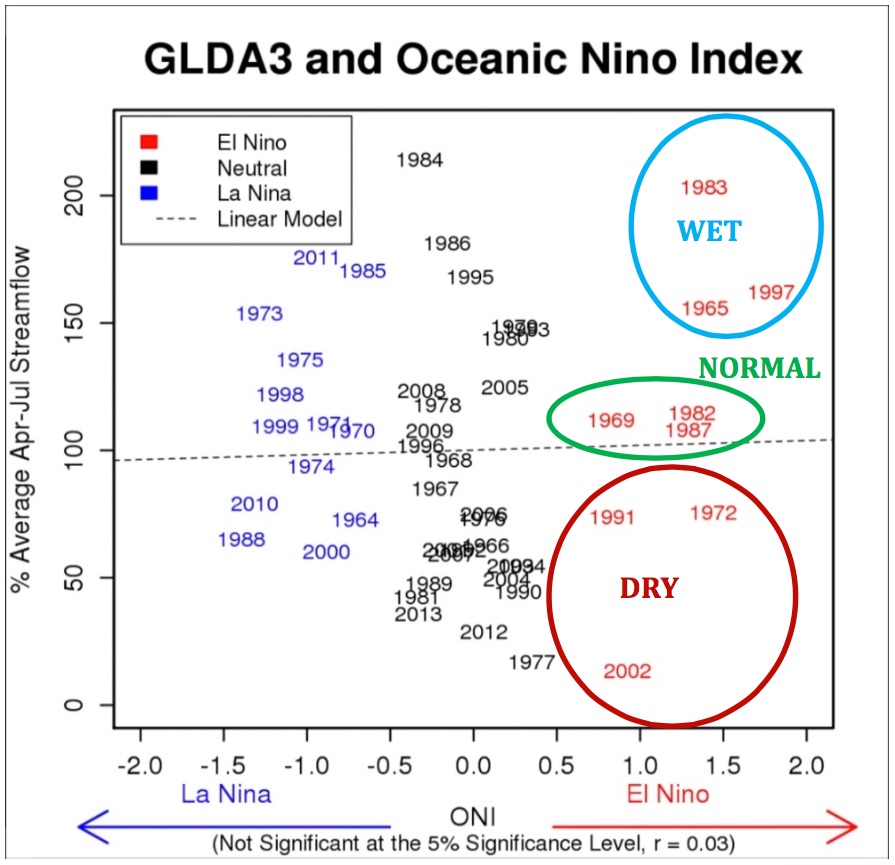
What does the growing El Niño oceanic pattern mean for the Colorado River Basin? Best to just shrug, and say the statistics are too small to say much of anything conclusive. In the nine El Niño years since the 1960s, three have been wet, three have been in the middle, and three have been dry. Here’s a graph from the agenda packet for Thursday’s meeting of the Central Arizona Water Conservation District board (“GLDA3” is jargon for natural flow at Glen Canyon):
El Niño on the Colorado River
When you think about the geography, this makes sense. El Niño’s strongest effect is the southern tier of states, but most of the Colorado River’s flow comes from mountains to the north, which is in the no-man’s land between wet and dry during El Niño years. Eyeballing the chart, it looks like stronger El Niño’s tip the odds slightly in the direction of wet, and this is a strong El Niño. But now the statistics are so small as to be meaningless.
We love to talk about “the big El Niño year of 1983 when we nearly lost Glen Canyon Dam,” but as you can see our little oceanic friend is no guarantee.
Pingback: El Niño/Colorado River Basin update - jfleck at inkstain
Pingback: Blog round-up: Shades of Owens Valley in the Delta?, The project that could have saved the US from drought, A bad water deal, A special session on drought, and more …MAVEN'S NOTEBOOK | MAVEN'S NOTEBOOK