
My new hobby, hunting for pictures of Lake Mead when it was full, led me this evening to the helpful USGS EarthExplorer archives of old U.S. government satellite images, where I found this little beauty. Apologies if it’s a slow load, they’re relatively large image file so interested water nerds can click on it and zoom and stuff. You can see that Saddle Island, near the center of the picture, is actually an island. The old Las Vegas Bay marina is still there on the branch on the upper left of the image. May 2000 is the last time Mead’s surface elevation was above 1,200 feet above sea level, and as Southern California water manager Bill Hasencamp told the L.A. Times last week, we’ll probably not see it full again in our lifetimes.
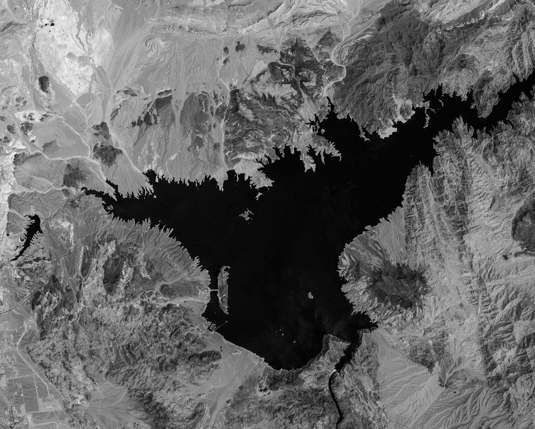
Landsat image of Lake Mead, May 3, 2000
For comparison, here’s Lake Mead taken Oct. 12 of this year. I tried to crop ’em sorta the same:
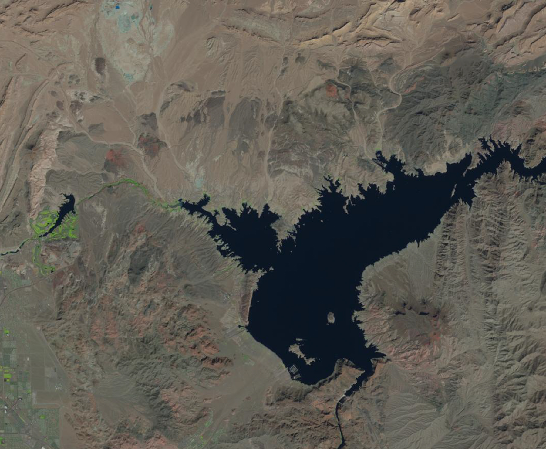
Landsat image of Lake Mead, Oct. 12, 2015