
Hydrologically speaking, the end of a river is a complicated thing.
Pumping groundwater in the Colorado River “flood plain”, March 24, 2014, by John Fleck
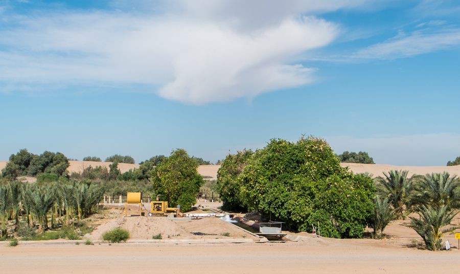
A couple of miles down the levee road on the U.S. side of the border with Baja in Yuma County, Ariz., I came across this farmer yesterday pumping groundwater to irrigate some sort of palm orchard (with some lovely bonus citrus). This is a farm that’s essentially in the riverbed, pumping groundwater. You see this type of farming on both sides of this stretch of the river, the 22 miles called the “limitrophe” that forms the border between the U.S. and Mexico here. As dg said:
When you are dealing with poverty and the needs for water in your own region to fuel the economy – you have priorities. Life is tough in the South West.
This is the stretch of river being slowly but surely wetted this week by the historic “pulse flow”, an experimental environmental release of 105,000 acre feet of water this spring from Morelos Dam into the largely dry Colorado River Delta. (Background here.) The flow started Sunday morning with a celebration at Morelos Dam, and the adventure now is watching how far the water gets each day – an adventure complicated by the fact that this is geopolitically tortured terrain, with border fences and armed Border Patrol agents and all the baggage of our borderlands problems that leaves the river uncomfortably physically isolated. (As an aside, I met a couple of great Border Patrol agents yesterday while I was wandering the no-man’s land on the U.S. side who were as curious as I was about the whole thing and were delighted to help in my efforts to find the water.)
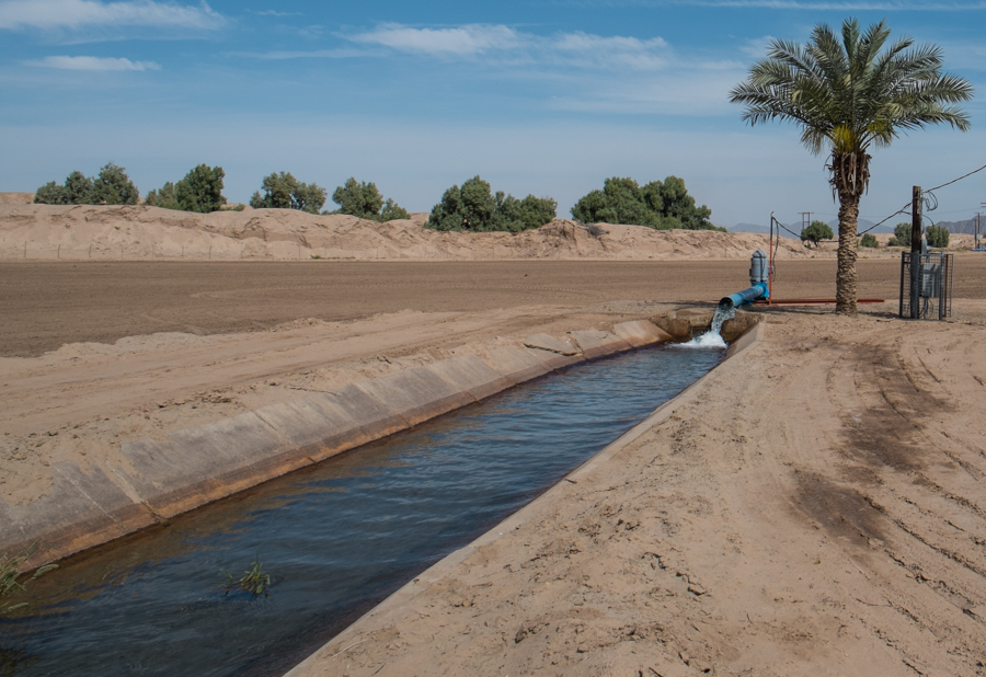
Groundwater pumping south of Algodones, along the Colorado River limitrophe, Baja, by John Fleck, March 2014
If this area is geopolitically tortured, it is even more hydrologically tortured.
My shorthand explanation for what’s happening down here is that the river ends at Morelos Dam, on the U.S.-Mexico border, with the last of the river’s water diverted into a canal for Mexican farmers. But that is not quite right. A desert river is as much underground as it is aboveground, and the groundwater-surface water interaction is critical to what’s going on.
Michael Cohen of the Pacific Institute, who is down this week watching the pulse flow, shared a paper he wrote last year deconstructing the complexity of the limitrophe’s hydrology.
Before humans plumbed the system with dams and diversions upstream, annual snowmelt floods would spread out across this landscape on their way to the sea, recharging the regional aquifer. When the river’s flow was low, the reverse would happen, with the aquifer contributing “base flow” to the river.
With that river shut down by upstread plumbing, only the second part happens, and for only a very short segment of the 22-mile limitrophe. Here’s Cohen:
The diversion of essentially the entire flow of the river upstream of the study area, combined with the loss of sediments behind upstream dams and subsequent incision of the river channel below Morelos Dam, means that the river is now a drain in the upper portion of the limitrophe and is completely disconnected from the aquifer in the last quarter of the limitrophe. In the form of irrigation, the river still ‘floods’ adjacent lands, recharging the aquifer. In the upper portion of the limitrophe, recharge from this irrigation is sufficient to maintain elevated groundwater levels and connectivity with the river.
But as you head south, as you can see from Cohen’s map below, that contribution diminishes and the water table beneath the river channel drops away.
Groundwater pumping within the levees in the river’s flood plain itself, like the farm pictured above, contributes to this. Cohen calculates 36,000 acre feet of groundwater pumping per year within the levees, with a lot more in the surrounding region. So as you go south along the 22-mile stretch of limitrophe toward San Luis Rio Colorado, the water table drops farther from the surface, at some point dropping so far that the roots of cottonwoods and other aquifer-tapping plants can no longer reach it. At this point, it loses what John Van Dyke called the “ribbon of green” that marks the rest of the desert Colorado. In some sense it is here that the river meaningfully ends.
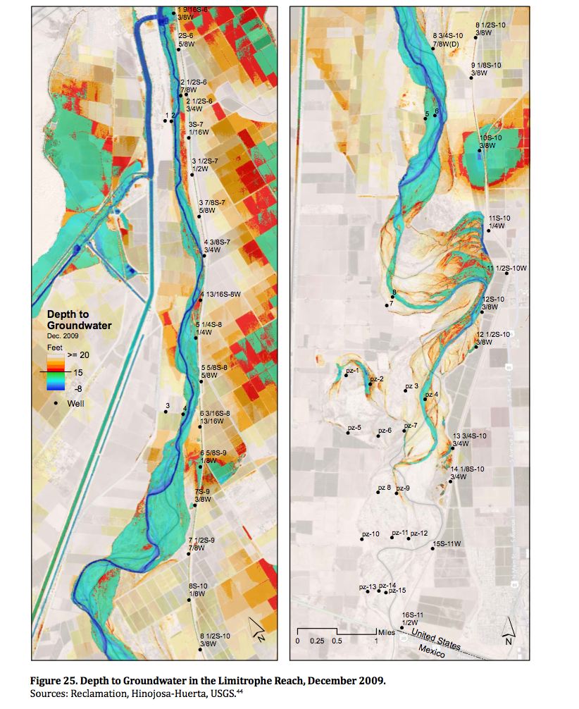
Estimated depth to groundwater, Colorado River limitrophe, courtesy Michael Cohen, Pacific Institute