
tl;dr – In 1960, U.S. Supreme Court Special Master Simon Rifkind made a fundamental mistake in calculating how much water was then available in the Colorado River Basin, and how much might be available in the future. The court, in its ruling in the case of Arizona v. California, accepted Rifkind’s math. The consequence is a shortage on the Colorado River relative to the expectations of the nine states (seven in the U.S., two in Mexico) that share it.
But it also was a fundamental mistake for the water users in the Lower Colorado River Basin to not recognize the flaw in Rifkind’s math and act accordingly. That second mistake, more than Rifkind’s, is the cause of our current troubles.
Click through for the longer version….
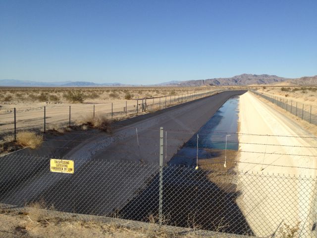
Colorado River Aqueduct, looking north into the Cadiz Valley in the Mojave Desert of southeastern California, March 2012
The great mistake made by the 1922 commission that crafted the Colorado River Compact is well known. Whether an error of omission or commission, their division of the water represented a bet on a total supply of water that in hindsight seems to have been ill informed. There is less wet water in the Colorado than the paper water allocated by the compact. Less well known is the way the U.S. Supreme Court in 1963 doubled down on that bet.
The great finesse of the Colorado River Compact, the thing that made a deal possible at all in 1922, was to leave the actual allocation of the water among the seven U.S. state (and two in Mexico) until later. The commissioners split the river 50-50 between what was in actuality a political rather than hydrologic geography – the “Upper Basin” and “Lower Basin.” Each got 7.5 million acre feet per year, with ambiguous language aimed at setting aside a share for Mexico. The details – how New Mexico, Utah, Colorado and Wyoming would split the Upper Basin’s share, and how Nevada, California and Arizona would split the Lower Basin’s share – were left for later.
The states of the Upper Basin, growing more slowly and using substantially less than their 7.5 maf, had a relatively easy time of it, negotiating a compact in 1948 (smartly using percentages in their division of the water rather than absolute quantities). Conflict between Arizona and California meant the states of the Lower Basin could never work a deal, and finally in 1952 Arizona sued, asking the U.S. Supreme Court to settle the question of who was entitled to how much water.
The court turned to Rifkind to serve as Special Master to help sort out the complexities of the case. After two years of hearings – 340 witnesses – Rifkind in May 1960 issued what would become the framework for the court’s ruling. He essentially gave Arizona everything it asked for: 2.8 million acre feet of water from the Colorado River itself, plus all the Gila River water it could use before the Gila reached the Colorado. He also gave California 4.4 million acre feet, and another 300,000 acre feet to Nevada.
In June 1963, the Supreme Court put its stamp of approval on Rifkind’s numbers, which became the post-World War II version of the basic guiding principals of the Law of the River.
If you do the math, the three states’ shares add up to 7.5 million acre feet. That sounds just about right, right? The compact says the Upper Basin is required to send 7.5 million acre feet of water per year, on average, down past Lee Ferry. So we’re good?
In the Natural Resources Journal last fall, Colorado River legal scholar Lawrence MacDonnell showed how Rifkind’s math didn’t pencil out. Consider:
- Lower Basin tributary inflows downstream from Lee Ferry (not counting the Gila): 1.025 maf
- Reservoir evaporation: 950,000 to 1 million acre feet
- channel losses: 300,000 to 600,000 acre feet
So right off the bat, according to MacDonnell’s analysis, you’ve got what a “losing reach” between Lee Ferry and the users of Nevada, Arizona and California. That whole 7.5 million acre feet will not be available for the downstream users. But it gets worse. You’ve also got to add in water needed to meet the 1.5 million acre foot U.S. obligation to Mexico. Once all the puts and takes are added in (I encourage you to read MacDonnell’s paper (pdf), pp 395-396 for the full details):
Thus, even assuming no increased consumption in the tributaries, it would be necessary for at least 8.8 maf
and perhaps as much as 9.775 maf to come from the Upper Basin each year.
In fact, the folks in California argued that things would be even worse than that. By their more pessimistic math, the Upper Basin would need to pass 11 million acre feet per year past Lee Ferry to make Rifkind’s numbers pencil out without the Lower Basin plunging into water deficit. Could Rifkind simply have been blind to the water supply gap he was creating? To the contrary, as MacDonnell points out, Rifkind (“the Master”) knew it, and thought there was enough surplus water in the system to cover it:
Since the Compact only ensure 75 maf over 10 years, it is evident the Master was assuming the Upper Basin would never use its 7.5 maf/year apportionment so this unused water would always be available to the Lower Basin.
The evidence for this lies in a priceless exchange between Rifkind and Northcutt Ely, California’s attorney in the case, during an Aug. 19, 1960 hearing:
MR. ELY: I think what you said yesterday and today is the key to this whole matter, that if there is a possibility or a probability of disaster attending upon the results of your decree it should be taken into account and you now told us this morning that you see not the slightest chance of that within your lifetime or ours.
THE MASTER: And in the more distant future.
MR. ELY: I think you should say that. I think you should say that in your report.
THE MASTER: The post-space age perhaps will drain the moon of its water supply. I don’t know and don’t pretend to guess.
MR. ELY: We are in effect relying upon unused Upper Basin water.
THE MASTER: It is a factor.
Ely argued that Rifkind was placing the water supply for the Metropolitan Water District of Southern California – urban/suburban LA’s supply, and the lowest priority among California’s Colorado River users – at risk. Rifkind scoffed:
I am morally certain that neither in my life- time, nor in your lifetime, nor the lifetime of your children and great-grandchildren will there be an inadequate supply of water for the Metropolitan Project….
I am morally certain, as certain as I am of the multiplication table, that not within the span of the ages indicated there will be any diminution either in the present uses of the Metropolitan Aqueduct or its contemplated expansion.
“The Special Master,” Ely wrote in a brief to the court 12 days later, “is demonstrably wrong.”
History has show that Ely was right and Rifkind was wrong. On Jan. 1, 2003, with a shortfall on the river, Interior Secretary Gale Norton curtailed Metropolitan’s deliveries. I’ve not researched Ely’s family tree, but whether or not he actually had “children and great-grandchildren,” the spirit of Rifkind’s comments was clearly wrong.
But is this, in fact, Rifkind’s fault? I would argue that the answer is “no”, because the Special Master, and the Supreme Court after him, were never allocating absolute amounts of water. Rifkind’s report, and the decision ratifying it, simply say that California, Arizona and Nevada were entitled to a 4.4m/2.8./300k split as long as that water was available. And were it to not be available, Rifkind and the court noted that shortages would have to be shared.
In allowing for more water use in the Lower Basin than a 7.5 million acre feet annual Lee Ferry delivery would serve, Rifkind explicitly invoked the Compact itself. As long as there was a surplus of unused Upper Basin water, the compact allocated it to Lower Basin users, Rifkind noted in his Aug. 19, 1960, exchange with Ely. Ely argued that the Lower Basin’s “great projects” had been built relying on water that now might not be there. Rifkind responded tartly:
THE MASTER: What you are saying is if you had known that in 1933 maybe you wouldn’t have spent the money to build it because you wouldn’t want to have relied upon it. It was built and is gushing with water today and will continue to gush full of water and it doesn’t make any difference whether the water is derived from III(a), III(b), IU(c), III(d) or unused Upper Basin water or any other supply because unused Upper Basin water is water that rightfully belongs to the Lower Basin under the Compact.
And therein lies the crucial point. Because in addition to allocating the 4.4m/2.8./300k split, Rifkind and then the Supreme Court were explicit in noting that a) when there were surpluses, the Lower Basin states were entitled to use the water, and b) shortages also were possible. Rifkind argued that they should be shared in the same ratios as when there was a full supply. The Court’s final ruling disagreed on this point, granting the Secretary of the Interior the thankless job of allocating shortfalls if there wasn’t enough water. Which is, in fact, what Norton did in January 2003. (In fact, Norton was just forcing California back down to 4.4 million acre feet from the 5-ish maf to which it had become accustomed. And to this day, everyone’s still gotten their full allotment per the numbers in Rifkind’s report, by way of draining Lake Mead to do it.)
Given the reality of Ely’s own math, and the framework of the decisions, California’s protestations in 2002 have, or should have, a bit of the ring of Inspector Renault’s shock upon learning that there was gambling going on in Rick’s Casablanca cafe. Clearly Rifkind’s assessment of how soon the problem would emerge was wrong, but everyone could or should have seen it coming.
A special thanks to Lawrence MacDonnell for the insightful analysis, both in writing and in person, on the 50th anniversary of the Supreme Court’s Decision in the case of Arizona v. California
References:
- Arizona v. California Revisited, Lawrence J. MacDonnell (pdf)
- The delightful Ely-Rifkind exchange is excerpted in California’s Aug. 31, 1960, Motion to Reopen (available from the University of Colorado Law Library’s Arizona v. California collection)
- Background on Norton’s January 2003 decision to curtail California’s deliveries from my “What Seven States Can Agree to Do“
- A look at how the math plays out today, and why Lake Mead keeps dropping even as the Upper Basin delivers its full legally required share
- For a brief history of the issues involved, you can’t do much better than the U.S. Supreme Court decision itself
Pingback: ‘Simon Rifkind’s great mistake and the shortfall on the #ColoradoRiver’ — John Fleck | Coyote Gulch
I live in the southwest Colorado basin made up of 9 drainages, the largest being the San Juan. One of the tributaries of the San Juan is the Rio Blanco. Several years ago, because Colorado wanted to keep agriculture in the San Luis Valley viable, it was agreed a substantial amount of water from the Rio Blanco would be transferred by transcontinental diversion (Chama Diversion) into the Rio Grande drainage so cities like Santa Fe and Albuquerque could continue to grow. This diverted 25% of the flow from the San Juan that now does not reach the Colorado. Does the amount of water so diverted count against the 7.5 Million AF due the lower basin states on the Colorado? Did SW Colorado receive any compensatory storage for this diversion?
Rodney – Thanks for the question. The San Juan-Chama diversion was authorized back in the late 1950s-early ’60s (there were a series of pieces of federal legislation) as part of the Colorado River Storage Project. It authorizes the diversion of 110,000 acre feet of water per year from the Blanco, the Navajo and the Little Navajo. The total diversion is about 5 percent of the average annual flow on the San Juan, and is charged to New Mexico’s share of the Upper Basin’s 7.5 million acre foot annual allocation. (Total natural flow averages approximately 2 million acre feet per year.) I don’t know a lot about the details of the southwestern Colorado Projects authorized as part of the legislative deal, but there were a number, including Animas-La Plata and Dolores.
Pingback: Blog round-up: Bad math on the Colorado River, CA groundwater insanity, drought, the BDCP, the Kennedys, and rethinking adaptation
Pingback: Crossing the divide | jfleck at inkstain
Pingback: Bonus water likely for Lake Mead in 2015, but it’ll just keep dropping anyway | jfleck at inkstain