The anthropologist William Abruzzi wrote a fascinating essay some years ago explaining the success of early Mormon agriculture in the Little Colorado River Basin, one of the more bad-assed desert environments in which one might want to do one’s 19th century, pre-federal-irrigation-subsidy farming. Holbrook, which spans the Little Colorado, averages a bit more than 8 inches (20 cm) of rain per year, with nearly half of that falling during

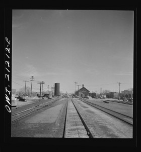
Holbrook, Arizona. Going through the town on the Atchison, Topeka and Santa Fe Railroad between Gallup, New Mexico and Winslow, Arizona. Photo by Jack Delano, courtesy Library of Congress
the chaotic summer thunderstorm season. But by spreading across multiple climatic zones, from the high country to the low country, and then sharing stuff among communities across the region, the early Mormons pooled their risk, according to Abruzzi:
Because the various Mormon towns were situated in widely dispersed river valleys, they generally experienced distinct schedules of variability; that is, while they all suffered the vagaries of environmental instability, they did not all experience the same instabilities simultaneously. Due to local differences in elevation, precipitation, temperature, growing season, soil quality and surface water availability, droughts, floods and other catastrophes occurred at different times and places. In addition, regional developments affected individual communities differently. For example, while higher temperatures threatened crops at Woodruff and St. Joseph by increasing evapotransporation rates throughout the lower valley, they raised the probability of a good harvest at Showlow and Alpine in the southern highlands by increasing the length of the growing season. Similarly, while cooler temperatures increased the likelihood of destructive early frosts in the southern highlands, they reduced the heat stress on crops at lower elevations and increased the prospects of a good harvest among the town in this sub-region.
This generalizes.
Consider Fitch’s recent bond rating for the Metropolitan Water District of Southern California:
Water is provided from two independent supply sources. Supply fluctuations occur on the in-state water supply, the State Water Project (SWP). The Colorado River supplies, banking arrangements, and Metropolitan’s substantial storage facilities help balance this risk. Consequently, Metropolitan has sufficient supplies to meet customer demands through at least 2014 despite statewide drought concerns.
While California’s in-state water system is suffering epic drought, Met has alternative supplies from the Colorado River Basin on which to draw, as Brett Walton recently explained in Circle of Blue:
Though it will not get much water from a state canal that moves supplies from the north to the south, Metropolitan will get a full allotment this year from the Colorado River.
Diversity of supply, from lots of different kinds of sources, reduces vulnerability to drought. Again Walton:
Many of Metropolitan’s customers are making significant investments in water treatment infrastructure that decreases its risk during drought by developing local supplies: groundwater, recycled wastewater, and capturing rainfall.
This cuts both ways. Back in 2003, when Met lost a substantial supply from the Colorado River, it was able to fall back on California’s in-state supplies.
