
It’s a nuance, but of such subtleties are progress often made.
In the Bureau of Reclamation’s new “Moving Forward” report on the future of the Colorado River Basin, a subtle change to the bureau’s canonical map:
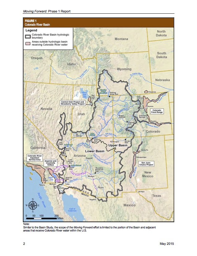
Colorado River Basin map, courtesy USBR
There, at the bottom. See that little bit poking down into Mexico? That’s the Colorado River Delta. The Bureau’s official map used to cut off its depiction of the Colorado River Basin at the U.S.-Mexico border. Here, for example, is the map that appeared in the predecessor to the “Moving Forward” report, the 2012 Basin Study:
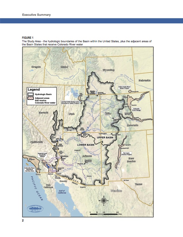
2012 Basin Map
On the heels of the enormously successful Minute 319 environmental pulse flow down through that Mexican Delta, a quiet recognition that the Colorado River Basin is a thing changed.
yes, *cheering!* every little bit of acknowledgment helps. i hear a lot of critics of that release of water (and the other environmental releases in CA), but that we could give the river some water once in a while even during a drought says that we have a chance of being humane towards the other creatures on this planet after all. we should be willing to sacrifice at times even if it is difficult.
i wish they’d do it again this year.
for those who don’t quite get it, sometimes a saying i heard from someone else helps. “This is the only planet with chocolate.” this is the only planet we have, we need to be more careful and respectful towards it. much more than what we are now.
Fierro! This is good to see. The new map still makes it look as if Tijuana, Mexicali, Tecate and Rosarito don’t receive Colorado River water, but perhaps that’s just a quirk of the map style.
This is a mark of real progress in thinking about the river. it may seem subtle, but it’s very significant. Kudos to those who made it happen.
Great progress. Todos Unidos! One watershed after all.