
For our anniversary, Lissa and I bought ourselves a present:
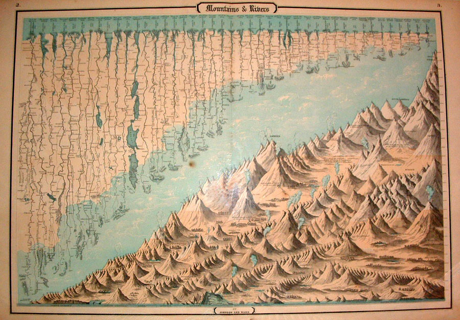
It’s “Mountains and Rivers,” from the 1862 Johnson and Ward Illustrated Family Atlas. It is a graphic assemblage of the world’s mountains and rivers, arranged to show their relative sizes, from the mighty Mississippi/Missouri system to the lowly Merrimac.
The Rio Grande is there, flowing out of the Rocky Mountains, past our house and into the Gulf of Mexico. The Colorado River, strangely, is not. (1862 was before John Wesley Powell mapped the Grand Canyon, but by that time people had a pretty clear idea where the thing started and ended.)
The mountains are sadly only numbered, not labeled with names. There must have been a key that went with it which is sadly lost to history. But great passes are named, and high mountain cities, and ecosystems: “Lower limits of the growth of pines in the Torrid Zone, 6,000,” and “Region of Lichens and Umbilicariae.”
It’s a wonderful exemplar of the time – the globe could, for the first time, be looked on as a whole, and the counting and mapping and categorizing of the entire planet could finally be done. There’s such a sense of European optimism in it, as if naming and mapping gave dominion. Seems charmingly naive.