With the latest monthly report from the U.S. Bureau of Reclamation, we now have end-of-water year numbers, and a chance to take stock. It’s been a terrific year for water supply on the Colorado River system:
- Lake Mead ended the year with a surface elevation of 1,116 feet above sea level, up 32 feet from a year ago when I was out in Nevada crying wolf. In wet water terms, that’s an increase of 2.9 million acre feet.
- Lake Powell is up 19 feet over last year.
- Most importantly, total storage is up 5.2 million acre feet over a year ago. That’s real water, and a lot of it.
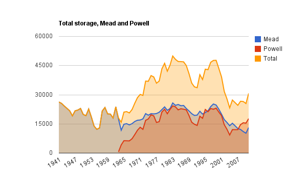
Here’s my total water storage graphic, updated with the latest numbers (data here):
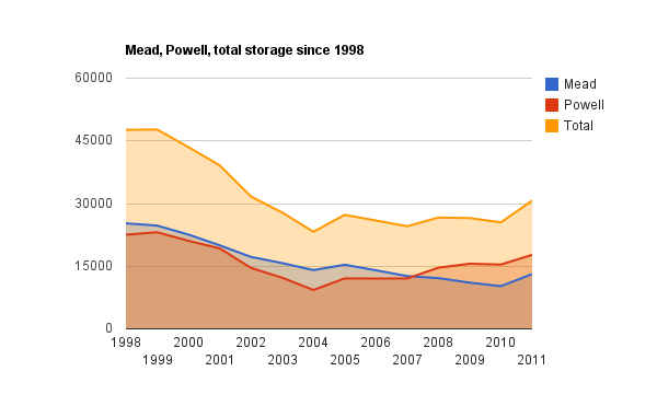
For a clearer picture of the current situation, here’s the same data from 1998 to the present:
But if you squint and look closely, you can still see wolves in the distance.
There remains a lot of empty, though less than a year ago. You also can see the dramatic drop during the dry years of the early 2000’s. Recall we’re up 5.2 maf this year. But we’ve seen drops of 4 maf or more four times in the last decade. Another good year could push things up, but this year’s bounty also could be largely wiped out by a single bad year.
But here’s the real wolf, and it’s actually closer than you think. The total release from Lake Powell this year, the amount sent downstream by the Upper Basin for use in the Lower Basin, was 12.5 million acre feet. The basic requirement under the Colorado River Compact is release of 8.2 maf per year. That’s the Lower Basin’s guaranteed allotment. I like to think of the 4.3 maf as “bonus water”. But remember Mead only went up 2.9 maf. The 1.4 maf difference is the ongoing Lower Basin problem of using more water than it can count on in the long term.
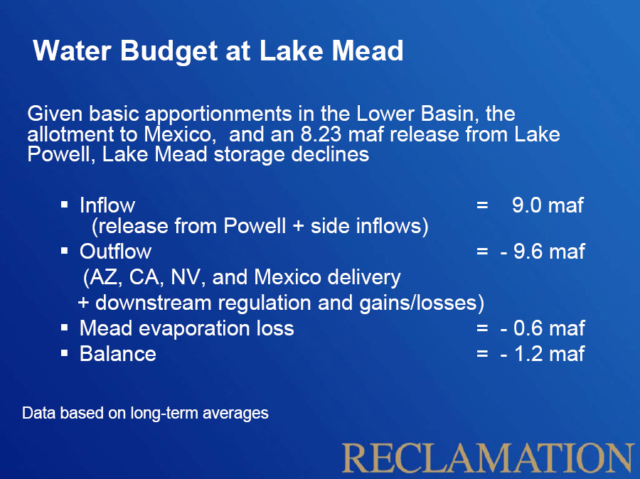
As a refresher on the problem, here’s the simple math:
1.2 million acre feet, 1.4 million acre feet, whatever. What’s a few hundred thousand acre feet of water among friends?


