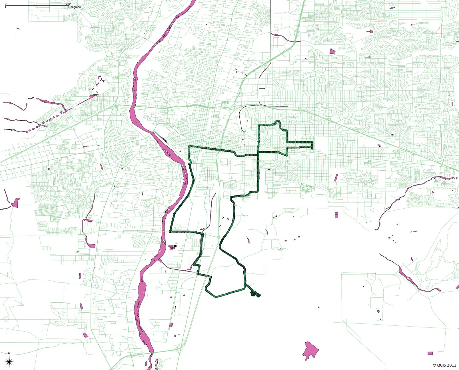
Inspired by the beautiful maps Geoff McGhee made for the Lane Center-KQED California Delta project, I spent some time this weekend playing with GIS software. I haven’t done any hackerly projects in ages, and a friend who’s a GIS professional had suggested QGIS, a free software project. (ArcGIS is pricey, and I’m a Mac guy at home.) The real driver here is a desire to use maps to better understand the subjects I’m writing about, and to better incorporate them into my published work.
OK, the real driver is I love to play with software? Whatever.
Herewith, one of my first maps, using Bernalillo County road and water base maps from Census TIGER files, plus the GPS trace from this morning’s bike ride:


I use QGIS for some personal projects (tracing old rail grades). Be sure to save before using any extensions, as those have crashed the app on me a few times.
The National Atlas is a good place to start for downloadable data.
http://nationalatlas.gov/atlasftp.html
Aah… enjoy your adventures. QGIS can be a real time-suck as it’s so much fun to explore what it can do. Community is a nice collection of serious people doing Serious Things who are willing to explain what they’ve learnt around the web.
Malcolm – Indeed, you are right re the time suck, and after clicking on the above link, I think we can blame PeakVT for my relative lack of productivity in coming days. 🙂
Always glad to contribute to some delinquency.
I’ve made a couple of maps of New Mexico, both of which started in QGIS. The first is a redraw of the counties, for which the watershed boundaries map from the National Atlas was essential. It’s not quite done, however. The other is of railroad lines, which includes a lot of old grades not found in any online dataset. If they are of interest to you (probably not), you can download the KML for them or any other custom GMap and import it right into QGIS as a vector layer. Exporting to KML from QGIS doesn’t work well, however.
https://maps.google.com/maps/ms?msa=0&msid=217493103495941267423.0004b19462aa9414ff295
https://maps.google.com/maps/ms?msa=0&msid=217493103495941267423.0004b4271f0dce2de1c3c