
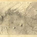
Ives map, courtesy Library of Congress
In 1857-58 1st Lt. Joseph Christmas Ives (ah, such a great name) conducted one of the first U.S. expeditions to map the Colorado River Delta, and figure out how to make use of it. Ives felt especially obligated to carefully document his journey “it being doubtful whether any party will ever again pursue the same line of travel,” and his report is, as a result, a delight. As he and his shipmates approached the estuary’s imprecise boundary between sea and river, they stopped at the southern end of Montague island to have a hunt:
Innumerable flocks of pelicans, curlews, plovers, and ducks of different varieties, were scattered over the flats. It was easy to shoot them, but almost impossible to get at them afterwards on account of the depth of the mud, and we started back to the schooner but little better provided with game than when we left.
It was then, indeed, a rich ecosystem.
Pingback: Another Week of Global Warming News, March 23, 2014 [A Few Things Ill Considered] | Gaia Gazette