
The snowpack this morning in the Colorado River Basin above Lake Powell (source: CBRFC) measures at 90 percent of average for this date, which is a bit nerve wracking with the basin’s reservoirs only half full (source: USBR pdf). The latest forecast runs from the National Centers for Environmental Prediction, the folks who run the seasonal models, still look encouraging. But we’ll have to be patient. February doesn’t look encouraging, but the models start to turn by March. Scroll down for the maps through May. The colors mean wetter or drier than average, not absolute amount.
February:
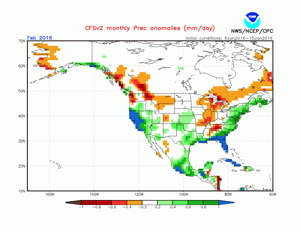
February precipitation anomaly, courtesy NCEP
March:
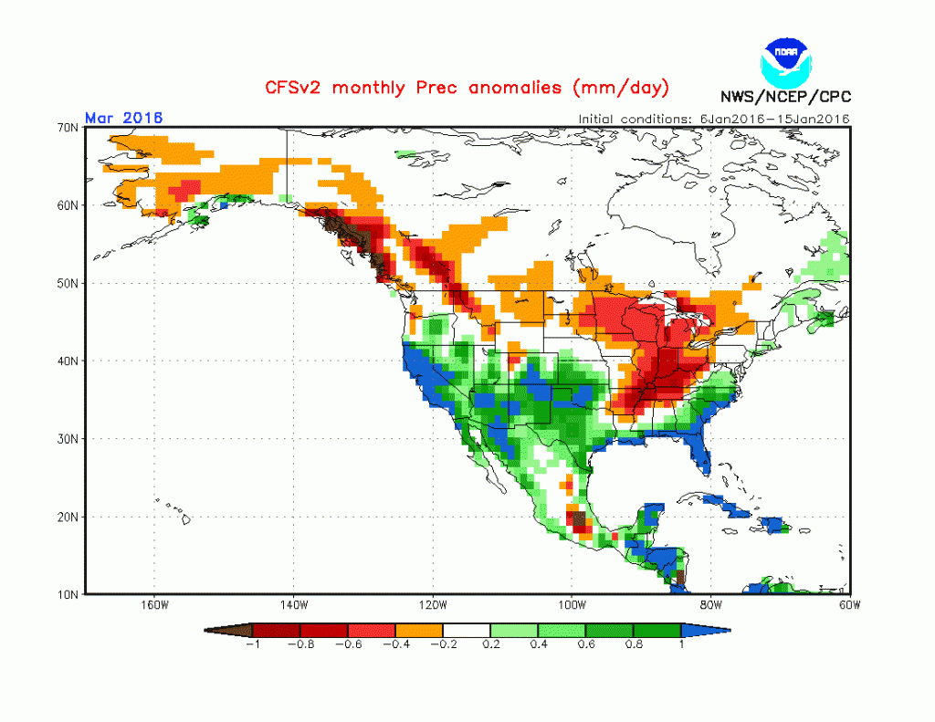
March precipitation anomaly, courtesy NCEP
April:
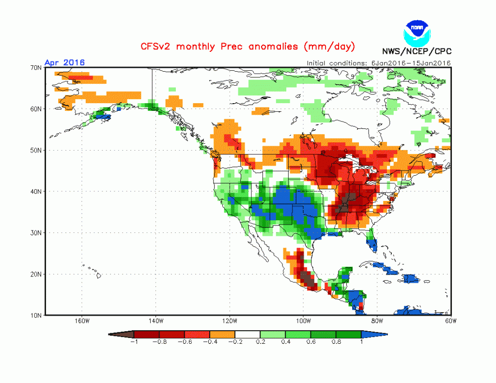
April precipitation anomaly, courtesy NCEP
May:
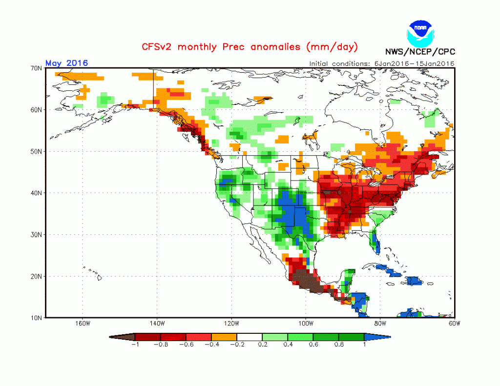
May precipitation anomaly, courtesy NCEP
Source for the maps: NCEP
El Nino usually good for San Juans, so should be a little relief. That’s what they feel is happening there right now. BTW, don’t know if it will be helpful or not, but the Mountain Studies Institute is run by two fellow alumni from UW when I was going there, I’d see one in the lab fairly often, they do a lot of high-altitude water quality work, active social media that may be of use to you: https://www.facebook.com/mountainstudies/?fref=ts
Keep up the good work, sir.