
There is something manifestly silly about the assertion, in table 5a of the Bureau of Reclamation’s 2015 Colorado River Accounting and Water Use Report, that the Imperial Irrigation District diverted 2,455,649 acre feet of water from river at Imperial Dam that year.
Park of the core curriculum for our University of New Mexico Water Resources Program students is an intensive field class in which students go out and measure water in a variety of ways (flow, chemistry, ecosystem properties, etc.). One of the class’s purposes, UNM engineering water guru Mark Stone tells the students, is to instill a healthy sense of the humility in the face of the difficulty of accurately measuring the parameters we’re using to manage water.
The notion that one can measure the flow of water with seven digit precision is absurd.
Hoover Dam stilling well, Oct 18, 2010
This is not to meant to be a criticism of the accuracy of the Bureau’s work. Far from it. One of the early tangents in the research I did for my book was a dive into the measurement of water, which included a memorable visit to the stilling well within Hoover Dam, where one of the river’s most important measurements is made. I developed the utmost respect for the people measuring water on the Lower Colorado River. They take their job seriously, and do it well.
Accuracy matters, and doing the work as accurately as one can matters a lot. But equally important is the credibility of the methodology, and the fact that the people using the numbers to make management decisions have a shared understanding that the numbers are good enough for the purposes at hand.
Jay Lund wrote about this last week, discussing disparities in the reported numbers for pumping from the Sacramento-San Joaquin Delta. Jay cites seven different measures that in some cases differ by enormous amounts. Which one is right?
Measuring water is hard. There is no “right” number. What matters is that the numbers are collected for an agreed-upon purpose, and that there is confidence among those who need to use them that they are being collected in a fair and diligent way.
In the case of the USBR’s water accounting report cited above, the measurement and accounting is a requirement of the Supreme Court’s 1963 decision in the case of Arizona v. California for determining allocation of Lower Colorado River water. There’s a clearly defined purpose, and little argument over the methodology used. This is one of Elinor Ostrom’s points in her book Governing the Commons – that agreement on the numbers is critical to successful common pool resource management. They don’t have to be “right” in some absolute technical sense, so much as reasonable enough for everyone to agree to use them.
So did Imperial divert precisely 2,455,649 acre feet of water in 2015? Of course not. But we’ve all agreed that it’s the number we’ll use.
Sometimes the “precision” problem is not one of actual measurement, but rather one of conversion. Volume can be accurately and reasonably precisely measured and recorded in one set of units [100’s of cubic meters, say], then mindlessly reported in cubic feet to as many significant figures as are on the calculator.
When water has a high value, some stakeholders will seek economic value in disputing the unavoidable errors of water estimation. The water management system and the courts must demonstrate due diligence and defend the integrity of authoritative estimates to avoid tempting stakeholders into such wasteful and disruptive legal actions.
I learned years ago about data collection (and am still learning two decades into the process), is that there is no simple rules that cover all the bases.
Jay Lund’s excellent article asked ‘Why was there differences’ in the numbers reported? The question was asked from a ‘top down’ approach.
I would start from the ‘bottom up’ in my analysis.
1. Who? The organization that provides the data set. How much effort did they invest into the process?
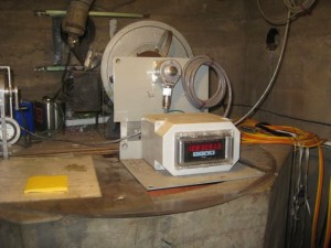
2. What? The instrumentation used. What was the accuracy? What was the time resolution of the collection? What type of data was collected? Was the sensor optimized for the site conditions? Is any secondary meta data collected? Is there any QA/QC processes in place that qualifies stellar operation?
3. The values contained in the data base? Instant or Averaged? How many samples per hour? To get the true quality of data, you need to understand the method of the collection.
Ask these questions and work up from there. The funny thing is that everyone blindly assumes that everyone’s methods and attention to detail are standard. They’re not. Nothing is truly ‘plug and play’.
One thing that jabbed me in Jay’s article was the ‘watch reference’. Bingo! Seen this before. Two instruments measuring the same conditions. Something as simple as making a water level measurement, you see two different values instead of the single value you expected.
There’s an art to water measurement. Getting the best from the instruments for the prevailing conditions, leveraging the technology at your disposal and understanding the dynamic nature of things.
Precision. This quality should not be assumed to be the number of ‘right digits’ in a number. Precision is a quality that addresses Accuracy and Precision in the instrument, time resolution in the sampling period, field protocols and QA/QC in the process.
Those are the things you see from the bottom up. Sorry to have rambled on about it.
dg