
Record low flows on the Gila River in New Mexico
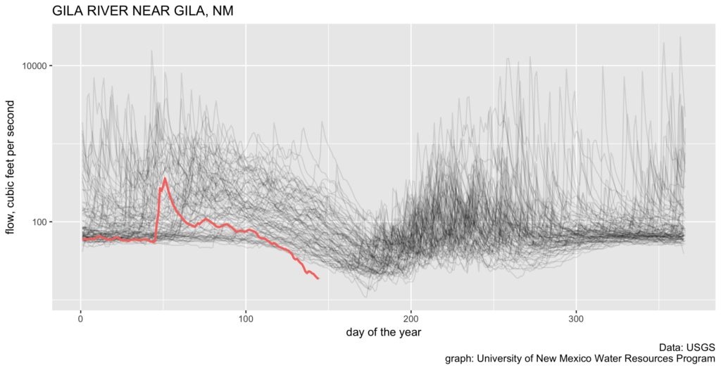
Another of my attempts to visualize data from this remarkably bad water year in New Mexico. The cloud of gray lines is flow at the Gila gauge as the river leaves its headwaters mountains in southwestern New Mexico, one line for each year. The red line is this year – significantly lower than in any of the 89 years of record.
(Code here, modified to plot a log scale on the y axis to make it easier to visualize the low flows.)