
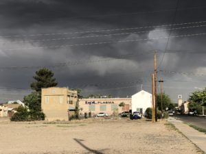
Storms over the plasma clinic in Albuquerque’s near south valley
Out bike riding yesterday morning, my friend Scot and I were watching the radar app and judging wind and storm direction, dodging the occasional raindrops with a spectacular sky around us. (In fact our ride was delayed because Scot had to put the goat in, something about lightning-goat risks.) But despite the stormy show, the morning brought very little rain.
The downpours didn’t start until afternoon, after we’d returned to the safety of our respective homes to enjoy the hailstorm with roofs over our heads. And after an extraordinarily dry water year (the third driest in more than a century of data for Albuquerque) it was most welcome.
But in the grand scheme of things, it wasn’t much at all.
The 0.57″ of rain at the Weather Service Albuquerque airport station brought us up to 1.45″ for the water year (which begins Oct. 1). That’s just 31 percent of average for this point in the year. It lifted us from the third driest to the sixth driest water year in records going back to the 1890s.
Trying to get a feel for the impact on the Rio Grande, I checked the river gauge at Bernardo, which last week had dropped below 10 cubic feet per second of flow. By way of comparison, the median for this time of year is 2,500 cfs, a couple of orders of magnitude higher. Bernardo is down in the reach of the river where we’ve been starting to see drying. It also was at the heart of yesterday’s storm, with 1.5″ recorded in a volunteer’s gauge in Jarales just upstream. The Bernardo gauge got nice bump up to 160 cfs yesterday evening, which is still an order of magnitude below normal for this time of year.
So yes, we enjoyed it. But a line of thunderstorms blowing through on a June afternoon can’t begin to make up for the lack of the widespread mountain snowstorms over the course of an entire winter.