
By Eric Kuhn
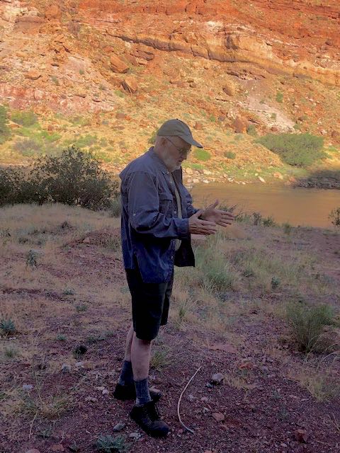
The University of Arizona’s Vic Baker on paleofloods of the Colorado River. Photo by Eric Kuhn
Last week I had the pleasure of exploring the banks the Colorado River near Moab, Utah with two of our most accomplished river scientists, Jack Schmidt (Utah State) and Vic Baker (U of Arizona), and hear a presentation by Dr. Baker on the science of studying past floods on the Colorado River system. When a flood occurs, the river leaves evidence of the flood by depositing materials that are carried by the river high on the banks of the river or in caves adjacent to the river. His basic message is “if it has happened in the past, it can happen,” therefore, if we can use the evidence nature has provided to estimate the peak discharge of past floods, we can use that knowledge to be better prepared for future floods.
With the recent focus by the basin’s water management agencies on drought contingency plans, flooding has been given little attention. In fact, there are now only very few of us around who were actively involved in river operations during the last major flooding event on the river; the high flows of 1983 and ’84. By now the story of 1983 is well known. The large runoff caused by a wet winter and spring combined with higher than normal carry-over storage in Lake Powell caught the Bureau of Reclamation by surprise. The resulting inflow quickly filled the reservoir and far exceeded the capacity of Glen Canyon Dam’s power plants and outlet tubes (44,000 cfs) requiring a large amount of water to be released through the emergency spillways. Cavitating flow through the spillways caused considerable damage carving out a small building-sized hole in soft sandstone that surrounds the dam. Further damage was avoided by the installation of 8’ plywood panels on the top of the dam (they were quickly replaced by steel panels). In theory, the emergency spillways have now been repaired and redesigned to reduce cavitation (and successfully tested with a short duration high flow), but clearly the reoccurrence of a large uncontrolled spill at a dam anchored in relatively soft sandstone (Glen Canyon) is an event we want to avoid.
The remarkable aspect of the 1983 and ’84 high flows is just how unremarkable and modest the peak flow levels were. The inflow to Lake Powell peaked at about 116,000 cfs in ’83 and 125,000 cfs in ’84. Before Glen Canyon Dam the largest peak flow we’ve experienced and documented at Lee’s Ferry is about 250,000 cfs in 1884, twice the peak flow of 1984. We know 1884 was a very big year based on newspaper reports and the diaries of settlers, but the flow estimate is somewhat crude. It was made based on the memory of one of the ferry employees whose cat became stranded in a tree by the flood and had to be rescued. Based on Dr. Baker’s science, even this 250,000 cfs flow at Lee’s Ferry is far from the largest flow that has happened in the past 2000 years. Based the field work of Baker and his students, evidence of flood flows on the Colorado River just upstream of Moab, Utah and the nearby Green River point to a flow as high as 300,000 cfs (each). The estimated past peak flow at Lee’s Ferry is about 500,000 cfs, four timed the 1984 peak!
But wait you say, don’t we believe that climate change is reducing, not increasing, the natural flow at Lee’s Ferry? The answer is yes, the best available science suggests that the long-term average annual natural flow at Lee’s Ferry is likely declining. That does not mean, however, that future large flood flows will be less. In fact, because a warmer atmosphere can hold more moisture, science points to the possibility of much larger future peak flows. I can envision an above average runoff year (like 2011 or 2019) that makes a reasonable dent in the filling of Lake Powell (enough that because of our concern with drought, the Upper Basin would want to keep every drop of it in storage) followed by a super-wet year. Perhaps a year where the track of a series of warm and very moist atmospheric rivers comes in off the Pacific through Southern California with the bullseye on the Colorado and Utah Rockies for an extended period of time. The resulting runoff peaks with an inflow to Lake Powell of over 400,000 cfs and a total volume of near 50 million acre-feet (the climate models suggest it’s possible). The potential impacts of such an event could be very serious. Even if Lake Powell was only half full, such flows would quickly fill the available vacant space, then possibly exceed the capacity of Glen Canyon Dam’s emergency spillways and over-top the dam. In theory, the dam might survive an over-topping event, but remember how a little imperfection in the service spillway at Oroville Dam resulted in huge damage to the structure (because of the immense erosive power of high velocity water).
Ultimately the flood waters would work their way down through the Grand Canyon, scouring the canyon and causing major environmental damage, into Lake Mead and the Lower Basin main stem reservoirs. The highest flows would be dampened by the lower river facilities, but still high enough to potentially cause major damage to communities along the river From the Mojave-Parker strip to Mexico. This stretch has seen considerable growth, but no high flows since the mid-1980s. In the worst-case scenario, the flooding impacts might cause a dam failure. The results of which would be catastrophic. I’m not predicting such an event will happen any time soon. I’m only suggesting that with the dominant focus on managing the impacts of aridification, we would also be derelict for not considering and being prepared for future large high-flow events. Given the uncertainties of climate change, the basin’s water agencies would be wise to fund additional studies on the high-flow side of hydrograph while they continue their plans to live with reduced average flows.
John: Here is our comilation of RG Floods useful for determining regional wet conditions.
Table 3. Record of Rio Grande conditions and flow from 1879 to 1942. Flow in excess of 5,000 cfs or 500,000-acre feet per year is considered a flood year. Sources are listed at end of table.
Date Source River Condition or Flow
(acre feet) Note
1749 Winnegar, 2018 Flood “Unusually severe flooding [in El Paso] marked beginning of its decline.”
1879 Follett, 1902 p. 294 River dry 6 weeks
1881 Burr, p. 95 Flood
1883 Follett, 1902 p. 294 Surplus of water
1884 Follett, 1902 p. 294; Burr, p. 95 Big Flood in May
1885 Follett, 1902 p. 294 Flood
1886 Follett, 1902 p. 294; Burr, p. 95
Hallenbeck, p.33 Flood
Photograph of flooding in downtown Socorro. The church built at Santo Domingo Pueblo built in 1607 was undermined by the Rio Grande and toppled into the river.
1889 Follett, 1902 p. 294; Burr, p. 95 River went dry
1890 Follett, 1902 p. 294; Burr, p. 95 A good amount of water
1891 Follett, 1902 p. 294 Dry a short time
1892 Follett, 1902 p. 294 River was dry a long time
1893 Follett, 1902 p. 294 A good deal of storm water, but normal flow small
1894 Follett, 1902 p. 294 River was dry along time
1895 Follett, 1902 p. 294 River was not dry
1895 Davis, p. 241 1,259,234
1896 Follett, 1902 p. 294 River was nearly dry June 1; entirely dry June 15 to September. Then up and down (There is a rock reef across the river near here which forces the surface the seep water moving in the sands of the river, the minimum flow here is 6 cfs.)
1896 Davis, p. 241; Burr, p. 95 554,855
1897 Davis, p. 241 2,215,953
1897 Rio Grande Republican
June 12 Reports a Flood in June of 1897 That washed through the bosque and through the Santo Tomaso, Chamberino and La Mesa Ditches south of Las Cruces.
1898 Davis, p. 241 2,215,953
1898 Harden, 2010 Flood “[The Assembly of God church of today] is located on the site of the old San Lorenzo Church, which was destroyed by flood waters in 1898.” “[The old church may have been built before the 1825 land grant.”
1899 Davis, p. 241 239,434
1900 Davis, p. 241 239,434
1901 Davis, p. 241 656,252
1902 Davis, p. 241 200,729
1903 Davis, p. 241 1,272,069
1904 Davis, p. 241 700,796
1905 Davis, p. 241 2,422,008
1906 Davis, p. 241 1,563,917
1907 Davis, p. 241 2,157,529 With dam in place since 1896 the river below the dam would have released 1,161,518 af
1908 Davis, p. 241 774,109
1908 Rio Grande Republican
September 26 Dry River The Rio Grande is Dry. The last water is being take from the river above Rincon
1909 Davis, p.241 1,279,934
1909 Fort Sumner Review
September 25 Flood Reports 8000 feet [cfs] flowing over the Leasburg Diversion Dam downstream of the EB Dam. in the Rio Grande near Engle, Sierra County, which is 1,000 feet [cfs] above the highest flood stage this spring, and the river is still rising
1910 Santa Fe New Mexican
May 2 Flood Says the El Paso herald “A flood of 3,000 cfs of water is coming down the river from Selden. It passed the diversion dam at Selden last night and is expected in El Paso some time Saturday morning. The river has been running at 3,000 cfs of water for the past week, the Reclamation Service hydraulic engineer says and the flood will flood [the channel] of the old stream when it arrives.
1910 Davis, p. 241 852,692
1910 Yeo –p. 41
September 25 “This was examined on September 26, and was dry. There being no water in the river.”
1911 Davis, p. 241; Burr, p. 95 1,799,733
1911 Rio Grande Republican
April 14 Flood Government Will Raise Dam Wall Seven Feet Higher than at First Estimated
1912 Davis, p. 241 525,443 With dam in place since 1896 the river below the dam would have flooded with the release of 717,530 af
1912 Albuquerque Morning Journal
May 12 1,093,701 “Unless the cold weather kept it up for a while longer, there would be such a flood along the Rio Grande as had never before witnessed. He also dais there were snowbanks six feet deep in places where last year at this time grass was growing” Railroad authorities are not worrying about high water in the river just yet, as the recent rise had receded considerably, and although a rise of eighth-tenths of a foot is coming, it will not do much, if any damage
1912 Albuquerque Morning Journal
May 31 0 Benjamin Pierce, Employee at Elephant Butte, Drowns in Whirlpool Caused by Flood Waters of the Rio Grande.
1913 Davis, p. 241 0
1914 Davis, p. 241 1,372,132,.55
1915 Davis, p. 241 856,315 No flow. Water was being impounded.
1916 Davis, p. 241 Flood No flow as river was being impounded
1917 U.S.G.S Gaging Records at EB Dam Spillway
1918 U.S.G.S Gaging Records at EB Dam Spillway
1920 Albuquerque Morning Journal
July 18; Burr, p. 95 The most serious damage was cause by high water in the Rio Grande in May and June. It is estimated that 20,000 acres of crops were destroyed. But the farmers are now busy planting crops where the crops were damaged,
1921 Burr, p. 101 Flood At least a foot of water at the Sickles Bee Ranch in Socorro owned by George Sickles. George Sickles was later an employee of the MRGCD.
1929 Burr, p. 91, 96 – 101
Harden, 2010 Flood Completely Destroyed village of San Marcial and damaged Socorro. Photographs of flooded San Marcial. Flood waters took months to recede. The San Marcial Fred Harvey House was flooded and staff took refuge on roof. The depth of water at Sam Marcial was at least two feet deep. San Marcial’s population was about 2,500 people at the time of the flood. AT&SF relocated 500 people and closed operations in San Marcial. Most of the buildings in San Marcial were of adobe construction. Water from the flood wicked into the walls, and the weight of the roof of the buildings collapsed the buildings.
“In 1929, floodwater roared down the Rio Grande. Much of Polvadera and the eastern portion of Chamisal were damaged. Thousands of acres of farmland were destroyed and covered in silt. Much of Polvadera’s “old town” was destroyed. People rebuilt their homes and farms farther away from the river, nearer to U.S. 85. The San Acacia dam was built to ensure such devastating flooding would not occur again.”
1936 Harden, 2010 Flood “However, in 1936, another major flood inundated San Acacia, Polvadera, and down river to San Marcial. When flood waters receded, once again, thousands of acres of farmland lay in ruin.”
“The lake that appeared from Polvadera to Escondida eventually drained. Today’s Escondida Lake is a remnant of that lake.”
“The 1936 flood did get the government’s attention. Almost overnight, WPA and CCC projects sprang up around the county. [The sages were] $12 a month, building new road from Escondida to La Joya, to bypass ruined U.S. 85, as well as additional flood control channels. In spite of these efforts, the farmlands around Polvadera were visited again by flood waters in 1943 and 1948.”
1937 Burr, p.95 Flood
1941 Burr, p. 95 Flood
1942
April 24 U.S.G.S
1960
23,100 cfs Gaging station 2 miles east of Belen.
1948 Harden, 2010 Flood Flooding affected the La Joya the Polvadera area.
1. 1922, Follett, W.W., Proceedings of the International (water) Boundary Commission
United States and Mexico Treaties of 1884 and 1889 Equitable Distribution of Waters of
the Rio Grande, Volume 2, pg 295-296.
2. 1917, Davis, A.P., Irrigation Works Constructed by the United States Government,
(Chief Engineer: U.S. Reclamation Service), First Edition, John Wiley & Sons, Inc., New
York., 413 pp.
3. 1910, Yeo, H.W., Report of Hydrographic and Irrigation Conditions in the Rio Grande Valley – New Mexico, New Mexico State Engineer Office
4. 1960, U.S. Gelogical Survey, Water Supply Paper 1312, U.S. Government Printing Office, Washington, D.C.
5. Albuquerque Morning Journal
6. Santa Fe New Mexican
7. Fort Sumner Review
8. Rio Grande Republican
9. Burr, Baldwin G., 2014. Images of America – Socorro, Arcadia Publishing, Charleston, South Carolina, ISBN 978-1-4671-3219-0
10. Harden, Paul, 2010. El Defensor Chieftan, September 4, 2010.
11. Winnegar, Andy, January 21, 2018. Understanding Disability, Santa Fe New Mexican. https://santafenewmexican.com/newsw/health_and_memories-of-flu-epidemci-inger-in -sata-fe/article_e7fafc83-2150-590c-b9c1-dfaa2a340afe.html
The record of flood between 1950 and 1960 and from 1990 to 2000 is presented below from Water Resources of the Rio Grande.
The major floods are shown on Figure 2 and the graph above upstream of the Elephant Butte Dam. A flow rate of 5,000 cfs or greater will generally bring the river onto its irrigated flood plain. Floods occurred also in 1957 and early to mid-1990’s. Three time since 1979 the Rio Grande flow caused spills at Elephant Butte Dam. So, though flood in has been greatly reduced by upstream control structures, the threat of flooding still exists. The threat is greater now after major fires in the Jemez Mountains. A study of the Peralta Canyon which passes through the Cochiti Pueblo and is tributary to the Rio Grande shows that the 100-year storm flow has increased from 100 cfs to 5,000 cfs. In increase of this magnitude immediately downstream of the Cochiti dam will most definitely result in flooding and loss of life and property if any discharge from the Cochiti Reservoir is not stopped.
If you can add to it, let me know.
Bill