
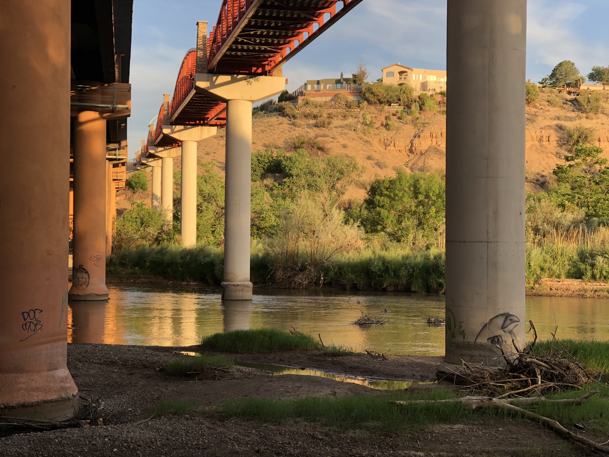
The Bird watching over a dwindling Rio Grande. To the right is the pedestrian-bicycle bridge, to the left is Interstate 40.
My mental map as I ride my bike across Albuquerque’s Rio Grande Valley floor has grown increasingly complex in the last six months as we’ve added layer upon layer of historic maps to the research for our forthcoming book Ribbons of Green: The Rio Grande and the Making of a Modern American City.
Yesterday morning, I rode at sunup, picking a path on sidestreets and the bike trail paralleling the freeway – a modern geographic feature that constrains Albuquerque’s urban form in a way similar to the way the Rio Grande served as an organizing principal for the human geography a century before. If you’re patient and have air conditioning in your car, it’ll get you all the way to Daggett in California’s Mojave Desert (I-40 actually ends in Barstow, just down the road, but Daggett has cooler stories).
The freeway bridge across the river is one of my favorite urban river spots, especially because of the graffiti. Regular readers should recognize one of Irot’s birds monitoring the Rio Grande on our behalf. The east side is just off the levee and easy to get to. The art is better on the west side, but getting there involves a gate, a very steep hill, and questionable legal behavior. I’ve only been once.
I rode early enough, to beat the heat, that the only business open was the methadone clinic, which was hopping. It’s in an underused industrial area, between the railroad tracks and what was once the American Lumber Company’s sawmill. The bike trail passes north of what’s now called the Sawmill District, which has some nice dense modern housing and a big food court open market thingie of the sort that’s all the rage right now. (Nobody goes there, it’s too crowded.)
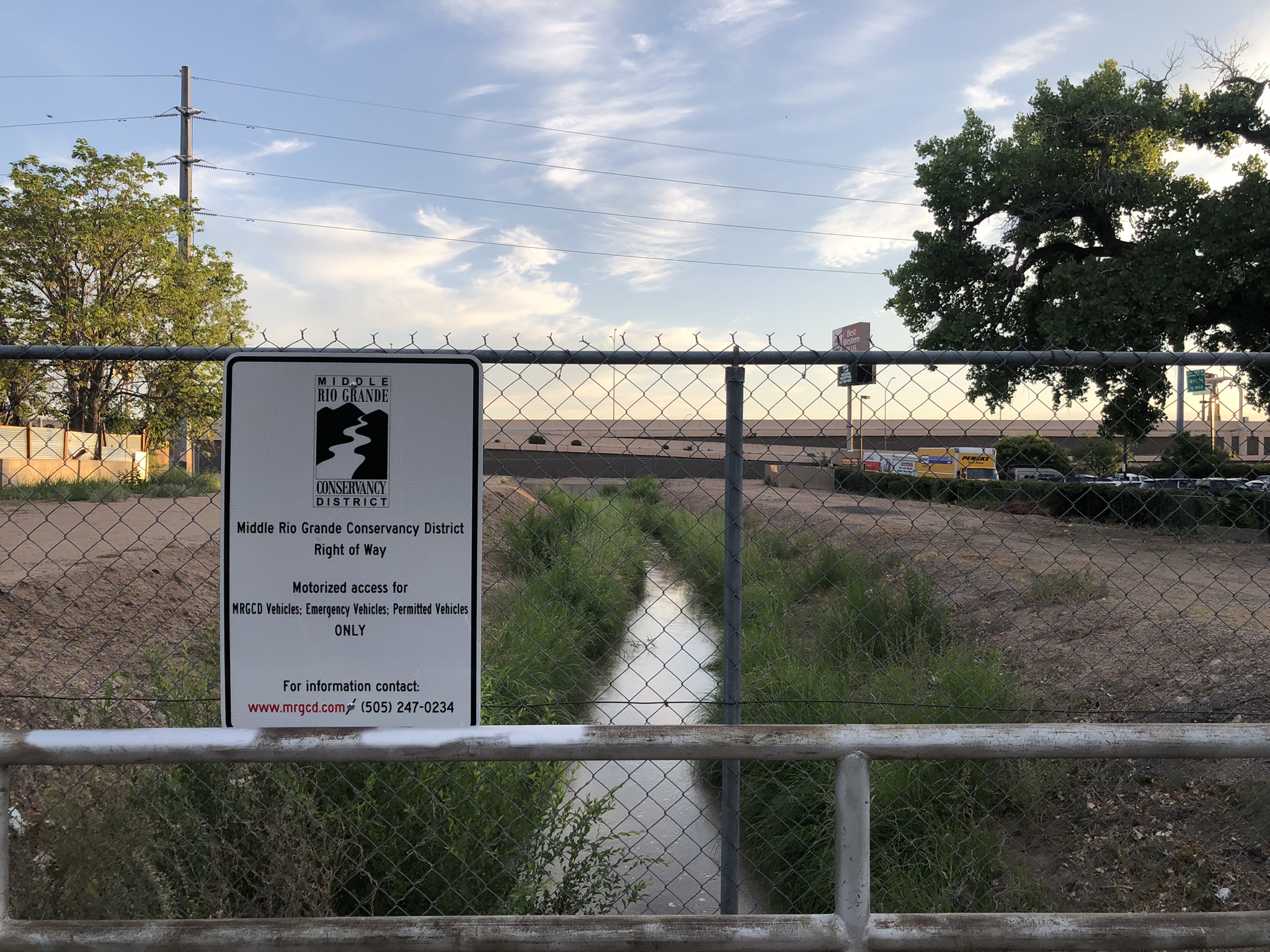
The Alameda Drain, passing beneath Interstate 40
A zig (zag?) through the neighborhood takes you past where the Alameda Drain passes under the freeway, another classic urban water feature. I need to go back to get a better picture, it’s a bit of a spectacle – lovely mini-ribbon of green with freeway off ramp and a motel.
The drains are so important to our book’s story, and so hard to get my head around. One of the central themes of the book is the way in which human communities completely rejiggered the valley’s hydrology, and the drains played an incredibly important role. Before they were dug in the 1930s, this area was swampy. My best guess based on nearby USGS groundwater monitoring data is that the depth to groundwater here today is 10-11 feet below the ground surface. The drains, dug in the 1930s, were designed to lower it to that level and drain the water off to the river for use downstream. In the process, the drains (along with levees to confine the Rio Grande to a narrow channel rather than spreading out in spring runoff), radically altered the valley floor.
That was the intent. As Steve Reynolds, the venerable New Mexico state engineer, once said, it’s hard to build a city in a swamp.
Just up the trail, I rode across what was once “Palmer Slough”, a favorite swimming hole for the locals, known for Boy Scout outings and the occasional drowning. The drains and levees acted like a moat between city and river, and I’m still trying to wrap my head around how the community’s relationship with the river changed, basically in a single year, as the draglines scraped their way down the valley floor.

Water in the desert
Today it’s easy to get to the Rio Grande along this stretch because of walking trails and bridges across the drains. Yesterday’s bike ride used a big beefy metal bridge (slippery when wet!), strong enough for fire trucks to get in, a response to our big bosque fires of 2003.
On the way home, I rode up the valley to another bike trail that parallels the Alameda Drain. We’re slowly but surely repurposing them for recreation. I saw folks watering their lawn off of one of the irrigation ditches (in what I think is the old main house of Matthews Dairy, the dairy’s land long ago repurposed as subdivisions). And this, a little irrigation ditch through neighborhood gardens. It’s been screamin’ hot here the last couple of weeks, and I can really see the attraction. The repurposing of old irrigation ditches for gardens and bike trails is at the heart of our story about how the “ribbons of green” have made modern Albuquerque, but in a way very different from that which was intended when they were built.
We’ve repurposed the Rio Grande in the making of our modern American city.
“Nobody goes there, it’s too crowded.”
I have heard tell of high school kids of the late-1960s water skiing on the big drain just east of the Rio in the North Valley near today’s Nature Center. A vehicle would pull the intrepid skier!
And about 2001, I observed my then-young neighbor in Algodones, Tyler Glidden, avidly fly fishing for trout (!) in a large drain just west of the railroad tracks. He told me there were trout in there!
Looking forward to you book. So much rich material! It must be hard to know where to stop…