
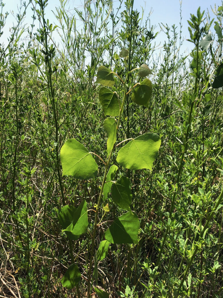
Baby cottonwood on a Rio Grande sandbar, Albuquerque, June 16, 2021
Mary Harner and I spent a good deal of time this morning trying to get our bearings walking along the west bank of Albuquerque’s Rio Grande near a place we call “the oxbow”.
Mary, a friend and colleague from the University of Nebraska at Kearney, has been working on a delightful river research project for the past few years, and had been popping back and forth between Kearney and Albuquerque quite a bit before The Thing shut our lives down for a year. In collaboration with my UNM biology/Water Resources colleague Becky Bixby, we’ve been thinking about how this river has changed over the last century.
Mary’s on her post-The Thing trip back this week, and we’ve been having a blast visiting sites and talking about the river.
In January 2020, during Mary’s last visit before The Thing, we walked down the concrete arroyo below Andalucia Park and out onto a big sand flat along the Rio Grande’s west bank. Repeating the walk this morning, we got a bit turned around – not lost exactly, but trying to figure out where it was that we’d walked 17 months ago was confusing.
We bushwhacked this morning through a thicket of young growth – willows, salt cedar, baby cottonwoods, and one of the nicest stands of feral alfalfa I think I’ve ever seen. We were looking for last year’s river bank and sand flat for a while before we realized the stand of new bosque we’d been bushwhacking through was the sand bar.
Because I’m a nerd that way, I was able to pull up the GPS I’d made with my sporty watch on that January 2020 walk, compare it today’s walk, and overlay it via Google Earth on old satellite photos to try to understand the progression – river->sand bar->nascent bosque.
A sandbar emerges
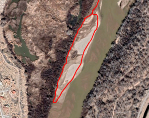
To the right is the path of sandbar in a Google Earth satellite image taken in February 2020, shortly after Mary and I trekked down there. The overlaid red line is our walk. (I’m sorry, I’m that guy who GPS’s his walks. But it came in handy for science!)
We were coming off of a very wet 2019, with peak flows the highest in this stretch of the river since 2005. It obviously moved a lot of sediment around, and we really need a geomorphologist or one of UNM’s river engineering people to help understand exactly what’s going on here. But whatever explains the sandbar’s emergence, it is clearly new.
Overlaying my trusty GPS walking path over past views of the river, it seems to have emerged in the wake of 2019’s high flows. This has happened before, notably in the mid-2000s during summer low flows. But it never seems to have stuck, to have developed enough vegetation to endure against the next high flows. Mostly you see a crazy GPS track that looks like John and Mary were wading in a river.
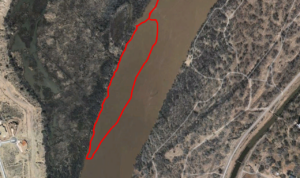
Wading in a river? Not. Satellite image from March 2004.
What’s interesting to me is what happens next. We’ve seen over the years that when vegetation establishes on these sand bars, they tend to become anchored and permanent little bits of our riverside woods. There’s an island I’ve been watching for the last 25 years up at the Alameda Bridge that has transitioned before my eyes from sand bar to lovely little forest. We like to say that without what we might call a “flood” regime – water up out of the channel during high spring flows – we won’t have cottonwood regeneration. But these sandbars and islands may be the exception?
The life of a river. The course of the river changes in increments. The natural vegetation is programmed to seek sandbars to populate. The opposing bank erodes. That erosion finds a new flat downstream.
But humans loathe a river that moves around. How do you keep track of property rights?
Pingback: Albuquerque’s Rio Grande Oxbow – jfleck at inkstain