
Boarding the Victoria-Port Angeles ferry this morning, a gang of scooters:
They got to get on the ferry first.
Needed: critter help
I was walking on the beach this afternoon when this critter poked his/her head out of the surf just offshore, looked around, then made a dash for the nearby woods. Need some lazyweb help – is it a sea otter?
update: Via Miriam Bobkoff, via Twitter – “More likely a river otter. His back feet similar in size to front, and he looks graceful on land…. We see them off Port Angeles shore, swimming in the Strait.” She links to this:
Sea otters rarely venture on land, where their movements are awkward and clumsy. In contrast, the agile river otter is frequently ashore. River otters maintain at least one permanent den on land, near the water, as well as several temporary shelters. While all otters consume fish and other aquatic animals, river otters also forage for food along the shore, and they prefer to eat on land rather than in the water.
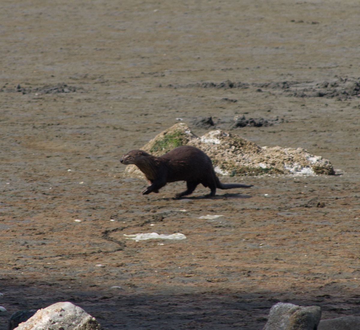
What’s this critter? Victoria, BC, May 2013, by John Fleck
Great blue heron
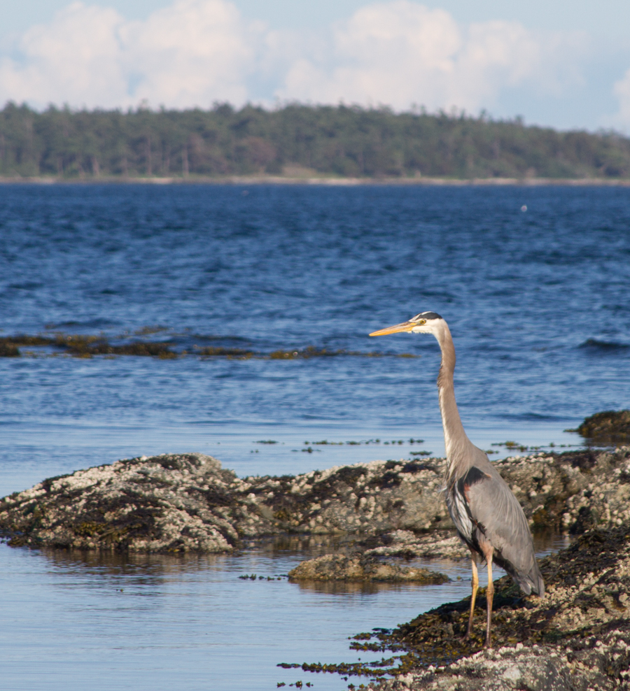
Great blue heron, Victoria BC, May 2013, by John Fleck
Observations on a brief visit to Canada
- Three of the five restaurants in which we have eaten during our brief visit have had hockey on the television. This includes breakfast this morning at Denny’s.
- The Kwik-E-Mart where we stopped to procure snacks had Hershey’s chocolate Stanley Cups for sale. Also, hockey on the television.
- The tendrils of empire extended to the park on Saturday, where a cricket match was underway.
- An urban seashore (Victoria and suburbs) strung out with public parks between the homes of the rich. Nearly all the public parks had clean toilet facilities, and on a sunny Sunday afternoon we never had difficulty finding a parking place.
- I realize it is a cliché (and a risk of nationalistic stereotyping) to comment on Canadian politeness, but it is a reasonable explanation for this, which I thought of as a “conceptual gate”:
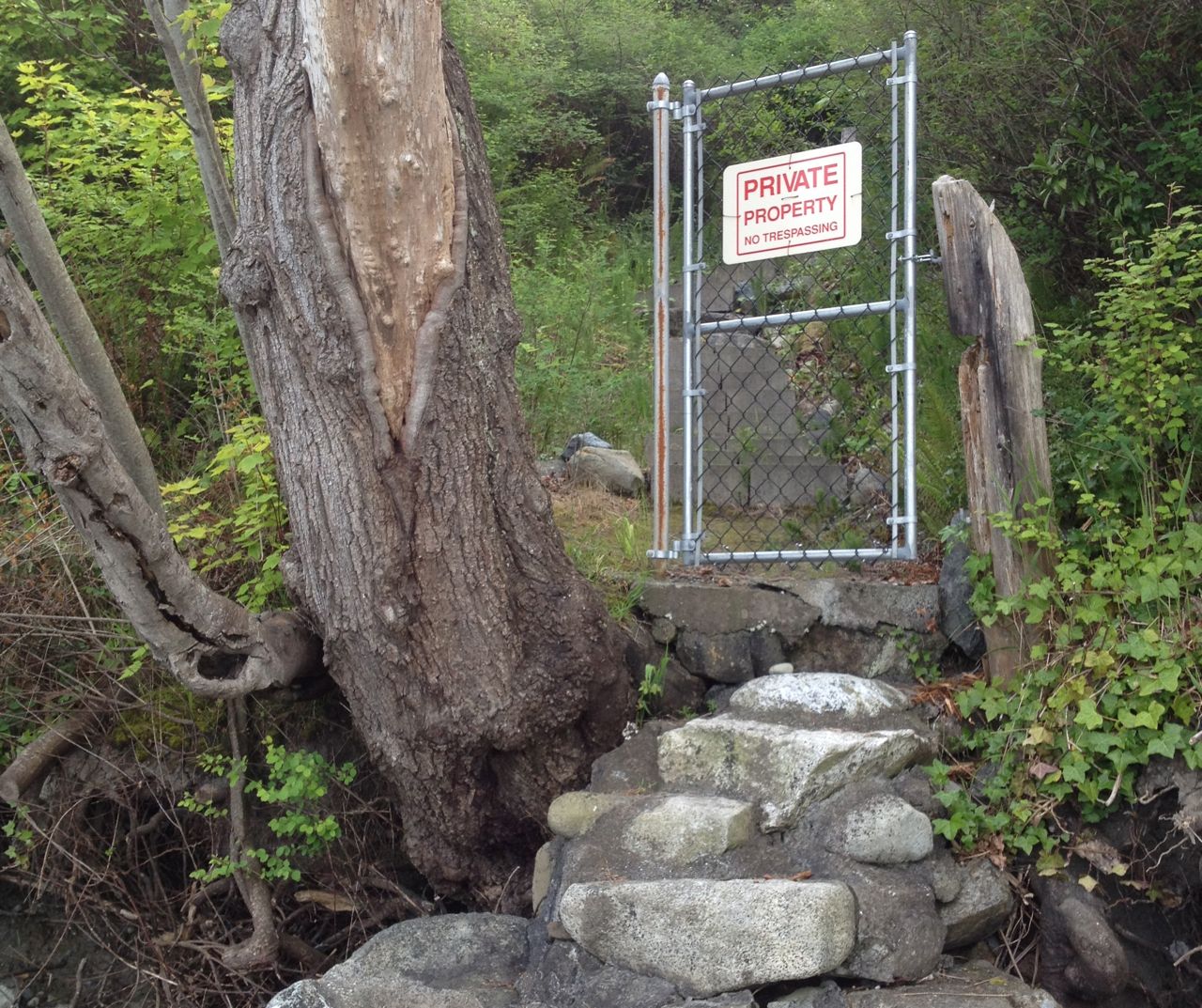
conceptual gate guarding steps from a Vancouver Island beach to a private home. by John Fleck, May 2013
Water’s for shippin’ over, too
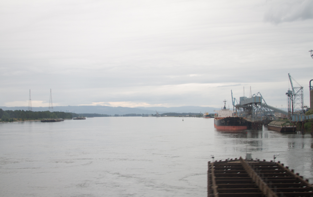
by L. Heineman
My particular view of the water world is constrained by scarcity. We don’t move a lot of cargo on the Rio Grande or the Colorado, the two rivers in my immediate field of view.
I forget, and our current trip to the Pacific Northwest has reminded me, of the magic of water in service of the movement of people and goods. Rivers and oceans provide smooth, low-friction roadways to move large quantities of stuff. (Steve Solomon’s Water: The Epic Struggle for Wealth, Power, and Civilization
This photograph is either the Willamette or the Columbia, taken by Lissa from the Amtrak as we crossed both in quick succession. In 2012, the Port of Portland shipped 4 million tons of wheat. (source: pdf) That’s enough for more than a pound of wheat for every human on the planet. In some small ways, as a young man I helped farmers out in eastern Washington to grow wheat. It most likely was shipped down the Columbia River, ending up at terminals at the Port of Portland, where the Willamette and Columbia meet upstream of the Pacific Ocean.
Portland and Seattle had a bit of a contest in the 19th century to become the Pacific Northwest’s dominant port

This is all good for me to remember. They don’t ship a lot of wheat on the Rio Grande.
Oystercatchers: “evolution, wtf?”
Saw oystercatchers on a Puget Sound beach this week. Their beaks are a freakish orange-red:
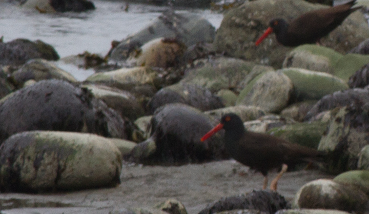
Oystercatchers, Whidbey Island, May 2013, by John Fleck
To which Nora commented, “evolution, wtf?”
Caspian terns
I spent time this afternoon watching Caspian terns fishing off the beach next to the Coupeville-Port Townsend ferry. This guy was successful.

Caspian tern, Whidbey Island, May 2013, by John Fleck
Later, when I was wandering the backwater nearby, I apparently got too close to the terns’ nesting area. The sent out the call, and five hovered around squawking while one repeatedly dive-bombed me. Never got close enough to poke my eyes out, but I got the message and left.
Seattle: creeping toward water
Our waitress at dinner tonight, on finding that Lissa and I are from Albuquerque, asked what brought us to Seattle. “The water,” Lissa said.
“We’ve got lots,” the waitress said, pointing with a smile out the window to Elliott Bay. “Happy to share.”
Seattle wraps around Elliott Bay, both geographically and historically. I guess that makes sense. Geography always constrains history, but in ways that are particularly striking here. We splurged on a couple of nights in the city overlooking the water before heading out to see family on Whidbey Island, and as I write this I’m looking out on a pair of gulls (glaucous-winged I think) in the foreground, dancing lazily in the wind, and the Port of Seattle in the background.
As Matthew Klingle explains in his environmental history Emerald City
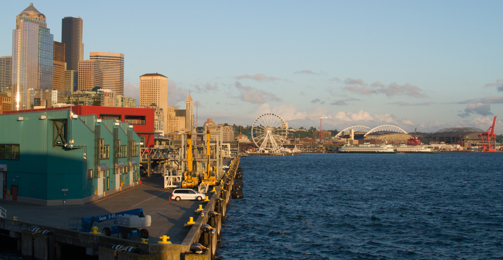
Seattle, May 2013, by John Fleck
Klingle’s book is a fascinating tale of Seattle simultaneously embracing and strangling the water around it – the lakes, the salmon runs, Puget Sound. As is almost always the case (few major US cities don’t have some roots in “port-ness”), Seattle grew up around its role as the regional shipping hub, which means it grew up around Elliott Bay. But as a community, a place, Seattle also loves its water, so the embrace is a complicated one. Heavy commerce meets jogging path. I noticed signs on several downtown waterfront piers explaining that they are public places (they have benches), but that on occasion commerce can trump public purpose when a ship’s unloading. Klingle tells the sometimes hilarious early stories of the decision about where to draw the line between public water and private land, that which was freely available for all to use and that which could be owned. The uneasy dance around that line continues.
I don’t know enough about Seattle’s economy to explain the role of the port. There have been stories in the local papers documenting the port’s decline relative to rival Tacoma. Traffic is down the last couple of years, but there’s still a lot of cargo moving through the big terminals sitting astride what used to be the Duwamish. We watched a pair of tugboats shepherd two big container ships.
But the horizon looking south across Elliott Bay highlights the complex geography – shipping terminals, ballpark, ferris wheel, clam shack (ah, Ivar’s), ferry terminal and the downtown skyline all compete for the scarce real estate embracing the bay.
As Lissa and I were walking around this afternoon, we stumbled upon a great tragedy narrowly averted. A trucker, lost in downtown, tried to make a right turn on Pioneer Square but couldn’t quite make the corner. When we arrived, the truck was lodged hard against the square’s historic pergola. Another few feet and it would have come crashing down, and not for the first time. A clerk in a store across the way told Lissa this has happened before.
Much flashing of lights and huffing and puffing by a truly mighty tow truck dislodged him, and the Pioneer Square pergola was saved to continue its sacred role of sheltering Seattle’s homeless from the city’s relentless drizzle. A rainstorm blew through, Lissa and I ducked into a shop for coffee and pastries, which is what one does here. The tables around us were all laptops and earbuds and while we were drinking it, I kid you not, we heard Pearl Jam on the shop’s stereo.
Farming, first world style
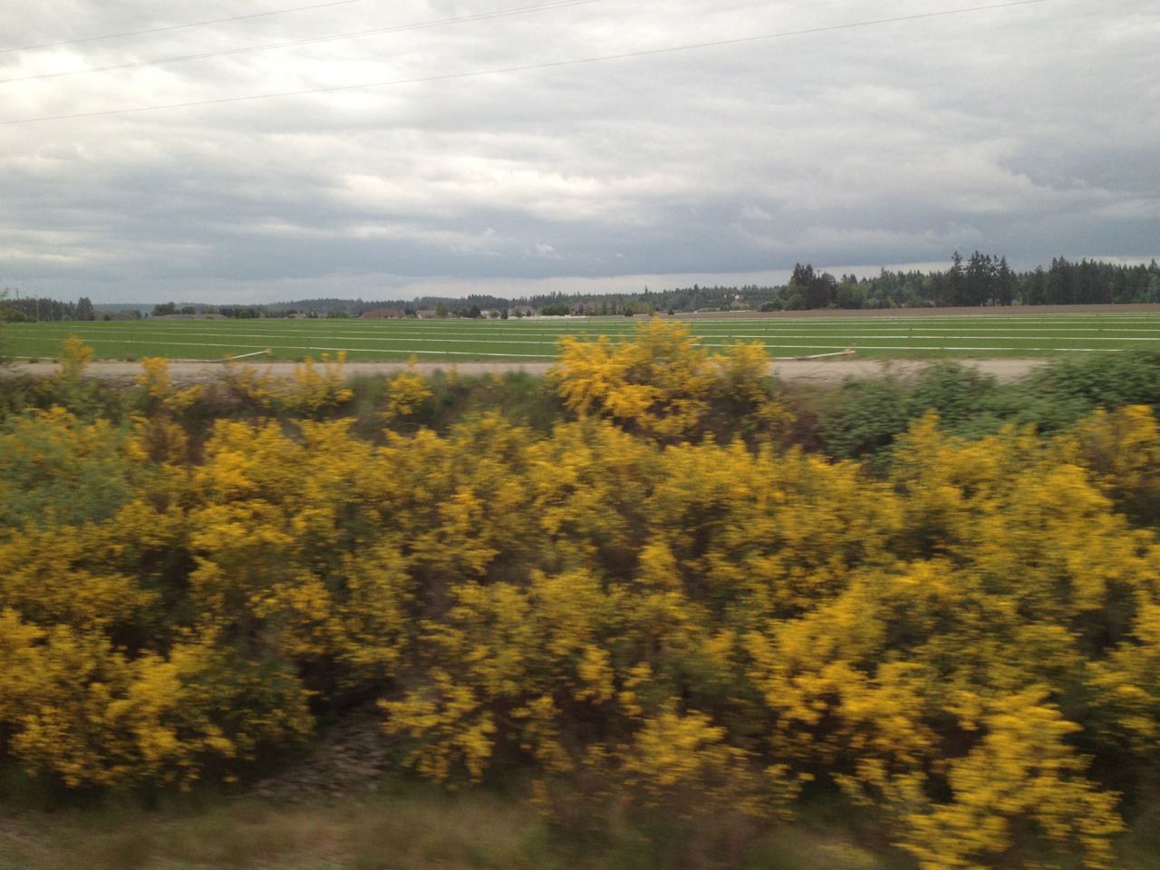
Country Green Turf Farms, Olympia WA
Given that I’ve got farming on the brain, our recent Amtrak trip across the western United States was fascinating. The train goes through a lot of farm country, I guess in part because there is a lot of farm country in the western United States. We saw strawberries in Oxnard, the metastasis that is California’s wine country, grand fields of lettuce, the most beautiful aggregation of iris I’ve ever seen and lots of wheat and alfalfa.
Wheat and alfalfa seem to be staples.
But the strangest farm of all came just outside Olympia, Wash., a carpet of green with little squares cut out of the edges, the largest lawn I’ve ever seen. When I tweeted a picture, Brett Walton recognized it as the turf farm where they grow the grass for the Seattle Mariners baseball stadium. With that clue and some Google mapping, I believe I tracked it down to Country Green Turf Farms.
Given the cost of a beer at the ballpark, I’d say that’s some high-value agriculture.
Total Mead/Powell storage headed for lowest level since Powell first filled
Ever the journalist in search of gloomy extremes, I just noticed that total storage in Lake Mead and Lake Powell, the two largest reservoirs used to manage flows on the Colorado River, is currently forecast (USBR pdf here) to end the current water year at its lowest level since 1968, when Powell, the uppermost reservoir behind Glen Canyon Dam, was first being filled:
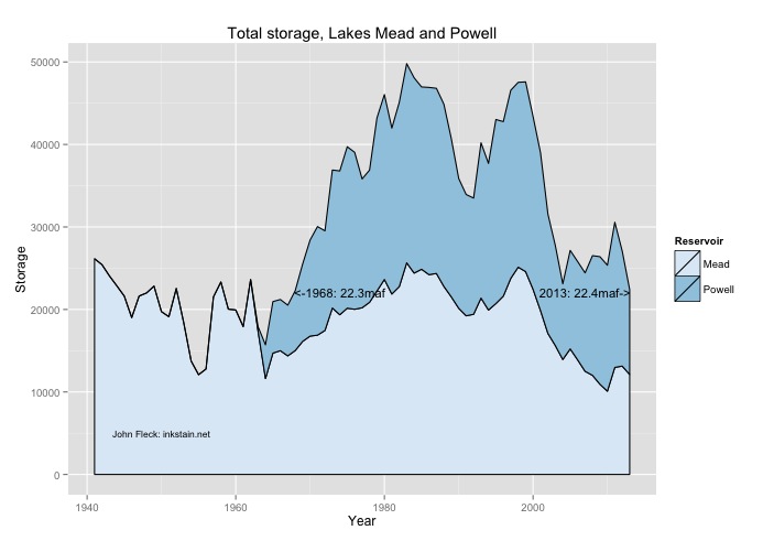
Mead/Powell storage
Data here