unseemly bragging and links to my award-winning work

This feels a bit unseemly, but I’m frankly enormously proud to have won a Society of Professional Journalists “Top of the Rockies” award for my work last year on forest health, fire, politics and policy in the mountains of the West:

The driest January through June in New Mexico history came down to this: For the first time in scientist Craig Allen’s 25 years at Bandelier National Monument, Frijoles Creek past the monument’s Jemez Mountains visitor center went dry.

Oak and mountain mahogany trees barely leafed out.

Since Jan. 1, the Bandelier fire lookout has received less than half an inch of rain.

“You can evaporate that from a pan on a warm afternoon,” Allen said Friday.

In that piece, the first of what turned into an accidental series, I had the luxury of backing into the story. New Mexicans reading it that Sunday, July 3, could look up and see the smoke. They knew I would eventually get from drought to fire.

Over the next few months, I also wrote:

I’m proud because these stories mattered to me a lot. I’m enormously grateful to a large group of scientists and policy wonks who helped me write them, especially Craig Allen, Tom Swetnam, Bob Parmenter, Laura McCarthy, Julio Betancourt, Nate McDowell and Melissa Savage. (update: so many more people belong on the list, but especially Don Falk)

Here’s how the first story ended:

Firefighters saved Bandelier’s main ruins area and visitor center, along with Allen’s office, but more than half the park’s acreage burned.

When he returned last week, Allen noticed something remarkable: Water has returned to Frijoles Creek.

Upstream, the forest that once lined the creek is gone. “You don’t have all those trees sucking water out of the system,” Allen said.
 

Nearly half of last year’s Colorado River “bonus water” will be gone by the end of the year

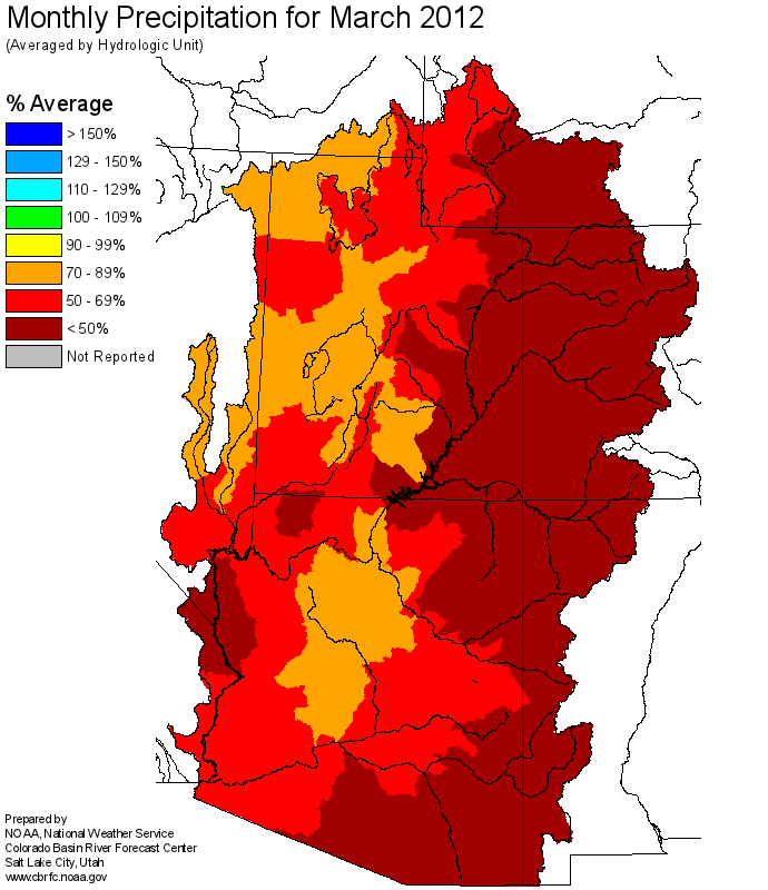
March Colorado Basin precipitation, courtesy CBRFC

March Colorado Basin precipitation

In an email last week, Kevin Werner at the Colorado Basin River Forecast Center called March 2012 “one of the warmest and driest on record in the Upper Colorado Basin.” The Forecast Center’s April 1 numbers are the ones you can start taking to the bank, with the bulk of the snow accumulation season behind us and melting and runoff now underway.

The Bureau of Reclamation has translated the runoff forecast from Kevin and his colleagues into reservoir numbers. The latest “24-month study” (pdf) shows the results. Total estimated storage combined in the reservoirs behind Hoover and Glen Canyon dams is down 1.469 million acre feet from the estimate just one month ago. Because of the equalization rules currently in place, intended to balance storage in Mead and Powell, Lake Mead is estimated to end the year with a surface elevation of 1,114.3 feet above sea level, down a bit less than 2 feet from a year ago. Powell’s estimated end-of-year surface elevation is 3,632.55 feet above sea level, down a bit more than 20 feet from last year.

Overall, total net storage in the two big reservoirs by the end of September is estimated to be 28.2 million acre feet, down 2.4 maf from the previous year. Remember that bodacious snowpack of 2010-11, all the bonus water filling both of the big lakes? 46 percent of last year’s bonus water will be gone by the end of this year, according to the new 24-month study.


“insufficient water to meet needs”

If Kelly Redmond had a nickel for every time I’ve quoted his definition of drought, he’s have enough money for lunch today:

Wet years have a way of covering up a multitude of water management sins. Drought exposes them for all to see.

Back in the 1990s, we had all the same underlying water management problems in this state, but a string of wet years left Elephant Butte full and allowed us to ignore our problems.

A run of 13 dry years out of 15 years since then on the Lower Rio Grande has left us with insufficient water to meet the needs of all the water users in the Lower Rio Grande Valley.

Kelly’s definition of drought can be found in “The Depiction of a Drought” (pdf), BAMS, August 2002.

Recreating the flow of the Indus

The ubiquitous Connie Woodhouse (one of the stars of The Tree Rings’ Tale) has been working with a team using tree rings to reconstruct the flow of the Indus River:
Dr. Woodhouse did the reconstruction of the water flow level in River Colorado in the US. She is working on a similar project for River Indus by looking at tree rings.

Speaking to Dawn.com, Dr Moinuddin Ahmed said that tree rings are not only used to assess the age of a tree, but also a powerful tool for water flow modeling, forest ecology, archaeology, drought, rainfall, glaciology and climate change. Wood chips from archaeological sites can also be used for dating and other purposes. Thus tree rings provide amazing other details rather than just counting their age. Juniper and Pine trees are often used in dendrochronology.


Did I miss the peak?

I’m kicking myself thinking I may have already missed the Rio Grande’s runoff peak.

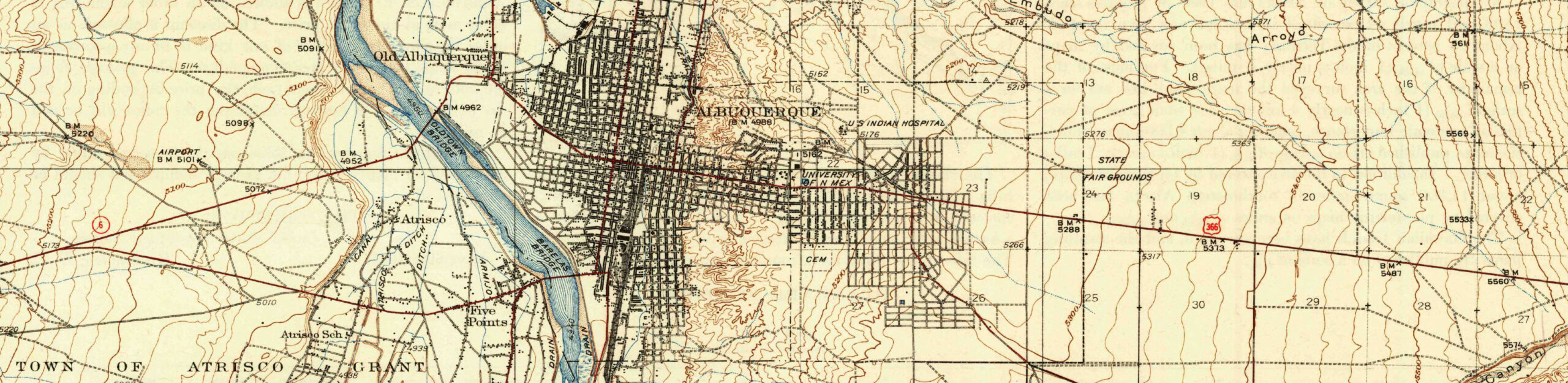
Earlier in the week, the river’s flow jumped up over 2,000 cfs through Albuquerque, which ain’t much as rivers go, but there’s at least a chance that’s the best we’ll see this year. The peak usually comes much later, late May-ish, but this year has been absolutely freakish with March drying out and warming up dramatically. There’s a possibility, based on some of the modeling I’ve seen, that the river could come back up in late April-early May. I hope so.

I was finally enough over this flu thing this evening to go out for a walk on my favorite riverside path, in the woods south of the Central Avenue bridge. Out on the river I saw gadwall and a cinnamon teal and got a glimpse of the massive gray back of a great blue heron flying low over the river. Up in the swampy reeds at the south end of one of the habitat restoration project ponds, a muskrat was driving a marsh wren absolutely crazy. I mostly heard the wren, which was making a racket, but got a glimpse through the still-brown reeds left over from last year. Life bird number 248.

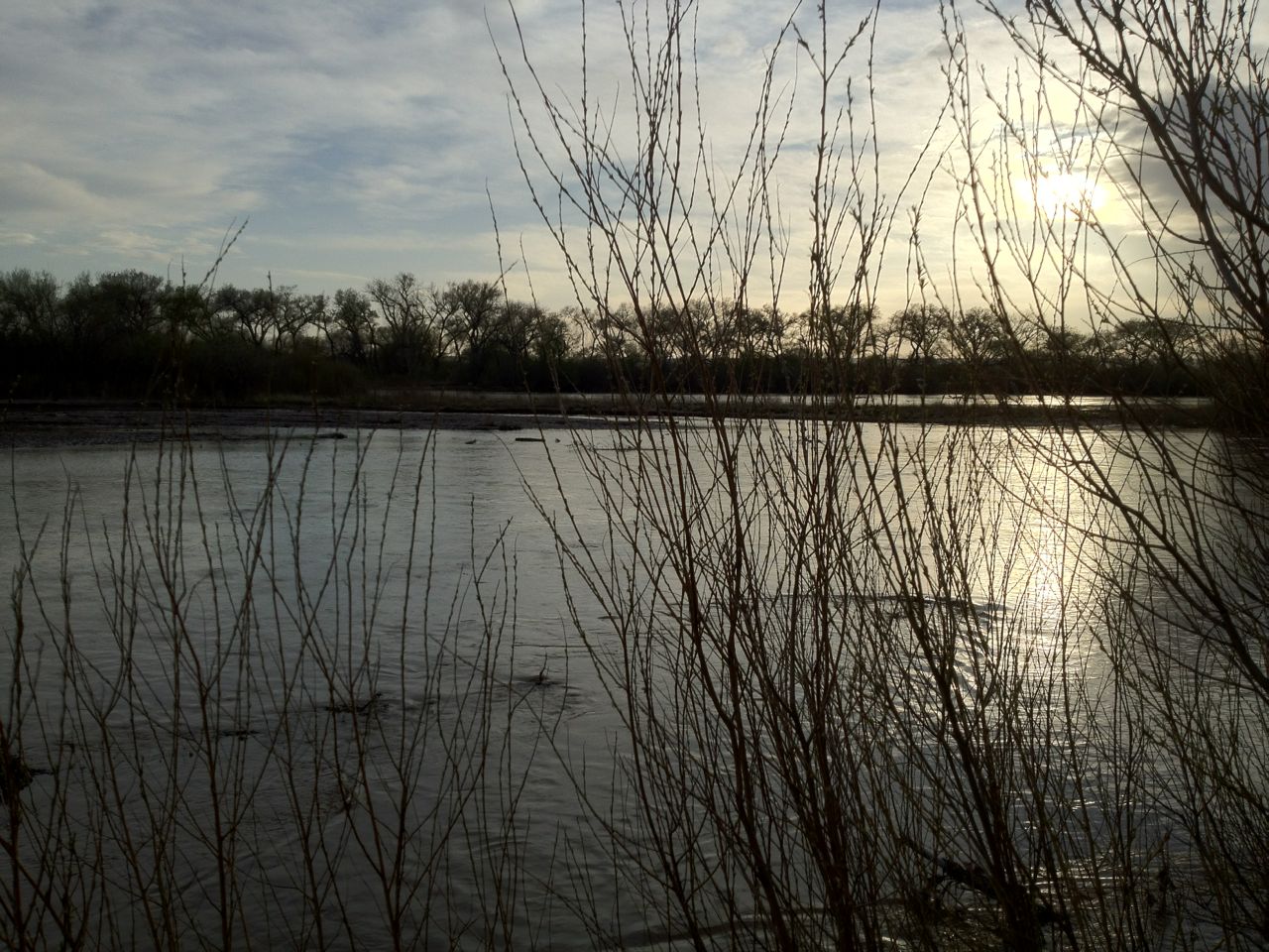
No picture of the wren, but here’s the dusky Rio Grande:

Dusky Rio Grande

Dusky Rio Grande, by John Fleck, April 7, 2012

Stuff I wrote elsewhere: lousy runoff on the Rio Grande

From the morning paper, a report on the April Rio Grande runoff forecast plunging off a cliff:

Gary Esslinger’s chosen profession, delivering irrigation water to southern New Mexico farmers, looks like some sort of cruel joke these days.

The latest punch line came this week in the form the federal government’s April Rio Grande runoff forecast, which calls for just 29 percent of normal spring and summer runoff into Elephant Butte Reservoir.

That’s the reservoir that supplies water to farmers in the Elephant Butte Irrigation District, in the Hatch and Mesilla valleys of southern New Mexico. Esslinger, the district’s general manager, faces the unhappy task of going back to his farmers next week and telling them to expect even less than the meager allotment they had been counting on.

“The business that I’m in, of supplying surface water, is kinda like going out of business,” Esslinger said Thursday.


New Mexico rural-urban groundwater project denied

From this morning’s newspaper, my story about the New Mexico state engineer’s decision to deny a proposal to pump rural groundwater from rural western New Mexico to the Rio Grande Valley:

By failing to be specific about where the water was going, the project’s backers failed to meet the requirements of state law, Verhines ruled.

The project amounted to water speculation, which is illegal, said Bruce Frederick with the New Mexico Environmental Law Center, one of the lead attorneys for a group of rural residents who fought to block the project. It is the second recent state ruling to conclude speculation is not allowed under state water law.

“All this ruling does is confirm what anybody who knows about water law and cares about water law already knew,” Frederick said Monday.

This project, the Augustin Plains Ranch proposal, is probably the least famous of three similar western water projects. As I wrote in an overview of the project last year, it would have moved 54,000 acre feet a year of water from the ranch country near the little town of Datil for unspecified uses in the Rio Grande Valley, where the bulk of New Mexico’s population lives.

It bears a striking similarity to the Cadiz project in California (similar in size, pumping an average of 50,000 acre feet per year from the Mojave Desert east of Joshua Tree National Park to coastal cities) and the much larger Southern Nevada Water Authority proposal (185,000 acre feet per year).

The legal decision here in terms of the big picture issues being discussed in these projects is quite narrow. While much of the political discussion in the Augustin Plains case surrounded area-of-origin questions – will the ranch communities where the water originates be harmed? – the New Mexico legal process never reached the point of considering that issue.

Instead, the State Engineer ruled that those proposing the project failed to clear a more preliminary threshold by not being able to specify who would use the water, where and how. In that regard Augustin Plains is very different from Cadiz and the Southern Nevada Water Authority projects.

Given that, I’m not sure there are any strong parallels to be drawn between this week’s New Mexico ruling and Cadiz or SNWA, beyond the fact that all three projects are evidence of strong pressure to do this sort of thing and the legal issues are sufficiently different here that the issues that led to the New Mexico decision don’t really apply to the other two cases.

National Research Council on the scarcity value of water

Another tidbit from the National Research Council’s new report on the problems of the California Bay-Delta:

By assigning to water a scarcity value of zero, many current policies signal consumers that water is available without limit, even while the limits imposed by scarcity are intensifying. As a result, more water is used than would be the case if its price reflected scarcity.

the sharp edge of a knife between wet and dry

I’ve written before about John Van Dyke’s memorable description of the line between a desert river’s ribbon of green and the arid landscape that surrounds it…

the line where the one leaves off and the other begins is drawn as with the sharp edge of a knife.

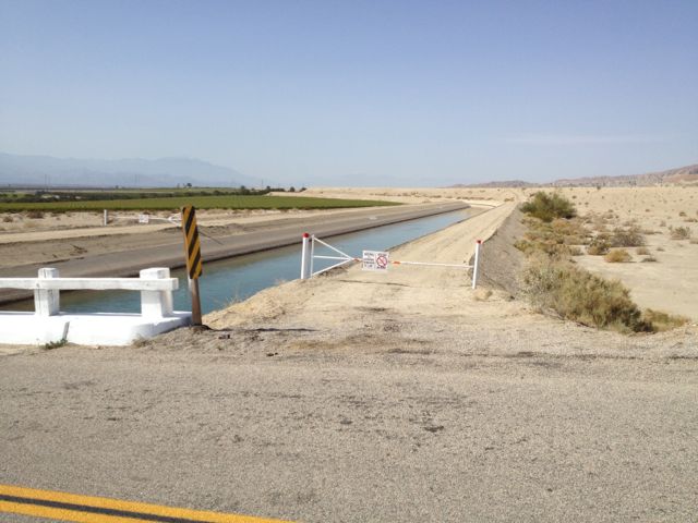
This holds true when the knife’s edge is drawn by a canal rather than a river. I took this last month in the Coachella Valley east of Mecca, Calif. The canal’s delivering water to irrigate the farmlands to the west, both metaphorically and also quite literally holding off the desert to the east:

Desert's Edge, Coachella Valley, February 2012, by John Fleck

Desert's Edge, Coachella Valley, February 2012, by John Fleck