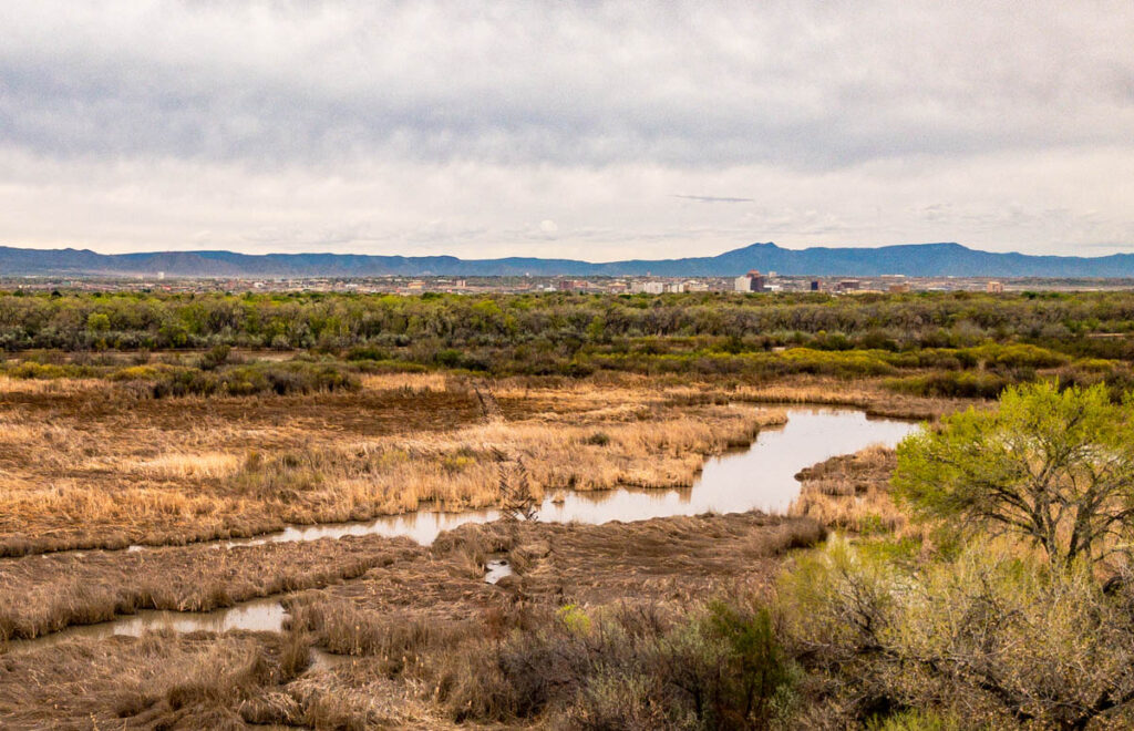
Rio Grande Oxbow, 2020-04-09, by John Fleck
I was talking last week with one of my collaborators about the challenge of working. All the things that so fully occupied my time and brain seem so inconsequential right now.
I envy friends filling the quiet with productive work.
Me? I ride my bike.
In the Time Before (was it just two months ago?) my UNM friend and colleague Becky Bixby and I delightedly tromped around Albuquerque’s Rio Grande with Mary Harner, a faculty member at the University of Nebraska who’s leading a fabulously eclectic study of the Rio Grande and some other rivers.
I first met Mary 15 or 20 years ago, when she was a PhD student at the University of New Mexico doing Rio Grande bosque ecology. She’d done some neat work back then using repeat aerial imagery to look at how the river system had changed. The new work is in some sense a return to that.
Mary and her Nebraska collaborator Emma Brinley Buckley have been in and out of Albuquerque for several years studying our Rio Grande with fresh eyes. Combining science with digital storytelling, they’ve been trying to make sense of the changes our river has undergone over the last century.
On their last few visits, they’ve been zeroing in on the stretch of river through the heart of Albuquerque, collecting old aerial maps and photographs. Emma’s done some nice repeat photography (see example here), and we spent a fruitful day in January poring over orthorectified aerial images over time.

the Rio Grande “oxbow”
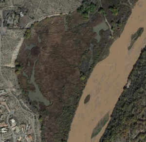
One in particular drew our attention – an area along the west side of the river for which Mary and her colleagues had found two images taken in 1959, one in the early spring and one in fall. It included a place we call “the oxbow” – an old cutoff meander at the base of a long, steep bluff along the river’s western margin.
In Life on the Mississippi, one of my pandemic reading diversions, Mark Twain offered a marvelous explanation of how such cutoffs form when a river decides to straighten out a sinuous bend – “the water cleaves the banks away like a knife”.
“There is something fascinating about science,” Twain wrote. “One gets such wholesome returns of conjecture out of such a trifling investment of fact.” So have Mary, Becky, and I been reaping returns on the facts of Mary’s aerial photos. In 1959 it seems not to have been a river straightening a sinuous bend, but rather humans directing heavy equipment to straighten the Rio Grande here, to more efficiently deliver water downstream during drought. You can see the cutoff happen in the before and after 1959 pictures.
Those of us who work and play on and around Albuquerque’s Rio Grande have long wrestled with this central fact – a river that once meandered a flood plain, straightened and channelized in the 1950s, turning it from river into water delivery ditch. Mary’s aerial photos electrified me when I first saw them, a snapshot in time capturing that central fact.
If you look closely at my picture at the top of the post, you can see a line of “jetty jacks”, metal structures installed that summer of 1959 to help stabilize the river’s flood plain. They show up in the second of Mary’s 1959 images, and they remain today. The oxbow itself also remains, the only sizable swampy bit along this stretch of river.
Neighborhoods have encroached on the bluff above it, save one piece of protected city open space park and one undeveloped parcel that is the subject of intense politics right now. Well, which was the subject of intense politics in the Time Before. Hard to know what new home development looks like in the Time After, if there is such a thing.
As I said at the outset, I’ve not been able to focus on the deep work that used to so fill my mind. We’re keeping the UNM Water Resources Program’s trains running, and I’m struggling mightily to figure out how to teach students who I can talk to face to face. But that’s about all the brain share I have right now.
So I ride my bike, to the bluff above the oxbow, and take pictures for Mary and Emma, who can’t be here.

John: The oxbow had been divided by a series of dikes (for lack of a better term) running perpendicular to the river. These obstructed water flow through the oxbow. There are flows from the Calabacillas arroyo from the west (which provides part of the northern boundary of that contentious development project you mentioned) and the Corrales riverside drain from the north. The Army Corps carried out a project 7-8 years ago (I’ve forgotten exactly but Ondrea Hummel was still there) to put drainage through the dikes to get better water circulation, remove some jetty jacks and invasives, and make some other improvements; at the time there were some thick willow stands along the river. The bluff was the original proposed location of a nature center that would look across the river at the proposed Candelaria wildlife preserve – that didn’t work out and the Rio Grande Nature Center State Park was built on about 40 acres of land leased from the 167 acres at the end of Candelaria purchased in 1977 (with partial support from the Land and Water Conservation Fund) for a nature center and wildlife preserve. The Candelaria Nature Preserve has a draft Resource Management Plan that (once approved) is supposed to finally (after 4 more years) replace the LWCF non-compliant alfalfa farming with a natural mosaic landscape similar to what is being done at Valle de Oro NWR and has been done at the Whitfield Wildlife Conservation Area.
Update: the undeveloped parcel mentioned above has now been acquired and will remain green space. Hoping for a nature center extension on the west side of the river.