The interior West’s disappearing snowpack

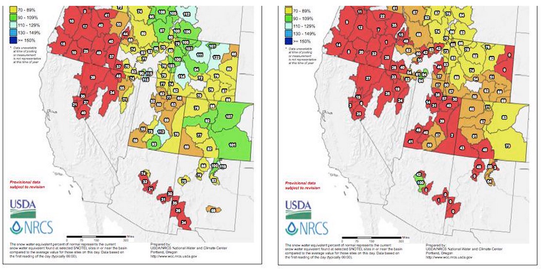
Checked in this evening on the snowpack map, which I haven’t been watching closely. Yow, what I missed! On the left is percent of average for March 1, on the right is this morning’s percent of average:

declining snowpac

declining snowpack

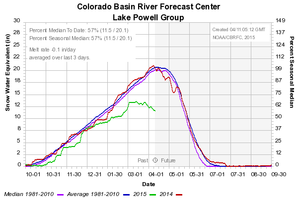
Here’s what that looks like summed up across the Colorado River Basin above Lake Powell:

Snowpack above Lake Powell

Snowpack above Lake Powell

Water in the desert, Wellton-Mohawk edition

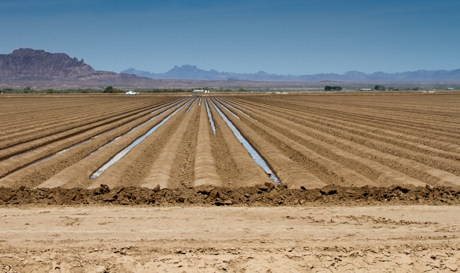
Preparing the field. Wellton-Mohawk Valley, Arizona

Preparing the field. Wellton-Mohawk Valley, Arizona

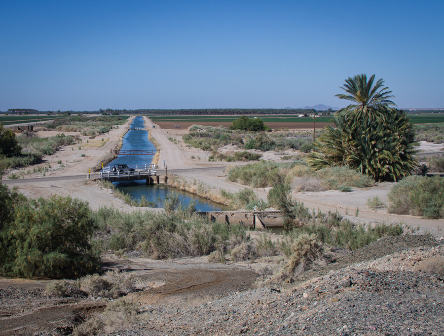
The Wellton-Mohawk Valley is one of those places where you can feel the desert pressing in around you, a ribbon of irrigated green no more than 3 miles wide along the Gila River in southwestern Arizona. The last of the winter vegetables are done, and farmers are getting the ground ready for their spring-summer cover crops. This is Colorado River water, diverted at the east side of Imperial Dam into the Gila Main Gravity Canal.

San Diego displeased with state water mandate

The San Diego County Water Authority is displeased with the state of California’s decision to set the starting point for its water conservation mandate at 2013, arguing that it rewards communities that ignored the need to conserve until recently, and  penalizes those that have been at the conservation game for a while:

For example, water use in San Diego declined 20 percent from 2007 to 2013. By failing to account for this conservation, the proposed regulations punish those who have conserved and rewards communities that did not make such early and sustained commitments to conservation.

Fallowed ground: 21st century water institutions on Yuma Mesa

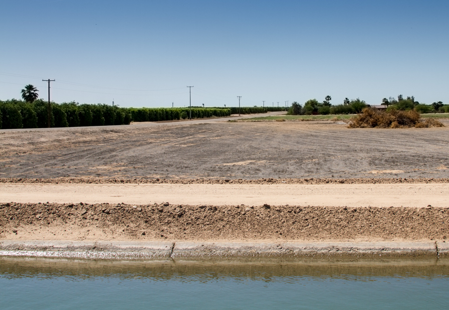
Fallowed field on Yuma Mesa, April 2015, by John Fleck

Fallowed field on Yuma Mesa, April 2015, by John Fleck

This is a field fallowed under a 2013 agreement between Yuma Mesa Irrigation and Drainage District and the Central Arizona Groundwater Replenishment District.

The deal is small, but it raises all kinds of fascinating issues of both water management and culture down here in Arizona’s southwestern corner, where water is both economically critical and culturally of profound importance.

The economics makes sense. Farmers up on the mesa’s sandy soil pretty much exclusively grow citrus, which has had its ups and downs in recent years. Every 15 or 20 years, they pull out groves and rest the land for a few years to kill the cooties (not the technical term) that build up in the soil before planting new fruit trees. Typically they’ll plant alfalfa as a cover crop to generate a bit of income during this cootie-killing phase. But CAGRD came down here a few years ago with an offer: $750 an acre to simply fallow the land. (update in response to reader question: It’s $750 per acre per year, currently a three-year agreement, with farmers able to move in an out of the program in one year increments during that time.) (Brett Walton did a good story back in 2013 explaining the deal in more detail.) That’s more than the farmers would have made with the alfalfa, so a bunch signed up – 1,420 acres’ worth, a bit less than 10 percent of the irrigated land on the mesa. The unused water, which preliminary calculations put at a bit less than 5 acre feet per acre, is held in Lake Mead.

It’s not a lot of water. This was as much about learning how to do a deal like this in Arizona as it was about the water saved. California is much further along in this sort of thing, with ag->urban transfers from Palo Verde and Imperial Valley to coastal Southern California. But this is new territory here in Arizona.

I’m not sure yet what lessons have been learned. There are, as one ag water person down here told me, a lot of people in Yuma that don’t want any water leaving Yuma. It’ll be interesting to see if the agreement is renewed.

The groundwater-surface water connection

Sharlene Leurig:

We dug through a ton of data to learn what we could about how much water in Texas rivers comes from groundwater. We were really amazed to find that in an average year, not a drought year, anywhere between 15 and 40 percent of a river’s flow comes from the water below ground.

During times of drought, like what we have been experiencing in the past few years, the amount of water in a river in Texas that comes from below ground can be as high as 80 percent of total flow. So it is a really critical interaction, but it is one that is poorly understood in terms of data and monitoring. It is poorly managed in terms of state water plans, projections of future availability, the impact of our desired future conditions.


Palm trees and durum wheat

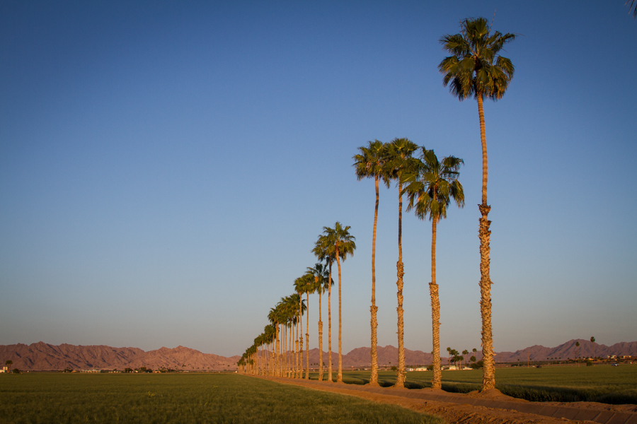
Palm trees and durum wheat, Gila Valley east of Yuma

Palm trees and durum wheat, Gila Valley east of Yuma

One of the things we do with Colorado River water is grow durum wheat in the Gila River Valley. Durum is used to make pasta. Here in the valley around Yuma, where the Gila River meets the Colorado in Arizona’s southwestern corner, durum is planted as a cover crop in spring on land that derives its primary income from winter vegetables.

The growth of a winter vegetable agricultural base here over the last four decades has been extraordinarily lucrative, and it also uses less water than the old days when they irrigated cotton and alfalfa during the crucible that is summer in the Lower Colorado River desert. Total annual water use here is about 20 percent less than it was in the 1970s, when the shift to winter lettuce began. (The Yuma County Agriculture Water Coalition has much more background on water use here, including an interesting report arguing the case for the efficiency of their water use.)

Most U.S. durum wheat is grown in North Dakota, with California, Arizona and Montana also contributing. (source pdf)

It’s not all Hoover Dam and giant canals

Pumping irrigation water from the Colorado River

Pumping irrigation water from the Colorado River

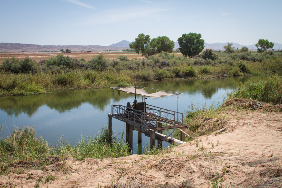
The Colorado River isn’t very big here, but there’s still enough water in it to drop a pump and irrigate a crop.

This is on a weird little geographic island, a chunk of land that is on the west (California) side of the river, but legally in Arizona – left stranded when the Colorado River meandered back on itself after the borders were drawn. Because of this clash between legal and physical geography, the land isn’t connected to any of the irrigation districts, but it still has water rights, which are met by sticking a pump in the river itself.

Huge thanks to Ron Derma, general manager of the Bard Water District, who gave me a great tour of the area.

Habitat conservation on the Lower Colorado

Laguna Division Conservation Area, Colorado River just south of Imperial Dam

Laguna Division Conservation Area, Colorado River just south of Imperial Dam

“Collaboration is a much better way of working than litigation.” – Estevan López, Commissioner, U.S. Bureau of Reclamation, during today’s festivities marking the tenth anniversary of the Multi-Species Conservation Program on the Lower Colorado River.

Jerry Zimmerman, former executive director of the Colorado River Board of California, told a story this morning about how the effort that became the Lower Colorado Multi-Species Conservation Program grew out of a series of conversations on a bus tour of the Upper Colorado River Basin. Stuck in a bus together on one of these things, I guess, leaves time for chatting.

It was the mid-1990s, and Colorado River managers were watching the chaos in California caused by endangered species battles over the Sacramento-San Joaquin Delta. That issue still has the delta tied up in knots, but the effort launched to prevent such tangles on the Lower Colorado seems to have sidestepped a similar fate.

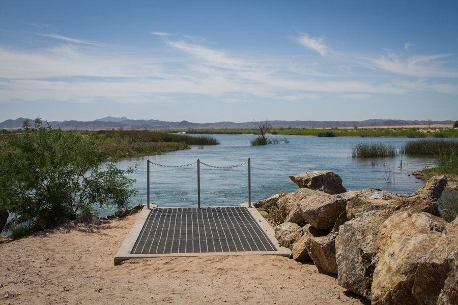
We toured the 1,100 acre Laguna Division Conservation Area, just downstream from Imperial Dam on the Arizona side of the Colorado River. This is a classic post-dam western river flood plain. Take away the floods, and the flats become choked and overgrown – in this area with salt cedar. The bureau tore out the salt cedar and contoured the land to simulate the old backwaters and meanders that would have existed before thanks to the natural flood-recession pattern. Cottonwoods, willows and other native plantings are already starting to green up, and a plumbing system has been installed that allows managers to raise and lower water levels to simulate a bit of the natural flood cycle, albeit at a much more modest scale. The water managers assume the new system ends up using the same amount of water that had been consumed by the old salt cedar thickets, so no new water rights were required.

We see much more modest versions of this approach on the Rio Grande in central New Mexico, though I know my New Mexico friends working on this would die for the $25 million budget used on this site. Everything on the Colorado is better funded.

It’s engineering attempting to mimic nature, but as engineering goes, it’s pretty cool stuff. The egrets have already moved in, and so far Zimmerman’s hope of avoiding endangered species entanglements on the Lower Colorado has been met.

In the Reservation Canal, a full supply

Reservation Canal, Bard

I spent much of today in Bard, which is one of the oldest western U.S. irrigation projects of the modern era. It’s modest – about 15,000 irrigated acres, roughly half on the Quechan Indian reservation and half non-Indian land, on the California side, just across the Colorado River from Yuma.

Medjool dates are a thing here, as are blood oranges (one of which I am eating as I write this, trying not to get sticky citrus juice on the keyboard of my laptop). But the real action is winter produce – lettuce, broccoli and the like. Good money in providing us with winter produce. Come spring, the acres that in winter are filling our salad bowls are mostly shifted to cover crops to feed cattle, such as sundangrass sudangrass, or to wheat. They can do all this in the driest desert in the United States thanks to a system of dams and canals that delivers a reliable water supply even in the most serious drought. By virtue of first putting the water of the Colorado River to beneficial use, the farmers of Bard and their neighbors across the river in Yuma have some of the most senior, most reliable water rights in the western United States.

Even in drought, the “Reservation Canal”, as the big ditch in the picture is known, runs full.