It now looks like 2017 is the earliest we could see a shortage declaration on the Colorado River

The latest Bureau of Reclamation monthly basin operating report, out today (the “24-month study”, pdf), makes it increasingly clear that we’re not going to see Lake Mead drop to levels that would require a shortage declaration in 2016.

The shortage is based on Lake Mead’s surface elevation, and the trigger level is 1,075 feet above sea level. According to the latest basin operating report, Lake Mead could drop below 1,075 in the spring of 2015. So wouldn’t that trigger a shortage declaration as early as the following year, 2016, then? No. This is where the specific language of the operating rules (pdf) becomes important. The formal decision about the shortage criteria is not made until the fall, based on most likely elevation estimates of the Jan. 1 Lake Mead elevation:

In the development of the AOP, the Secretary shall use the August 24-Month Study projections for the following January 1 system storage and reservoir water surface elevations to determine the Lake Mead operation for the following Calendar Year as described in this Section 2.

Lake Mead’s currently at 1,099, and unless space aliens come down and scoop up a bunch of water we’re unlikely to see a forecast of 1,075 by the time the August 24-month rolls around. That means it’s a virtual certainty we won’t have a shortage declaration for 2015. We’re likely to see 1,075 by the spring of 2015, but as long as the August forecast shows it bouncing back by the following Jan. 1, no shortage for 2016 either. Which the latest 24-month study suggests it’s likely to do.

But as Juliet McKenna notes, odds are good (bad?) for a shortage as early as the 2017 calendar year:

This year, runoff from the Upper Basin is projected to be slightly above normal, minimizing the chance of shortage declaration in 2015 or 2016. However, for 2017, the chance still exceeds 50 percent. The past 30 years remain the driest such span on record and, with storage currently below 50 percent of total reservoir capacity, the chances for shortage become even higher after 2017.

Here’s the updated graph with estimated Mead and Powell reservoir storage through the end of September:
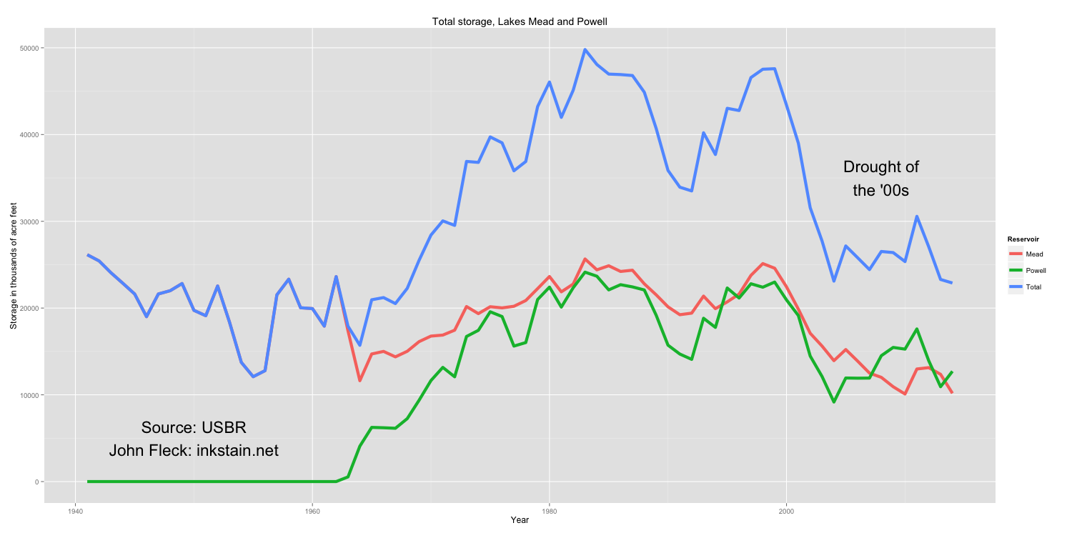
Reservoir Storage, Mead and Powell, data courtesy USBR, graph by John FLeck
Reservoir Storage, Mead and Powell, data courtesy USBR, graph by John FLeck


pulse flow progress

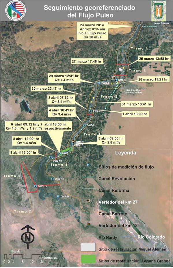
Courtesy of the folks at CILA, the Mexican boundary and water commission, the latest Colorado River pulse flow map shows water making it past the Laguna restoration sites in the Colorado River delta, continue its slow push toward the Sea of Cortez:

Pulse Flow Progress, courtesy CILA

Pulse Flow Progress, courtesy CILA

In Las Vegas, an acknowledgment that growth is gone

You can’t understand water in the west without understanding urban growth patterns. They’re joined at the hip. Here, in a single graph, is the explanation for the Vegas announcement yesterday that its two main water agencies are laying off 7.5 percent of their staff:

Henry Brean explained it thus:

The Southern Nevada Water Authority and the Las Vegas Valley Water District began laying off 101 full-time workers Wednesday as the wholesale water supplier and its largest member utility shift their focus from chasing growth to maintaining existing infrastructure.

“At both the district and the authority for the last 20 years or more, we worked to install the plumbing that makes big parts of our community possible,” said John Entsminger, general manager of both agencies.

Today that mission has changed from “growth-support” to one focused on operations, maintenance and customer service, he said.

The Colorado River is no one thing

Photographer John Trotter on the Colorado River:

When they opened those gates on (Morelos) dam and let water back into the main channel on the river, it kind of engaged those people. It brought them back into the mainstream of all the other people who are living along it in Moab or Grand Junction or Needles or Tucson. All these people are party to this very over-allocated river.

I came to realize that people, especially here in the East, they don’t even know that it’s the same river that I’m talking about. That the one going through the Grand Canyon is the same one that goes to the Delta in Mexico.

I encourage you to click through to High Country News to see Trotter’s pictures of the river, the pulse flow, and the delta.

fighting off the desert with fake water

Meadow Lake

We come to a desert but it is not to our liking. One wonders why, then, we came to a desert, but no matter. We can engineer our way out of this:

Meadow Lake was never much of a meadow. It was too wild, too wide, its sage-studded plains golden with buffalo grass and endless sunshine spilling, sparkling toward the blue shadows of the Manzano Mountains to the east.

But there had been a lake.

In 1967, the lake – fed by eight wells and stocked with trout, bluegill and catfish – had been the focal point of a 1,700-acre community planned by Albuquerque developer D.W. Falls.

That’s my colleague Joline Gutierrez Krueger in a sad piece about the ambitions of land development on the greater Albuquerque metro area’s south side. Journal photographer Dean Hanson added some nice ruin porn of the gutted mobile homes that are, along with crime, now Meadow Lake’s hallmark. And no lake.

As so often is the case, we learn late that can’t engineer our way out of this.

Welcome, pulse flow readers. Buy my (old) book!

It occurs to me that the brief and delightful pulse flow of clicks to this blog reading my recent coverage of what’s going on in the Colorado River delta might be potential book buyers. (Duh. Marketing is not my strength.)


It’s called The Tree Rings’ Tale, a science book for kids (middle school aged, 13 years old give or take) about weather, water and climate, especially here in western North America. Yes, it has John Wesley Powell’s grand adventures, and also Connie Woodhouse’s more recent grand adventures. (Connie uses tree rings to figure out how much water was in the Colorado River back before we had stream gauges. She’s not as famous as John Wesley Powell, but her stories are pretty great and important too.)

It includes a lot of hands-on science, too, like how to record the rain and snow in your backyard.

If you buy it on Amazon via the link above, I get a little piece of the action, which is nice, but if there’s some bright youngster in your life who you think my enjoy it, the best thing would be to support your local bookstore and order it through them.

land and water: Colorado River pulse flow arrives at Laguna

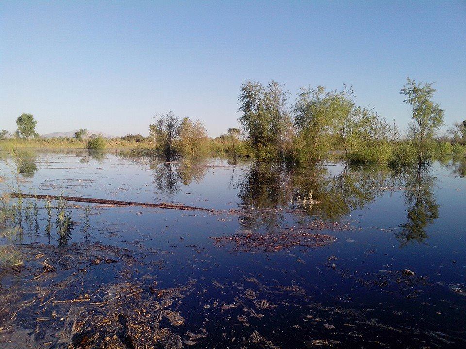
Colorado River pulse flow at the Laguna CILA environmental restoration site. Picture by Tomás Rivas of the Sonoran Institute

Colorado River pulse flow at the Laguna CILA environmental restoration site. Picture by Tomás Rivas of the Sonoran Institute, used with permission

Folks on the Colorado River delta “pulse flow” science monitoring team sent around a few pictures yesterday taken by the Sonoran Institute’s  Tomás Rivas of the water arriving at the Laguna CILA environmental restoration site. The beauty of this picture for me, beyond the obvious sight of water in a formerly dry delta river channel, is that despite taking a site tour two weeks ago, I don’t recognize the spot where the picture was taken. Water changes everything. Here’s one of my pictures from our tour.

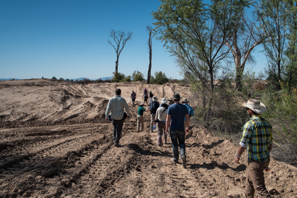
Scientists and journalists tour Laguna Cori restoration site in the Mexican Colorado River Delta, which awaits its first flows. March 27, 2014, by John Fleck

Scientists and journalists tour Laguna Cori restoration site in the Mexican Colorado River Delta, which awaits its first flows. March 27, 2014, by John Fleck

Imagine that now filled with water!

As I’ve written previously, Laguna CILA is one of the restoration sites that takes advantage of the high water table in stretches of the levee-pinned delta river channel to bring back native riparian vegetation. The idea here is that a pulse of “nature” in the form of water flows like this can help regenerate willows, cottonwoods and the like, which can then get their roots down into the water table and sustain themselves. Here’s how Jennifer Pitt of the Environmental Defense Fund and a group of colleagues explained it in back in 2000 (pdf), in one of the early academic papers explaining how it might work:

Annual flood events are not necessary for survival of these native tree species: they are capable of surviving at least a three-to-four-year interval between major flow events in the flood plain. Pulse flows of 260,000 acre-feet, released at a rate of 3,500-7,000 cubic-feet per second, are sufficient to inundate the Delta’s floodplain within the levees, sustain riparian corridor vegetation, and stimulate seed germination.

Much has changed since that was written. In 2000, the Colorado River’s reservoirs were mostly full, which made carving out a modest chunk of water to serve society’s environmental values seem more possible. The reservoirs are now half empty, which makes the political and policy challenge far greater. The flows in the current pulse are substantially less, but the water is now hitting sites that have been engineered to take better advantage of it.

This is fundamentally new territory. You drive across the farm fields of Mexicali and San Luis and see an agricultural technology that’s been optimized over a century to grow the most food and fiber with the least inputs. This thing that we’re seeing, in essence farming nature, is a new gig. Much study yet to come….


after the rush, getting down to the science

Ultimately, what’s going on down in the Colorado River right now turns on a complicated mix of politics and science. The politics involves how much support advocates can gain for environmental restoration of the troubled system, on both sides of the border. The science supports those decisions After the rush of excitement about the historic release of a small environmental “pulse flow” into the Colorado River delta, most of the reporters (including, sadly, me) are gone, and the scientists are getting down to their work.

As of yesterday, the water had reached past a major dry stretch, and was approaching the crucial Laguna restoration sites, according to an email last night from one of the project scientists.

Sandra Postel, who thankfully has remained has a nice look at the scientists getting down to the science:

On Wednesday this past week, when the advancing Colorado River met up with the higher water table of Reach 4, delta scientists breathed a sigh of relief.

“It was very exciting to see the leading edge get connected to Reach 4,” said Osvel Hinojosa Huerta, a wetlands ecologist and bird specialist with the Mexican conservation organization Pronatura Noroeste. Hinojosa has been working in the delta since 1998.

The swallows and cinnamon teals were not here this morning, Hinojosa said, standing near the location where the flowing river met the channel filled with groundwater. “They came after the water arrived.”

“We’ll be tracking birds very carefully,” Hinojosa added. “They are good indicators of system health.”

Hinojosa and his colleagues were doing this work from the moment the release started. In the first days of the release, as the water was making its way past the groundwater “hole” near the San Luis Bridge, I caught up with him after the group had just completed a bird survey: wigeons, cinamon teal, blue-winged teal, ruddy ducks, lesser scaup along with coopers and sharp-shinned hawks following the water (and their lunch) downstream). They even say coots, which had lost their happy shallow home in the pool immediately behind Morelos Dam, riding the pulse flow down on cattail rafts. And carp “this big”, he said, his hands held apart fisherman-style to indicate a very large fish floating through a previously uninhabitable desert.

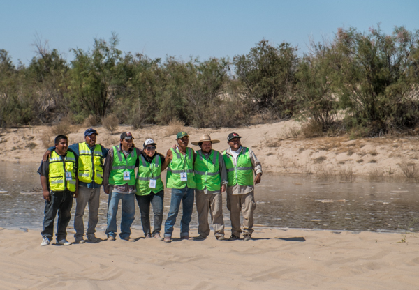
Osvel Hinojosa (second from right, in broad-brimmed hat) and crew as the pulse flow approaches San Luis, March 25, 2014

Osvel Hinojosa (second from right, in broad-brimmed hat) and crew as the pulse flow approaches San Luis, March 25, 2014, photo by John Fleck