“bronze buckshot” at the MWD

There are no silver bullets for dealing with the west’s water problems. There is instead, as several speakers said last week at a workshop I attended, “bronze buckshot”.

The Metropolitan Water District board yesterday handed out 16 grants to local Southern California water agencies that looked very much like what this metaphor implies – lots of small projects targeted at funding preliminary work on lots of little local solutions:

  • $180,000 to Glendale to study technology for removing hexavalent chromium, cleaning ick out of existing groundwater reservoirs
  • $200,000 for an Orange County study of conjunctive management of storm water, desal and other techniques in basins with impaired groundwater
  • $125,000 to the San Diego County Water Authority for work on indirect potable reuse
  • a scattershot of money to a bunch of different agencies to develop direct potable reuse communications strategies

And the list goes on (staff report in pdf here).

This is the sort of thing that makes me hopeful about our ability to cope with western water’s supply-demand imbalance. Southern California has long confronted the reality of growing demand and constrained supply. They were among the first to come up with aggressive joint management of their groundwater basins (pdf), they built extraordinary water importation systems (this isn’t going to all be “soft path” stuff), and they managed far better than anyone expected when they had their Colorado River supplies curtailed a decade ago.

When you face the prospect of running out of water, you do stuff. Sometimes big things, sometimes lots of little things. But you do stuff.


Stuff I wrote elsewhere: water management tools we learned in kindergarten

From yesterday’s newspaper:

The (San Juan) basin, in northwestern New Mexico, has every competing water interest you’d want in the mix if you were creating a recipe for conflict: Native American water rights (the Navajo and Jicarilla Apache nations), endangered species (the Colorado pikeminnow and razorback sucker), farming large and small, city water use and a couple of big coal-fired power plants. Also, not one but two interstate water compacts lurk in the background.

As Navajo Reservoir on the San Juan River dropped, the risk of conflict was enormous.

“We were looking into an abyss,” Leeper said.

But rather than fire up the lawyers and prepare to fight over the dwindling supplies, the basin’s water users began talking. When 2003 started looking every bit as dismal, they had a negotiated agreement in place to share the shortages.

Water theft

The Times-Standard in Humboldt County (northern California) reports that someone swiped 20,000 gallons of water. From a school:

Bridgeville Elementary School was reopened Wednesday after being forced to close for a day when staff discovered up to 20,000 gallons of water had been stolen from an onsite water tank during the Labor Day weekend.

”There were tire tracks in the field on the south side of the school,” Humboldt County Sheriff’s Office Lt. Steve Knight said. “The school staff believes someone climbed the fence, and used a school garden hose to drain the tank.”

Knight said it is believed a water truck or large truck and trailer with water tanks were used in the theft. He said the reason behind the theft is unknown.

Who’d do such a thing? Bruce Ross, who commits journalism for a living in that part of the country, offered this hypothesis:


Rio Not

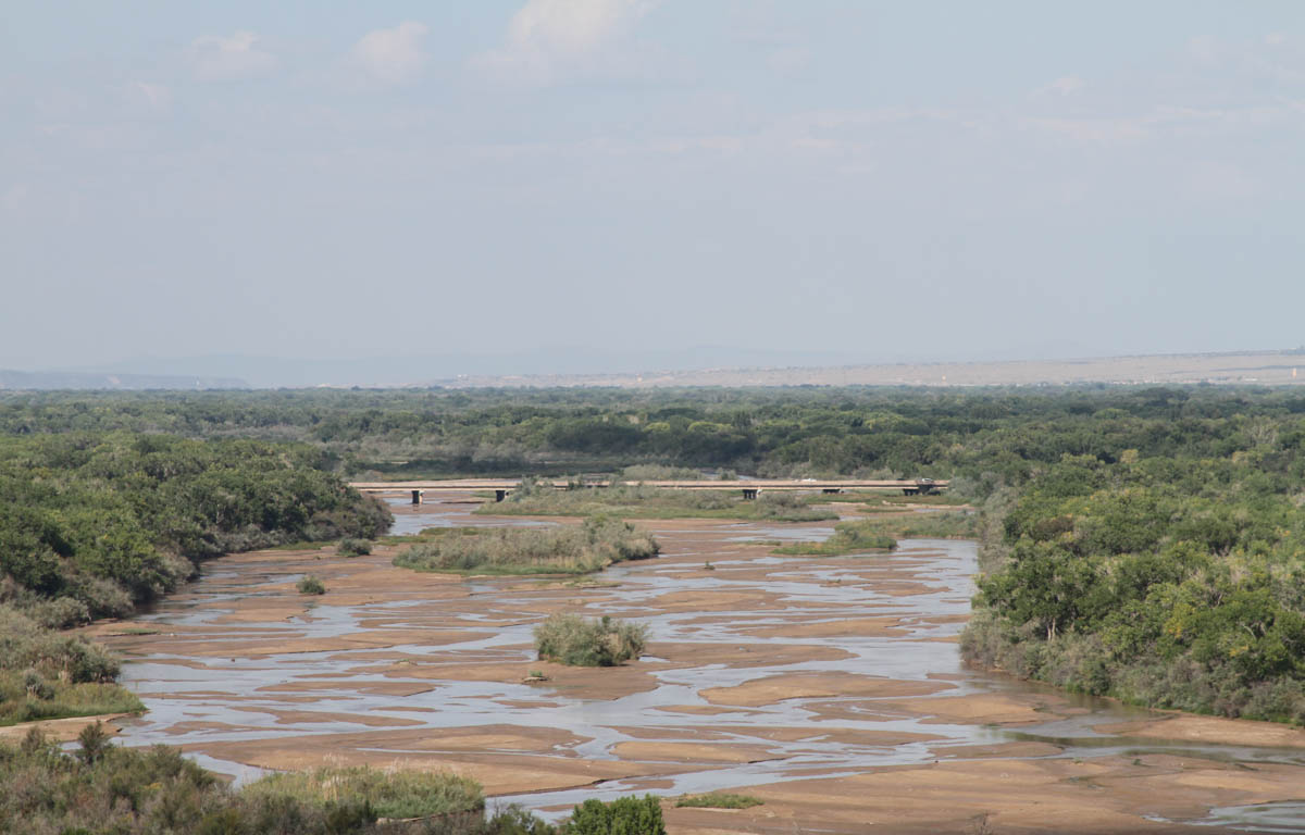
Albuquerque’s Rio Grande is currently not much of a river.

River No More: the Rio Grande as seen from Albuquerque's west bluff neighborhood, Sept. 8, 2013, by John Fleck

River No More: the Rio Grande as seen from Albuquerque’s west bluff neighborhood, Sept. 8, 2013, by John Fleck

Lissa and I made the rounds this afternoon of a few Rio Grande viewpoints. This is from Albuquerque’s West Bluff neighborhood, on the west side of the river north of downtown. The bridge in the distance is Montaño.

With an abysmal snowpack, the river was dropping fast in June, but a wet July rescued flows temporarily. As August dried out, though, the river started dropping again. The gauge at Central Ave., the most important measure for regulatory purposes, is down this weekend, but the Paseo del Norte gauge, at 137 cfs, is the lowest it’s been all year. The Central gauge has typically been 50 to 100 cfs below the Paseo gauge all year (data here), so I’d only be guessing based on past performance that the Central flow well south of 100 cfs. Eyeballing it from around Central, it sure looked lower than in early July, when it briefly reached the mid-70s.

Maybe it’ll rain this week.

Q: What do fracking and viticulture have in common?

This is such an old story, but the new garb makes an interesting side-by-side comparison: a community faces tension as a new water user comes to town.

In Barnhart, in West Texas, it’s fracking for oil:

The Barnhart area has been hard-hit by drought, he said, just as surging oil and gas drilling activities have increased local water demands.

In Paso Robles, CA, it’s wine:

Where did the water go? Smith and other residents say it’s flowing freely into the area’s signature industry — wine.

Let us set aside, for a moment, the value judgments one might have about the newly produced products involved, and the fact that we love one while find the other abhorrent (I’ll let you decide which is which.).

What policies could be implemented in these communities to sort out the competing demands for scarce water?

The audacity of building rivers: Parker Dam and the Colorado River Aqueduct

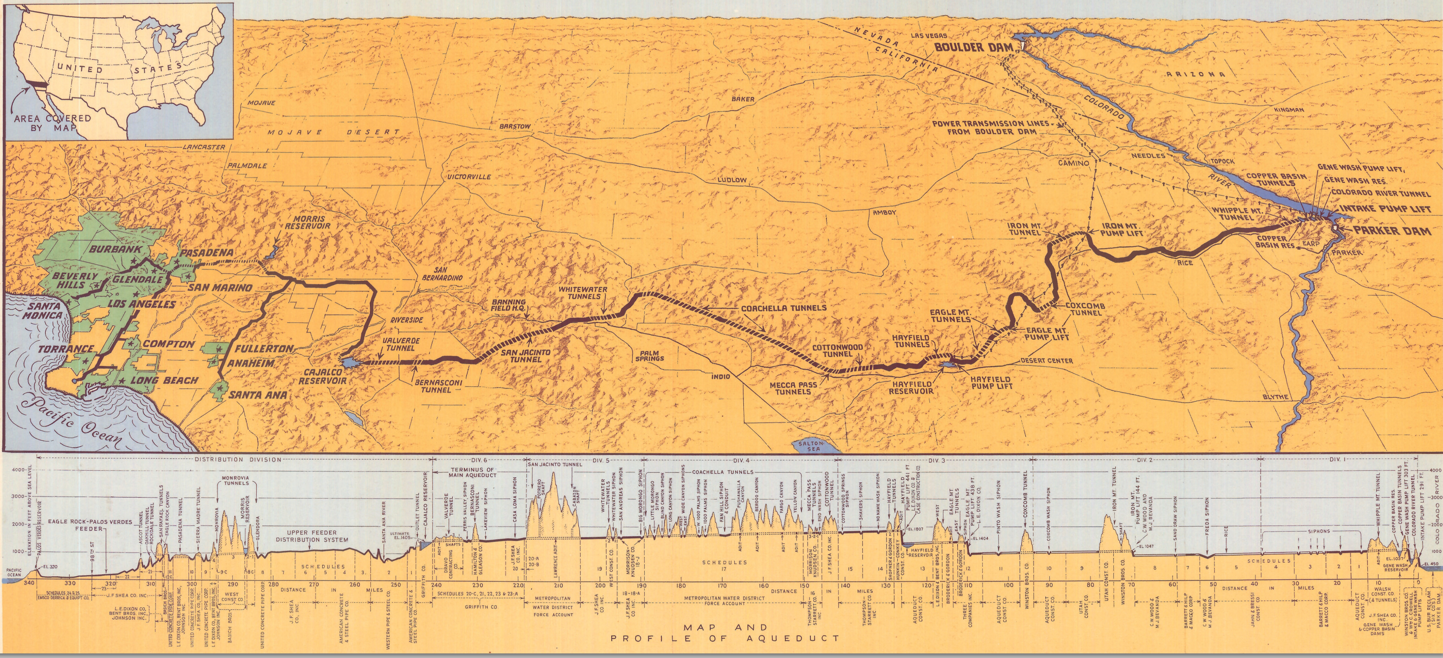
Southern California, if I may quote myself, didn’t have enough water to support a city, “so they built three great rivers.” Not one or two. Three aqueducts to carry water to “the southland”, as we called it in my youth. The audacity of that act is captured in this map I stumbled across today, from the Metropolitan Water District’s “History and First Annual Report“:

Colorado River Aqueduct

Colorado River Aqueduct


Click to blow it up. Really.

Stretching the Ogallala Aquifer

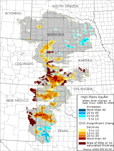
Ogallala Aquifer depletions

Ogallala Aquifer depletions, Wikimedia

If one wanted the Kansas portion of the Ogallala Aquifer to last forever, to be farmable sustainably in perpetuity, one would need to cut back current groundwater mining by 80 percent to bring withdrawals into line with natural recharge, according to a new study published last week in PNAS. That ain’t gonna happen. But even a 20 percent reduction in pumping could stretch out the peak of agricultural production to 2070, according to David Steward of Kansas State University and his colleagues.

Reducing pumping now to stretch out their supplies for future generations is an important community question, as Brett Walton explains in a nice piece on the study and its implications:

The allure of heritage is powerful in this deeply agricultural land. Farms here run in the family, often for generations. Testifying last November in favor of the voluntary reductions in northwest Kansas, Roche Meier, a Sheridan County farmer who would be affected by the cuts, told a state water official that the restrictions would be worthwhile if they kept irrigated agriculture alive for his grandchildren.

Reducing pumping by 20 percent might turn out to be less a burden than feared, for several reasons. More crop production with less water is possible thanks to water-efficient technologies such as center-pivot and drip irrigation, varieties of corn selected to endure drier conditions, and farming techniques that maximize water use. The goal for each strategy is to ensure that each drop of water applied to a crop is put to use by the plant. The study found that this measure, called water-use efficiency, has increased by roughly 2 percent every year.

Tree rings: it’s not just the width any more, it’s the isotopes

I’m thinking I may need to update my tree rings book, or write a new one.

Much of my focus was on measurements of tree ring width, which makes sense. If you pick the right tree, the ring width can tell you whether a year was dry or wet. Thin rings mean the tree didn’t have much moisture to work with that year. But a rapidly growing new approach using the isotopic composition of the wood to tell us much, much more.

The technology’s been there for a while to do this, but improvements in isotopic analysis methodology make it possible now to do it with much smaller sample sizes, and much more quickly and economically. Here’s an example, from a research program aimed at reconstructing drought history in the upper Great Plains of North America:

Because old trees are scarce at low elevations in the arid inland western United States, ring-based flow reconstructions in large rivers are usually based on conifer trees in the mountains, where most of the run-off is derived. Such chronologies are important, but incomplete because they do not integrate events and hydrologic processes lower in the watershed. Ongoing work has shown that the dominant riparian tree in the lowland western United States, cottonwood (Populus spp.), is long-lived (as old as 370 years), cross-dates well, and has growth strongly correlated with surface-water flow (Merigliano et al. 2012, Friedman et al. 2012, Edmondson et al. 2013). Cross-dated sets of cottonwood cores from the northern Great Plains are now available for stable isotope analysis and past work in this genus has shown a strong relation between carbon isotope fractionation and drought stress (Leffler and Evans 1999). This presents the possibility of conducting multi-proxy studies using ring widths, stable isotopes, and possibly trace elements and radiogenic isotopes of both low-elevation cottonwoods and high-elevation conifers.

It’d be cool to see this done with cottonwoods here in the Rio Grande Valley. We don’t have 370-year-old cottonwoods, but I’m sure there are things to be learned.