Pitt on “Day Zero”

Audubon’s Jennifer Pitt, one of the most stubbornly optimistic actors in the Colorado River Basin, wrote this Friday:

[F]ederal officials project that within two years, the water level in Lake Powell could be so low that it would be impossible for water to flow through the dam’s turbine intakes. When that happens, it’s clear the dam will no longer generate hydropower, but it’s also possible the dam will not release any water at all. That’s because the only other way for water to move through the dam when the water is low is a series of outlet tubes that were not designed, and have never been tested, for long-term use.

What happens if little to no water can be released from Lake Powell? Water supply risks multiply for everyone who uses water downstream. That includes residents of big cities like Las Vegas, Phoenix and Los Angeles, and farmers and ranchers in Arizona, California and Mexico who grow the majority of our nation’s winter produce, as well as numerous Native American tribes. Some of these water users have alternative supplies, but some—including Las Vegas residents, Colorado River tribes and most farmers—do not. Day Zero for these water users might not happen immediately as Lake Mead, the reservoir fed by Lake Powell still has some water in it. But without flows from upstream to replenish it, Lake Mead would also be at risk of no longer being able to release water.

There is also the river itself. Think of it—no water flowing through the Grand Canyon. No water flowing in the Colorado River for hundreds of miles downstream from Hoover Dam. That’s an ecological disaster in the making for 400 bird species and a multitude of other wildlife, exceeding the 20th century devastation of the Colorado River Delta.

The whole thing is recommended reading.

“unless extraordinary circumstances arise” – tweaking Colorado River Basin rules

Watching the back-and-forth among the U.S. Department of Interior and the seven Colorado River Basin States over Glen Canyon Dam operations over the last few months, I’d been thinking that we’ve dropped into an area where the rules developed in 2007, and tweaked in the years since, no longer apply.

In short, if we use the reservoir operating rules the states and federal government negotiated back in 2007 (tweaked more recently by the ill-named “Drought Contingency Plan”), we drive Lake Powell below the level at which Glen Canyon Dam can generate electricity. Our only choice is to throw out the rules.

But speaking on the sidelines of the Stegner Center Colorado River Compact symposium last month, one of the smartest Colorado River lawyers I know corrected me. Because the rules were written in way that leaves Interior with an escape hatch. It’s Section 7.D of the Interim Guidelines:

The Secretary will base annual determinations regarding the operations of Lake Powell and Lake Mead on these Guidelines unless extraordinary circumstances arise. Such circumstances could include operations that are prudent or necessary for safety of dams, public health and safety, other emergency situations, or other unanticipated or unforeseen activities arising from actual operating experience. (emphasis added)

I still think my earlier observation has an element of truth. The decline in reservoir levels has dropped us into an area where the rules that were developed – a complex nested set of “if this, then that” rules where the this’s and that’s refer to elevations in Lake Powell and Lake Mead and annual releases from upstream to downstream – no longer work. By invoking the “extraordinary circumstances” clause – as Assistant Secretary Tanya Trujillo did in her April 8 letter to the states, and as the states did today in their letter written in response – the parties are agreeing to suspend the if-then’s and improvise.

But the ever-clever drafters clearly new bad shit was possible, and they were ready with the “extraordinary circumstances” clause.

I retain my admiration for the collaborative process of the seven states and Reclamation here. Holding everyone together for this rapid-fire reservoir management improvisational octet has been a truly impressive feat.

But given what has transpired, it’s worth looking back to the original purpose and need of the 2007 guidelines. In the supporting documents developed for the ’07 guidelines, Reclamation explained their purpose thus:

This action is proposed in order to provide a greater degree of certainty to United States Colorado River water users and managers of the Colorado River Basin by providing detailed, and objective guidelines for the operations of Lake Powell and Lake Mead….

“Greater degree of certainty”? In 2022, 15 years later, not so much.

At this point, no one knows what the fuck happens next.

Time to rethink the Upper Basin’s “Bonus Water” contributions to Lake Mead?

By Eric Kuhn

For years, the Colorado River management community has ignored, or at the very least sidestepped, a problem that has effectively sent more Upper Basin water downstream to help fill Lake Mead. But with the reservoir system operating on razor-thin margins, this “bonus water” – seeping through the sandstone cliffs of Glen Canyon, rather than being released through Glen Canyon Dam’s penstocks – could become a significant issue soon.

That leakage adds up. 150,00 acre feet per year is 1.5 million acre feet every ten years – enough, had it not been sent downstream to Lake Mead, to have pushed the Lower Colorado River Basin into shortage four or five years ago.

On April 8th, Assistant Secretary Trujillo formally informed the Colorado River Basin States that the Bureau of Reclamation would like to make a mid-year correction to the operation of Glen Canyon Dam, reducing this year’s annual release from 7.48 maf to 7.0 maf. This action coupled with additional releases from upstream reservoirs is deemed necessary to help prevent Lake Powell from falling below the minimum power elevation. Clearly, if aridification continues, more proactive measures will be needed including revisiting the issue of how annual releases are managed considering what basin insiders refer to as the Lower Basin “bonus water”.

The 2007 Interim Guidelines include storage tiers that are used to set and adjust the annual releases from Glen Canyon Dam. These annual releases, however, are not the same as the flows at Lee Ferry, the compact point. There are two sources of water between the dam and Lee Ferry; the Paria River which has an average annual flow of 20,000 af/year and groundwater inflows below the dam which, since 2010, have averaged about 150,000 af/year. The negotiators of the 2007 Interim Guidelines considered the Paria (this is the reason the flow levels are 7.48 and 8.23, not 7.5 and 8.25), but did not consider the groundwater inflows for the simple reasons that the data were not then available and there had always been an assumption beginning with the promulgation of the first Long-Range Operating Criteria in 1970 that releases from the dam and the flow at the Lees Ferry gage would be the same. Former UCRC Executive Director Don Ostler coined the term Lower Basin “bonus water” to label these groundwater flows.

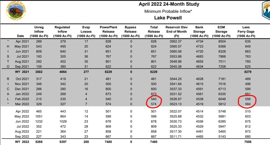
The 24-month studies show both the monthly releases from Glen Canyon Dam and the monthly flow at the Lees Ferry gage (about 1.5 miles upstream of the Lee Ferry compact point). Shown below is an excerpt from the April 2022 24-month study:

“Bonus Water” flowing past Lee’s Ferry

I’ve highlighted the total releases from Glen Canyon and the Lees Ferry gage flows for February and March 2022. In February the flow at the gage was 16 kaf greater than the release from the dam. In March the difference was 10 kaf. If one checks the 24-month studies back to 2010, the average annual difference between the gage and the dam release is nearly 151 kaf.

The annual amounts of bonus water vary considerably from month to month and year to year. There is a weak correlation between the annual regulated inflow to Lake Powell and the annual amount of the bonus flows and the monthly flows show a seasonal pattern, monthly bonus flows are the highest in mid-summer and lowest in late fall.[1] In 2019, the last wet year, the bonus flow was 270 kaf. For the 2021 drought year it was only 50 kaf. While 150 kaf/year may only be a small fraction (1.8%) of the normal annual release of 8.23 maf/year, over ten years it’s a big deal, 1.5 maf is over three times the 480 kaf reduction ordered by Assistant Secretary Trujillo. Had this 1.5 maf stayed in Lake Powell, its storage elevation today might be 20-25’ higher.[2] Further had it not been delivered to Lake Mead, a Tier I shortage may have been necessary 4-5 years ago forcing the Lower Basin to further ramp up their conservation efforts much earlier.

After the 2012/13 two-year drought, Ostler raised the issue of the groundwater bonus flows with technical representatives from the USGS, Reclamation, and the other states. The USGS looked at the gage issues and concluded that while not perfect, the accuracy of the Lees Ferry River gage and the ultrasonic flow meters used at the dam are state of the art. The bonus flows are not an artifact of gaging error. Further, a visual inspection of the river below the dam showed numerous springs and weeps. Despite these finding, there was little interest by the Lower Basin States or Reclamation representatives for using the Lees Ferry gage to manage monthly releases from Glen Canyon Dam.

The movement of reservoir water into bank storage, through the sandstone then back into the river below the dam is obviously a very complicated hydrogeology problem. Factors include the hydraulic conductivity and fracturing of the rock surrounding the dam and reservoir (mainly Navajo Sandstone), the storage level in the reservoir, whether the reservoir is filling or draining, and others such as local precipitation. We may not understand the fine details of how the groundwater gets to the river below the dam or how much of it originated from the reservoir.  But what we know with certainty is that the water is in the river at the Lees Ferry gage – the Compact measurement point – and it is flowing downstream to the Lower Basin.

While the easiest path forward may simply be to wait and address this matter as a part of the renegotiations of the 2007 Interim Guidelines, why wait four years (or more if the current package of Interim Guidelines and DCPs is temporarily extended)? The Secretary has the authority to operate Glen Canyon Dam to meet an annual target flow at the downstream Lees Ferry gage. Unless we get an unusual series of wet years, refilling Lake Powell and the upstream CRSP reservoirs is going to be a struggle. Using this approach could keep an extra 600 kaf in Lake Powell over the next four years. It’s more water than what might be squeezed out of Blue Mesa and Navajo Reservoirs under drought operations.

It won’t solve the basin’s basic math problem. Only a reduction in total demand to match the available supply will do that. But it will better balance the burden on each basin.


[1] Based on the 12-year period of 2010-2021, average monthly bonus flows are the highest in August at 23.8 kaf and lowest in November at 4.9 kaf. The correlation between annual regulated inflows and annual bonus flows (WY) has an R squared of .59 which is significant at the P<.05 level.

[2] This is actually a much more complicated question. Under the 2007 IG tier structure, as my colleague Ben Harding has concluded, Lake Powell storage has “memory,” Changes in storage in one year carry forward and impact future years. For example, in both 2020 and 2021 Lake Powell was in the Upper Elevation Balancing tier. The releases were 8.23 maf, but had there been more water in Powell, they could have been as high as 9.0 maf depending on the storage level in Lake Mead.

Losing ground(water) in Albuquerque

Losing groundwater in Albuquerque

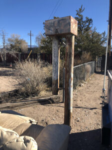
At the eastern end of Sandia Road NW in Albuquerque is a ratty but important piece of Albuquerque’s water management history – City Well #2. Maintained now by the US Geological Survey, City #2 was installed in the late 1950s, a pivotal time in Albuquerque water management.

The community’s population was booming. To meet the new demand, the city’s water department was drilling groundwater wells all over town. Newly appointed State Engineer Steve Reynolds saw a problem, and was trying to put a lid on expanding groundwater depletions by requiring the city to offset any future impacts of pumping by retiring surface water rights.

Litigation shenanigans ensued.

City Well #2, with couch, photo by John Fleck, November 2020

Four groundwater wells were drilled in the summer of 1957 to begin monitoring what the heck was going on beneath the ground – a novel water management approach in the go-go years of the 1950s, when population all over the West was growing rapidly and communities were sinking groundwater wells with reckless abandon.

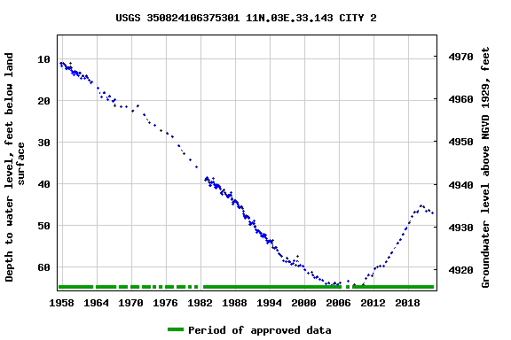
We’ve been monitoring the four wells – by Los Poblanos Open Space, in Los Duranes, by the tracks near downtown, and this one on Sandia NW – ever since, with the faithful USGS technicians making two measurements a year, early spring and late summer. It’s a wonderful dataset, telling a rich story.

When I first visited City #2 in the winter of 2020, it was flanked by a trash bin and an old discarded couch.

It also was beginning to show the effects of lower river flows.

The impact is largely indirect. When the Rio Grande is down, Albuquerque shuts down its San Juan-Chama diversions, pumping groundwater to meet municipal needs. We’ve been doing that for the last copuple of years, and you can see the impact in the graph above. After a steady rebound of more than a decade, our aquifer has begun dropping again. Whether this is an ominous sign of trouble ahead, or simply The Plan – use the aquifer as a drought reserve in times like this – is a point of debate. (I tend to come down on the side of the latter, notorious optimist that I am.)

Google streetview suggests the couch has since been removed, which I guess can be counted as progress.


Carpenter’s Last Stand for Complete State Sovereignty – 100 Years Ago at the Compact Negotiations

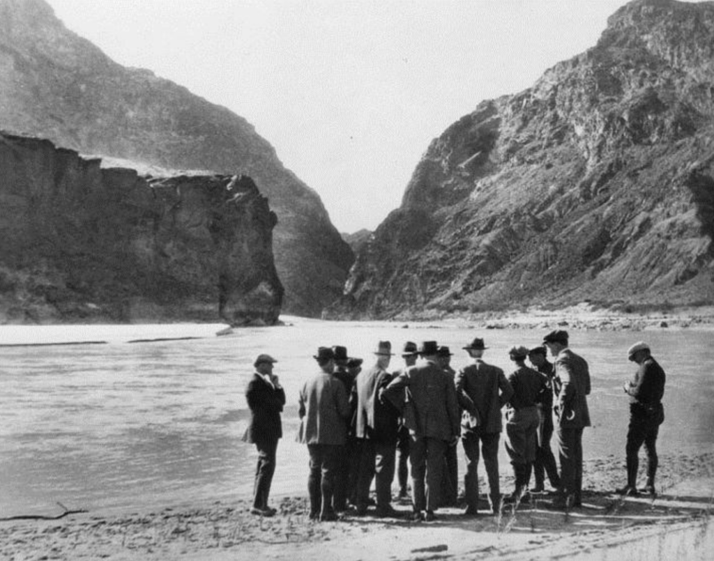
The Colorado River before Hoover Dam

By Eric Kuhn and John Fleck

On Saturday, April 1st, 1922, at 9:00 AM in Denver’s iconic Brown Palace Hotel, Chairman Herbert Hoover opened the 9th meeting of the Colorado River Commission. The official meeting lasted only 30 minutes. The commission took only one action of consequence. It asked its members to submit to Executive Secretary Clarence Stetson “suggested forms of compact for the disposition and apportionment of the waters of the Colorado River and its tributaries.”  The commission would then consider these draft compacts at future meetings.

At 9:30 AM, the meeting ended, and the commissioners headed to the day’s main event, a public hearing at the Colorado State Capitol. The Denver hearing was the next to the last of a long series of public hearings and inspection tours that had begun back on March 15th in Phoenix. After Phoenix, the Commission visited the Boulder Canyon project site near Las Vegas and agricultural development in the Imperial Valley. It held three hearings in Los Angeles on March 21st and 22nd, then headed to the upper river where it held hearings in Salt Lake City and Grand Junction and inspected the federal Grand Valley Project.

Governors Join the Ruckus

The April 1 hearing was a big deal. Four of the basin state governors would join them; three from the upper river – Charles Maybe from Utah, Merritt Mecham from New Mexico, and Oliver Shoup from Colorado – and one from the lower river, Nevada’s Emmet Doyle.

In proposing the tour and public hearings, Hoover hoped to build both knowledge and social capital. While each of the commissioners was an expert in the water needs of their own states, there had never before been an effort to bring people together to think at the basin scale. Hoover wanted the commission to see and better understand the water issues facing the basin. He also hoped that during the two weeks the commission and their advisors were together they could get to know one another and engage in the candid discussions that could break the current impasse.  In particular, he wanted to soften up Colorado’s Delph Carpenter, to get him to back off of his insistence that water projects on the lower river never interfere with development on the upper river.  Hoover had asked New Mexico’s Steven Davis, a state supreme court justice, for help.

The tour was a big success. After visiting Boulder Canyon, the commission went south to the Imperial Valley.  What they saw clearly impressed them. The Imperial Valley, which before irrigation promoter Charles Rockwood renamed it for marketing purposes was referred to as the Colorado Desert, is a vast expanse of potentially irrigable land, much of it at an elevation below the Colorado River channel just to the east of the valley. While some maps do not include the Imperial Valley as a part of the Colorado River Basin, those familiar with the geology of the basin consider that silly. Like the Grand Canyon, the Imperial Valley owes its existence to the river. The valley lies at the very northern end of the Salton Trough, a geologic feature called a “rift” created by plate tectonics extending from the tip of Baja California to Palm Springs. Over the eons, as the rift was subsiding the valley floor, the Colorado River was filling it in with sediment. The valley is a part of the river’s delta.

The Foundations, and Challenges, of Imperial Valley Farming

Rockwood’s California Development Company first delivered water from the river via a route through Mexico to the valley in June 1901. In 1911 the Imperial Irrigation District (IID) was formed to buy the irrigation works from the Union Pacific Railroad which had taken over Rockwood’s bankrupt company and saved the valley from the floods of 1905-07 when the entire river diverted itself through the newly constructed canal into the Salton Sink – as it had countless times in the past. In 1922 when the commission arrived, there were over 20,000 settlers farming about 300,000 acres of land. The IID needed help from the Reclamation Service in two major ways; a supply canal that avoided Mexico, an “All-American Canal”, and an upstream reservoir to help control the floods that were still threatening the valley. The recently released Fall-Davis Report made a strong case for both.

On to Los Angeles

From the Imperial Valley the commission travelled to Los Angeles where it held three public hearings. The Los Angeles of 1922 was a rapidly growing city of over 600,000 in a county with a population of over a million. It had already exhausted its local water supply and was importing water via a 220-mile aqueduct from the east slopes of the Sierra Nevada. While local community leaders may have been coy about plans to import water from the river, they made it clear that they wanted and needed the hydroelectric power the Boulder Canyon Project would produce. In Los Angles, Arthur Powell Davis first suggested that the Commission abandon the idea of apportioning water among the states. Davis suggested instead a split between an upper and lower basin. Davis’s proposal would allow unrestricted development in the Upper Basin for 50 years. Projects built during this 50-year window would be senior to all Lower basin uses. After the 50-year window, new Upper Basin projects would be subject to the priorities of existing Lower Basin projects.

Carpenter and the Sticking Points

The combination of the tour and Davis’ proposal made an impression on Carpenter, but not the one Hoover and Davis were hoping for. Instead, what Carpenter saw in California caused him, and Utah’s R. E. Caldwell, to double down on their demands that any compact be based on the principle of non-interference by Lower Basin projects on the Upper Basin, subject only to a possible limit on exports out of the basin. The issue of trans-basin diversions had been a hot topic during many of the public hearings. While perhaps open to a limit, all four of the commissioners from the upper river, as well California’s McClure wanted to keep the option open for their states.

In a choreographed performance at the Colorado statehouse, New Mexico Governor Merritt Mechem told the Commission that New Mexico could not accept a limited period (50 years) for development, unless the limit was so far in the future that it was no limit at all. For all practical purposes, most of the Arthur Powell Davis Los Angeles proposal was now dead.

After the Denver hearing, the Commission had one last public hearing scheduled for Cheyenne the next day. After that, it might be a while before the Commission could meet again. Steven Davis let Hoover know that any efforts to soften Carpenter might now be in hands of the United States Supreme Court. What it decided in the pending Wyoming v. Colorado case over Colorado’s tiny Laramie River would be big news for the mighty Colorado – stay tuned.

Eric Kuhn on less water

Eric Kuhn:

One hundred years ago, we had some flexibility because the river was not very well-used. Today, not a drop of the Colorado River reaches the Gulf of California, so we don’t have that luxury. The way I look at it is: we legally allocated water based on an assumption that this river system had about 20 million acre-feet. Today, we think it’s more like 13, and it might be less in the future with climate change. Predictions and models show that increasing temperatures are going to reduce flows to the Colorado River. The drama is not how much water we’re going to have in the future — we know it’s going to be less. The drama is how we’re going to decide who gets less water, and when.

Clearing the institutional logjam to allow (some small amount of) NM Rio Grande storage in 2022

Ok, the logjam isn’t cleared yet, but we can see how the clearing will happen.

Also, it’s not really Rio Grande storage, it’s the Rio Chama. But it’s a tributary to the Rio Grande. Headline writer’s prerogative.

The deal is that El Vado Reservoir on the Chama, where central New Mexico stores its irrigation water, is about to undergo repairs. Abiquiu Reservoir, just downstream, has been discussed for a while as an alternative storage site. But it’s a Corps of Engineers dam, with different rules for whose water can be stored there, when, and for what purposes.

The instititutional chit-chatting about this has been going on for a while, but we’ve been growing nail-bitingly close to May, when the work on El Vado is set to begin.

Happy to report that we now have a draft National Envirornmental Policy Act analysis from the Corps which seems to have arrived in time for the actual storage of water to begin on time.

Comments being accepted through April 4.

Brad Udall on the Drying of the Colorado River Basin

The Drying of the Colorado River Basin, slide from Brad Udall

The only lever we currently control is the demand lever.

– Brad Udall, Stegner Colorado River Symposium, March 18, 2022

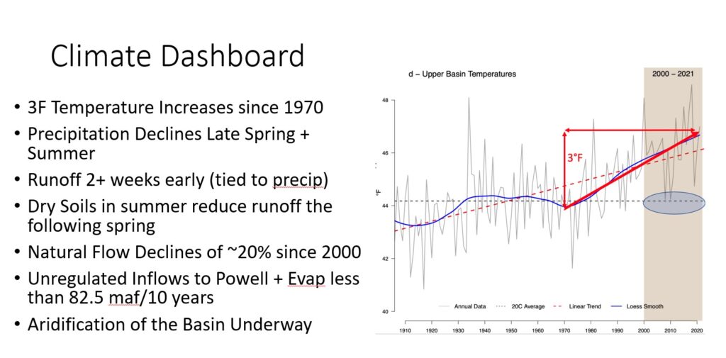
Colorado State University climate researcher Brad Udall poked again last week at a question he’s been thinking and speaking about for the past year – the knock-on effects of summer warming in the Colorado River Basin.

Precipitation declines in late spring and summer, combined with summer warming, are leaving us with dry soils as we head into the winters that follow. Which means less runoff in the basin.

His talk included a graph of new modeling being done by a group of Colorado River researchers. Under a continuation of the hydrology we’ve had for the past two decades, the total storage of Lake Mead and Lake Powell bumps along at basically empty for the foreseeable future.

And Brad, a scientist whose work more than most straddles the scientific and policy worlds, shared his “biggest fear” – that it’s easier for basin managers to let the system crash than to make the hard choices needed to avoid that crash.

Colorado River Compact at 100; Lake Powell at 3,524.42

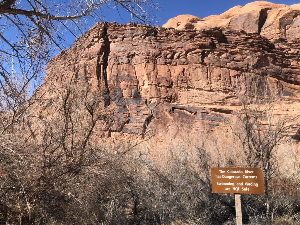
The Colorado River has dangerous currents. Moab, March 2022, photo by John Fleck

The most interesting news at this week’s University of Utah Stegner Symposium on the Colorado River Compact, past and future may be the news that we didn’t hear.

It was an amazing gathering, bringing together pointy headed academics like me with most of the basin management leadership team from tribes, state and local agencies, and the federal government. The crisis situation on the river made for some pointed conversations.

The news we did hear was stark:

  • Colorado River Basin water users are currently consuming 14-15 million acre feet of water from a river that for the 21st century has averaged 12.3 million acre feet. Several water users suggested a need to be ready for that to continue to drop – 11maf? 9?
  • Reclamation is scrambling to figure out how to safely move water through Glen Canyon Dam as Lake Powell dips below the safety threshold elevation of 3,525 feet above sea level, creeping toward “minimum power pool” – lowest since filling in the 1960s.
  • Summer drying is making it harder for snowpack the following winter to make it to headwaters rivers.
  • Declining river flows have us staring down a fundamental conflict, rooted in the century-old Colorado River Compact, about how much water upstream users are required to pass downstream past Glen Canyon Dam each year.
  • Unresolved Native American water rights – some rights that exist on paper but aren’t being used, some not yet even quantified – have us on a collision course with fundamental legal and moral questions about equity as non-Indian users risk crashing the system while Native Communities have not yet had the chance to use water to which they have long been entitleld.

The news we didn’t hear – Las Vegas is not at risk of losing its water supply

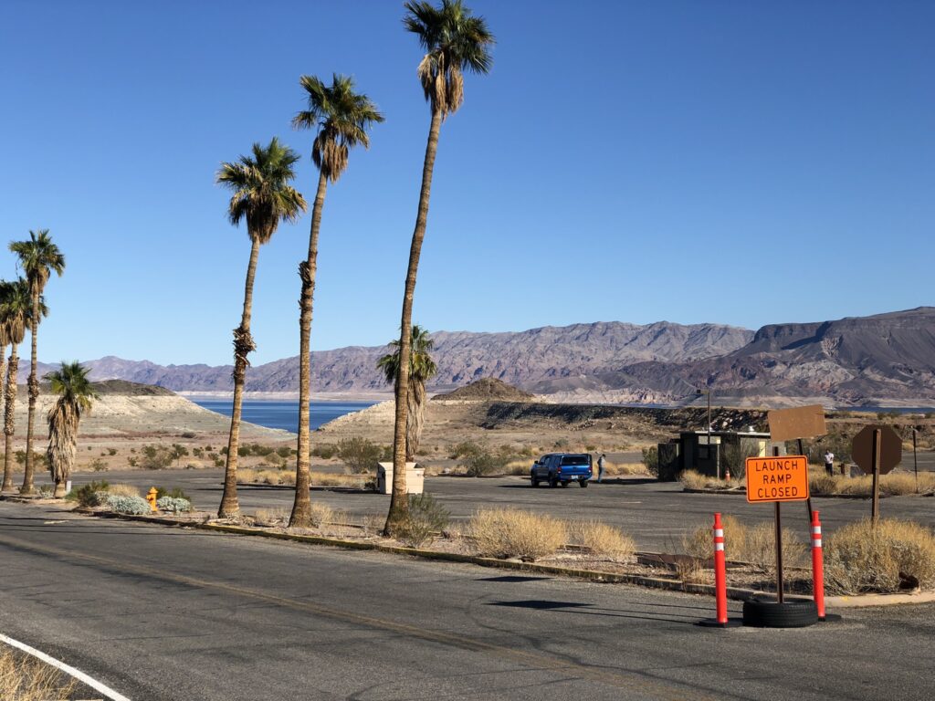
Here’s what we didn’t hear: Las Vegas, Nevada, is not at risk of losing its water supply as Lake Mead’s levels drop toward Vegas’s intake pipes.

Was a time when the Las Vegas intake system was vulnerable as Lake Mead’s elevation dropped toward elevation 1,050. But years of planning and an expenditure of some $1.5b have the Southern Nevada community equipped with new intakes deeper in the reservoir, and a new pumping plant that is now scheduled to be flipped on for the first time later this spring as Lake Mead’s elevations drop toward elevation 1,060.

Turning on those pumps, designed to keep the water flowing to Las Vegas at the sort of elevations we’re now seeing, is a huge milestone, reflecting a community that took low probability/high consequence risk seriously and invested heavily in mitigation.

The low probability event is happening, the high consequences are not.

With Reclamation’s current “most probable” forecast showing Mead headed toward 1,035 in 2023, with a clear possibility of dropping into the 1,020s over the next 18 months, it’s fascinating to think about what the basin conversation would be like right now if the Southern Nevada Water Authority hadn’t built its “third straw”.

A few notes below on discussions that attracted my attention over the two-plus days of symposium sessions and the critical conversations in hallways, at dinners, and in hotel bars.

The integrity of Glen Canyon Dam

Assistant Secretary Tanya Trujillo was blunt about the risks as Lake Powell continues to drop. Under normal operating conditions, water is released through penstocks that drive turbines to generate electricity. But somewhere around elevation 3,490 (or maybe higher?), that becomes infeasible, first because of the risk to the turbines if air gets entrained in the inflows and second because at some point it’s physically impossible to get water out throught that door.

At that point, Reclamation is left with Glen Canyon Dam’s low elevation bypass tubes. Their use poses, in Tanya’s words, many operational uncertainties. Aside from testing and early filling days when the dam was built in the 1960s, they’ve only been used briefly during flooding in the 1980s, and during the relatively short-term high-flow experiments as part of the Glen Canyon Dam LTEMP.

Tanya continued to emphasize Reclamation’s statutory obligation to protect the integrity of the dam, something she also did in her public remarks at the December CRWUA meeting – the Colorado River Water Users Association. She said Reclamation may need to reduce annual flows from Glen Canyon Dam to protect the infrastructure.

That’s a big deal. In hallway conversations and side meetings, there was apparently significant conversation among state and federal officials about how all that might happen.

How small a Colorado River should we prepare for? 11maf? 9maf?

Southern Nevada Water Authority’s John Entsminger described how his agency’s long run planning includes a worst-case “what if” of an 11 million acre foot river. Recall that it’s been a 12.3maf river in the 21st century, which has been enough to drain the reservoirs. This would be worse. At 11 maf, Entsminger said, his agency’s modeling shows Mead bumping round 900 feet in elevation, while Powell is basically empty.

“The future of the Colorado River is pain,” Entsminger said. “Anyone who tells you anything different is selling something.”

Andy Mueller, from western Colorado’s Colorado River Water Conservation District saw Entsminger’s 11maf bet and raised (lowered?) him another 2 million acre feet, saying we need a plan in place to deal with the possibility of a 9 million acre foot Colorado River.

You shouldn’t see this as a disagreement between Andy and John. You should see this as a disagreement between the two of them and a bunch of other people in the basin. Last year’s Getches-Wilkinson Center conference in Boulder, for example, included a noteworthy exchange between Entsminger and New Mexico’s then-State Engineer John D’Antonio in which Entsmber suggested the need to prepare for an 11 million acre foot river and D’Antonio’s suggest that 13-14 maf is a more realistic planning baseline.

Consider what we might do with an 11 million acre foot river (never mind 9!). This is a world, under current operating rules, with likely cutbacks in the Upper Basin, a frequently dry Central Arizona Project canal, and difficult contestation over what the river’s operating rules really mean in a world far different from the one the Compact’s drafters thought they were in a century ago.

A quip from Arizona Tom Buschatzke suggests how hard these conversastions will be. “I won’t say I agree to 11,” Tom said in one of the many moments of remarkable frankness we saw over the two days of the symposium, “or I might get arrested when I get off the plane in Phoenix.”

Equities – tribal water

It is noteworthy that the symposium, one of the most important events during this year’s Colorado River Compact centennial, was co-sponsored by the Water and Tribes Intiative, an effort to expand the basin’s water management discourse.

The impact on our First People of our nation’s colonial history is profound. How to come to terms, in the area of water management, with that impact becomes an increasingly urgent question as the river shrinks. We have tribes with:

  • legal rights to water now being put to use
  • legal rights to water on paper that are not yet being put to wet water use
  • unquantified rights

(see here from the Water and Tribes Initiative for more details)

We heard lots of positive discussion at the symposium about the recognition of this question, with tribal leaders (most notably Daryl Vigil from Jicarilla in New Mexico) and their representatives (especially Margaret Vick and Jay Weiner, two of the most prominent tribal attorneys, who play crucial briding roles between tribes and the water management law and policy plumbing). The question is how that talk translates into substantive roles for the basin’s 30 tribal sovereigns.

One key thing to watch: We’ve seen tribes playing an increasingly important role in the use of their currently used apportionments in helping solve basin problems. Will the discussions expand to compensation to tribes for the forebearance of the use of water not currently being put to use?

The tribal equity questions are far broader, but this question of whether compensation for forebearance is on or off the table is a test worth watching.

Equities – Upper Basin

My pal and coauthor Eric Kuhn gave an entirely too short presentation (I know because he shared the draft white paper version of the background with a bunch of us before the meeting) on the Upper Basin-Lower Basin equity issues embedded in a Compact that seems to set fixed deliver obligations at Lee Ferry regardless of what the climate is doing.

That fixed obligation would seem to place most of the climate change burden on the Upper Basin – no matter how much the river shrinks, we have to send 7.5 million acre feet per year (or, depending on one’s interpretation of unresolved legal questions, 8.25 maf) downstream.

Conversations about relaxing that Lee Ferry delivery obligation will be among the most difficult in coming years, but Eric argues it’s the only way to resolve this fundamental equity problem embedded in the 1922 Colorado River Compact.

“We need to manage the river we have today,” he said, “not the one we thought we had a hundred years ago.”

What are we thinking about when we think about Colorado River water management?

In light of today’s dire situation on the Colorado River, it’s interesting to return to the basic conceptual structure of the “2007 Interim Guidelines” – the rulebook for today’s river management.
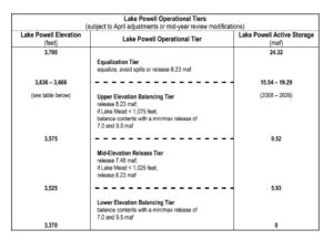
The heart of the “interim Guidelines”

They include this crazy table. (There exist more graphically neato versions, but I think it’s worth going to the source.)

It defines a complex nested set of “if this then that” rules for determining how much water is released from Lake Powell each year. All the “ifs” refer to the elevation of Lake Powell and Lake Mead, the two giant reservoirs at the heart of the system. We are currently operating in the “Lower Elevation Balancing Tier”, which creates all kinds of crazy incentives. If the Upper Basin puts more water into Powell, some of that will end up being released to Mead under the rules. If the Lower Basin foregoes some water use to prop up Mead, under the rules that could trigger smaller releases from Powell.

This reflects a basic paradigm in Colorado River management – decisions made on the basis not of flow in the river but rather on the basis of water in the reservoirs.

This is because those reservoirs – the water they store, really – have been for nearly a century central to the project of building a hydraulic empire that is the West we all know and love. As one of my other pals and coauthors, Anne Castle, noted, they’ve been enormously valuable in helping with that task.

But that was then. Now?

“They don’t do us much good,” Anne said, “when they’re empty.”

This is why Southern Nevada’s construction of the third straw looks so smart in 2022. Down to a nearly empty Lake Mead, Las Vegas will still be able to get water.