Deadpool Diaries: In March, the Rio Grande/Colorado River snowpack went bonkers

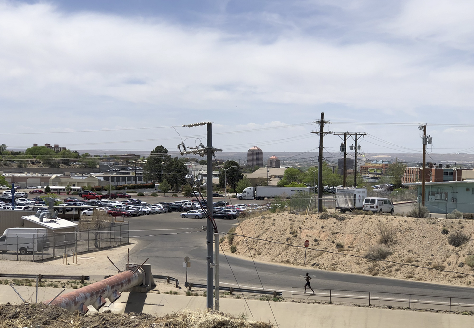
Irrigation canal with cement plant in the background.

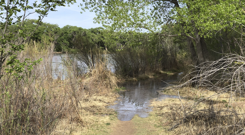
An urban river. Arenal Canal in Albuquerque’s South Valley

The ditches were flowing across Albuquerque’s valley floor yesterday as I criss-crossed them on a long, aimless bike ride, the first day it really felt like spring. The cycling challenge at this winter<->spring pivot point is clothing – layers for a morning start hovering just above freezing, with a pannier stuffed with the layers by the time I was down to shirtsleeves for my taco brunch.

Graph of flow at Embudo Creek on the Rio Grande in New Mexico, showing day-night oscillations and rising runoff as snow melts

Embudo Creek

My favorite gage at this time of year is Embudo Creek, just above its confluence with the Rio Grande in northern New Mexico. You can see the diurnal cycle of day-night melting, and the rising as the temperature warms. With the big snowpack, flows right now are well above the median. (Prof. Fleck note: The skewed nature of the data, with flows a lot higher on the high side than the lows on the low side, makes the mean – typically what we mean by “average” – less meaningful for a data like this. Hence median.)

The West Gulf River Forecast Center is forecasting Embudo Creek runoff at more than double the median this year.

The Embudo is just one little creek, but people live on it and built their lives around it. Of such creeks is the entire West built. Good to pay attention to one.

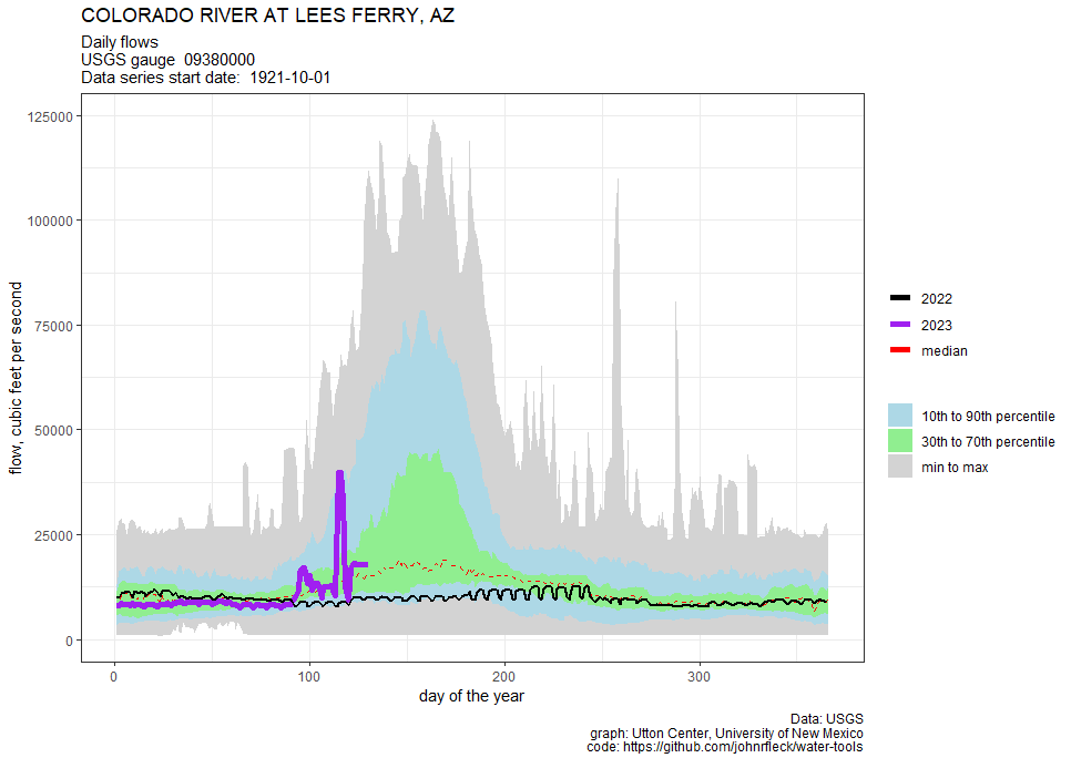
Colorado River at the start of April

The whole deadpool/wrecked speedboats emerging from the Lake Mead mud thing seems a bit of a quaint echo from a stranded past, as the Colorado River discourse shifts from how to protect the infrastructure from a dark cascade toward deadpool to “Which reservoirs should we refill, and by how much?”

The official CBRFC April 1 forecast hasn’t dropped yet, but the preliminary modeled numbers are up 3.6 million acre feet from March 1.

3.6 million acre feet.

Wrecked speedboat emerging from Lake Mead mud.

Never forget.

That seems like a lot, but it is worth remembering that we’ve been overusing the river by about 1.5 million acre feet per year since the turn of the century.

This likely means a release from Glen Canyon Dam to the Lower Basin of 9 million acre feet (or more?) in 2023, which might be enough to re-submerge some of the wrecked speedboats. That would be nice, but I hope we don’t forget the visceral message they’ve been sending us.

Interior’s draft modeling results should emerge next week (perhaps April 10-11-12?), but the specific near term crisis they were meant to help us through – the possibility of a Glen Canyon Dam release of less than 7 million acre feet this year – is gone.

Yay.

Instead, the Basin community is wrestling with a “what shall we do with the extra water” question: refilling Flaming Gorge and the other Upper Basin reservoirs drawn down by DROA, erasing “operational neutrality” by solving the confusing mess of the relationship between how much water was held back in Powell to keep the dam from breaking, and how that affects Lower Basin shortage tier accounting. (Don’t ask me hard questions, it’s super confusing.)

In a really important way, the discussion has shifted from short term crisis management to long term, umm, I guess “crisis management” remains the right description? Raise your hand if you disagree.

Rio Grande at the start of April

The Rio Grande, which is getting my most focused thinking right now on account of the new book (see bike ride picture above), is in good shape. Usually at this time of year I shift from watching the snowpack to worrying about dry wind events, but this year there’s so gosh-darned much snow up there that I’m, like, “Meh, whatever, bring it on, spring!”

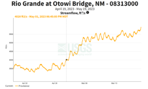
Graph showing high runoff in the Rio Grande at Otowi

Otowi runoff via WGRFC – a very good year on the Rio Grande

I lot depends on spring winds now, and the rate of warming and meltoff. But that will just be the difference between a big year and a very big year.

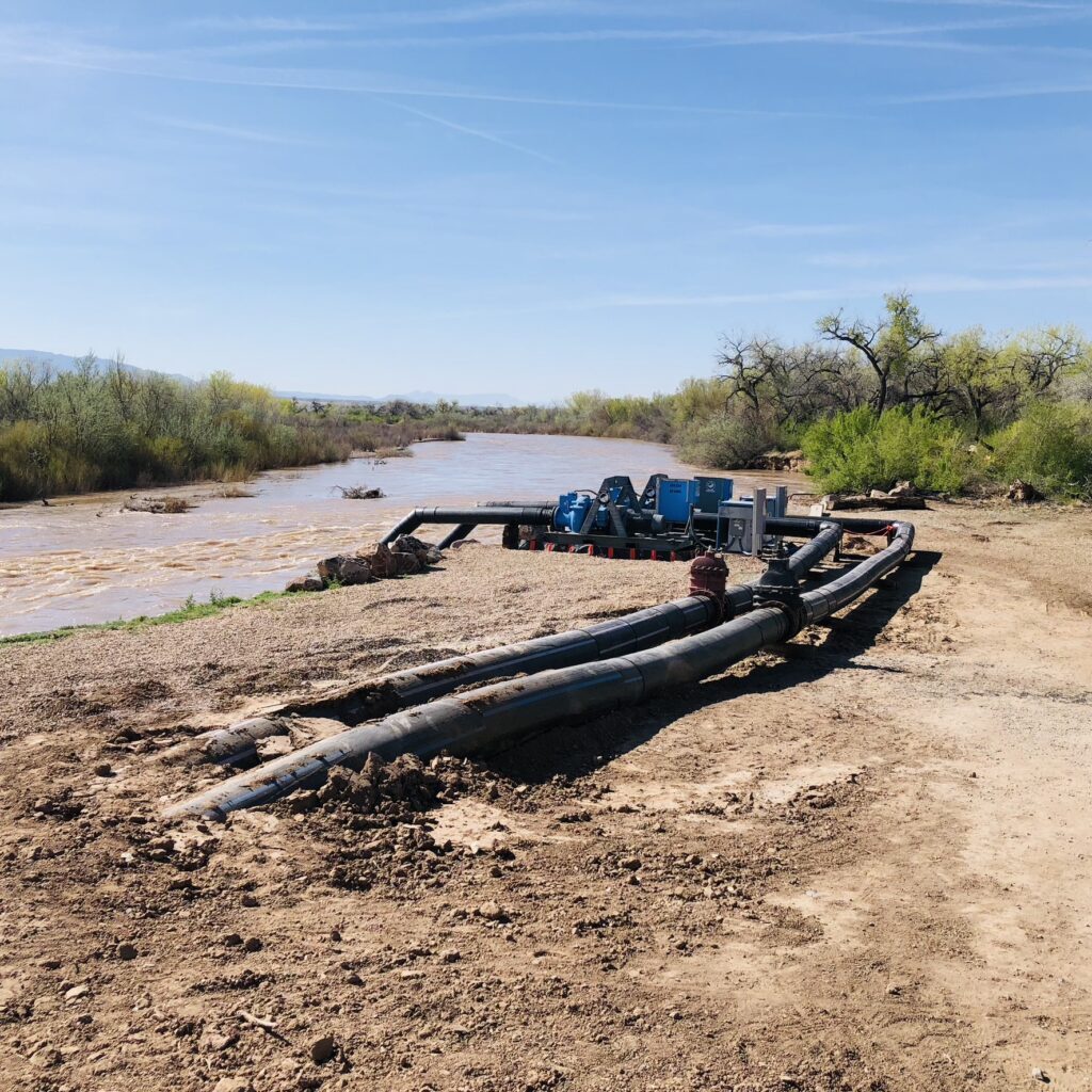
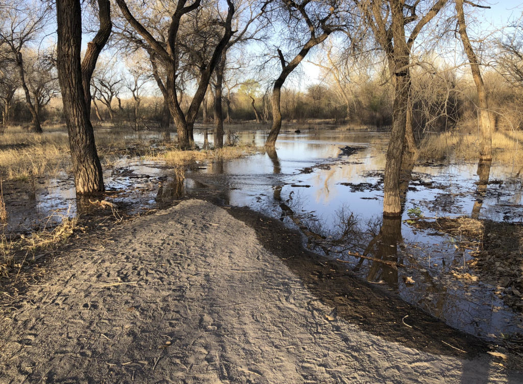
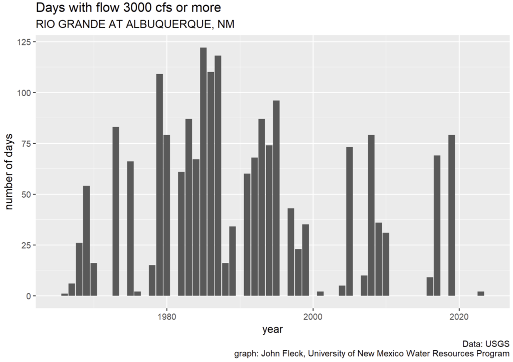
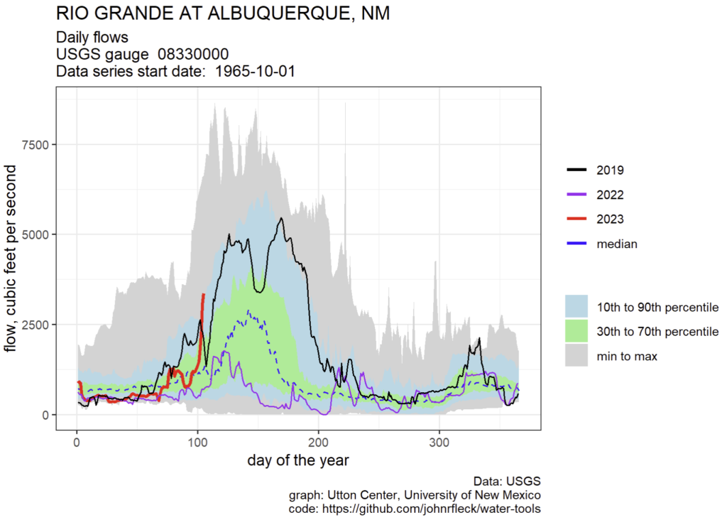
My great hope is for overbank flows in the Middle Rio Grande, like we had in 2019. Those were super fun.

As always, a big thanks to Inkstain’s supporters for helping support this work.

To use or refill? (a good mid-March Colorado River Basin forecast raises the question)

With more wet in the forecast, the latest numbers from the Colorado Basin River Forecast Center look very good right now:

The active weather pattern that began around mid-February continued through mid-March across the region. Precipitation was above to well above normal across most of the region during the first half of March. March 1-16 precipitation in the UCRB ranged from 80% of normal in the Colorado Headwaters above Kremmling to 275% of normal in the Duchesne River Basin. In the LCRB, March 1-16 precipitation ranged from 110% of normal in the Upper Gila River Basin to 285% of normal in the Virgin River Basin. Precipitation generally exceeded 200% of normal during the first half of March in the GB.

Graph from Colorado Basin River Forecast Center showing unregulated inflow to Lake Powell at nearly 5 million acre feet above average.

A good runoff forecast

This poses a really interesting question for water managers: Do we keep our water conservation foot firmly on the throttle (or brake? a metaphorical muddle?) and use this year’s bonus water to refill the reservoirs? Or do we back off the throttle (brake?) and let some of bonus water flow to users?

As always, a huge thanks to Inkstain’s supporters for making this possible

“partición de bienes” – Albuquerque’s Long Lots

A “long lot” in Albuquerque’s Duranes neighorhood

Sunday’s bike ride book research took us up along the old Duranes ditch, through Albuquerque’s near north valley. The landscape is still wearing its winter coat, but it’s clearly dusting off its leaf-growing apparatus and getting ready for spring.

We stopped to get a look at one of my favorite old farm fields, on Los Luceros Road. If you don’t count parks, it’s likely the largest irrigated parcel left in Duranes, about an acre in size. But look at the picture. Look at its weird shape – 600 feet long, maybe 75 feet wide

Long lots and “partible inheritance”

A guiding theme of our new book is the notion that institutions shape landscapes. By “institutions” here, we mean rules. The government agencies, the more common thing we talk about when we talk about “institutions”, are relegated to an important but secondary role – they are the tools we build to carry out the rules. So you’ve got to start with the rules.

The rule that drives the shape of this long narrow lot on Los Luceros is “partible inheritance”, a practice rooted in Spanish law of dividing land up equally among heirs to a piece of property. You can’t write Johnny out of the will because he joined the circus to pursue his dream of becoming a clown. Johnny still gets his share of the land when Mom and Dad are gone. And, importantly, because its value is connected to his ability to irrigated, Johnny and his siblings each get a narrow piece of land, connected on one end to the ditch.

Partible inheritance – “partición de bienes” – inevitably led to a bunch of “long lots” in the midst of urban Albuquerque.

Long lots and Albuquerque’s urban form

The urban development of Albuquerque was passed through the institutional funnel of partible inheritance.

Long lots of Duranes. Source: MRGCD 1927 Property Maps

You can see it in the map to the right (click to blow it up), showing the land ownership structure of the old village of Los Duranes circa 1927.

Long lots helped to establish a distinct agricultural landscape, as small family-owned subsistence farms gave way to work in the wage economy after the arrival of the railroad in 1880.

The long lots and the ditches influenced the layout of roads and paths, and which mostly (as in Duranes) run parallel to the ditches, sharing the high ground path the ditch builders chose for the first and most crucial piece of Albuquerque’s urban infrastructure.

Partible inheritance also resulted in fragmented land ownership, which shaped the urban growth and development patterns of Albuquerque.

The primary large parcels available to the early 20th century city-builders were the ones not subject to the “long lot” phenomenon. (Reader warning, I’m getting arm wavy here, but this is the hypothesis.) These big chunks of non-long lot land were mostly swamps and riverside woods, and that’s where you find the wave of suburban home building in the middle third of the 20th century. I think.


“the valley breathing in”

The Duranes, in Albuquerque’s North Valley, awaits first water. February 2023

The Middle Rio Grand Conservancy District began diverting water this morning (March 16, 2023) around 4 a.m. from the Angostura Diversion Dam north of town into the Albuquerque Main. The big concrete-lined channel carries water down the east side of the river some 15 miles to Albuquerque’s North Valley.

It irrigates land along the way in Santa Ana and Sandia Pueblos, two Native American communities that have lived and farmed their lands for what we call “time immemorial”, a poetic term rooted in English common law that the English jurist William Blackstone in the 1700s described as “a time whereof the memory of man runneth not to the contrary.”

By next week, the water will be flowing down through the city, through a hybrid landscape that is sorta “peri-urban”, a term that’s usually used to describe the transition zone between urban and rural areas. But Albuquerque’s peri-urban landscape is weird, or at least we think it’s weird (a central theme in our new book).

Peri-urban landscapes are often characterized by the tension of a city sweeping away the rural, an expanding series of concentric circles as the urban area pushes outward. But in Albuquerque the ditches of the Middle Rio Grande Conservancy District instead became a peri-urban anchor that preserved a belt of quasi-rural green run straight through the city’s urban core.

The economics wonks have a conceptual framework to think about what has happened here in the notion of “non-market values”. We normally think of irrigation ditches as conveying economic benefit via crops that farmers sell. Here, the value is non-market:

  • a preservation of a perceived cultural and historical significance, maybe growing a bit of hay or some fruit trees (I say “perceived” – maybe not quite the right word? – because our narrative of the history of agriculture in the valley doesn’t seem to match up well with the actual history, but the non-market value comes from the perception, eh?)
  • ecosystem services – the richly understudied biodiversity of the ditch network is endlessly fascinating, a novel ecosystem that’s been around for hundreds of years
  • recreational opportunities – walking, biking, fishing. Yeah, really, people fish the ditches!
  • community cohesion – social capital is built around the shared experiences of a neighborhood ditch
  • aesthetic values – have y’all seen that giant cottonwood along the Griegos Lateral?

My book’s co-author, Bob Berrens, and I are playing with an intriguing hypothetical: What would it take to add something like this to a city after the fact? Like, take a modern western city that’s kinda dry and boring and add a network of public flowing water through its midst, with trees and walking trails in the cool summer shade?

You couldn’t do it.

Years ago I was out on a newspaper story around this time of year with the late Joey Trujillo, the MRGCD guy in charge of helping usher the water down the Albuquerque Main into the city. I can’t find the old quote, so I’m doing this from memory, which is risky, but what I remember Joey saying is this:

I love this time of year. You can feel the valley breathing in.

Deadpool Diaries: Colorado River report card

An old wrecked speedboat emerging from a declining Lake Mead.

The structural deficit

With the March 24-month study out, a status report on the Colorado River Basin’s critical numbers. I’ve added the “minimum probable” forecast this time to help better understand the risk profile.

In brief, water users continue to take more water out of Lake Mead than is flowing in.

Most Probable
Lake Mead million acre feet
Start of WY2023 7.328
End of WY2023 6.589
Change in storage (0.739)
Year-end elevation 1,034.27
Miminum Probable
Lake Mead million acre feet
Start of WY2023 7.328
End of WY2023 5.883
Change in storage (1.445)
Year-end elevation 1,023.46


Projected water use by Lower Basin states

State Projected use in maf Percent of full allocation
California 4.423 100.52%
Arizona 2.358 84.21%
Nevada 0.227 75.67%


Sources: Projected reservoir levels, March 24-month studies, retrieved March 15, 2023; Forecast Lower Basin use, USBR Forecast, March 13, 2023, retrieved March 15, 2023

As always, a huge thanks to Inkstain’s supporters for helping make this possible.

Does 2023’s “cabin crusher” of a snowpack herald a return of California’s Tulare Lake?

Map showing the Tulare Lake Basin in Central California, USA.

Map showing the Tulare Lake Basin in Central California, USA. Shaded relief data from USGS. Solid blue: Perennial streams Dashed blue: Seasonal streams Dashed light blue: Man-made aqueducts Beige: Dry lake beds. Courtesy Wikimedia Commons

It is easy to forget that California’s Tulare Lake, in the southern San Joaquin Valley, once competed with Lake Cahuilla (the “Salton Sea”) for the title of “largest lake west of the Mississippi”.

We drained it. We farm it. But as Erica Gies happily reminds us at every opportunity, water is a formidable adversary if we aren’t willing to make peace with it.

Here’s Jeff Mount:

It is easy to forget that the Tulare Basin once held a very large lake, covering more than 1,000 square miles. The lake was very productive, with vast tule marshes teeming with fish and waterbirds that supported numerous Native American tribes. In very wet periods, it got deep enough (more than 40’ deep) to spill over into the San Joaquin River. In surface area, it was the largest water body west of the Mississippi, surpassing even the Great Salt Lake.

But in the 1900s, inflow to the basin was tamed by a combination of levees, dams, and canals, allowing farming throughout the region. Despite this, every few decades, nature recaptures a portion of the old lakebed when flows from the four rivers that drain into the basin—the Kings, Kaweah, Tule, and Kern—overwhelm the ability of landowners to move water around to avoid flooding their fields.

The last big cabin-crusher of a snowpack happened in 1983. That year, a young John Fleck got “trapped” in Chico, California, by the bodacious runoff (the scare quotes a reference to the fact that 23-year-old me being stuck in a party town with a delightful traveling companion and no particular need to be anywhere else was not a bad thing). In 1983, according to Mount’s PPIC post, 100,000 acres of Tulare’s former lakebed, now turned lucrative farmland, ended up under water.

There’s a good chance of something along those lines happening again this year – the water has to go somewhere! But Mount notes a fascinating “wrinkle”:

For the past decade, extensive groundwater withdrawal has lowered portions of the Tulare Basin, including areas both in and around the historic lake. This is likely to have two impacts. First, flooding may affect a potentially wider area that’s now lower and within reach of flood waters. Second, even though infrastructure that’s used to move water around in the Tulare Basin is critical to managing floodwaters, subsidence has altered the slope of many irrigation canals, reducing their capacity to move water. It’s not yet clear how this will impact flood management, but it could pose a challenge.

Jeff’s post is useful throughout.

Deadpool Diaries: A report card on our response to inconvenient science

A Colorado River report card

Lake Mead Water Year 2023, based on the most recent Bureau of Reclamation 24-month study

Lake Mead million acre feet percent full
Start of WY2023 7.328 28.08%
End of WY2023 6.508 24.93%
gain(loss) (0.820) -3.14%


Current forecast U.S. Lower Basin water use

state projected use in maf percent of full allocation
California 4.427 100.61%
Arizona 2.36 84.29%
Nevada 0.227 75.67%


Sources: Projected reservoir levels, February 24-month study, retrieved March 13, 20-23; Forecast Lower Basin use, USBR Forecast, March 10,2023, retrieved March 13, 2023


Some “inconvenient science”

An Assessment of Potential Severed Droughts in the Colorado River Basin

Salehabadi, Homa, et al. “An Assessment of Potential Severe Droughts in the Colorado River Basin.” JAWRA Journal of the American Water Resources Association (2022). (from the terrifically helpful Utah State Colorado River team and collaborators)

We summarize our updated understanding of plausible future drought conditions by considering historical flows, tree-ring reconstructions, and climate change…. We produced three drought scenarios, each comprising 100 streamflow sequences to be used as input to systems operation and management models. We used analysis of the duration-severity and cumulative deficit relative to the mean natural flow to evaluate droughts and drought simulations and show that the current millennium drought that started in 2000 has an average flow far less than the historical record. However, the flows reconstructed from tree rings or future flows projected from climate models indicate that even more severe droughts are possible. When used as input to the Colorado River Simulation System the drought scenarios developed indicate considerable periods when Lake Powell falls below its hydropower penstocks, indicating a need to rethink management and operation of these reservoirs during these critical conditions. (emphasis added)

Let the rethinking begin.


Inkstain at Twenty

tl;dr I started this blog 20 years ago today. I used it to learn to write.

Why?

Black and white photo of a 20th birthday cake.

Tims 20th birthday cake, courtesy Marion Doss

This blog started 20 years ago today (March 9, 2003) thus:

I have too many blogs already – Advogato, the Nuke Beat, my ABQJournal musings. Starting another seems a bit of overkill. They all have their roots elsewhere – a pre-existing publisher in the case of the Journal and Advogato, which provides a built-in audience. There’s comfort in that. The Nuke Beat’s just a hare-brained experiment, which may or may not work. But they all have something in common, which is me.

By that time I’d been a professional writer for two decades, for most of that time solely in print. My nerdy volunteer side hustle working on free software (GNOME, a Linux user interface thingie) took me down the tech rabbit hole, and I was part of the newspaper geek crew trying to figure out how make sense and use of the Internet’s amazing possibilities.

As the quoted bit above notes, I’d already been experimenting with blogging – Advogato was a free software community site, the Albuquerque Journal gave some of us blogs to play with early on, and I’d set up the “Nuke Beat”, a topic-specific blog associated with the nuclear stuff I was covering at the newspaper and as a freelancer at the time.

But none of them were “me” exactly – all were derivative of some particular subset of what I was writing and thinking about.

Rob Browman and I had registered the Inkstain domain name some years earlier and were already using it as a sandbox, first with a little Sun box plugged into a rack of gear at the office, then hosted at Southwest Cyberport, our still-awesome local ISP.

Inkstain began with two mottos: “Some things you don’t want to do on your employer’s production server.” and Jello Biafra’s “A prank a day keeps the leash away.” Some days had more than one.

So I installed Movable Type, one of the first-gen blogging platforms, and began to type.

David Cassidy and the Stochastic Parrot

Working on the new book, I’ve ponied up for a newspapers.com subscription for research. In addition to the book research (1920s newspapers are a blast), a fun side benefit is access to a bunch of my old newspaper work.

One of my first searches was for what I think of as the Fleckest thing I’ve ever written – the time I interviewed David Cassidy. Yeah, the Partridge Family guy, that guy.

some of the vast detritus of my newspaper carrier

It started as a joke.

On my morning commute, I’d seen a billboard announcing that Cassidy would be playing Sat., Oct. 21, 2006 at “San Felipe Casino Hollywood,” one of our Indian casinos. Our Friday entertainment section would do setup pieces for weekend shows, a delightful sad tired ritual where the publicist would set up a phone interview with the artist from some random tour stop the week before.

I wandered over to the arts desk and told Dan Mayfield that he should let me do the David Cassidy piece.

It was sort of a joke.

I was the science writer.

I had a reputation as the office policy wonk.

David Cassidy was an aging pop star.

But I have always taken my craft seriously, and also the Inkstain motto: “A prank a day keeps the leash away.”

Cassidy was a great sport in what must have been the approximately 5,782nd time he had to cheerfully reflect on his Partridge Family life.

The joy for me is rereading the rat-a-tat of my own voice, the way I used the Cassidy peg for a tight, sweeping little essay on ’70s art and pop culture. This is one my favorite paragraphs I’ve ever written. The setup was a paragraph introducing Shirley Jones and the Partridge Family’s peppy intro, “C’mon get happy!”, then somehow this spilled out.

They had the symbolic trappings of counter-culture rock ‘n’ roll, down to the old hippie-looking tour bus. But this wasn’t a Ken Kesey-style “Electric Kool-Aid Acid Test” bus. Its colorful paint job carried the cheerful clean abstract lines of Piet Mondrian rather than the revolutionary stylings of Jasper Johns.

I still marvel at where stuff like that comes from.

In a widely read and lately even more widely quoted-without-reading-it-all 2021 paper, linguist Emily Bender and colleagues introduced the “stochastic parrot” to help us understand language models like ChatGPT, the “AI” thingie that all the cool kids are talking about. Language models ingest huge volumes of words written by humans and develop probabilistic models of what sort of words follow what other sorts of words.

They’re super interesting, and I’ve been spending a ton of time experimenting with ChatGPT, in part as a sort of “compare and contrast” to try to think about my own writer’s brain, which is a marvelous puzzle. Here’s Bender et al explaining the parrot metaphor:

A LM is a system for haphazardly stitching together sequences of linguistic forms it has observed in its vast training data, according to probabilistic information about how they combine, but without any reference to meaning: a stochastic parrot.

You’re either on the bus or off the bus

The thing I puzzle about, that fills me with wonder, is how stuff like the Cassidy piece comes together in the chaos of my writer’s mind.

I had to start with Cassidy, and from somewhere – 11-year old me sitting in front of a TV with my 13-year-old sister, Lisa? – came the notion that the Partridge Family made rock and roll safe for suburban middle American us. I doubt I thought it up myself, all of my ideas are derivative, right? I’m no parrot, yes? An original thinker, yes?

David Cassidy helped make rock ‘n’ roll safe.

A cultural revolution fueled by anger over war in Southeast Asia, with rock ‘n’ roll as its soundtrack, was tearing the United States apart in 1970 when “The Partridge Family” premiered.

In Vietnam, American soldiers were thick in the middle of what would be the last major ground offensive of the war. In America, young people were on the streets, loudly and angrily.

Jimi Hendrix, symbol of all that was dangerous about rock ‘n’ roll, died Sept. 18, 1970 after taking too many sleeping pills. Two weeks later, Janis Joplin died of a heroin overdose.

Sandwiched in between, on Sept. 25, the perky members of the sitcom “The Partridge Family” made their television debut, an upbeat message out of their garage telling us that everything was going to be just fine.

Rat-a-tat. “…perky… “…out of their garage….” I can still remember my delight at nailing down the timeline – Hendrix, Joplin, the Partridge Family. Rat-a-tat.

Off the bus?

Mondrian and Jasper Johns were just icing. Modrian was obvious – look at that bus! Jasper Johns rolled out of my own language model, the art I’d grown up around, the water I swam in as a juvenile fish, the obvious thing that comes after Mondrian when you’re looking for countercultural art.

Obvious, anyway, to a kid trained at LACMA.

Having been born in 1959, I always felt cheated that I was too young to appreciate “the Sixties”, but I played all the music as a college DJ after the fact, and I read the Electric Kool-Aid Acid test at a very impressionable moment in my development as a young writer – “You’re either on the bus or off the bus.” I had so very much wanted to be on the bus.

So all the raw materials were there. But how did my writer’s brain assemble them? I’ve no idea.

At this point, stuff like this is beyond the large language models.

While working on this piece, I prompted ChatGPT to output some words about the connection between David Cassidy and Jasper Johns. The resulting text was a story about how David Cassidy was a big fan and avid collector of the artist’s work.

It sounded great – that’s what LLM’s are good at, sounding great, a terrific parrot as parrots go – but seems not to be anchored in verifiable reality.

More deeply, to borrow from Bender et al, “without any reference to meaning” – somehow those life experiences, dropping acid and reading Kesey in the late 1970s in a desperate attempt to recapture the ’60s, standing in bemused fascination before a Jasper Johns flag at some big boy art museum show, scratchy Hendrix on the turntable at KWCW, sitting in the Fleck family TV room rapt in September 1970s – “c’mon get happy!” – assembled by my writer’s brain into my crazy wonderful David Cassidy piece, contained “reference to meaning.”

Where did I learn to be archly dismissive of Mondrian? Where did that come from?

Rat-a-tat.

Inkstain at 20

I eventually ported Inkstain to WordPress, and according to my installation’s database, when I hit “publish” this will be my 6,176th blog post here.

As I think I mentioned, I’d been crafting workable sentences for a living for 20 years by the time the blog launched, but this is where I learned to write.

Thanks for reading.

Inching toward El Niño

Today’s ENSO outlook (El Niño Southern Oscillation) suggests a consensus among “the models” that the odds are tipping toward an El Niño for the coming summer and fall. The humans in the loop are more bearish:

The most recent IRI plume favors ENSO-neutral to continue through the spring, with El Niño forming during summer 2023 and persisting through the fall. In contrast, the forecaster consensus favors ENSO-neutral through summer 2023, with elevated chances of El Niño developing afterwards. The smaller chances of El Niño relative to the model predictions are primarily because ENSO forecasts made during the spring are less accurate, and also the tropical Pacific atmosphere is still fairly consistent with a cool/La Niña-like state. However, it is possible that strong warming near South America may portend a more rapid evolution toward El Niño and will be closely monitored. In summary, La Niña has ended and ENSO-neutral conditions are expected to continue through the Northern Hemisphere spring and early summer 2023.

Reminder: El Niño tips the odds toward wet along the southern tier of U.S. states – meaning the Rio Grande and lower reaches of the Colorado River basin(s). The upper reaches of the Colorado River basin are meh. And note “tips the odds”, a reminder that echoes through my typing fingers as I hear the voice of the late great Kelly Remond every time I write about this. See: Southern California’s cabin-crusher of a snowpack after a La Niña winter – ENSO tips the odds, but is no guarantee.

As always, a huge thanks to my supporters for helping make this work possible.