The hydrograph of the All-American Canal

With little water storage to speak of in the Imperial Valley, the flow of the All-American Canal west from Imperial Dam integrates, in close to real time, the collective decisions of a thousand farmers growing crops on half a million acres.

A “hydrograph” is a commonly used tool for looking at the flow of water past a measurement gauge over time. You put time on the “x” axis and flow on the “y” axis, to help visualize its ups and downs. There aren’t many natural hydrographs left to look at in the western United States, but I’m fascinated with human-intermediated ones.

I’ve written before about the “institutional hydrograph” on my Rio Grande, where we have an annual bump in flow as water is moved to meet end-of-year compact delivery obligations. On the All-American Canal, you can see – what – an “agronomic hydrograph”?

All-American Canal flows

I spent my holiday afternoon cleaning up some data visualization code I use to help me think about USGS gauge data. (On github here.) One of the gauges I tried it out on was the flow down the All-American Canal from Imperial Dam. The double peak is fascinating – heaviest water use in April, then a drop, then another peak in late July and early August.

It’s an agronomic hydrograph, driven in part by cropping patterns (the Imperial Irrigation District publishes wonderful data here summing up the collective behavior of the valley’s farmers) and partly the weather. August, I’m told, is really hot down there.

Farming the desert. El Centro, California, June 2019, by John Fleck

New USBR modeling shows substantial reduction in Mead, Powell risk over the next five years

The unusually wet winter (with an assist from new Colorado River Drought Contingency Plan water reduction rules) has substantially reduced the near-term scare-the-crap-out-of-me risks on the Colorado River for the next few years, according to new Bureau of Reclamation modeling.

Modeling done in January showed significant risk – a nearly one in three chance – of Lake Mead dropping below elevation 1,025 by 2024, a level that would place the reservoir’s long term ability to make deliveries at risk. That has dropped to a one-in-30 chance, according to the new USBR modeling.

At Lake Powell, the risk of reaching elevation 3,525, a danger point beyond which power generation and the Upper Basin’s ability to meet Colorado River Compact delivery obligations are at risk, has dropped from a one in four chance by 2024 to a one in 25 chance. The chance of dropping below Powell’s minimum power pool – the point at which the reservoir is too low to generate electricity – has dropped from one in six to essentially zero.

reduced risk of shortfalls at Lake Powell and Lake Mead

Details of the modeling results, presented today to basin water managers, suggest the bulk of the risk reduction is the result of the wet winter, which has pumped up runoff and reservoir storage. But the new Drought Contingency Plan, under which water users in the Lower Colorado River Basin have agreed to leave water in Lake Mead if and when it drops below critical thresholds, also played a role.

As I write this (Monday evening, July 1), you can find the old model results here. The new ones aren’t posted yet, but by tomorrow (July 2) the new ones should be posted at the same link.


Delph Carpenter’s Preferred Compact

By Eric Kuhn

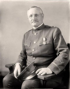
Delphus Carpenter. Picture courtesy Colorado State University library

Colorado attorney Delph Carpenter (1877-1951) is given credit as the driving force behind the 1922 Colorado River Compact, a much-deserved accolade. Had the compact negotiators actually listened to him, however, both basins would be better off today. Before the compact negotiators settled on the deal we are now trying to live with, Carpenter proposed a far simpler arrangement that, in retrospect, might have been better. Had they listened to him and adopted his idea, the Upper Basin today would not be facing the daunting task of implementing demand management to maintain critical storage levels in order to meet its downstream obligations and the Lower Basin would have more water and fewer shortages.

The 1922 compact as it was signed in November 1922 was not the compact Carpenter wanted when the negotiations began in the previous January. He was a fierce advocate for state sovereignty over all the waters that originate or flow through a state, but Carpenter knew he might be on the wrong side of the United States Supreme Court on the matter. He was Colorado’s lead attorney in Wyoming v. Colorado, a case involving the Laramie River, a small and relatively unknown stream that flows north out of the mountains west of Ft. Collins into Wyoming where it eventually joins the North Platte River near Wheatland.

In the early 1900s, A Colorado developer proposed a project that would divert water from the Laramie River Basin into the adjacent South Platte River Basin. In 1911, Wyoming went to the U. S. Supreme Court to protect water rights that had already been perfected in the Wheatland area. As the Colorado River negotiations began, the case had been through two oral arguments, but had not yet been formally decided. Carpenter feared that since both Colorado and Wyoming were prior appropriation states, the court would apply the doctrine to the Laramie on an interstate basis, undermining his cherished state sovereignty and, on the Colorado River, giving the advantage to faster growing lower river states.
The Laramie case loomed as representatives of the seven Colorado River Basin states came together to negotiate what would become the Colorado River Compact.

After joining Utah commissioner R. E. Caldwell during the sixth Compact Commission meeting to block a proposal to apportion water to individual states based on the amount of irrigable acreage within each state, during the seventh meeting, Carpenter made his move. Carpenter’s proposal was relatively simple. He suggested that the lower river states should allow the upper river states to develop and use water within the basin unimpeded by the states of the lower river –“the construction of any and all reservoirs or other works upon the lower river shall in no manner arrest or interfere with the subsequent development …of the upper states or the use of water therein….”

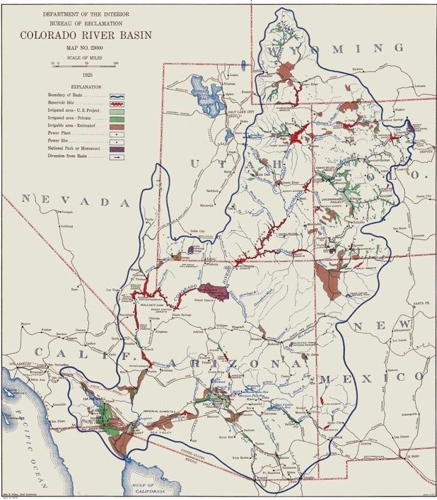
In return, Carpenter said, the upper river states would do the same- “give you absolute free unbridled rights, all objections withdrawn…” The upper river states would not litigate or oppose in Congress, any development in the lower river. Carpenter made the case that due to the canyon and mountainous topography, climate (limited growing season), and because of return flows, water use within the upper part of the basin would have little impact on the supply of water to the lower river- “the areas which may be irrigated and the consumption …. so limited by nature, that the states of origin will never be able to beneficially use even an equitable portion of the waters …. of each.” When pressed by Commission Chairman Herbert Hoover, Carpenter acknowledged that because exports out of the basin were fully consumptive the upper river would agree to limit the amount water moved across the continental divide. In Silver Fox of the Rockies, historian Daniel Tyler suggests that Carpenter and his fellow upper river commissioners would have accepted a limit of 500,000 – 600,000 acre-feet per year, about 25% less than the current exports.

Commissioners from the lower river rejected Carpenter’s proposal countering that without an overall limit on upper river use, they would not have the certainty necessary to finance their proposed projects. In June 1922, the Supreme Court unanimously ruled in favor of Wyoming and applied the concept of prior appropriation to the Laramie River as a whole, confirming Carpenter’s fears. The decision forced him to change tactics. When the commissioners reconvened in Santa Fe in November 1922, building on a proposal by the Reclamation Service’s Arthur Powell Davis (now Bureau of Reclamation) to create a compact among the two basins, Carpenter made a new proposal which became the framework for the compact that was ultimately approved. Carpenter proposed the basins be divided at Lee Ferry (a mile downstream of Lee’s Ferry), the Upper Basin would, in Carpenter’s words, “guarantee” a 10 year-flow at Lee Ferry (the negotiated number ended up at 75 million acre-feet), and each basin would share any future treaty obligation to Mexico.

Today with the specter of climate change reducing the water available from the river, perhaps the key concepts and messages from Carpenter’s preferred compact deserve a second look. As Carpenter suggested, consumptive uses in the Upper Basin have been self-limiting. After a building spurt triggered by federal funding made available under the 1956 Colorado River Storage Project Act that lasted from the late 1950s through the mid-80s, the total consumptive use of water in the Upper Basin from 1988-2017 has been flat or even slightly declining.

Upper Basin water use

The reasons are not difficult to understand. The last big federally subsidized irrigation projects were completed in the late 1980s and early 90s. As were the last big transmountain diversion projects. In-basin municipal growth has been strong, but since much of it is occurring on lands that were previously under irrigation, the net impact of residential growth on water consumption is small. The energy sector, once projected to be a major user of the Upper Basin’s share of water, is now more likely to accelerate the decline in total Upper Basin use. Natural gas and oil production consumptively uses very little Colorado River water. And, more importantly, the basin’s aging and uncompetitive thermal power plants, which at one time were consuming over 170,000 acre-feet per year, are being rapidly decommissioned. Within a decade, total use by thermal power will likely be less than 50,000 acre-feet per year (if not zero).

In theory, new export projects out of the Upper Basin to meet the needs of the booming Colorado Front Range and Wasatch Front could be a driver for new consumptive uses, but reality suggest otherwise. There are currently only three export projects in the planning or permitting process; Denver Water’s Moffat System Expansion project, Northern Water’s Windy Gap Firming project, and the State of Utah’s Lake Powell Pipeline. The net additional consumptive of the first two projects is small, no more than about 20,000 acre-feet per year. The Lake Powell Pipeline will divert about 80,000 acre-feet per year to the St. George area, but it may not really be an export project. The water it diverts will be used in the Lower Basin. Like overall Upper Basin consumptive uses, since 1988 the trend for exports has been flat or slightly declining.

Upper Colorado River Basin Exports

The Lower Basin’s total mainstem use is also on a recent downward trend primarily because of the conservation measures implemented to preserve storage in Lake Mead and less evaporation due to reduced storage levels. There are insufficient data on Lower Basin tributary uses to make any trend conclusions. Despite this progress, when reservoir evaporation and tributary uses are included, the Lower Basin is consuming, on average, more than ten million acre-feet per year.
The current situation on the river raises the basic question of equity between the two basins that Carpenter recognized a century ago. The Lower Basin is using more than its 8.5 million acre-feet apportionment under the 1922 compact. The Upper Basin is using far less than its 7.5 million acre-feet, about 4.3 million acre-feet per year. Yet, with fixed obligations to the Lower Basin and Mexico under the 1922 compact, the Upper Basin still bears the brunt of the climate change risk. To avoid what could otherwise be inevitable future conflict, basin water leaders should carefully consider the wisdom of Delph Carpenter’s preferred compact and devise an approach that gives each basin the flexibility to live with the water they currently have and stay out of each other’s business.

You can’t address the Colorado River Basin’s problems without addressing the Salton Sea

Red Hill Bay boat ramp, Salton Sea, Imperial County, California. June 2019

RED HILL BAY – I couldn’t resist the “abandoned boat ramp” trope when I visited the Salton Sea this week. No amount of channel dredging is going to get you to the Sea at this point. And all that recently exposed shoreline between the old boat ramp where I was standing when I took the picture and the Sea off in the distance represents a source of dangerous dust.

Conserve water on the farms of the Imperial Valley, and you reduce tail water flowing to the Salton Sea, which shrinks when evaporation is greater than inflows. When the wind whips up from the south, this place can be unbearable. We cannot address the Colorado River’s problems without addressing that dust.

Colorado River water flows down an Imperial Irrigation District canal

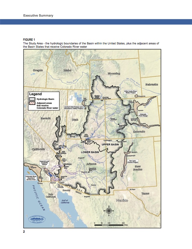
Imperial is a remarkable place, half a million acres of desert with a lattice of irrigation canals draped across it that has turned it into some of the most productive farmland in the United States. More than 40 miles from north to south at its longest, and nearly 30 miles east to west at its widest, it is a bustle of farming, even in the heat of summer.

The cultural and institutional nature of that lattice of irrigation canals makes Imperial one of the most water-aware communities you’ll find anywhere. Lots of communities are deeply connected to the Colorado River, but Imperial has a unique self-awareness about its relationship with the river that is fascinating.

My trip to the Lower Colorado this week coincided with Tuesday’s meeting of the Imperial Irrigation District Board of Directors, which as a longtime student of local government I found fascinating.

Folks from around the valley gathered for the ceremonial handing out of checks from the irrigation district to help fund local community pools. Dippy Duck, the district’s canal safety mascot, was on hand.

Dippy Duck and friends

I’m told Dippy is a big deal here.

The deputy general manager of the San Diego County Water Authority gave a presentation about a study his agency is launching to consider the feasibility of connecting a pipe from San Diego to Imperial’s system to move conserved farm water to the coastal city. (Wait, what? Ry Rivard has done the heavy lifting on this one. I don’t have much to add other.)

But to me, the most fascinating discussion involved 25 acres of currently unfarmed, unirrigated land that an Imperial farmer wants to turn into an olive orchard.

The farmer had filed a “petition for inclusion”, which would have brought the land within the district’s Imperial Unit boundary, making it eligible for water from the district’s Westside Main Canal. This was 25 acres in a district that’s half a million acres large. But however small the acreage, the discussion captured the tension between two important but seemingly irreconcilable positions: the importance of using water to irrigate land to support the community’s economy versus the reality, as the IID staff report on the issue noted, of “the ongoing 19-year drought on the Colorado River.”

Young Reservoir, Imperial Irrigation District

Tina Shields and Mike Pacheco, the Imperial Irrigation District’s water managers, gave me a great tour of the district yesterday. In addition to Red Hill Bay to talk about a proposed restoration site there (more on that in a moment) we stopped by Young Reservoir. On the scale of the Colorado River, Young is tiny – less than 50 acres of surface area, a 275 acre foot capacity. But in terms of institutions and policy, it is huge. In 1989, IID and the Metropolitan Water District of Southern California, the nation’s large municipal water wholesaler, signed an agreement through which Met paid for efficiency improvements in IID’s system in return for the saved water. A newly built interceptor catches tail water flowing out the ends of 11 laterals (about 31,000 acres worth of farmland) and pumps it to Young, from which it can be returned to IID’s Vail Canal and used by farmers. Had it not been caught, it would have simply flowed into the Salton Sea.

But that’s the thing, right? It would have flowed into the Salton Sea. Enough conservation efforts like this (and there have been many, and there could be many more) and we reduce inflows to the Sea to leave places like Red Hill Bay stranded, and the many thousands of acres of newly surfaced shoreline vulnerable to the desert winds. Out at Red Hill Bay, we’re about to see a few hundred acres of habitat restoration, which will cover a significant area of dust source. But it’s a drop in the bucket compared to the work that needs to be done.

Imperial Irrigation District is the largest water user in the Colorado River Basin. Any effort to roll back Colorado River water use to live with hydrologic reality will be very difficult without Imperial’s help.

We have to deal with the Salton Sea problem.

The untimely death and life of the Colorado River

YUMA – I brought a bicycle this week on a road trip to the Lower Colorado River, and left myself the morning today to ride out to Morelos Dam.

A rainbow unicorn on the Colorado River

After a quick morning of meetings yesterday in Tucson with the University of Arizona Press folks turning our words into a book, I drove on to Yuma for the night. Yuma is in the lettuce pocket at the bottom of the Colorado River, and it’s one of my happy places. I dumped my luggage at a riverside hotel (they got me a room facing the Colorado), drove to In-N-Out, and took my dinner and a camera down to Yuma’s Gateway Park.

I love this park. Families families were picnicking and floating, including a rainbow unicorn (right).

This morning I rode west, juggling gravel levee road and paved (and narrow) farm road to get to Morelos. It’s six miles by line of site, but I logged 20 there and back with the jogs this way and that wandering down narrow farm roads and gravel levees.

Morelos is the last dam on the Colorado, sending what’s left of the river at this point to the west, to the farms and cities of the Mexicali Valley.

My trusty bicycle, Morelos Dam on the U.S.-Mexico border, June 18, 2019.

I first came here in the spring of 2010, was struck by seeing the end of the Colorado River:

The first time I saw this, I was stunned. Driving the Yuma County levee past Morelos Dam in 2010, I saw the last trickles of water from leaks in the dam and a shallow water table disappear within a few miles into a sandy, dry channel. This great river, the Colorado, around which I have spent much of my life, whose water I have showered with and drunk, which has grown the food I eat and floated my boats for hundreds of miles, simply disappears into the desert sand.

That’s from Water is For Fighting Over, which came out in 2016. I quit a job to write that one, got a new job, wrote a new book (Science Be Dammed, also about the Colorado River), and now I’m back for more.

Morelos remained striking for me when I rode my bike out there this morning, but in ways that grow have only grown more complicated since I first saw it in 2010. I was playing a game with the paragraph above that remains my unfinished business – setting my “OMG the river ends!” against the benefits I have received – “whose water I have showered with and drunk, which has grown the food that I eat”. I’m spending time on this trip with people who do the food-growing piece – in the Imperial and Palo Verde valleys.

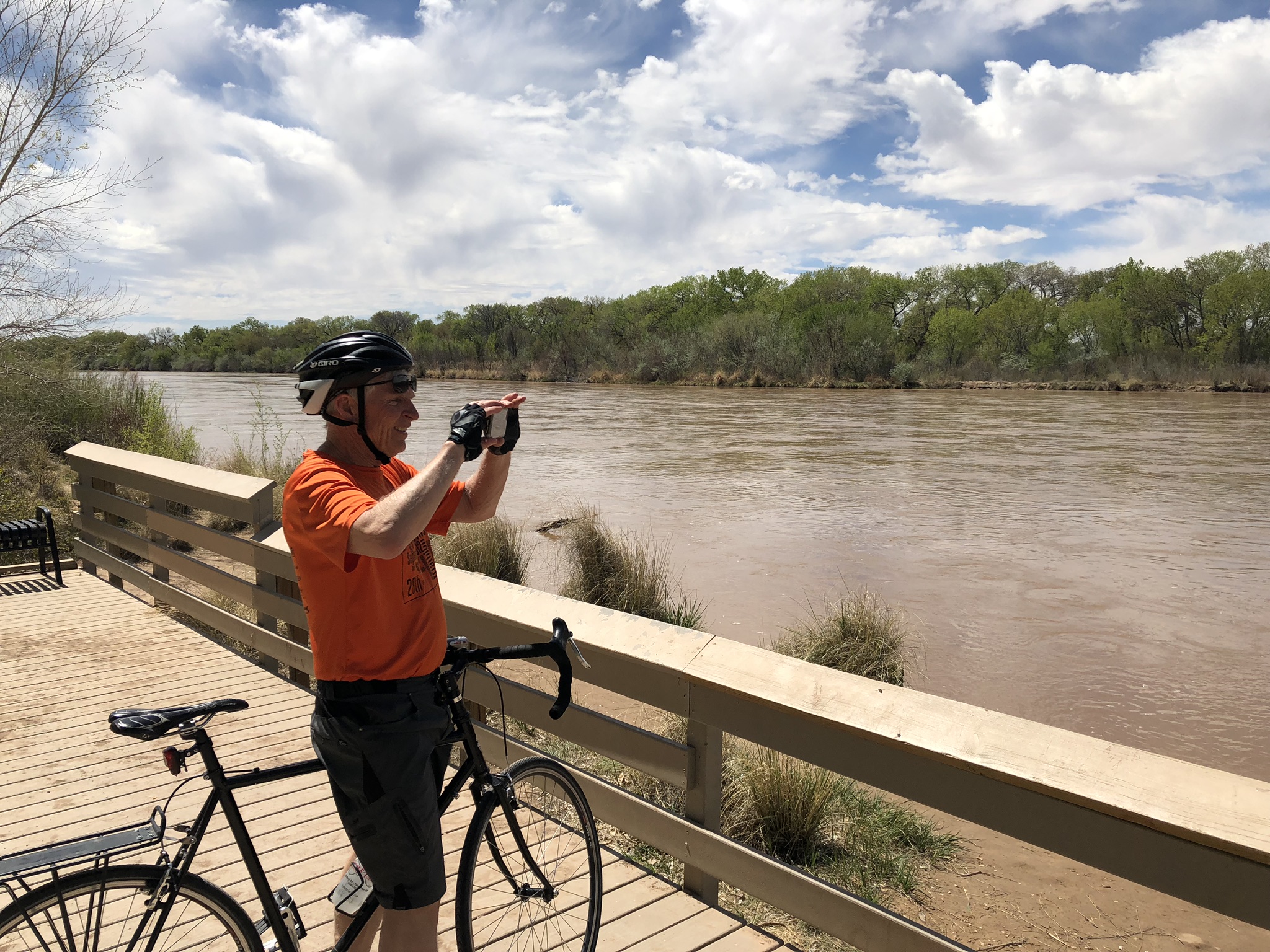
The Colorado River at Yuma, where I took a dip to cool off after my bike ride, was flowing at ~1,100 cubic feet per second this morning. Downstream from Morelos, that drops to ~0 cfs. Upstream from Yuma, the All-American Canal is running at about 5,000 cfs. I got an email from my collaborator Eric Kuhn, who did a similar bike ride this morning where he lives, in the mountains of western Colorado – bankful at 17,000 cfs. It’s a complicated system.

Colorado River at Glenwood Springs, June 18, 2019. By Eric Kuhn


Powell forecast up a million acre feet

The Bureau of Reclamation’s monthly storage model runs, based on the latest Colorado River Basin runoff forecasts, show Lake Powell ending the water year (Sept. 30) at 13.8 million acre feet. That’s an increase of more than a million feet over the May estimate, and 2.8 million acre feet above the Sept. 30, 2018 number:

Mead-Powell storage, end of water year

Updated data here.

Study: Small increases in Upper Colorado water use would cause big shortage risk

Increasing Upper Colorado River Basin water use by just 11.5 percent would double the risk that the Upper Basin fails to have enough water to meet its obligations under the Colorado River Compact, according to a new modeling study to be rolled out in a big meeting in Grand Junction, Colorado, next week.

The study hammers home an important point former Assistant Secretary of the Interior Anne Castle has been making: new uses on the Upper Colorado increase risk for existing users.

The analysis, done by John Carron of Hydros Consulting for Colorado’s four West Slope Basin Roundtables, suggests that even without increased use, the risk is high – 46 percent over the next 25 years based on hydrological assumptions chosen to take climate change into account. But Carron found that “an increase in annual Upper Basin Consumptive Use averaging 11.5% (approximately 500,000 acre-feet roughly doubles the risk.” The study’s results are being circulated in state of Colorado water management circles in preparation for a big meeting June 20 in Grand Junction.

(Disclosure: I worked with Carron on early phases of this work, as a consultant to the Colorado River Water Conservation District. I was not involved in the current work

.)

The risk is basically this: taking more water for new uses leaves less of a margin, increasing the risk that the Upper Basin will not have enough water in storage during a spell of dry years to meet its obligations under the Colorado River Compact to deliver 82.5 million acre feet of water in each 10 consecutive years (7.5 million acre feet per year the Upper Basin owes the Lower Basin under the compact, plus an additional 750,000 to meet U.S. treaty obligations to Mexico). If that happens, all sorts of hell could break loose, in court and/or as Colorado and other states scramble to cut back uses to meet downstream delivery obligations.

To be clear, smart Upper Basin lawyers will argue that we don’t really owe all that water to the Lower Basin and Mexico, but the Lower Basin has smart lawyers too. I’d prefer not to go there.

There are tons of assumptions in the study that matter – Carron’s slides open with the famous George Box quote we use with our water resources modeling students: “All models are wrong, some are useful.” In particular, the key conclusions are based on the “stress test hydrology.” This is a technique developed by Carron and my book co-author Eric Kuhn that attempts to be more realistically pessimistic about the threat of climate change. I am not unbiased here – I think the stress test is a great “some models are useful” tool.

Water folks in Colorado will find the details of what Carron has done particularly useful, looking at the details of where within that state the vulnerabilities lie, based on a new analysis of the web of water rights seniority on the Colorado and its tributaries. This is a great model for what other states and the Upper Basin as a whole probably need to be looking at to better understand our water supply reliability risks. I’ve been trying to understand, for example, where similar vulnerabilities lie in my own state of New Mexico.

Details here.

All water is local. Sort of.

Putting in downstream from the Taos Junction Bridge. June 8, 2019, photo John Fleck

TAOS JUNCTION BRIDGE – I took back roads upon back roads this weekend to get home from Boulder, where a bunch of us had gathered for three very socially and intellectually intense days talking Colorado River stuff.

I ended up on one of those “what happens if I turn here?” digressions, off US 285 onto NM 567/570 (I’m confused about the numbering). The road drops via zany unpaved switchbacks onto the Rio Grande in Taos Gorge, crossing at Taos Junction Bridge, circa 1930.

I stopped for a few minutes at the boat ramp on the far side of the bridge, lurking and watching as happy families rigged their boats for a float down a pretty robustly flowing Rio Grande. It’s the biggest flow at this point in the year since 1997. After three days of thinking about water management at the scale of the entire Colorado River Basin, it was a great reminder that at its root all water – this day, this river, this reach, these families – is local.

Sort of.

As I was leaving the University of Colorado School of Law Friday afternoon, headed for the San Luis Valley near the Rio Grande’s headwaters, one of my friends said, “Buy up all the water rights you can!”

My friend’s crazy scheme is that “we” (someone, who?) should buy up water rights in the San Luis Valley and retired them. The water would be sent down the Rio Grande to Albuquerque, which could use it in lieu of importing Colorado River Basin water via the San Juan Chama Project.

This is of course a crazy scheme. I first heard my friend float it over breakfast at a meeting in Phoenix. Sitting at the table with us were a couple of senior water managers from Arizona and Colorado. They noted that, what with interstate compacts involved (one on the Rio Grande, a second on the Colorado), this would be a tricky transaction that their states would have to approve, but would not look upon kindly. And of course the good folks of the San Luis Valley might have something to say about this as well.

As I said, it’s a crazy scheme. But as Utah State’s Jack Schmidt said during a talk Friday in Boulder, we stand on the shoulders of some pretty crazy schemes in the Colorado River Basin.

On the drive Friday to Alamosa in the San Luis Valley, I passed one of them, the outlet of the Roberts Tunnel, which diverts Colorado River Basin water 20-plus miles beneath the Continental Divide dumping it into the North Fork of the South Platte (yeah, they really call it that) for use in Denver.

US 285 climbs out of the South Platte drainage, eventually crossing into the Arkansas River Valley. By the time the highway joins the Arkansas at Buena Vista, that river has already been augmented by another transbasin diversion. The Fryingpan-Arkansas Project (“Fry-Ark”!) takes water from the headwaters of the Fryingpan, a tributary of the Roaring Fork, which is in turn a tributary of the Colorado.

Standing on the shoulders of crazy schemes, as Jack said.

Blythe, Todd L., and John C. Schmidt. “Estimating the Natural Flow Regime of Rivers With Long-Standing Development: The Northern Branch of the Rio Grande.” Water Resources Research 54.2 (2018): 1212-1236.

As I stood at the Taos Junction Bridge this morning watching families rigging boats, the Rio Grande was flowing at about 3,700 cubic feet per second. Given that, as I said, it’s the most at this point in the year since the late 1990s, it feels to us like a lot of water. But up in the San Luis Valley, a lot of water is being diverted right now for farming. At Del Norte, where the Rio Grande enters the San Luis Valley, flows today were more than twice that which finally reaches Taos Junction Bridge.

Jack and one of his students, Todd Blythe, published a neat paper last year trying to estimate how much water would be flowing down the Rio Grande absent upstream dams and diversions. In the stretch I visited today, they concluded, modern flows are about half what flowed before we started all our crazy schemes.

The result of all these crazy schemes is that no water is ever really local. But one of the corollaries of my friend’s admonition to buy up San Luis Valley water rights is that less land in the valley would be farmed and more water would flow every year past the Taos Junction Bridge.

In essence, then, no water is really local. It’s all interconnected.