Presa Morelos: when in doubt, make a bird list

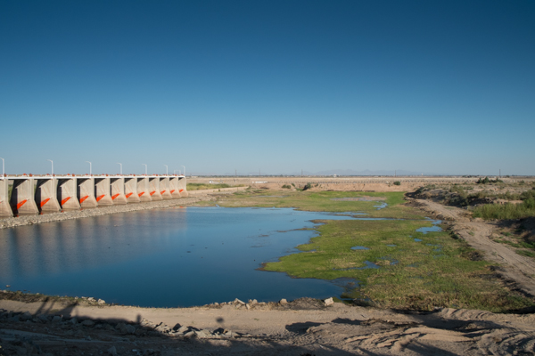
Morelos Dam, March 22, 2014, by John Fleck

Morelos Dam, March 22, 2014, by John Fleck

LOS ALGODONES, B.C. – I made it to Yuma with time to spare this afternoon, so I dumped my bags at the motel and drove around to the Andrade border crossing and through the little town of Algodones  (best dentists in North America!) to Morelos Dam.

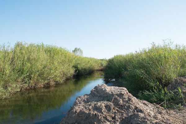
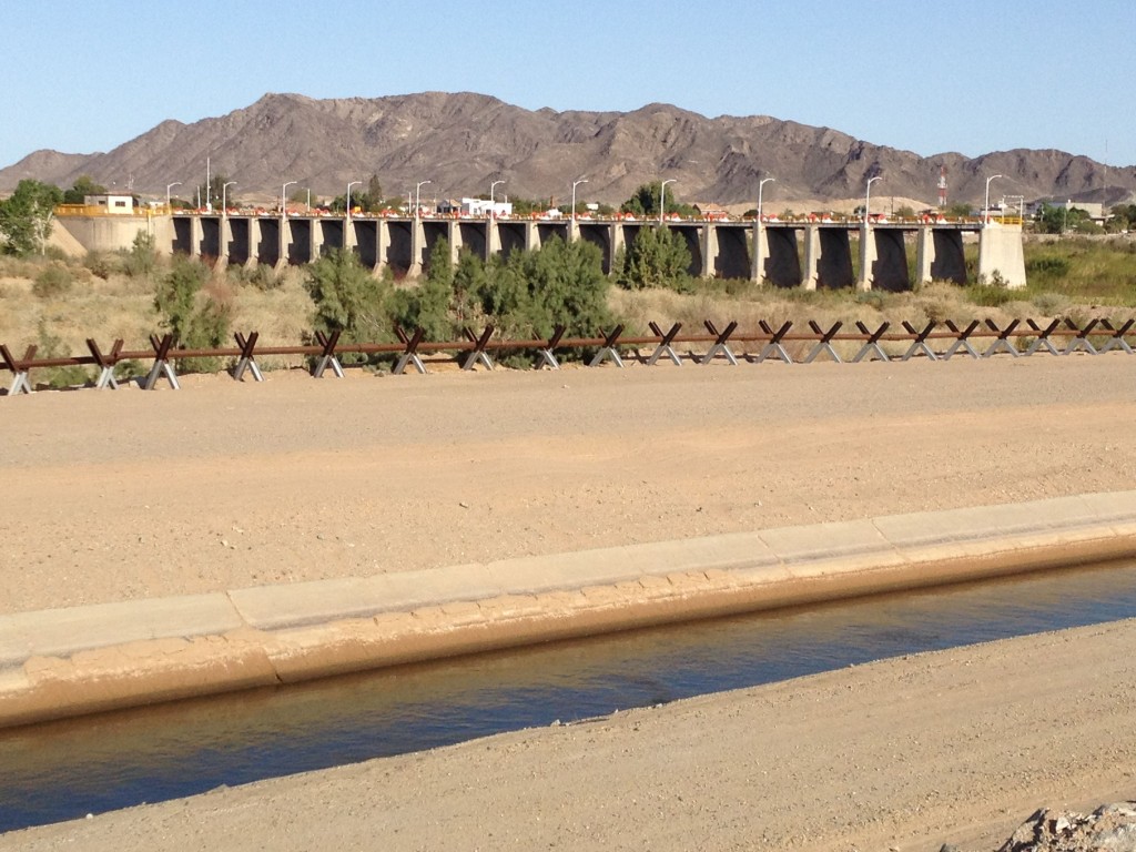
I couldn’t find the angle to get the picture I wanted, so you’ll have to settle for some words. In the picture above, we’re on the downstream side of the dam, which diverts the last of the Colorado River’s waters to farms in Mexico. The dam’s closed, so the water you see is just groundwater leaking through. If you look closely at the dirt road on the right side of the picture, you’ll see a little gap. That’s all that’s left of the Colorado River. Words fail me, here’s a closeup of all that’s left of the Colorado River. Hard to get a feel for the scale here, but there was a guy out walking his dog. The dog splashed from Mexico to the U.S. and back in just a few seconds.

The Colorado River, ten feet wide, by John Fleck, March 2014

The Colorado River, ten feet wide, by John Fleck, March 2014

It’s a nice shallow pool, so of course there were birds:

  • cormorants
  • a green heron
  • some undetermined sandpipers
  • a bunch of black-necked stilts (lordy, such graceful creatures)
  • I’m pretty sure a blue-winged teal
  • lots of coots (“American” coots, to be specific)
  • a gallinule

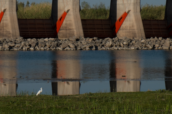
Since I’m down here to watch the historic release of Colorado River water back into the long-dried delta, this of course raises all kinds of fascinating questions about what is “nature”. It’s just a bunch of dam leakage confined by levees. Whatever. The egret was gorgeous:

Snowy egret, Morelos Dam, March 22, 2014, by John Fleck

Snowy egret, Morelos Dam, March 22, 2014, by John Fleck

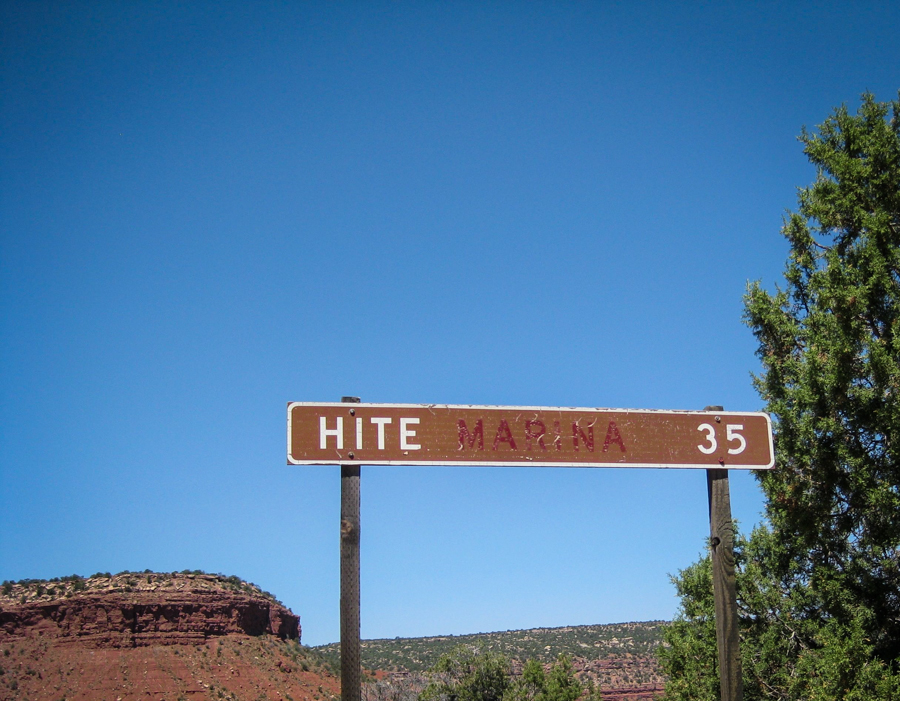
The Hite Marina

Hite sign, by L. Heineman, June 2009

Hite sign, by L. Heineman, June 2009

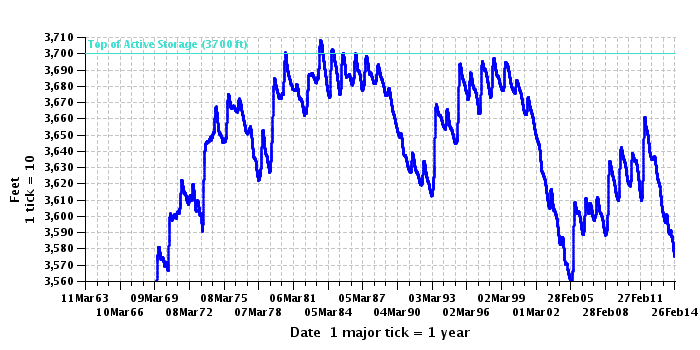
There used to be a marina at Hite, Utah, on the upper end of Lake Powell. The Park Service abandoned it in the early 2000s, when the reservoir dropped out from underneath it. They also fixed the sign.

Lake Powell elevation, courtesy USBR

Lake Powell elevation, courtesy USBR

Crossing the divide

HOLBROOK, AZ – Driving on Interstate 40 in western New Mexico, the continental divide feels like a geographic afterthought.

When I was a boy, I remember the Continental Divide as high mountain passes in the Rockies, deserving of capitalization, a thing of great import. I was mesmerized by the concept. If I stood here and peed, it would flow to the Atlantic Ocean. Walk just a few steps over there, and my pee would end up in the Pacific.

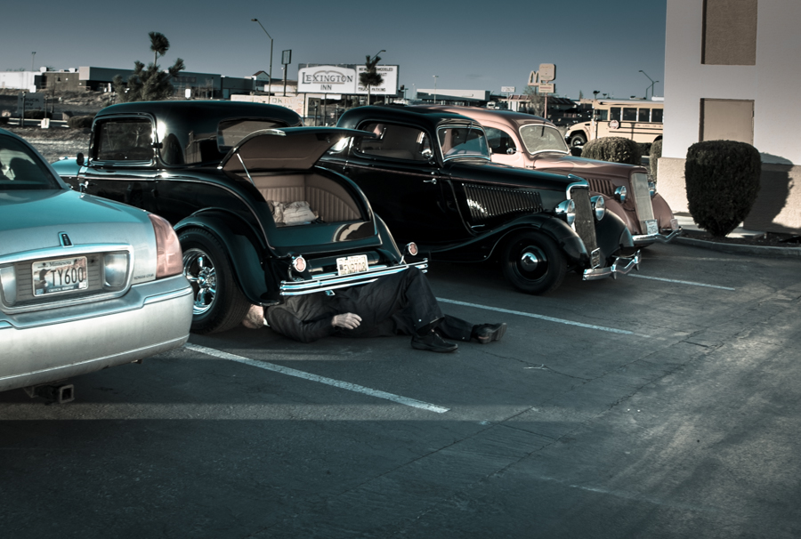
Car Club Road Trip, Holbrook, Ariz., March 2014, by John Fleck (the guy in the picture is not dead)

Car Club Road Trip, Holbrook, Ariz., March 2014, by John Fleck (the guy in the picture is not dead)

On the highway between Grants and Gallup, the only way you can tell the difference between one piñon-juniper-covered hill and the next is the big “Continental Divide” highway sign and the faux Indian curio shop. But it is, in fact, a boundary of great import, worthy of capitalization.

There’s no mention in the Law of the River – the great text of the Colorado River Compact or Simon Rifkind’s epic special master’s decision in the case of Arizona v. California – about which way a little boy’s pee might flow upon crossing the divide. And it’s pretty clear that in the arid high country of western New Mexico, the pee wouldn’t flow far at all regardless. But crossing that line late this afternoon places me quickly, somewhat arbitrarily but firmly in the Colorado River Basin.

Last night, when I flushed the toilet at home, the water made its way to the sewage treatment plant, to be counted as a Rio Grande return flow credit against Albuquerque’s water rights consumption. Tonight’s flush (I made it as far as Holbrook, on my way to Yuma for the week) is now entangled in the Law of the River.

In Memoriam: Fred Phelps

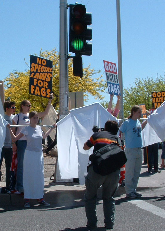
For many years, the most-read post on Inkstain was this, from April 23, 2005:

When Fred Phelps’ motley entourage came to Albuquerque, Nora and her friends made wings – big-ass wings.

The Phelpsites set up on one corner at the entrance to the University of New Mexico, and the counter-protesters set up on the other. And out of that crowd of counter-protesters emerged three angels, with these really big-ass wings.

big-ass wings

The fate of the Colorado River delta: shared blame

When I first became interested in the Colorado River delta a few years back, I wrote a piece for the newspaper explaining why I’m partly to blame for its fate:

I know the collapse of the Colorado River delta ecosystem is not entirely my fault.

But I couldn’t help but feel a little personally responsible as I had lunch in Isabella’s in Downtown Albuquerque last month with Karl Flessa. I kept glancing uncomfortably at my cup of water.

Now that the Albuquerque Bernalillo County Water Utility Authority is delivering San Juan-Chama water into our community’s water system, I was in essence drinking water that once would have made the thousand-mile journey from the mountains of southern Colorado to the Colorado River delta.


Ives in the Colorado River Delta

Ives map, courtesy Library of Congress

Ives map, courtesy Library of Congress

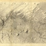
In 1857-58 1st Lt. Joseph Christmas Ives (ah, such a great name) conducted one of the first U.S. expeditions to map the Colorado River Delta, and figure out how to make use of it. Ives felt especially obligated to carefully document his journey “it being doubtful whether any party will ever again pursue the same line of travel,” and his report is, as a result, a delight. As he and his shipmates approached the estuary’s imprecise boundary between sea and river, they stopped at the southern end of Montague island to have a hunt:

Innumerable flocks of pelicans, curlews, plovers, and ducks of different varieties, were scattered over the flats. It was easy to shoot them, but almost impossible to get at them afterwards on account of the depth of the mud, and we started back to the schooner but little better provided with game than when we left.

It was then, indeed, a rich ecosystem.

You’d never know you’re in the city

Robert Browman, Laura Paskus and Lissa Heineman along the Rio Grande, March 2014, by John Fleck

Robert Browman, Laura Paskus and Lissa Heineman along the Rio Grande, March 2014, by John Fleck

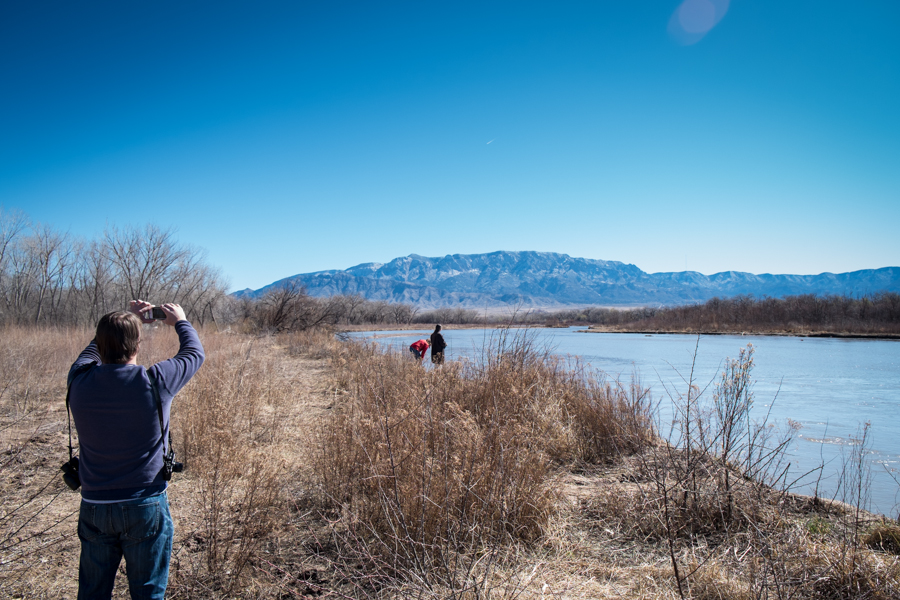
Went with friends this morning in the woods along the Rio Grande in search of porcupines. You’d never know you’re in the middle of New Mexico’s largest metro area. (We found porcupines!)

Morelos Dam, Minute 319 and replumbing the Colorado River Delta

Morelos Dam and the end of the Colorado River, 2010, by John Fleck

Morelos Dam and the end of the Colorado River, 2010, by John Fleck

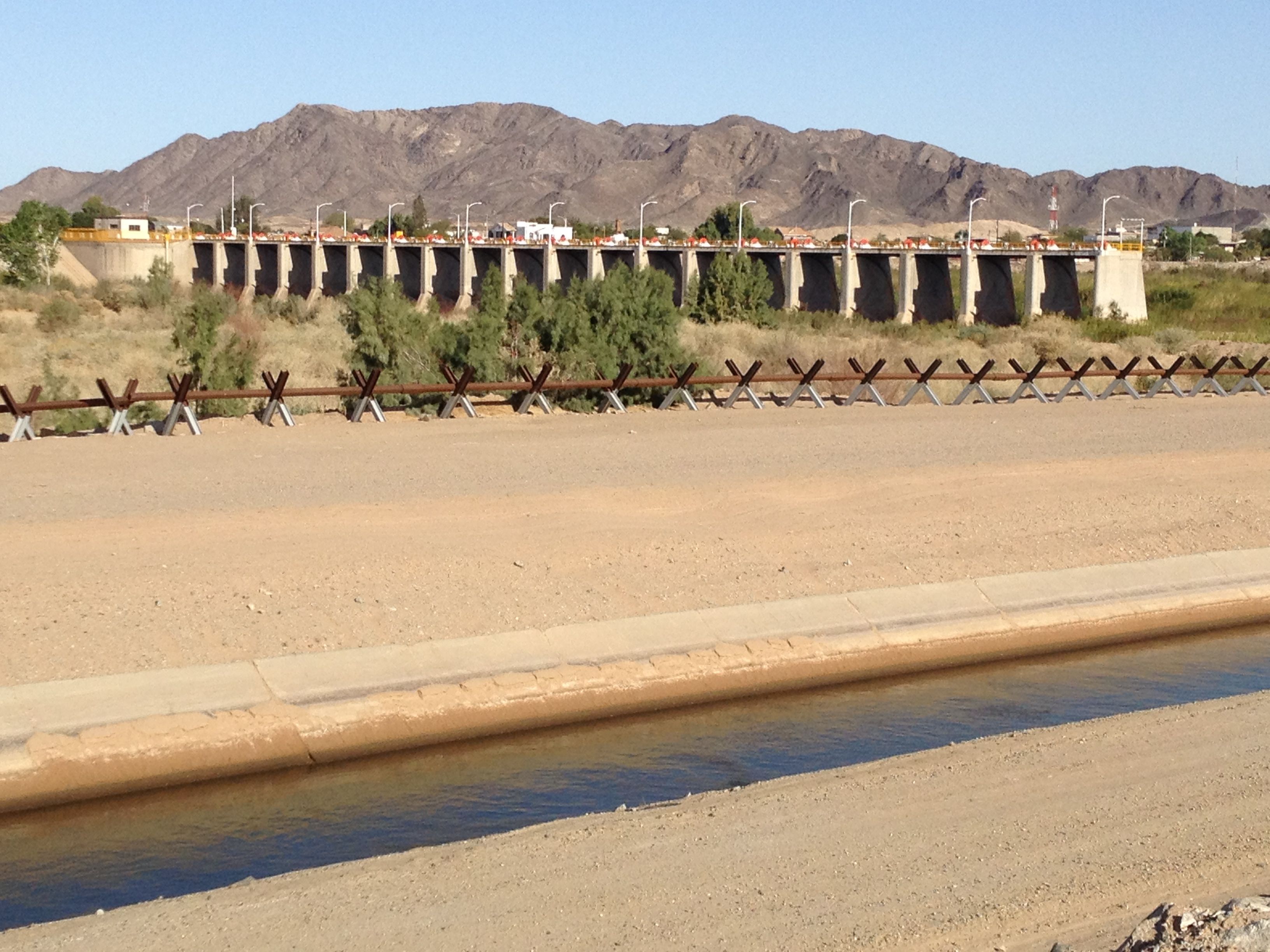
When I give talks about western water and the Colorado River they usually end, or sometimes start, at Morelos Dam. Built from 1948-50, it spans the river between Baja California Norte and Arizona, scooping up the last of the great river and diverting it west, to the farmlands of the Mexicali Valley.

Visiting the Lower Colorado River region a few years back, one of my hosts at the Bureau of Reclamation’s Yuma Area Office suggested a drive down the levee on the river’s east bank from Yuma past Morelos Dam to San Luis. It’s probably rhetorical excess to say that drive changed my life, but it sure as hell makes a great storytelling device. A river I’ve spent my whole life on and around, an obsession since I peered down into the depths of the Grand Canyon as a tot and saw a muddy little ribbon between the cliffs, simply stops. In the foreground of the picture above, the Yuma County Water Users Association’s Cooper Lateral delivers Colorado River water to farms on the U.S. side of the border. The road you see is the levee road, with Border Patrol vehicle barriers as a reminder that this is contested ground. Drive south and the levees continue, but they seem comically superfluous, flanking a dry sandy wash, relegated to the service of the ever-present Border Patrol.

If all goes well, at the end of this month I’ll be standing on Morelos Dam watching the Colorado River flow back down that sandy wash. I am very much looking forward to this.

The environmental “pulse flow” beginning this month is an experiment on many levels. At a scientific level, it is an experiment in determining how the parched ecosystem of the once-lush Colorado River Delta responds to the return of water:

The pulse flow experiment is expected to flood low terraces and backwaters, move sediment, elevate the water table, and promote the germination of cottonwood and willow trees…. The information gathered throughout the experiment will be used to inform future binational efforts in the Colorado River delta. (Flessa et al., Flooding the Colorado River Delta, EOS, Dec. 10, 2013)

This is what I think of as the “physical plumbing” level of the experiment. We have turned the Colorado River into a plumbing system, delivering water for human use by 40 million people and 5.5 million acres of land. In the process, that physical plumbing dried up the Colorado River Delta, one of the great estuaries of North America. This experiment will use that physical plumbing to return some water to that natural system. Scientists will be watching and measuring, and I plan on tagging along as much as I can to document what they learn.

But far more important here, I think, is the “institutional plumbing” part of the experiment. In the course of building the dams and canals to deliver all that water to those 40 million people and 5.5 million acres, we also built in parallel a system of institutional plumbing through which we decide how to allocate that water. My notion of “institutional plumbing” is a fuzzy concept, intentionally so, because it’s not entirely clear what fits within its boundaries. Certainly the “Law of the River”, which includes the Colorado River Compact, the Mexican Water Treaty, the various statutes and court decisions that have interpreted and implemented the underlying legal framework. But the institutional plumbing also includes an enormous body of social capital – the people who understand the system and work at the boundaries between physical and institutional plumbing to make the system function.

The thing that makes the “pulse flow” work is a masterwork of an institutional plumbing valve called “Minute 319“, a U.S.-Mexico agreement that acts as an addendum to the two nations’ 1944 treaty governing the management of their shared river. The environmental flow is the shiny part of the deal, but 319 is an incredibly rich, many-layered thing that includes surplus sharing and shortage sharing provisions as well.

Matt Jenkins, in High Country News last December, has done the best takeout on the agreement and the intricate dance between the goals of the environmental interests and the traditional water movers. In short, the big municipal water agencies saw opportunities in Mexico:

[S]ince the early 1990s, the Metropolitan Water District of Southern California had contemplated the possibility of some kind of cross-border water swap. It could provide funding to help Mexican irrigation districts tighten their relatively inefficient water systems, thereby allowing them to grow the same crops using less water. In exchange, Metropolitan would increase its own water use upstream, in the U.S., by a corresponding amount.

Environmentalists, especially the Environmental Defense Fund’s Jennifer Pitt, saw opportunity in that process. If new water was being carved out, maybe some could be carved out and left in the sandy river bed downstream from Morelos Dam. With an increasingly vocal environmental community on the Mexican side of the border and Mexican water users seeing some benefit in a deal that would make themselves more resilient to drought, the space for a grand bargain emerged.  Again, Jenkins, who has really done the journalistic heavy lifting on this:

The meetings had blurred traditional lines in water politics, giving conservation organizations unprecedented access to decision-making about the river’s future. And, as Pitt points out, international negotiations proved to be a realm in which many conventional environmentalist tactics – such as using lawsuits to force change – simply don’t work.

“Those tools aren’t there, because you can’t apply them across the border into another country,” she says. “Everything has to be through consensus; there’s no rolling anybody.”

The central thesis of my book is that, for better or worse, we’re stuck with the grandiose physical plumbing we’ve built and the communities that have come to depend on it. Our success or failure in the 21st century will depend on the robustness and resilience of the institutional plumbing to help us adapt to a changing world. It is there, more than in the physical flow of water past Morelos Dam, that the importance of this month’s milestone lies.