Stuff I wrote elsewhere: more on our forests burning

Lissa and I are in St. Louis, a wet place. I know it is a wet place because there is no dirt. Or, more specifically, there is no bare dirt. Something’s growing everywhere, the result of 38 inches (97 cm) precipitation per year. I’m always struck by that when I visit a wet place.

While here (we’re actually sitting in the airport pending a return to Albuquerque) I see that my story about the ponderosa forests in our dry place has run in the Sunday newspaper. It’s a bit of a grim tale (sub/ad req):

As fires burn through Southwestern forests with increasing intensity, the ponderosa pines so characteristic of the landscape are increasingly being eaten away, and in some areas have little chance of returning, scientists say.

Las Conchas was the sixth and largest of a series of increasingly destructive fires dating to the 1950s on the east side of the Jemez Mountains. While some of the fire burned at low severity, leaving healthy forests behind, more than 150 square miles of the area’s forests have been burned in destructive, stand-replacing fires, according to Allen. Much of that forest was ponderosa. The result has scientists and forest managers looking intensely at the area to try to understand what happens next.

Ponderosa is only one of the types of forest ecosystem found in the mountains of New Mexico. Piñon-juniper of the lower elevations and the mixed conifer forest found in the Sangre de Cristos above Santa Fe burn differently, resulting in different patterns of revegetation. Damage from fires has been far less severe in those forest types. But ponderosa is a special case because of the special ferocity with which it has burned in recent years.
Conservation and the water pricing dilemma

We see this over and over again.

Generally speaking, water is free to municipal/industrial customers in the United States. What we pay in our water bill is for the cost of delivery – the pumps and pipes. We’re paying for water delivery infrastructure, not the commodity itself.

But we nevertheless generally price the water by unit consumed, with utilities setting their rates to cover those infrastructure costs (plus profit if it’s a private utility).

We conserve. Revenue (remember it’s priced by unit sold) goes down. But most of the cost for the pipes and pumps is fixed, and doesn’t vary when users consume less. So conservation-minded customers are rewarded by rate increases. From the Orange County Register:

The Golden State Water Co. has applied to the California Public Utilities Commission to raise its 2013 water rates that could see Golden State’s average residential customer’s bill in Orange County increase by 24 percent. The boost, the company says, is to offset lower profits caused by a drop in water consumption and for system upkeep.

Cue Zetland.

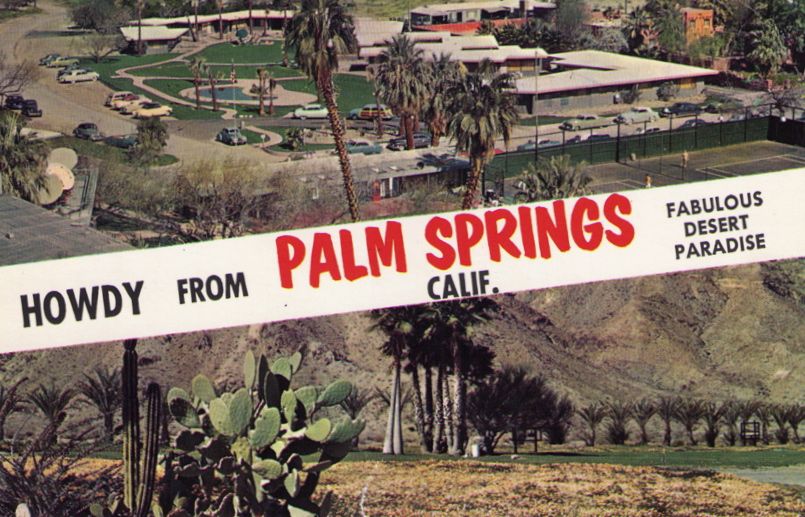
Fabulous Desert Paradise

My sister, Lisa, found this old postcard at Mom’s last week:

Palm Springs postcard

Howdy from Palm Springs, Calif., Fabulous Desert Paradise

The caption on the back argues that Palm Springs is America’s favorite winter playground. Who am I to argue?

After we’re done with the Peripheral Tunnel, pyramids!

Pyramids

Pyramids, courtesy Ricardo Liberato/Wikimedia Commons

An economic analysis released last week suggested a Peripheral Tunnel to move California’s water around the Sacramento-San Joaquin Delta could create 129,000 jobs. (Good Alex Breitler story lays out the details.)

The boosters at the Southern California Water Committee jumped on the argument:

This new jobs study on the tunnel options is the first major study of its kind, and it opens our eyes to the fact that – beyond helping secure our water supply, promoting a better Delta environment and providing a monumental boost to our aging and deteriorating public infrastructure – building a new conveyance tunnel could create more than one hundred thousand new California jobs.

Awesome. But can I point out that spending $12 billion building anything will create a lot of jobs building that thing?

Personally, I think new pyramids would be awesome.


Mike Taugher tells us what’s really going on with Sacramento Delta diversions

A group with one set of interests in California water has tried to frame the discussion over how much water can be diverted from the Sacramento-San Joaquin Delta in the classic “farmers vs. fish” framework. Others disagree. Traditional “view from nowhere” journalism quotes one from Column A and one from Column B and calls it good.

Kudos to my old bike riding buddy Mike Taugher for a more blunt, “view from somewhere” approach in his story Friday on the end-of-water-year pumping numbers:

New measures to protect fish indeed have affected water supplies, but most of the cuts to date have been due to drought.

Taking a straw out of the Colorado?

The premise of a piece I wrote recently over at the Lane Center was that folks in the Colorado River’s Upper Basin are all elbowing up to the front of the line to try to get the next straw slurping water out of the big river before it’s too late. The focus was on the state of Colorado’s discussions of a running a giant, multi-billion dollar straw up to Flaming Gorge:

Colorado’s dilemma is the same one found all across the states of the Colorado River Basin. The water is in one place, while the people are in another. Thus you have what amounts to artificial rivers all up and down the Colorado, siphoning and draining and pumping the water away from the Colorado as the basin states try to maximize usage of their legally allotted shares of the river.

In response, an alert reader pointed me to an interesting counter example – a Salt Lake Tribune editorial arguing against a similar project up there:

The Legislature should close the floodgate on any scheme to finance the Lake Powell Pipeline with state funds. Utah can’t afford the pipeline in the current weak economy, the water for the project may become unavailable due to climate change, and other state demands must have higher priority, beginning with education and transportation.

Anyone know if this would be a first?


Irony defined: Barnett’s “Blue Revolution” at the office pond

Irony defined: sitting in the shaded courtyard at work yesterday at lunch, next to a lovely fountain/pond flanked by lush lawn, reading the opening chapter of Cynthia Barnett’s Blue Revolution:

Sacramento landscape architect Ronald Allison tells of a two-and-a-half-acre residential design in Granite Bay with a waterfall, a grotto, a cave, six fountains, a pool with a bridge and an island, and a ninety-foot water slide: “It’s fun for the grandkids.”

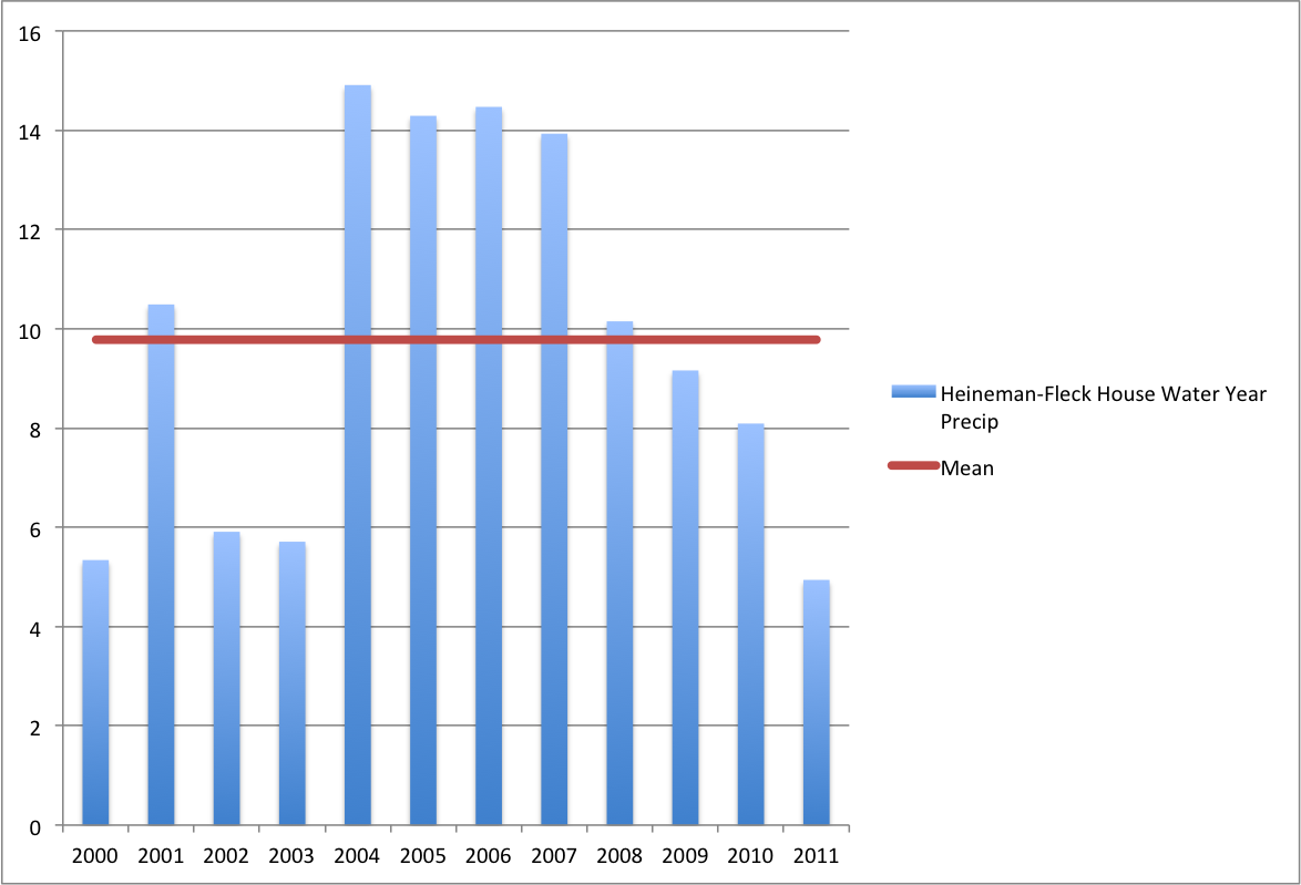
Irony multiplied: After lunch, walking back to the newsroom to write about Albuquerque finishing up its driest water year on record, at 3.26 inches (8.28 cm)  since last Oct. 1.

This morning I totaled up and double-checked the numbers for my house, a couple of miles from the official airport gauge that yielded that depressing 3.26. I had a whopping 4.94 inches (12.55 cm).

The international implications of U.S. water subsidies

While we all understand the market distortions caused in the United States by government subsidies for irrigation water, Michael Campana raises an interesting question about the international implications. Quoting a talk at the XIV World Water Congress by Paul Stanton Kibel of the Center on Urban Environmental Law (“CVP” is the Central Valley Project in California):

[S]ome countries, Brazil in particular, are upset because they feel that export crops like cotton (in Brazil’s case) are receiving subsidies from the US because of cheap CVP water. They claim that the cheap water represents ‘foregone revenue’ on the part of the Federal government, which is disallowed by the WTO. Kibel said that other exported crops like pistachio nuts and a few others might also come under the purview of the WTO should someone file a claim. So also might other crops like rice (China and India) that are grown in the Sacramento Valley.

We’re in trouble when we’re arguing about the numbers

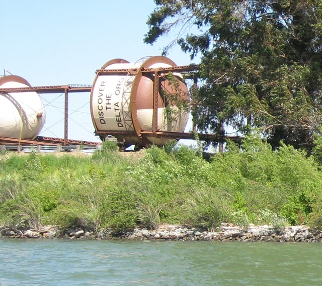
Discover the Delta

Discover the Delta, June 2011

John Bass made a great point in a recent comment thread at Delta National Park that highlights one of my frustrations about California water discussions:

[I]f basic facts are contentious, then the problem isn’t facts.

The comment was triggered by a point the California Farm Water Coalition’s Mike Wade made regarding an editorial that ran in the Oakland Tribune. To solve California’s water problems, the Tribune wrote, “sacrifices by water users will have to be made, particularly by agriculture, which uses more than 80 percent of California’s water.” To which Wade replied (in the comments):

The Department of Water Resources identifies water use in California during a normal year as environmental, 48%, agriculture, 41% and urban, 11%.

John’s response:

It may not be that Ag uses 80% of the state’s water, and Mr Wade’s number of 41% may be close to a reasonably accurate percentage of Delta water use by Ag, but only if calculated as the theoretical/ideological total amount of water available to export.

The fact that these discussions get tangled up in numbers, different versions of which serve to frame the issue in very different ways, is unsurprising. That’s the way this game is played. See Sarewitz 2004 for some great case studies of how arguing over numbers is used as a proxy for the real arguments at hand:

[S]cientific uncertainty, which so often occupies a central place in environmental controversies, can be understood not as a lack of scientific understanding but as the lack of coherence among competing scientific understandings, amplified by the various political, cultural, and institutional contexts within which science is carried out.

That it is common doesn’t make it any less unhelpful.

My Fake Rio

In honor of World Rivers Day, I rode my bike down to check out the Rio Grande through Albuquerque this morning. That’s really a bit of a cheat. Most weekends I end up riding my bike down to check out the Rio Grande at least once, but it’s World Rivers Day, and water nerds are supposed to think about their rivers, so I did.

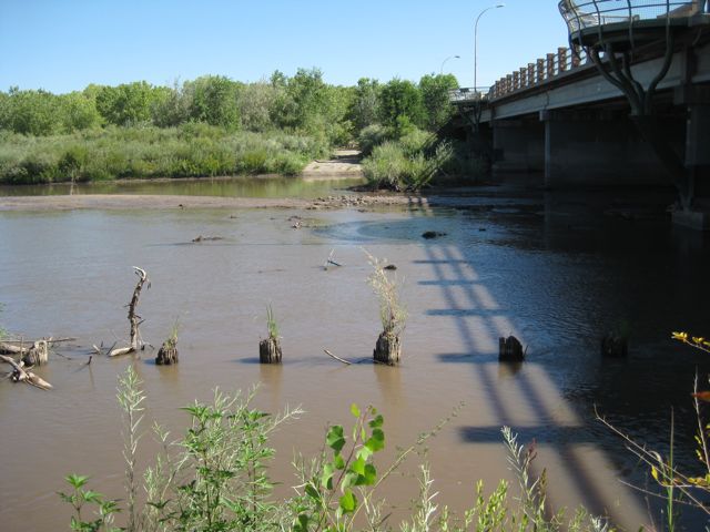
Pilons in the Rio Grande, Central Avenue, Albuquerque NM, September 2011

Posts in the Rio Grande, Central Avenue, Albuquerque NM, September 2011

I was thinking about it anyway after my USGS stream gauge alert started firing off Friday when the Rio Grande at the Central Avenue Bridge dropped below 150 cubic feet per second. This is always the dry time of year, with the snowmelt done and the summer rains over and mostly just base flow in the river. But between the dry year and the upstream irrigation diversions, the Rio would probably be dry completely through Albuquerque were it not for the US Bureau of Reclamation releasing water from storage to meet flow targets for the endangered Rio Grande silvery minnow. (more on that over at the (probably adwalled) work blog)

N. Reed and and I were discussing what I should choose as my favorite river for my World Rivers Day blog post. I said “Rio Grande”, to which she responded, “But I thought your favorite river was the Colorado?” But then she pointed out that, because of the San Juan-Chama Project importing water from the Colorado Basin, the Rio Grande has a bit of both. So I guess I’m cool.

In fact, right now, one might argue that it’s mostly Colorado River water in the Rio Grande thanks to the USBR minnow flow releases, though the distinction between paper water and wet water makes this very quickly a confusing question. But it’s clear the flows as I stood on the river’s bank this morning were the result of human intervention, as is essentially the entire system – pinned between levees, channelized when it used to meander, buffered by dams upstream.

Willow

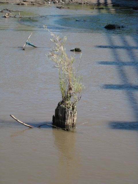
Willow, Rio Grande, September 2011

All the cool kids are reading Emma Marris’s Rambunctious Garden, which argues that we need to accept and even embrace the fact that there is no pristine nature, no ecosystems left devoid of human engagement and alteration. The book, which I loved, touched a nerve with me, given my fondness for the Rio Grande, however unnatural this vast riverside park through Albuquerque’s middle has become.

I rode my bike across the Central Avenue Bridge (old Route 66) and turned into the woods, down a dirt road to the west side of the river. Out in the shallow water beyond the USGS gauge, I saw these five posts sticking out of the river bed. I assume they’re the remains of the old Route 66 bridge. (Those who have lived around rivers know the central role bridges, or the lack thereof, play in the life of a community.)

Look more closely at the second post from the right. Growing directly out of its top is what looked to me like a willow. That’s a rambunctious garden if I’ve ever seen one.