
Stopped in the new Routes Rentals on Mountain west of Old Town on my bike ride today. Don’t know much about them, but I’m happy to see an Albuquerque bicycle rental shop give it a go. Their cruisers are gorgeous.
On the relevance of paleoclimate studies
As Irene prepares to drop by and visit our eastern neighbors, Kevin Anchukaitis points to this:
Evidence of historical landfalling hurricanes and prehistoric storms has been recovered from backbarrier environments in the New York City area. Overwash deposits correlate with landfalls of the most intense documented hurricanes in the area, including the hurricanes of 1893, 1821, 1788, and 1693 A.D.
A reminder of the societal relevance of paleoclimate studies.
Stuff I wrote elsewhere: The Great Banana Peel Sticker War
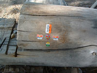
Banana Peel Sticker War (my old picture, circa 2005)
Now that I get to be an occasional columnist in the newspaper, it’s remarkable how much of the work that seems appropriate in that new (for me) form builds off of something that started here, as a simple riff. To the extent that I’m getting my legs beneath myself as a columnist, it’s pretty clear that the voice and approach has its roots in Inkstain’s founding principle:
We put the stuff on here we can’t figure out a way to get paid for.
This week’s case in point is The Great Banana Peel Sticker War:
I suppose that — the fact that it’s the only shade to be found — is what makes the log bench such contested space between the banana-peel affixer and his or her adversary.
I confess I’ve had my suspicions who’s responsible — a bike trail regular I’ve seen sitting in the shade eating a banana on many occasions. I won’t reveal any identifying details (is there a statute of limitations on banana peel stickery?), but I even once pointed to the stickers in amusement and asked if s/he was responsible. The answer was “no,” and who am I to question?
Recently, a tagger hit the bench, which seems like bad karma. But the lines of spray paint are now cheerily decorated with banana peel stickers. For now, no one seems to be scraping them off.
Roots here, but all buffed up with some actual reading reports and calling people and gathering the history of my beloved bike trail – riff turned journalism. Oddly, now I sometimes get paid for this sort of thing. How did that happen?
California Flooding in a Warming World
Jay Lund and colleagues have modeled a range of possible impacts of climate change on flood flows in California. From a nice summary on the UC Davis California WaterBlog:
Warming generally worsened flood inflows into reservoirs. Even with less precipitation, warmer conditions often increased flood inflows to reservoirs. When more precipitation fell as rain, rather than snow, and more existing snowpack melted, flood volumes increased. This was particularly true for historical storms that were “cold”, where much of the precipitation was held as snowpack. Warm storms, which historically produced less snow, were less affected by warming.
But the research suggests adaptations in reservoir operating rules can be relatively effective in dealing with the problem:
Reservoirs with flood operating rules that respond to the wetness of their watersheds seemed to adapt well to changes in climate, even fairly severe changes in temperature and precipitation. This was true for Shasta and Oroville Reservoirs, whose existing flood operation rules vary with moisture conditions upstream. This shows that existing reservoirs may have considerable ability to accommodate flooding effects of climate warming.
Water in the desert: blackwater edition
A river is not just in one place. It extends in time up and down its watershed.
Last night, Daniel Porter at the Albuquerque National Weather Service office sent out an alert of possible flooding on Peralta Canyon, which enters the Rio Grande about 40 miles north of Albuquerque. Its watershed was burned in the Las Conchas fire:
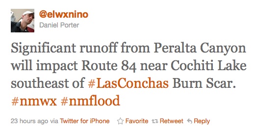
Daniel Porter's tweet, 8:30 p.m. 8/19/2011
Much of the Las Conchas burn area is north of Cochiti Dam, a flood control structure that has been trapping the soot and ash from burn scar thunderstorms. But Peralta is downstream from the dam. This morning I took a bike ride to see the river. Here’s what it looked like from the bike bridge next to Interstate 40, in the middle of Albuquerque. Hard to see, but the water is a grayish black:
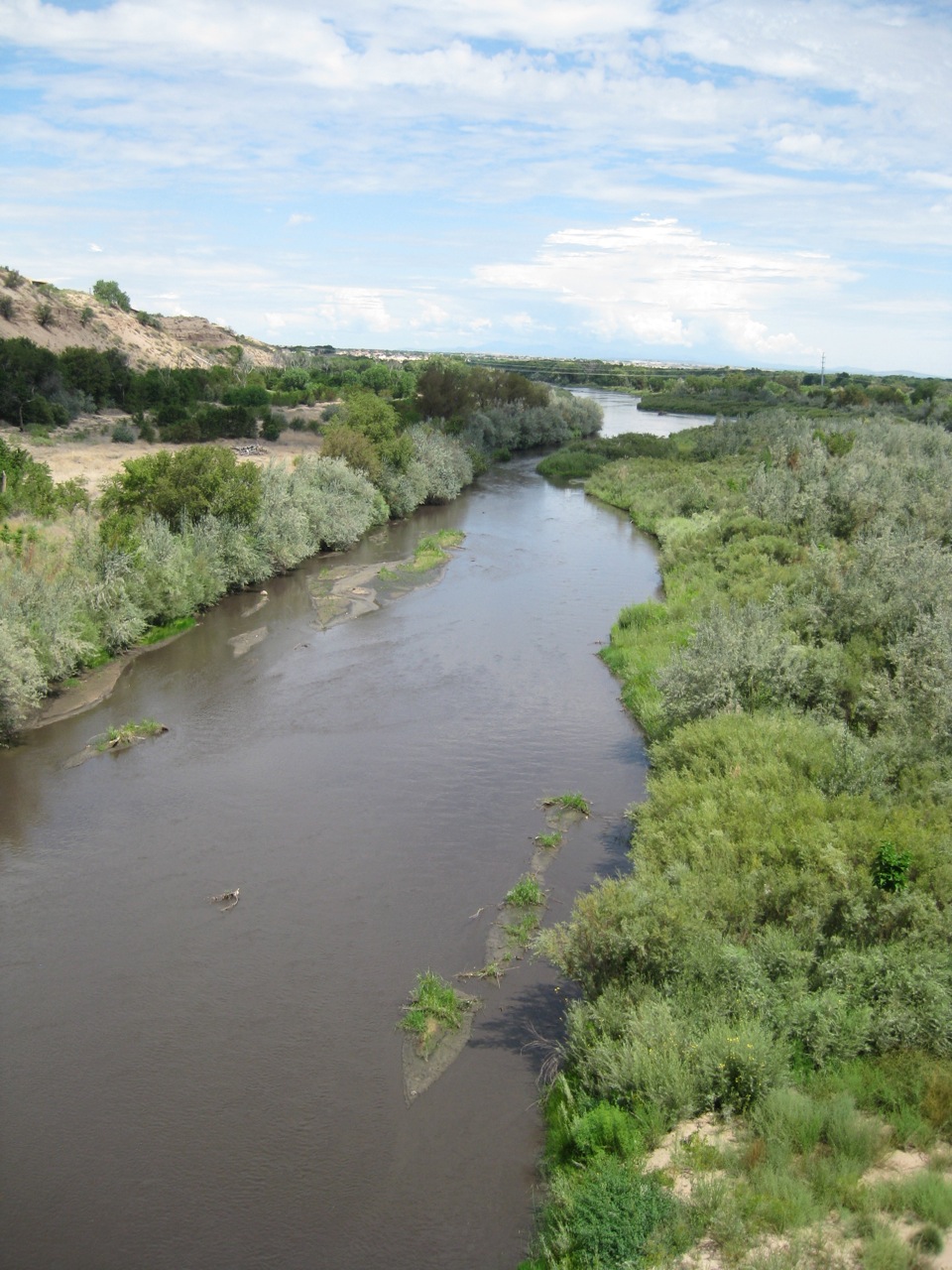
Blackwater, Rio Grande, Aug. 20 2011
For comparison, here’s the normal reddish brown of the Rio Grande:
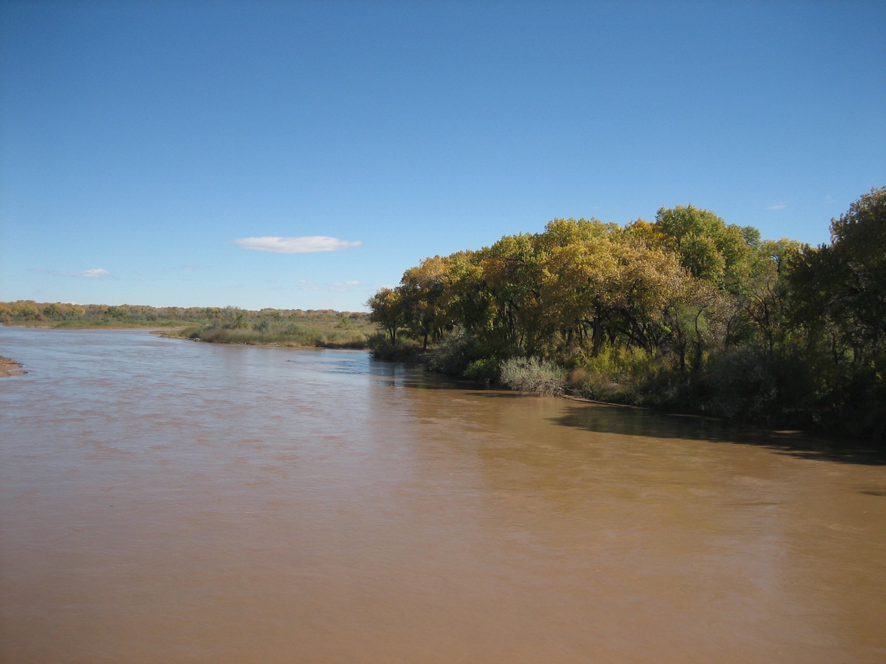
Brownwater, Rio Grande
On borrowing and the richness of language
One of the things I love about language is its staggering combinatorial possibilities. I revel in a Google game – picking a seemingly ordinary phrase and doing a search to see how many times it has appeared in the vast body of language indexed by the search engine. It is amazing how relatively few times even the most compact phrases have appeared.
It was with that in mind that I read Emily Green’s piece today in the Los Angeles Review of Books about the similarities between her epic Las Vegas Sun series Quenching Las Vegas’ Thirst and the discussion of Vegas water in Alex Prud’homme’s The Ripple Effect. Emily quotes two passages, first hers and then Prud’homme’s.
Green:
Las Vegas lies at the intersection of three deserts. To the west is the Mojave, to the south the Sonoran, and to the north the Great Basin.
Prud’homme:
Las Vegas sits at the intersection of three deserts. To the south is the Sonoran, to the west is the Mojave, and to the north lies the Great Basin.
Savor that simple four-word phrase: “intersection of three deserts”. In the entire corpus indexed by Google, that phrase appears to have been written only three times – once by the Australian Wildlife Conservancy to describe three Australian deserts, once in 2008 by Emily Green to describe Las Vegas, and once by Alex Prud’homme in his new book – also to describe Las Vegas.
Sadly for Emily, Prud’homme’s book is the first Google hit.
Stuff I wrote elsewhere: water policy and the endangered species act
New Mexico’s in the midst of a tense and interesting discussion about the Rio Grande silvery minnow, the Endangered Species Act and managing the Rio Grande. I’ve got a post up over at the work blog going meta on the underlying issues – why I think ESA discussions have become our proxy discussions for big water policy issues (sub/ad req):
Why is this such a big deal? Hint: It’s not really about a fish. Or, more precisely, it’s about much more than a fish. If you believe those who argue that we’re overusing water in the Middle Rio Grande Valley and headed for a crash, it’s likely that the problem will first show up in the river itself, as we take out too much surface and groundwater and leave the Rio Grande dry. The first specific legal/regulatory manifestation of that problem will be a lack of water to meet Endangered Species Act requirements for the Rio Grande silver minnow. The minnow has been described as a “canary in a coal mine” for a crashing ecosystem. But it’s also a canary for our water supply problems. So we see here a jockeying over the question of who’s responsible for the problems of the fish that mirrors broader jockeying over who’s responsible for the region’s water problems.
I’ve thought this for a while, but the work I’ve been doing on Sacramento-San Joaquin Delta issues has really helped clarify my thinking by giving me a second case study where the issues are playing out in much the same way.
But are there other case studies of water policy/ESA management on western rivers where it’s not playing out this way? What are the counter examples?
The case for calling it a “Peripheral Thingie”
John Bass today argues for clarity in our use of language when talking about a water conveyance around the Sacramento-San Joaquin Delta:
Could I ask that Dan Bacher and those he quotes use the term “canal” when referring to a canal to take water around the Delta, the term “tunnel” for the other option under discussion, and canal/tunnel when referring to both?
I ask because there are important differences in the potential effects of a canal or a tunnel on the Delta’s environmental and social health (to keep it tight), and elisions that blur these distinctions make everyone that much less informed.
Might I humbly suggest that “canal/tunnel” is clumsy, and that a “peripheral thingie” might be just the linguistic solution needed?
Bonus water as seen from space
From NASA’s Earth Observatory, Lake Powell at Hite this month compared to a year ago:
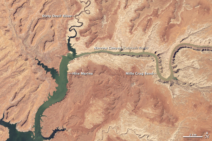
Lake Powell, August 2011

Lake Powell, August 2010
h/t David Appell
Stuff I Wrote Elsewhere: Bonus Water on the Colorado
Over at the Lane Center, a look at what the extra water on the Colorado River means:
While Colorado Basin water users had survived 11 years of drought without suffering shortages, simply by draining their two big reservoirs, US Bureau of Reclamation calculations raised the clear possibility that by next year, the first ever shortage declaration on the river would be needed, forcing Nevada and Arizona to cut back.
This year’s bounty has pushed that possibility off another three years at least.