as war turned to peace

Robert Fleck at Bad Kissingen, Germany, June 1945

Martin Reber, a distant relative, tracked me down to share this picture of my father, for which I will be forever grateful.

We don’t know much about it, other than the scrawled message on the back suggesting it was taken within a few weeks of VE Day as my father’s unit moved into Germany. Dad was an artist, who had hauled his paints with him through war and into peace. He had found a porch, to paint in the natural light.

I have written before about my life amid art – “art as a verb – a thing not that has been done, but rather a thing that people do.”

See how his right hand, his brush hand, is blurred.

the federal role in water infrastructure

There are several federal programs with a demonstrated success in making infrastructure-related investments that support sustainable water use, healthy rivers and facilitate much-needed public-private partnerships. These include WaterSMART at the Department of the Interior; the Rural Utilities Service program at the Department of Agriculture; and the Clean Water and Drinking Water State Revolving Funds at the Environmental Protection Agency (EPA).

Collectively, these and other programs that focus on conservation and watershed improvements are the backbone of making efficient and sound infrastructure improvements that address today’s water resource challenges….

Water resource programs across Interior, Agriculture, EPA and the Army Corps of Engineers (COE) are critical elements of an overall strategy to leverage significant non-federal investments to implement durable solutions that stretch limited supplies, improve watershed health, support economic activity and contribute to investments needed for aging infrastructure.

Unfortunately, the Trump administration’s recent budget framework threatens many of these programs with cuts or elimination at a time when it is most important to support the infrastructure needs of communities. While the details are still unclear, the proposed 31 percent, 21 percent, 16 percent and 12 percent cuts to the EPA, Agriculture, COE and Interior, respectively, leave little room to adequately fund important programs to address the needs identified by ASCE.

That is former Deputy Interior Secretary Mike Connor in The Hill, the whole thing is worth reading.

Why should I conserve just so those other guys can have the water?

This story is a bit of a garble, but it illustrates one of the central challenges in making water conservation deals in the Colorado River Basin.

Here’s how I explained it in my book:

Within the network of state and water-agency representatives working on Colorado River Basin problems, there is a clear recognition that eventually some sort of “grand bargain” will be needed that finds a way to reduce everyone’s water allocation. To keep the system from crashing, everyone will have to give something up. But each of the participants in that core network also understands the dilemma that follows: each must then go home and sell the deal in a domestic political environment that views the river’s paper water allocations as a God-given right.

The story describes a Glendale City Council discussion of leaving water in Lake Mead, at which one of that community’s elected representatives said this:

“We are conserving water only for it to be consumed by other states,” said Councilmember Lauren Tolmachoff.

World Water Day on the shores of old Lake Bonneville

Flying into Salt Lake City this afternoon, I noticed the old shoreline benches of Lake Bonneville, the great Pleistocene inland sea that once filled a big chunk of what we now call the Great Basin. The benches are these big flat topographic features a few hundred feet above the valley floor. One one, south of town, they’ve built a neighborhood, a modern repurposing. It’s one of those geologic features that’s dead obvious from the air, but harder to see when you’re on it.

I’m at the University of Utah for the Wallace Stegner Center 22nd Annual Symposium – Water in the West: Exploring Untapped Solutions. With an hour to kill before dinner, I walked up the hill behind campus where there are signs for the Bonneville Shoreline Trail, which traces the counter of the old shoreline bench here.

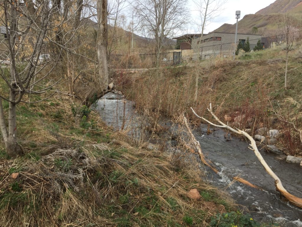
I ended up at Red Butte Creek, which emerges from a culvert on the southern edge of campus before winding down to the Jordan River. It’s a little creek, but with the big snowpack to the east it was running full.

Red Butte Creek, Salt Lake City

Happy World Water Day from the Red Butte Creek watershed, on the shores of old Lake Bonneville.

six crossings of the Rio Grande

The Rio Grande through Albuquerque has been rising this week, thanks to a combination of a great snowpack and a quirk in the river’s operating rules.

The snowpack part is obvious – it’s big and melting fast – the rule quirk less so. Under Article VII of the Rio Grande Compact, we cannot store water in most of our upstream reservoirs unless Elephant Butte Reservoir (the downstream reservoir that delivers water to Texas) is above a 400,000 acre foot threshold. It is not, so the rules require the Bureau of Reclamation and the Corps of Engineers, the managers of the upstream dams, to pass all the water. The rule quirk has weird subquirks involving Pueblo communities’ water rights, which I’ll leave as an exercise for the law students in the audience. But the bottom line is that flows through Albuquerque are up by a thousand cubic feet per second today compared to a week ago, because Rules.
six crossings of the Rio Grande

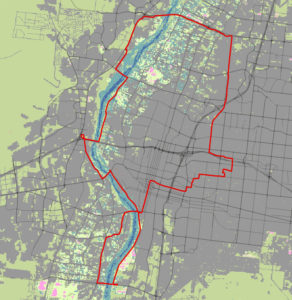
Last night I lay on my couch intently staring at maps on my iPad for more than an hour, plotting. The result – a morning bike ride that looped and twisted and turned to include all six of Albuquerque’s crossings of the Rio Grande.

A bicycle is a great way to see one’s place. The spatial and temporal scale – in a morning I can cover a big chunk of Albuquerque at a speed slow enough to ponder – combined with the physicality of moving your own body across the landscape, builds an intimate geography.

My  friend Andrew has gotten me hooked on Strava, a web-based tool for tracking your bike rides. You slap one of those GPS goobers on your bike, download the data, and the fun begins. (Heatmaps!) I started more than a year ago after Andrew told me that municipal planners use Strava data to help make bike route decisions. Most of my riding the last couple of years has been commuting, and helping planners identify commuting patterns seemed like a useful contribution.

Lately, though, I’ve become enamored with the performative, social aspects of the thing.
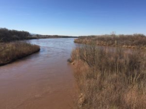
Rio Grande at Bridge Boulevard (yes, we have a bridge named “Bridge”)

Andrew moved recently (boo), but it’s been fun to “watch” him explore his new town via his Strava feed. Strava is designed for the spandex crowd, with things like “suffer scores” and timed interval reports and such, and its Facebook-style use thus lends itself to a kind of public performance. This is not me. I am old, and slow. But with words and pictures it also opens the possibility for little stories. There was comedy, for example, as one of Andrew’s carefully planned routes in his new town failed at a large stairway.

So I planned my route with care, knowing that my Albuquerque friends could take amusement at the zigs and zags and curlycues needed to hit all the bridges as I worked my way back and forth up the Rio Grande Valley. With a picture of the river at each crossing.

My water obsession means our routes, when we bike together, often include detours to get a picture of the Rio Grande. So even though I was riding by myself, this ride had a social element.

I eagerly await their criticism – “There are really seven crossings, John, what about Alameda?” – and the argument that will ensue and the planning for another ride that adds the seventh bridge. Or maybe the eighth, out in Bernalillo?

I’m old and slow, and that’s kind of far, but not out of the question.

Going Down to the Water

My students have all heard me tell this story, many more than once (sorry!), but it was fun to work it through in writing:

Some years ago, through the serendipity of a missed airport connection, I found myself stranded for 24 hours in Prague. I was tired, my mind set in the way of air travel on my destination—home. Prague may be one of Europe’s great cities, but it had not been my plan to visit it. It took me some time to warm to the opportunity my travel mishap had presented.

After stashing my belongings in a room at the airport hotel, I got a map from the concierge and directions for the transit connections to find my way into the old Eastern European city. With no advance knowledge of the city and no particular plan in mind, I emerged from the Malostranská subway station and did what I often do when I start from scratch—I began wandering toward the water….

“Say you are in the country; in some high land of lakes. Take almost any path you please, and ten to one it carries you down in a dale, and leaves you there by a pool in the stream,” Herman Melville wrote in the opening chapter of Moby Dick. “There is magic in it.” It is always down—simple gravity and fluid mechanics mean water occupies a landscape’s lowest spot. It is also instructive. To learn about a new place, I’ve found, you can always start with its water. To know London, start with the Thames and the earliest mariners traveling up its estuary for the first time, searching for a good place to land. But think also through London’s nineteenth century sewage management crisis, when the growing city finally had too much and was forced to organize around the problem of ridding itself of “the great stink.” To know Seattle, explore the wharves of Elliott Bay and learn the history of the Duwamish River—sacred salmon river turned industrial wasteland. To understand Los Angeles, and the Southern California metropolis that surrounds it, is to see the land as a community with little water of its own but the audacity to build three great artificial rivers to make up for its natural shortcomings. Lacking the natural harbors of its urban competitors, Los Angeles built a port.

For Prague, a community that grew up in a place where the river could be crossed, the city’s first water was the Vltava. Knowing nothing else about the city, I could trace the little canal back from a low diversion dam across the river and begin to see how the early community’s members organized themselves around the task of managing their water. “How societies respond to the challenges presented by the changing hydraulic conditions of its environment using the technological and organizational tools of its times,” Steven Solomon wrote, “is quite, simply, one of the central motive forces of history.”

That is the introduction to “Going Down to the Water“, an essay in the latest issue of the Natural Resources Journal, published by the University of New Mexico School of Law. Huge thanks to Colin McKenzie for inviting me to do this piece, and Matthew Ramirez for some crackerjack editing.

Really, thanks y’all, this was the most fun I’ve had writing something in ages. A reminder – I need to write more, it’s fun!

There’s a bunch of really interesting stuff in the new issue, which focuses on water governance. I was especially smitten with this piece by Burke Griggs on the political cultures of irrigation communities, and their relationships to the water law that emerges therefrom.

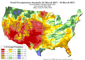
don’t let the dry March overshadow the good news for Lake Mead

A dry March in the West. Courtesy PRISM

Chris Harris, the new executive director of the Colorado River Board of California (just named to the job Wednesday, congratulations, Chris!) made a point in the comments of this post that’s worth highlighting. While the dry March in the Upper Colorado River Basin has eating into the runoff forecast, likely eliminating the chance of a huge pulse of bonus water for Lake Mead under the “equalization” of Lake Mead and Lake Powell, the implications of the good snowpack are significant, and will be long lasting:

While it seems like “good news, bad news” for Mead; in my opinion, it really isn’t–it is all good news, in my opinion. First, even though we may not have equalization releases in 2017, the probability for equalization releases in 2018 likely have gone up significantly. The runoff into Powell this year will be very, very good. Secondly, the side-inflows from tributaries between Glen Canyon Dam and Mead are currently 200% of average and have contributed something like two feet of elevation to Mead. I think the probability for shortage in 2018 is now very, very low. None of this takes into account any of the water supplies that will be left in Mead as a result of ICS or system conservation contributions. Finally, because of the wet winter uses are way down in the Lower Basin so far this year, again resulting in water being left in Mead. One would think this gives all of us a little bit of time to forge ahead with drought contingency planning and binational discussions.

Those last two points are critical.

The flows into Lake Mead from the main tributaries upstream from the reservoir but below Lee Ferry (“side-inflows”) are essentially “free water” for the Lower Basin, not counted against the Upper Basin’s compact delivery. And because of the wet weather, farmers in the Lower Desert are taking far less water out of Lake Mead than anticipated. As a result, Mead ended February 5 feet above its level of a year earlier, only the third such year-over-year since The Troubles began in 2001.

That combines with good water supply news elsewhere in California. Great snow in the eastern Sierra Nevada means Los Angeles will have good supplies to fill its the L.A. Aqueduct. Southern California also is likely to get a decent supply of water from Northern California. Those factors, combined with low demand (because of the wet winter and successful conservation), further reduce pressure on the Colorado River, because metropolitan Southern California doesn’t need as much.

It’s still early, but the current forecast (pdf) calls for California’s take on the Colorado this year to be under 4 million acre feet of its allotted 4.4 maf. Total forecast U.S. use is under 7 million acre feet of an allotted 7.5 maf.

a big boost this year to Lake Mead?

The Bureau of Reclamation’s monthly forecast, out this morning (pdf), contains some very good news for Lake Mead and its water users in California, Nevada, and Arizona. But there is a huge caveat.

the good news

As it stood in early March, the snowpack in the Rockies was enough to send a big slug of extra water into Lake Powell during the spring-summer runoff. That would push Powell high enough to send a big slug of bonus water downstream, the result of operating rules intended to try to keep the reservoirs roughly in balance. If the forecast holds, Mead would rise 27 feet this year.

the huge caveat

Note those weasel words – “if the forecast holds”. It probably won’t. The Upper Basin’s version of the report (pdf) includes these words in big bold type:

It should be noted that since the March final forecast was issued on March 2, 2017, the Colorado Basin River Forecast Center Ensemble Streamflow Prediction indicates a decrease in the forecasted inflow. It is unlikely that the March final forecasted inflow will be sustained in the April final forecast. The April 24-Month Study projections are used to determine whether there is an adjustment to equalization or balancing under the Interim Guidelines governing Lake Powell releases for the remainder of water year 2017.

It’s not the March forecast that matters, it’s the April one. So the dry spring is taking a bite out of Lake Mead’s hope.

Sally Jewell’s post-cabinet road trip is the best thing on the Internet

I always figured Sally Jewell, who until January was the U.S. Secretary of the Interior, had the best job. If you followed her on social media, you’d see her visiting cool places, hiking around, looking at stuff.

I realize being Secretary of the Interior has some hard bits, too, involving meetings and policy and big thick briefing books. But the fun side of her job looked so fun.

Turns out it was just the beginning. Since she left office in January, Jewell has been on the road, hanging out with rangers, visiting parks, and showing us all how incredibly cool our lands, those managed by Interior on behalf of the American people*, really are:


* The language here is important. They are sometimes called “federal lands”, but that misses the point. They aren’t the federal government’s. They are ours.

US-Mexico water sharing deal is sparing Colorado River users from shortage

Water in the Río Colorado from the U.S.-Mexico deal

In my book, I focused a great deal on the environmental and cultural benefits of the “pulse flow” through the Colorado River Delta, enabled by a 2012 agreement between the United States and Mexico. It was a shiny bauble, but there’s a lot more to the agreement than that. Most important from the perspective of U.S. water users is Mexico’s ability to conserve water and store it in Lake Mead.

That part of the deal is huge right now. If/when Lake Mead drops too far, a shortage will be triggered, with water deliveries to U.S. users cut. If not for the U.S.-Mexico deal and related U.S.-side conservation measures, Mead would be 10 feet lower today, according to a new report from the Congressional Research Service (pdf)*. About a quarter of that water resulted from the Mexican deal. Absent that, we’d be flirting with shortage right now.

Worth remembering as we all nervously watch Washington for clues about how the broader U.S.-Mexican relationship under the recent change in administration will affect negotiations over the Colorado River.

* Thanks to Steve Aftergood at the Federation of American Scientists for making CRS reports available. Thanks to Brett Walton at Circle of Blue for bringing the CRS report to my attention. Brett’s Federal Water Tap is a Monday must read for me.