Jewell announces bridge to completion of Colorado River deals

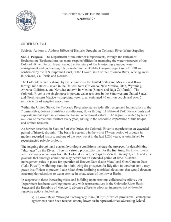
update: here’s a link to the full text of the Secretarial order

The Obama administration’s senior western water leadership this afternoon announced a Colorado River water management package that appears intended to signal a bridge for the administration transition, to continue work on nearly-completed deals to reduce the draining of the river’s big reservoirs.

The package falls short of two major deals some had hoped to be completed before the current team left – a deal with Mexico over future Colorado River water sharing, and a set of agreements among US states and the federal government to reduce water use in the Colorado River Basin, protecting the river’s beleaguered reservoirs. But it suggests that those deals are now the subject of widespread and bipartisan agreement, and appears to create a framework for continuity as the deals’ final details are worked out, rather than a risk of a sudden change in direction as the new administration takes office Jan. 20.

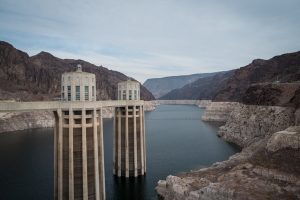
Lake Mead, December 2016

The package is embodied in a “secretarial order” signed this afternoon by Sally Jewell that includes new data suggesting that, without action, the risk to Colorado River water supplies is growing. Absent action, according to the new Bureau of Reclamation modeling runs, there is a one in three chance of Lake Mead dropping below the critical elevation of 1,025 feet above sea level by 2026. At that level, drastic water supply cuts to be needed to keep the reservoir from dropping to dead pool.

With the proposed actions discussed in Jewell’s order, that risk drops to about a one in 16 risk, according to the new USBR analysis.

From Jewell’s order:

Given the significant progress that has already occurred, and the commitment of the Seven Basin States and other key leaders to finalize the drought response actions, there is a very high probability that this work will be completed in the first half of 2017.

Quiet diplomacy?

As with much in Washington right now, what happens next is shrouded in  uncertainty. But the deal appears to reflect quiet diplomacy between the Obama team and the incoming Trump administration to create a bridge toward solving these problems as the government changes hands later this week. I didn’t have time to catch Interior nominee Ryan Zinke’s testimony yesterday, but I’m told that in response to questioning from Catherine Cortez Masto, Zinke testified favorably about the nearly completed “Drought Contingency Plan” described in Jewell’s secretarial order. If true (anybody who watched, feel free to jump into the comments and elaborate) that would provide evidence for my hypothesis that the bridge is being built to try to ensure continuity in the final steps of working out these deals, and that the incoming administration may look favorably on this stuff.

Concrete steps

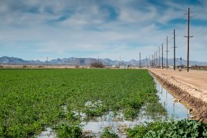
Jewell’s announcement includes concrete steps toward a near term reduction in Colorado River water use, including an agreement to pay the Gila River Indian Community in Arizona $6 million this year to forebear water use, leaving the unused apportionment in Lake Mead. That’s a critical piece of Arizona’s part of the complex water saving deals now being negotiated. While the amount of water is relatively small, it fills a critical political and policy niche by demonstrating a new path to reduced water use in Arizona.

The deal also adds an addendum to an agreement between the federal government and the Salton Sea. Dealing with the Salton Sea is critical (see my Sacramento Bee piece from last month for details on why). Jewell’s move here is an effort to bolster efforts to deal with the Salton Sea problems, which is critical to winning support in return from the giant Imperial Irrigation District for the water use deals.

Jewell’s order also sets out an interesting set of steps to be implemented should further negotiations to finalize the water-saving agreements among the states fizzle, including this: “undertaking a review of the Secretary’s authorities under the Law of the River to implement policies that will reduce depletions in the Lower Basin”. Of course any order by the old Secretary of the Interior can be un-order by the new one, but this provides a threat in the background – if the states don’t work out the final details of a deal, the federal government should at least consider stepping in and ordering action to protect Lake Mead.


California’s finally wet enough that the Metropolitan Water District of So Cal could store this year

This is a big deal:

The Metropolitan Water District of Southern California, which gathers water for 19 million people in the region, expects it can now begin storing water for future years. In recent years, it had been using up its water reserves.

It’s just one bit of a thoroughly excellent piece on the state of California’s drought by Ry Rivard at Voice of San Diego.

If Met can store this year because of surplus in local and Northern California supplies, that buys the big water agency breathing room in current negotiations over water use reductions on the Colorado River. Which means those of out here in the rest of the West, the ones nervously eyeing California because of their importance to our shared water supplies, can breathe more easily.

How much water does Arizona need?

The question of the headline, which was the title for the talks I gave last week in Phoenix was, I admit, a little cheeky. I’m just some schlub from New Mexico with an academic title and a book. That doesn’t mean I know the answer to the question. But to the extent I have an answer, it is this – Arizona (and lots of other places) probably don’t need as much water as they think.

Citrus groves, Mesa Arizona

Arizona gets some criticism in my book – for some holes in its groundwater management laws, and for its sometimes pugilistic approach to water management with its neighbors. But one of the things I very much like about Arizona is that both of those things arose out of a very deep and serious ongoing community conversation about water. I’ve seen this before, but I was really struck again on this visit by the passion and thoughtful conversations about water in Arizona.

My “probably not as much water as you think” argument is based on data on “decoupling” in Arizona and elsewhere – the way populations and economies have been growing in recent decades while water use has not. This is true across most geographies and water use categories in the United States, and for my talks I pulled together a few Arizona datasets that illustrates the phenomenon there:

  • overall, according to USGS data, total water use in Arizona peaked in 1980 and has been declining since, even as population has more than doubled.
  • A big part of that change involved the transition from an agricultural economy to an urban economy in central Arizona. But even in the municipal sector alone, you can see decoupling happening. In Phoenix, total water use (not per capita, total) peaked in 2002. Since then, water use has declined by 15 percent, while population has gone up 14 percent.
  • On some Arizona’s most important agricultural land, in Yuma County (that’s where that lettuce you just ate came from), water use is down by 30 percent from its mid-’70s peak, while farm productivity is up. Adjusted for inflation, crop revenue per acre foot of water has doubled.

As I argued in this piece I wrote last year, decoupling of water use from economic activity and population growth is a critical feature of the contemporary water policy landscape. If we can incorporate it in our policy discussions, it will provide crucial breathing room for the kind of collaborative arrangements I argue for in my book.

Part of my answer to our cheeky talk title question is that it’s for Arizonans to decide how much water they need. But successful decoupling means they have a lot more space to do it than some of the conflict-ridden discussions within the state might suggest.

Working landscapes

PHOENIX – Drive south on Interstate 10 out of the Phoenix metro area, past Ikea, and the city ends abruptly, a sharp line between development and desert.

alfalfa fields, Stanfield-Maricopa Irrigation and Drainage District

Given its reputation for sprawl, Phoenix (when I say “Phoenix” here I’m talking about the whole metro area, not just the city itself) is remarkably compact. The realities of building a city in the desert – specifically the need for water – make it hard for a city to dribble beyond its margins. “The plumbing necessary to deliver water in support of people,” Grady Gammage wrote last year in his fascinating book on sustainability and Phoenix, “means that development in the desert is a phenomenon of concentration. A desert dweller cannot simply settle wherever he wants, drill a shallow and cheap well, and set up a subsistence farm. He needs access to communal systems.”

On the south side, the line is particularly sharp, as a spreading city bumps up against the Gila River Indian Reservation. But head southwest on Arizona 347 and the Sonoran Desert soon gives way to a working landscape. The Gila River Indian Community has turned its water rights into lush patches of farmland, as have the Ak-Chin, their neighbors to the south. And the Ak-Chin farmland blends seamlessly into the Maricopa-Stanfield Irrigation and Drainage District.

Pinal County crop coverage, courtesy USDA Cropscape

I’m in Phoenix this week for some meetings and to talk about my book, and I carved out some time to visit Pinal County, the stretch of mostly agricultural land that sits astride Interstate 10 between Phoenix and Tucson. When I say “mostly agricultural”, we’re speaking in relative terms here. It’s mostly desert, but to the extent there’s a human imprint, it comes in the form of alfalfa, cotton, and wheat, on Gila Indian, Ak-Chin, and Maricopa-Stanfield land.

At one point I pulled off to look at a recently irrigated alfalfa field and scared up a flock of sandpipers. They may have been yellowlegs, I didn’t get a good look, but as I stood taking pictures I heard the unmistakable squawking of killdeer, a bird from home, a call I recognize. There were a few dozen of each, lunching in the freshly watered landscape.

I tend to take for granted the categories of “nature” and “not nature”, but I’m intrigued by the conceptual blurring created by a flock of sandpipers in an irrigated alfalfa field and what that says about these coupled human-natural systems and the stories we tell about them. The old ecosystem services of a riparian wetland have been replaced by this alfalfa field. What does that mean?

In general, the “Sun Corridor” (the “megapolitan” region that includes both greater Phoenix and Tucson) has followed a pattern of evolution from old agricultural land to city. Because the urban development generally uses less water than the farms it replaces, this has simplified the region’s water problems – ag-to-urban water transactions by way of real estate deals rather than water policy maneuvering.

But a few significant agricultural regions remain in the land around Phoenix – the valley of the Gila River out west of the city and Pinal County to the south. These remain very much working landscapes – this is primarily agriculture as a business, not “custom and culture” farming. It is a landscape defined by:

  • agricultural economics, which determines which crops will likely be grown (the future of dairy here seems especially huge)
  • water policy questions – who gets how much water?
  • the law and policy around Native American rights to their own land and self-determination, and the resulting choices those sovereign communities make both about their own land and in their relationships with the communities around them
  • a changing climate
  • the changing shape of the economies of greater Phoenix and Tucson

All these things mash up together to create the future of that landscape. Seems like there’s a good story in here somewhere.

Throwback Thursday: the 1885 Riverside Citrus Fair

citrus displays at the 1885 Riverside Citrus Fair, Riverside, California, via Calisphere

Starting to think about what my next book might be, I’ve been reading about the history of citrus agriculture in the Southern California of my birth. My interest, in terms of the book, is the way the evolution of irrigation technology and governance maps onto the working landscape that was, for a time, the richest agricultural region in the country before evolving into one of the planet’s great megacities.

This whole marketing schtick – the citrus fairs, the romance of the orange crate labels – is a bit of a side road, but a fun one. Or maybe not? It’s impossible to separate the economics of citrus marketing from the change on the landscape that resulted.

Ignore this quite encouraging Rio Grande runoff forecast

It is only January. We have months and months of snow season left, which will determine whether we have a good runoff year on New Mexico’s Rio Grande.

So you should in no way click obsessively on the snowpack map every morning while you’re having your first cup of coffee. I repeat, do not click. Even worse, please don’t click to see if the NRCS has updated its automated daily regression forecast today. (For the record, they haven’t done this yet this morning.) And please don’t obsessively tweet about the latest numbers.

So please ignore the following excellent news out this morning from the NRCS:

  • median forecast for March-July runoff at Otowi: 715,000 acre feet, 99 percent of normal

UC Davis irrigation experiment shows big increase in alfalfa yield per acre foot of water

Cleverly managed deficit irrigation (when you significantly reduce water applied during the hot part of the year) substantially increased yield per unit water applied in a new study by researchers at UC Davis. In controlled side-by-side field experiments, Dan Putnam and his colleagues demonstrated that if you do it right, a big reduction in water applied will result in just a small reduction in yield.

The technique involves full irrigation for a good part of the year, but an irrigation cutoff in the hottest part of the summer. That’s the time of year when alfalfa can drink up a lot of water for not much additional yield. This reflects something farmers have long known – that alfalfa is a sturdy crop, offering resilience in a drought. When summer supplies run low, the plants hunker down. Yield drops, but they don’t die.

I talked about this in my book:

This opens up interesting policy options. If, say, the water saved was sufficiently valuable to a municipal water user to compensate the farmer for the lost yield in return for sending the saved water off to the city, you’d have the room for a deal that keeps the land in production and the farmer in business while also providing water to the city.

This sidesteps the biggest criticism of agriculture-to-urban water transfers—that they dry up land and community livelihoods. “Buy-and-dry” has become an epithet in the Colorado River Basin, and deficit irrigation provides an alternative if we can get the institutional arrangements right. By one calculation, widespread use of intentional deficit irrigation in alfalfa fields in Arizona and Colorado irrigated with Colorado River water could save nearly four times as much water per year as the annual consumption of the Las Vegas metro area.

The citation for that last bit leads to Michael Cohen and colleagues’ 2013 analysis of Colorado River Basin agriculture.

Beneath Wichita, a recovering aquifer

At least one community in the midwest has found a way to protect its dwindling aquifer:

Groundwater levels were generally higher in January 2016 than they were in January 2015. On average, in January 2016, groundwater levels in the shallow part of the aquifer were about 3.4 feet higher and groundwater levels in the deep part of the aquifer were about 3.8 feet higher than in January 2015. The volume of water stored in the study area decreased by about 74,000 acre-feet between predevelopment (the time period before substantial pumpage began in the 1940s) and January 2016; increased by about 121,000 acre-feet between the historic low in 1993 and January 2016; and increased by about 61,000 acre-feet between January 2015 and January 2016. About 62 percent of the storage volume lost between predevelopment and 1993 has been recovered. The increase in storage volume from January 2015 to January 2016 can probably be attributed to less pumping by the city of Wichita and irrigators, more recharge due to higher-than-average precipitation, and higher volumes of artificial recharge in 2015.

Wichita, Kansas, and the communities around it realized in the early 1990s that their aquifer was in trouble. Conservation and aquifer recharge followed, to good effect.

This is from Status of groundwater levels and storage volume in the Equus Beds aquifer near Wichita, Kansas, January 2016, a report by the USGS and the City of Wichita. (Via Brett Walton’s Federal Water Tap)