
measurements show rising groundwater in a newly wetted stretch of the Colorado River, March 28 2014
You’ve seen lots of pretty pictures of the Colorado River flowing anew into its delta, right?
But one of the most interesting things going on is the movement of water out of sight, beneath the ground (see “hydrology at the end of a river” for some background). I had a chance this morning to visit a number of the U.S. Geological Survey monitoring sites set up along the U.S.-Mexico border to gather data on the environmental “pulse flow” now underway. They’ve set up “direct current resistivity” gizmos that essentially measure the ability of electricity to travel through the ground. Since electricity moves more easily through wet ground, it’s a good proxy for changes in groundwater.
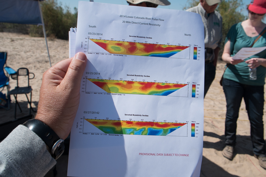
The top graph shows the transect at the “20 Mile” monitoring site, near a bend in the river close to Gadsden, Ariz. The oranges and reds are “drier”, and the blues and greens are “wetter”. The top graph was taken before the water arrived. The bottom one, taken yesterday, shows rising groundwater.
It’s not as pretty as a picture of a flowing river, but perhaps equally important.