Colorado River pulse flow: managing expectations

More than once last week while I was down in the Colorado River delta, I heard people involved with the historic “pulse flow” talk about one of the problems that comes next: managing expectations.
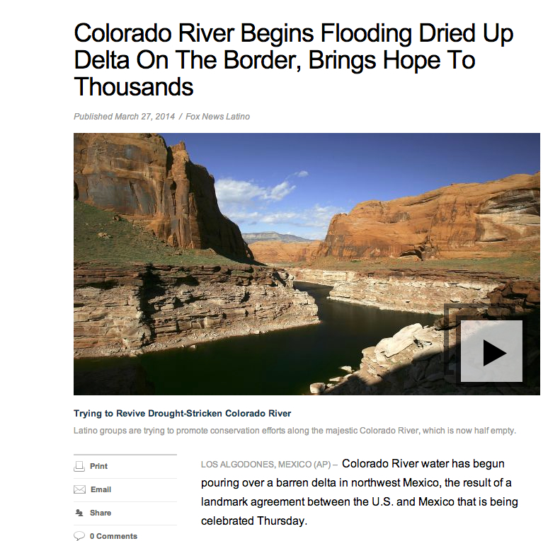
Fox Latino calls it a "flood"

Fox Latino calls it a “flood”

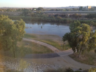
This headline and file art, from Fox Latino, illustrates the problem. “Colorado River Begins Flooding Dried Up Delta,” the headline reads, accompanied by a picture of the Colorado River near Page, Arizona. The Colorado River I watched last week flowing past San Luis Río Colorado in Sonora, Mexico, was a beautiful thing to see, but it was another thing entirely from the stock imagery you see here.

I don’t recognize where the picture accompanying the Fox Latino story was taken, but the Colorado River at Lee’s Ferry (the nearest gage to Page) is running right now with a peak flow of around 10,000 cubic feet per second (a little less than 300 cubic meters per second). On Friday at San Luis, the last good number I had from a member of the U.S. Geological Survey team working on the pulse flow monitoring was around 1,300 cfs (37 cms). The releases from Morelos Dam, the place where water is being turned loose into the normally dry delta channels, are larger, but it’s a parched system, and the losses as the water headed downstream were significant.
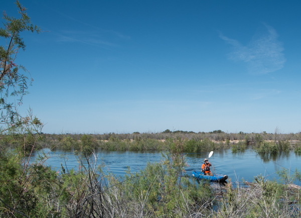
USGS monitoring on the pulse flow, March 28, 2014, by John Fleck

USGS monitoring on the pulse flow, March 28, 2014, by John Fleck

In the desert landscape, it looked like a substantial river, as the picture to the left shows, but nothing like the “Mighty Colorado” imagery conjured up by a Fox Latino desk editor looking to fill a click-bait slide show.

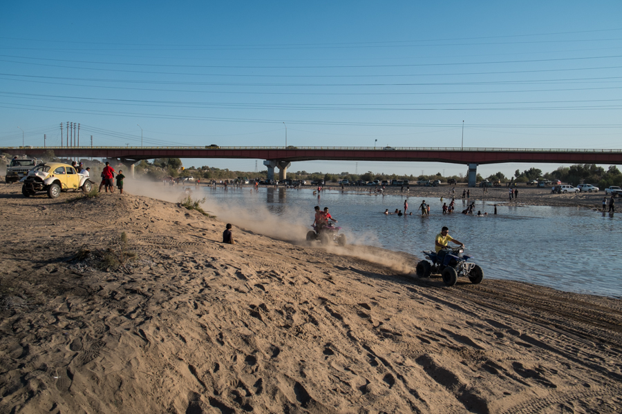
In San Luis Río Colorado, the party was genuine, but it wasn’t clear how much the partiers understood how short-term this flowing river was going to be. That, at least, was the worry. I talked to four twenty-something men under the bridge in one of those broken Spanglish exchanges who clearly had little idea why the water was there or how long it would last, only that it was wonderful. “Thank you Americans!” one of them said. Our shared language wasn’t up to the task of communicating the fact that it was Mexican water, and the Mexican government and non-governmental organizations who were equally responsible for this shared project.

Here’s the thing. Wonderful as it is, the water is not going flow through San Luis for very long. The peak releases from Morelos Dam end today (Sunday, March 30). The releases will decline rapidly after that, with releases from Morelos into the main river channel ending completely by the third week of April, according to the USGS. It’s truly a “pulse” of relatively high water moving down the channel of relatively short duration, not a sustained simulation of a full spring flood flow. For the rest of April and into May, water for environmental flows will continue, but instead of being released into the main channel, the water will be moved through Canal Reforma and Canal Barrote, bypassing reaches of the river where infiltration losses were expected to be substantial because of deep water table.
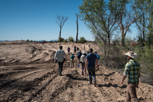
Scientists and journalists tour Laguna Cori restoration site in the Mexican Colorado River Delta, which awaits its first flows. March 27, 2014, by John Fleck

Scientists and journalists tour Laguna Cori restoration site in the Mexican Colorado River Delta, which awaits its first flows. March 27, 2014, by John Fleck

That will allow water to be targeted directly to key habitat restoration areas like this one at Laguna Cori, on the river’s western bank, which I toured with some members of the project science team and a group of reporters Thursday. (Huge thanks to Karl Flessa from the University of Arizona for shepherding around the delta.) Within the next couple of days, the scientists expect the main pulse released from Morelos, after having travelled down the main channel, to reach the key habitat restoration areas. The idea is a wetting from the channel to coincide with cottonwood germination. With the rapid recession in main channel flow, water then will be moved via more efficient irrigation canals to keep the site wet into May. This a site with a very shallow water table, which offers a much better chance for restoration. Properly nurtured, the scientists hope, the cottonwoods will be able to get their roots down into the water table, giving them a shot over the long run.

I admit to being as caught up as anyone in the “living river” part of this. Watching the water fill the dry, sandy Río Colorado bed at San Luis, watching the happy scientists and happy townsfolk splashing and partying was special. But if a “living river” is the goal, this is a very modest first step. Incredibly important, historic even, but modest.

Expectations are a funny thing.
“the most beautiful sight”

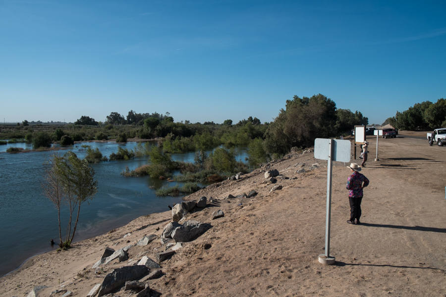
Water flowing downstream, below Morelos Dam, March 27, 2014

Water flowing downstream, below Morelos Dam, March 27, 2014

Packing up this morning to head home after a week watching the environmental pulse flow on the Colorado River into Mexico. Ran across this in one of my notebooks, from Bob Snow, an attorney in the U.S. Interior Solicitor’s Office who has been working on this since the ’90s and helped negotiated the international agreement that enabled this to happen. We were standing on the dam, watching the water flow south:

I think this is the most beautiful sight I have seen in my career.

To be fair, Bob is the kind of guy who grins a lot anyway. But this week, the grin seemed bigger.

a boy and his river

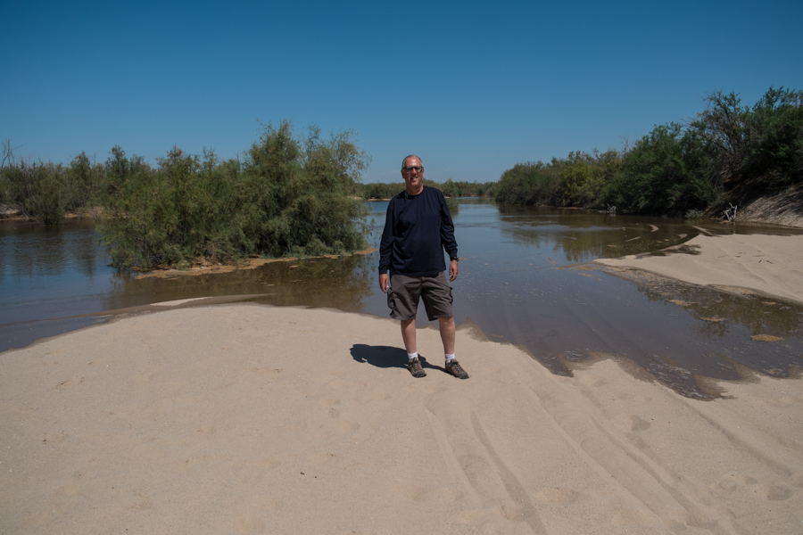
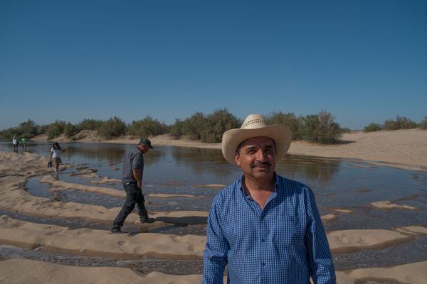
Standing in the bed of the Colorado River north of the San Luis Bridge, looking upstream at the advancing water, March 25, 2014. Juan Hernandez took this picture of me

John Fleck, standing in the bed of the Colorado River north of the San Luis Bridge, looking upstream at the advancing water, March 25, 2014. Juan Hernandez took this picture.

I consider it a great accomplishment that I spent an entire week in the desert sun of the Colorado River delta without getting sunburned.

A river underground

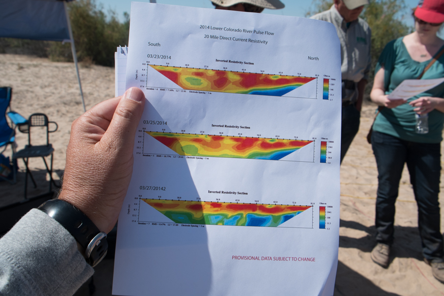
measurements show rising groundwater in a newly wetted stretch of the Colorado River, March 28 2014

measurements show rising groundwater in a newly wetted stretch of the Colorado River, March 28 2014

You’ve seen lots of pretty pictures of the Colorado River flowing anew into its delta, right?

But one of the most interesting things going on is the movement of water out of sight, beneath the ground (see “hydrology at the end of a river” for some background). I had a chance this morning to visit a number of the U.S. Geological Survey monitoring sites set up along the U.S.-Mexico border to gather data on the environmental “pulse flow” now underway. They’ve set up “direct current resistivity” gizmos that essentially measure the ability of electricity to travel through the ground. Since electricity moves more easily through wet ground, it’s a good proxy for changes in groundwater.

The top graph shows the transect at the “20 Mile” monitoring site, near a bend in the river close to Gadsden, Ariz. The oranges and reds are “drier”, and the blues and greens are “wetter”. The top graph was taken before the water arrived. The bottom one, taken yesterday, shows rising groundwater.

It’s not as pretty as a picture of a flowing river, but perhaps equally important.


Plumbing the pulse flow

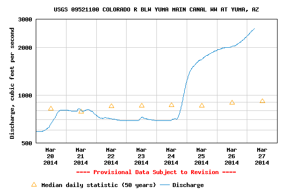
Yuma Flow, courtesy USGS

Yuma Flow, courtesy USGS

The water outside the window of my Yuma, Ariz., hotel, has been rising since Monday. The Bureau of Reclamation likes to keep it below 3,000 cubic feet per second here so it doesn’t disturb the lovely park the folks of Yuma built here over the last decade. But sometimes its hard.

There’s an irony to how the plumbing is being operated to create the environmental pulse flow I’ve been covering this week. Water for the pulse is released from Hoover Dam, with about three days’ travel time to get here. But on the U.S. side, it doesn’t travel directly in the riverbed the whole way. Instead, the Bureau of Reclamation diverts the water at Imperial Dam, 30 miles upstream, into the Imperial Canal.

Rising Rio Colorado at Yuma, by John Fleck, March 27, 2014

Rising Rio Colorado at Yuma, by John Fleck, March 27, 2014

There’s a point by over by Pilot Nob, the point at which the All-American Canal and the old river are quite close, where the Bureau and the Imperial Irrigation District can drop water back down out of the Canal and into the river. Much of the water for the pulse flow is being moved that way, though at this time of year, with Imperial farmers doing crop rotations and ordering extra water, there’s not enough capacity to move all the pulse flow water that way. So now, some of it is actually flowing down the river channel, past my hotel – a river all the way from the snowpacks of the Rockies in a riverbed the entire way to – well, some folks hope, all the way to the Sea of Cortez.

A reminder that this river, even when we’re trying to make it more river-like, is fundamentally plumbing.

Following the Rio Colorado west

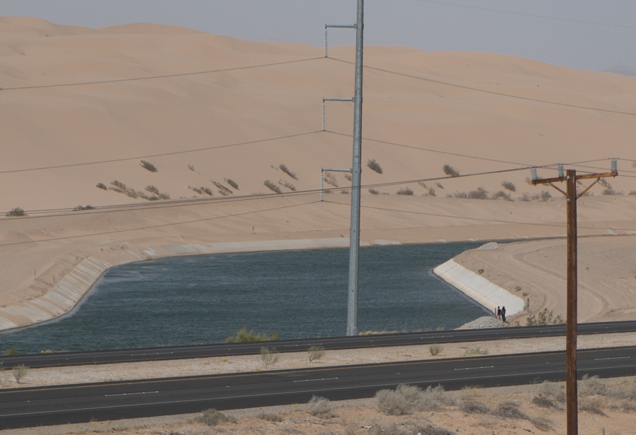
All-American Canal passing through the sand hills west of Yuma, March 2014 by John Fleck

All-American Canal passing through the sand hills west of Yuma, March 2014 by John Fleck

I took a break today from the excitement of following a newly rejuvenated Colorado River south, across the border into Mexico, where it rarely flows, and followed “the river” west instead.

Forty-nine river miles upstream from the “Southern International Boundary” – essentially the bridge at San Luis Rio Colorado – a structure known as Imperial Dam diverts the majority of what is left in the Colorado River into the All-American Canal. The canal, which carries about 3 million acre feet of water per year to the farms of the Imperial and Coachella valleys, is far larger than the river that remains. The people standing at its edge in the picture above give a sense of the scale of this thing. It’s huge. Lined for part of its length with concrete, it’s obviously not a “river”, but it’s something like one.

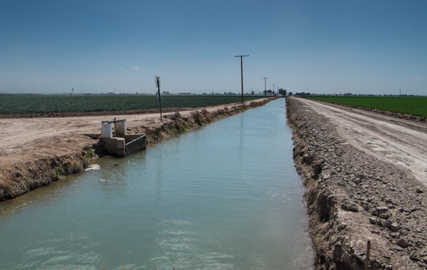
Wheat, right, and onions with a canal, Imperial Valley, March 2014

Wheat, right, and onions with a canal, Imperial Valley, March 2014

Following it west, the All-American Canal splits into four giant mains that distribute water across what was once the dry desert of the Salton Sink – three canals to the Imperial Irrigation District and a fourth to the north, to the Coachella Valley. There, you can see the tradeoff we’ve made – dewatering a river in service of agricultural magic, the basic human goal of growing food. This is a geography profoundly altered by the irrigation revolution of the twentieth century. For a water nerd, it’s endlessly fascinating – a complex distribution network for the river water and an equally complex network of drains that carry waste water away from the fields and into the Salton Sea. For a water politics and policy nerd, it’s a central part of the story.

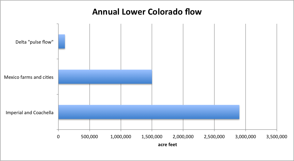
Here’s why. For all the fuss and excitement about the “pulse flow” to the delta (a fuss I think is warranted and an excitement I share), the amount of water turned to human use in this part of the river dwarfs the water we’re sending down from Morelos Dam and past San Luis:

Lower Colorado Water

Lower Colorado Water

Water is no one thing. Different groups of people value it and draw meaning from it in different ways. Farmers value it to grow food. Community members value a living river flowing through their midst. No one’s “right” here. The trick is negotiating the terrain of competing values. The size of those bars suggests the outcome of that negotiation over the 20th century. We mostly valued water for farms and cities. That’s not going to change. But if the modest flows involved in the current experiment have the desired effect, we can almost certainly find the slack in the system to meet both sets of values here. That’s what is really hopeful in all of this.

multiple meanings of “presa”

Francisco Rosas, San Luis Rio Colorado, March 25, 2014, by John Fleck

Francisco Rosas, San Luis Rio Colorado, March 25, 2014, by John Fleck

SAN LUIS RIO COLORADO – Morelos Dam, the last dam on the Colorado, normally diverts the river’s entire flow west, into the Canal Reforma, for farms in the Mexicali valley. In Spanish, it’s called “Presa Morelos,” where “presa” means “dam.” But Francisco Rosas, a Mexicali farmer, told me that it has a second meaning – to capture, or the animal you killed:

“‘Presa’ to a Mexican means ‘You caught it.'”

As we spoke, water was filling the sandy bed of the normally dry Colorado downstream from Presa Morelos, and kids splashed happily. “It’s something new for them,” Rosas said.

A pickup, stuck in the Colorado River sand

Pickup stuck in a sandy riverbed as the Rio Colorado arrives, March 25, 2014, by John Fleck

Pickup stuck in a sandy riverbed as the Rio Colorado arrives, March 25, 2014, by John Fleck

SAN LUIS RIO COLORADO – Apologies. This is kinda convoluted, but it’s what happened.

One of my journalistic techniques is to try to put myself in a place where something interesting is likely to happen, something real, and then wait. So at lunchtime today, I parked in the shade of the San Luis Bridge on the Baja-Sonora border to wait for a river to arrive. (Background on how long the Colorado has been dry here, and why it was about to get wet, can be found  here.)

I knew the water, which had been released into a mostly dry Colorado Sunday 22 miles upstream, was near, but I wasn’t sure how near. My goal was to be at the San Luis Bridge when the water got there.

Two guys from Conagua, the Mexican national water commission, drove up in a white pickup. We didn’t speak one another’s language, but in a pantomime that included pointing at watches and gesturing upstream, I concluded that it would be a matter of hours, they couldn’t be sure how many. I ate half my sandwich.

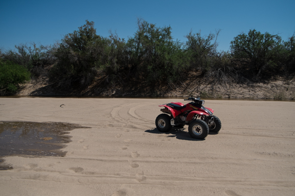
A couple of young men had been prowling up the riverbed and back to the bridge on four-wheeled all-terrain vehicles. I flagged one of them down. His name was Juan Hernandez. I asked him if he’d seen the water. He said yes, and asked if I wanted to hop on back and go see it.

Juan's red Honda chariot, March 25, 2014, by John Fleck

Juan’s red Honda chariot, March 25, 2014, by John Fleck

I must explain at this point that I am not a particularly adventurous person. Hopping on the back of a Honda all terrain vehicle and trundling off across the desert is not the sort of thing I take easily to. But, well, I did want to see the water and I was waiting for something to happen. This seemed like something, so off we went.

I wish I had a better sense of how long or far Juan schlepped me through a sandy riverbed clogged with tamarisk, and then suddenly there was water. Juan turned off the Honda’s engine, and there was quiet. It wasn’t what I expected. Well, to be honest, I wasn’t sure what I expected – water creeping slowly forward into dry sand, I guess. There was a small main channel that was moving pretty well, deep enough that we would have gotten plenty wet trying to cross. And in the quiet, we heard bubbles. Water was flowing over dry sand, and air was bubbling up through it.

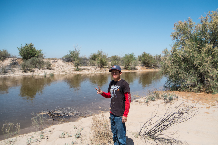
Here’s a picture of Juan, standing next to the Colorado River, which hasn’t flowed very much through his community of San Luis in recent years:

Juan Hernandez, San Luis Rio Colorado, March 25, 2014, by John Fleck

Juan Hernandez, San Luis Rio Colorado, March 25, 2014, by John Fleck

Juan drove me around to a few more spots before swinging back to the south and heading up the main river channel so we could see the front of the water headed to the San Luis Bridge.

We were, I guess, less than a mile from the San Luis Bridge when we came across two guys in a nice late model white Ford Lobo FX4 Off Road pickup. Stuck in the main river channel. With the water maybe 50 yards upstream from them and creeping toward the truck. There was jumping and bouncing and revving and a sense of urgency because of the impending arrival of a river. And continued stuckness. Then, just as the water reached the channel behind the truck, as you see in the picture above, not one but two men appeared on a low bluff to the west, with shovels. This all seemed like magic to me. I am told by those more experienced in Colorado River Delta travel that sand stuckness is common. Flowing water threatening you when you’re stuck in the sand, less so. The magical appearance of men with shovels?

With the shoveling well underway but the truck still stuck, Juan asked me to hop on back so he could return to the bridge in search of further assistance. Juan dropped me off, and within minutes, I saw Juan, the pilot fish, leading an even larger pickup, equipped with a winch, back up the riverbed. And perhaps 15 minutes later, the happy ending, as pilot fish, Ford Lobo FX4 Off Road and the giant rescue truck all returned to safety.

Eventually, the river did arrive at San Luis, lots of people showed up to greet it, and a fine time seems to have been had by all:

River Party at San Luis Rio Colorado, March 25, 2014, by John Fleck

River Party at San Luis Rio Colorado, March 25, 2014, by John Fleck


hydrology at the end of a river

Hydrologically speaking, the end of a river is a complicated thing.

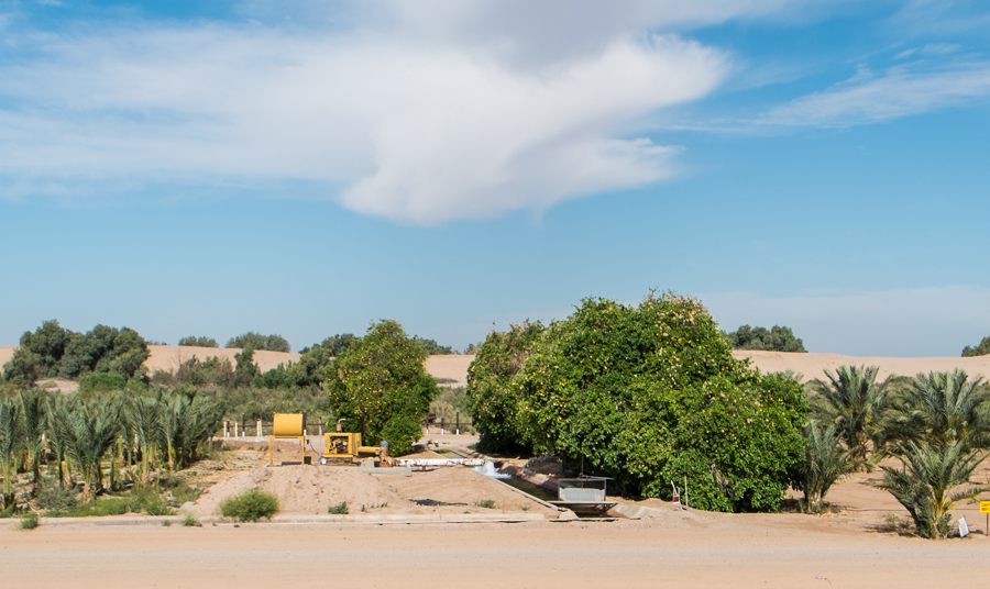
Pumping groundwater in the Colorado River "flood plain", March 24, 2014, by John Fleck

Pumping groundwater in the Colorado River “flood plain”, March 24, 2014, by John Fleck

A couple of miles down the levee road on the U.S. side of the border with Baja in Yuma County, Ariz., I came across this farmer yesterday pumping groundwater to irrigate some sort of palm orchard (with some lovely bonus citrus). This is a farm that’s essentially in the riverbed, pumping groundwater. You see this type of farming on both sides of this stretch of the river, the 22 miles called the “limitrophe” that forms the border between the U.S. and Mexico here. As dg said:

When you are dealing with poverty and the needs for water in your own region to fuel the economy – you have priorities. Life is tough in the South West.

This is the stretch of river being slowly but surely wetted this week by the historic “pulse flow”, an experimental environmental release of 105,000 acre feet of water this spring from Morelos Dam into the largely dry Colorado River Delta. (Background here.) The flow started Sunday morning with a celebration at Morelos Dam, and the adventure now is watching how far the water gets each day – an adventure complicated by the fact that this is geopolitically tortured terrain, with border fences and armed Border Patrol agents and all the baggage of our borderlands problems that leaves the river uncomfortably physically isolated. (As an aside, I met a couple of great Border Patrol agents yesterday while I was wandering the no-man’s land on the U.S. side who were as curious as I was about the whole thing and were delighted to help in my efforts to find the water.)

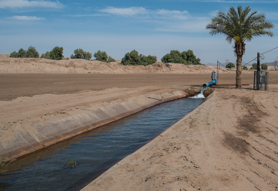
Groundwater pumping south of Algodones, along the Colorado River limitrophe, Baja, by John Fleck, March 2014

Groundwater pumping south of Algodones, along the Colorado River limitrophe, Baja, by John Fleck, March 2014

If this area is geopolitically tortured, it is even more hydrologically tortured.

My shorthand explanation for what’s happening down here is that the river ends at Morelos Dam, on the U.S.-Mexico border, with the last of the river’s water diverted into a canal for Mexican farmers. But that is not quite right. A desert river is as much underground as it is aboveground, and the groundwater-surface water interaction is critical to what’s going on.

Michael Cohen of the Pacific Institute, who is down this week watching the pulse flow, shared a paper he wrote last year deconstructing the complexity of the limitrophe’s hydrology.

Before humans plumbed the system with dams and diversions upstream, annual snowmelt floods would spread out across this landscape on their way to the sea, recharging the regional aquifer. When the river’s flow was low, the reverse would happen, with the aquifer contributing “base flow” to the river.

With that river shut down by upstread plumbing, only the second part happens, and for only a very short segment of the 22-mile limitrophe. Here’s Cohen:

The diversion of essentially the entire flow of the river upstream of the study area, combined with the loss of sediments behind upstream dams and subsequent incision of the river channel below Morelos Dam, means that the river is now a drain in the upper portion of the limitrophe and is completely disconnected from the aquifer in the last quarter of the limitrophe. In the form of irrigation, the river still ‘floods’ adjacent lands, recharging the aquifer. In the upper portion of the limitrophe, recharge from this irrigation is sufficient to maintain elevated groundwater levels and connectivity with the river.

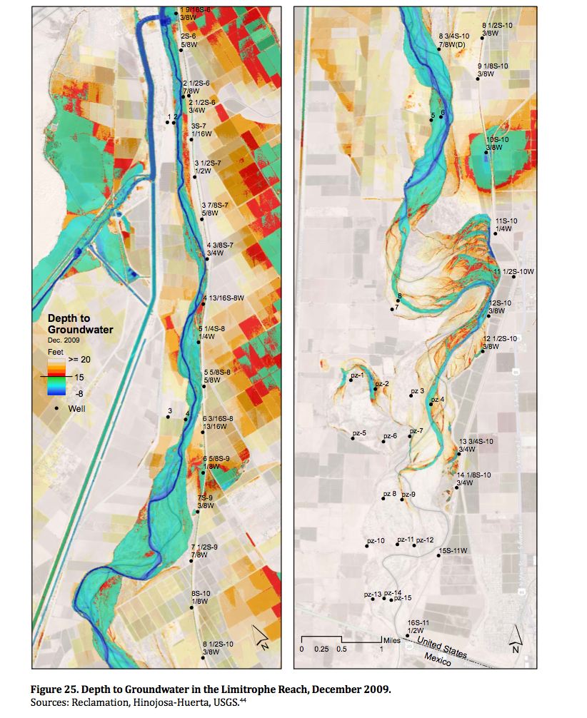
But as you head south, as you can see from Cohen’s map below, that contribution diminishes and the water table beneath the river channel drops away.

Groundwater pumping within the levees in the river’s flood plain itself, like the farm pictured above, contributes to this. Cohen calculates 36,000 acre feet of groundwater pumping per year within the levees, with a lot more in the surrounding region. So as you go south along the 22-mile stretch of limitrophe toward San Luis Rio Colorado, the water table drops farther from the surface, at some point dropping so far that the roots of cottonwoods and other aquifer-tapping plants can no longer reach it. At this point, it loses what John Van Dyke called the “ribbon of green” that marks the rest of the desert Colorado. In some sense it is here that the river meaningfully ends.

Estimated depth to groundwater, Colorado River limitrophe, courtesy Michael Cohen, Pacific Institute

Estimated depth to groundwater, Colorado River limitrophe, courtesy Michael Cohen, Pacific Institute