Memories of water

When last we met, I was waxing poetic about the memories of water in San Luis Rio Colorado:

I asked Medina, who kindly served as translator for a monolingual norteño, when San Luis had last seen water in the Rio Colorado. “1998,” he said. What struck me was how he said it without hesitation, and what that suggests about the longing for water. Without pause, he knew exactly how long the rio has been dry.

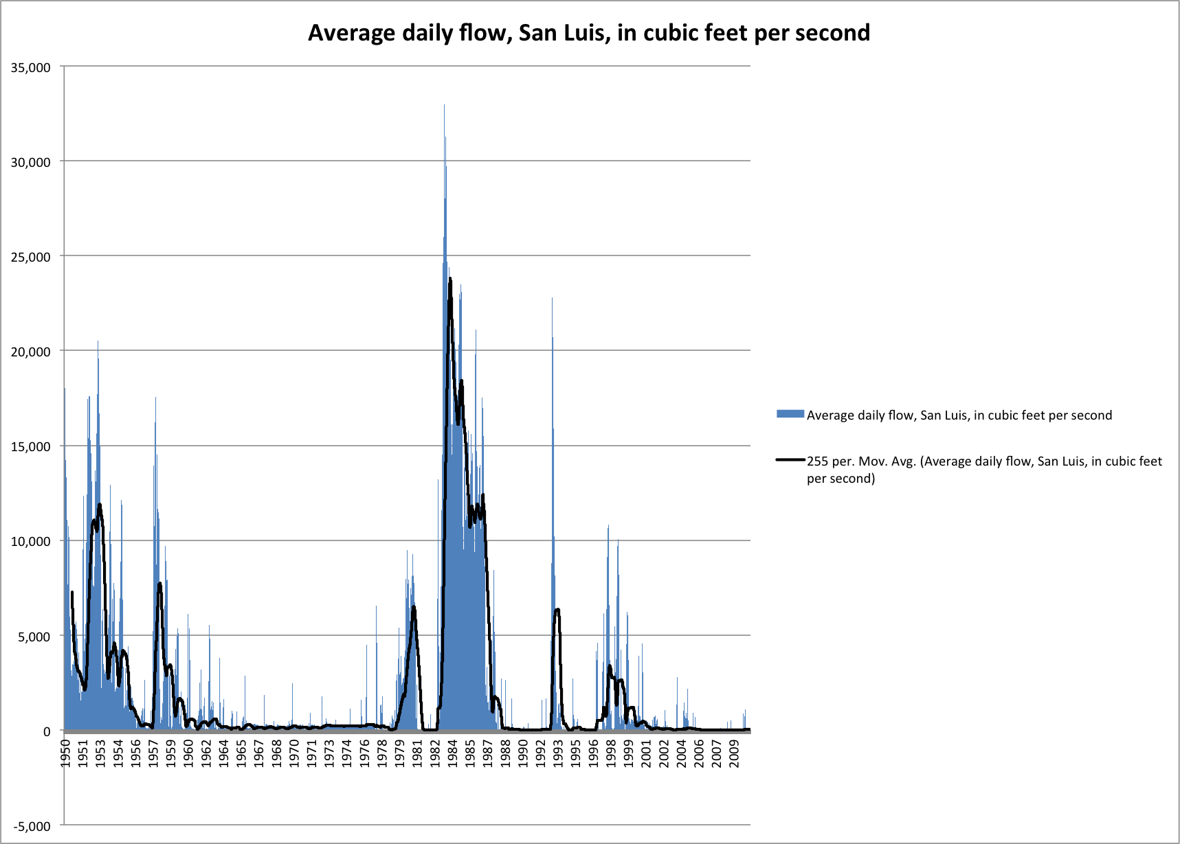
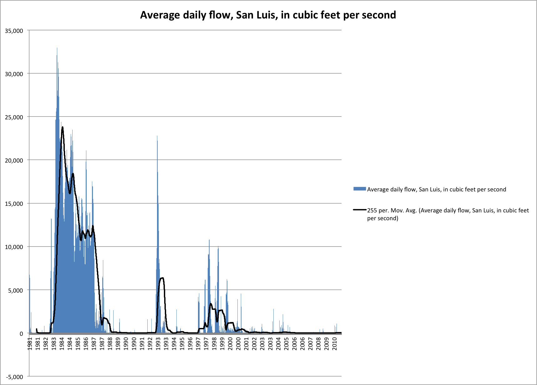
Beware the poetic instincts, there, Mr. Journalist! A member of the brain trust pointed me to data showing that there has been water in the Rio Colorado at San Luis on a number of occasions since then. This is the daily average flow since 1950, when Morelos Dam was completed:

San Luis flow

San Luis flow

I’ve thrown in a 365-day smoothed average to give a feel for the longer term trend.

Here’s the same data set, zoomed in to the last 30-plus years. 1983 was the year of the great El Niño that almost took out Glen Canyon Dam, the year all the dams spilled and water flowed freely to the sea. One of the Border Patrol agents I met today while I was prowling the riverside, who grew up in San Luis, Ariz., told me about fishing a big, wet river as a boy during those years:

San Luis flow

San Luis flow

My correspondent is definitely correct. The Rio has flowed at San Luis many times in the years since 1998. But you can also see why the late 1990s stand out in local lore and memory.

(The graphs in this post have been updated because I screwed up the metric-vs-wacky US measure conversion)

“La Cuenca is dead right now”

San Luis Rio Colorado, March 23, 2014, by John Fleck

San Luis Rio Colorado, March 23, 2014, by John Fleck

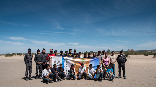
SAN LUIS RIO COLORADO – Manuel Campa was very particular. His town’s name is often shortened to merely “San Luis”, but standing in the dry bed of the Colorado River this morning, the full name mattered very much. “It’s the only city that has the name ‘Rio Colorado,'” he said.

The sandy riverbed beneath the bridge just west of town has become an iconic, sad image of the drying of the Colorado River. Since Hoover and Glen Canyon dams corralled the river’s flow for human use, the once-great river at San Luis has been slowly but surely dried until just a bed of sand remains.
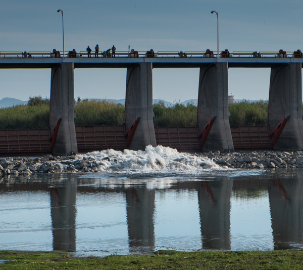
The Colorado River "pulse flow" begins. Morelos Dam, March 23, 2014, by John Fleck

The Colorado River “pulse flow” begins. Morelos Dam, March 23, 2014, by John Fleck

But this morning the riverbed felt more like a party than an icon. A couple hundred area residents were out with Campa for a community riverbed cleanup, and to await the water. Around 8:15 a.m., 22 miles upstream, one of the middle gates on Morelos Dam inched up and a froth of water gushed through, part of an experimental “pulse flow” to use the Colorado’s plumbing to mimic, in some small measure, the flow that once made this not only one of the planet’s estuarial ecosystems, but also gave places like San Luis their cultural identity.

It’s not clear how soon the first water will reach San Luis – probably not for a couple more days. But that didn’t dampen the festivities this morning as pickups and Harleys and families with soccer balls and four-wheelers turned the shady stretch under the bridge into an impromptu festival rio. “They want to see the water,” Waldo Medina explained.

I asked Medina, who kindly served as translator for a monolingual norteño, when San Luis had last seen water in the Rio Colorado. “1998,” he said. What struck me was how he said it without hesitation, and what that suggests about the longing for water. Without pause, he knew exactly how long the rio has been dry. (update: An emailer points out, with data to back it up, that “1998” is incorrect, and that there have been a number of flows past San Luis Rio Colorado since that time. I’ve got the data, and once I get the handy dandy graph made, I’ll put up a new post. update 2: Here’s the data showing that the river has, in fact, flowed a number of times since 1998 at San Luis.)

I’m going to invoke the blogger’s prerogative to revise and extend my remarks here at a later time, because the language barrier made this a tough conversation, but Medina worked hard to explain to me the idea of “la cuenca” – the area of the delta where both waters – the river water from the north, the seawater from the south, meet. “La cuenca is dead right now,” Medina said.

A friend pulled out a iPhone and began scrolling up and down a satellite map of the area, a mix of green of farms and brown of desert. “All this a long time ago was the river,” Medina explained.

“The water is very important for the life,” Medina said. “All people living around the Colorado River, they need the water.”
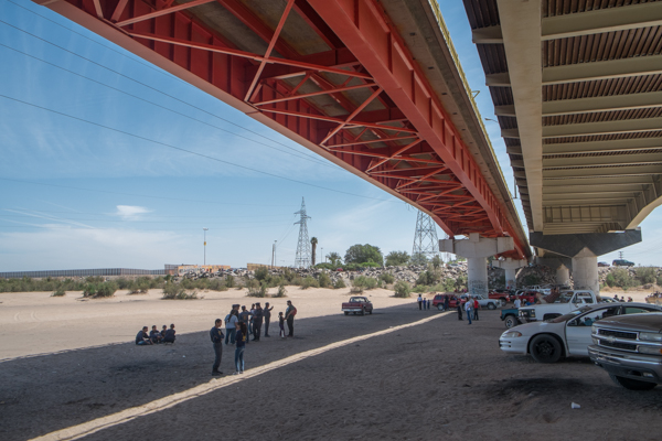
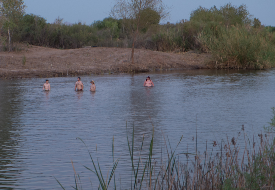
Party at San Luis Rio Colorado, March 23, 2014, by John Fleck

Party at San Luis Rio Colorado, March 23, 2014, by John Fleck
Presa Morelos: when in doubt, make a bird list

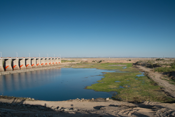
Morelos Dam, March 22, 2014, by John Fleck

Morelos Dam, March 22, 2014, by John Fleck

LOS ALGODONES, B.C. – I made it to Yuma with time to spare this afternoon, so I dumped my bags at the motel and drove around to the Andrade border crossing and through the little town of Algodones  (best dentists in North America!) to Morelos Dam.

I couldn’t find the angle to get the picture I wanted, so you’ll have to settle for some words. In the picture above, we’re on the downstream side of the dam, which diverts the last of the Colorado River’s waters to farms in Mexico. The dam’s closed, so the water you see is just groundwater leaking through. If you look closely at the dirt road on the right side of the picture, you’ll see a little gap. That’s all that’s left of the Colorado River. Words fail me, here’s a closeup of all that’s left of the Colorado River. Hard to get a feel for the scale here, but there was a guy out walking his dog. The dog splashed from Mexico to the U.S. and back in just a few seconds.

The Colorado River, ten feet wide, by John Fleck, March 2014

The Colorado River, ten feet wide, by John Fleck, March 2014

It’s a nice shallow pool, so of course there were birds:

  • cormorants
  • a green heron
  • some undetermined sandpipers
  • a bunch of black-necked stilts (lordy, such graceful creatures)
  • I’m pretty sure a blue-winged teal
  • lots of coots (“American” coots, to be specific)
  • a gallinule

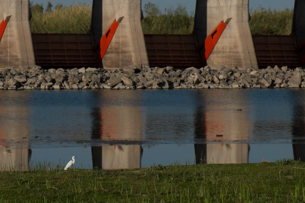
Since I’m down here to watch the historic release of Colorado River water back into the long-dried delta, this of course raises all kinds of fascinating questions about what is “nature”. It’s just a bunch of dam leakage confined by levees. Whatever. The egret was gorgeous:

Snowy egret, Morelos Dam, March 22, 2014, by John Fleck

Snowy egret, Morelos Dam, March 22, 2014, by John Fleck

The Hite Marina

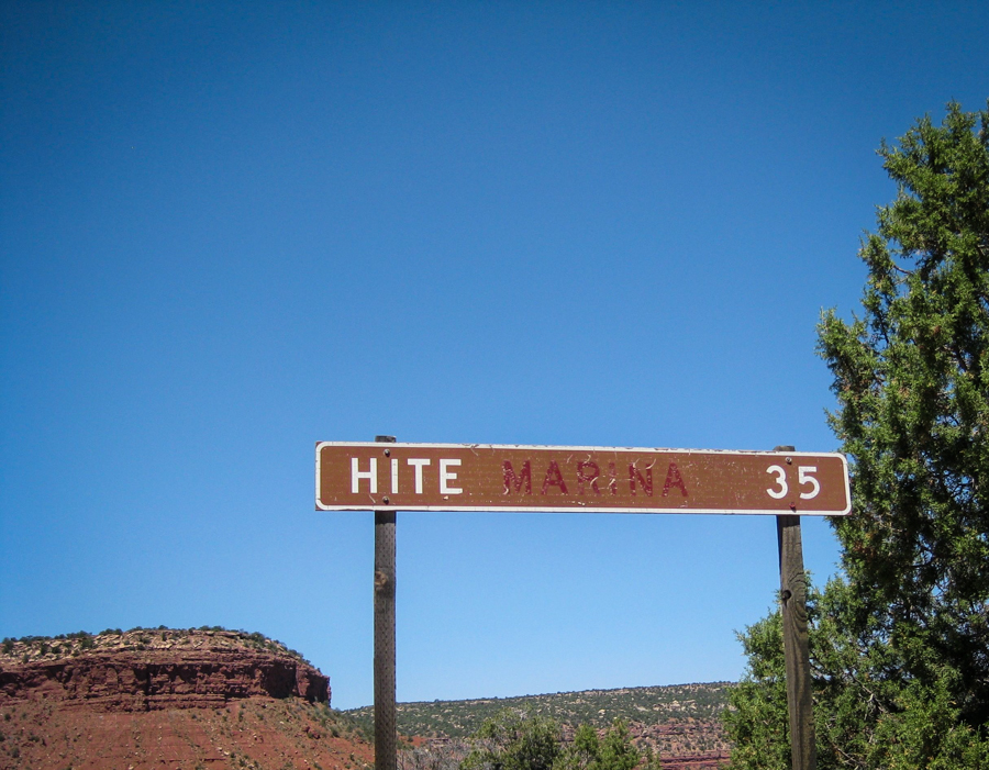
Hite sign, by L. Heineman, June 2009

Hite sign, by L. Heineman, June 2009

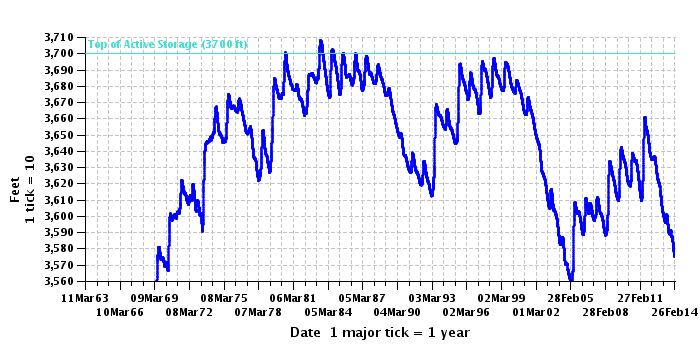
There used to be a marina at Hite, Utah, on the upper end of Lake Powell. The Park Service abandoned it in the early 2000s, when the reservoir dropped out from underneath it. They also fixed the sign.

Lake Powell elevation, courtesy USBR

Lake Powell elevation, courtesy USBR

Crossing the divide

HOLBROOK, AZ – Driving on Interstate 40 in western New Mexico, the continental divide feels like a geographic afterthought.

When I was a boy, I remember the Continental Divide as high mountain passes in the Rockies, deserving of capitalization, a thing of great import. I was mesmerized by the concept. If I stood here and peed, it would flow to the Atlantic Ocean. Walk just a few steps over there, and my pee would end up in the Pacific.

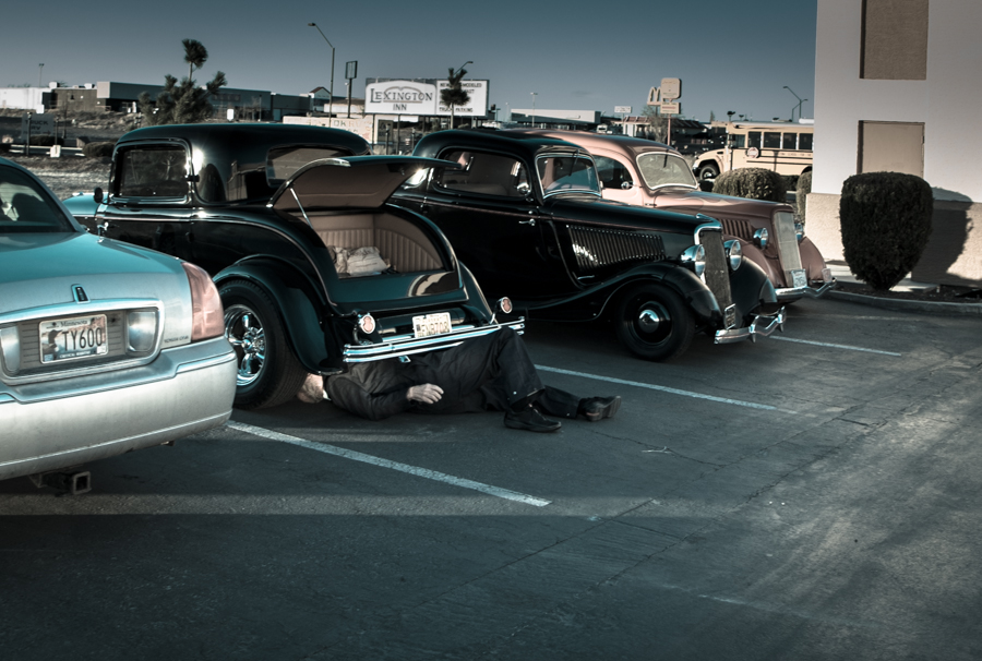
Car Club Road Trip, Holbrook, Ariz., March 2014, by John Fleck (the guy in the picture is not dead)

Car Club Road Trip, Holbrook, Ariz., March 2014, by John Fleck (the guy in the picture is not dead)

On the highway between Grants and Gallup, the only way you can tell the difference between one piñon-juniper-covered hill and the next is the big “Continental Divide” highway sign and the faux Indian curio shop. But it is, in fact, a boundary of great import, worthy of capitalization.

There’s no mention in the Law of the River – the great text of the Colorado River Compact or Simon Rifkind’s epic special master’s decision in the case of Arizona v. California – about which way a little boy’s pee might flow upon crossing the divide. And it’s pretty clear that in the arid high country of western New Mexico, the pee wouldn’t flow far at all regardless. But crossing that line late this afternoon places me quickly, somewhat arbitrarily but firmly in the Colorado River Basin.

Last night, when I flushed the toilet at home, the water made its way to the sewage treatment plant, to be counted as a Rio Grande return flow credit against Albuquerque’s water rights consumption. Tonight’s flush (I made it as far as Holbrook, on my way to Yuma for the week) is now entangled in the Law of the River.

In Memoriam: Fred Phelps

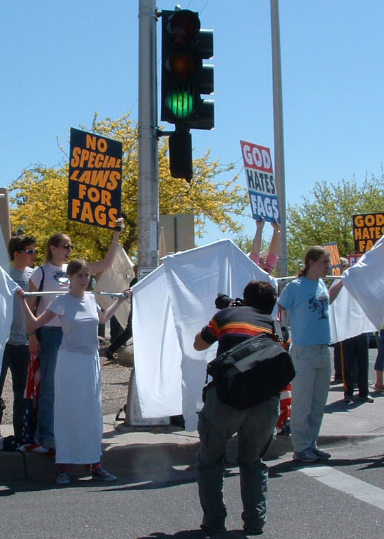
For many years, the most-read post on Inkstain was this, from April 23, 2005:

When Fred Phelps’ motley entourage came to Albuquerque, Nora and her friends made wings – big-ass wings.

The Phelpsites set up on one corner at the entrance to the University of New Mexico, and the counter-protesters set up on the other. And out of that crowd of counter-protesters emerged three angels, with these really big-ass wings.

big-ass wings

The fate of the Colorado River delta: shared blame

When I first became interested in the Colorado River delta a few years back, I wrote a piece for the newspaper explaining why I’m partly to blame for its fate:

I know the collapse of the Colorado River delta ecosystem is not entirely my fault.

But I couldn’t help but feel a little personally responsible as I had lunch in Isabella’s in Downtown Albuquerque last month with Karl Flessa. I kept glancing uncomfortably at my cup of water.

Now that the Albuquerque Bernalillo County Water Utility Authority is delivering San Juan-Chama water into our community’s water system, I was in essence drinking water that once would have made the thousand-mile journey from the mountains of southern Colorado to the Colorado River delta.


Ives in the Colorado River Delta

Ives map, courtesy Library of Congress

Ives map, courtesy Library of Congress

In 1857-58 1st Lt. Joseph Christmas Ives (ah, such a great name) conducted one of the first U.S. expeditions to map the Colorado River Delta, and figure out how to make use of it. Ives felt especially obligated to carefully document his journey “it being doubtful whether any party will ever again pursue the same line of travel,” and his report is, as a result, a delight. As he and his shipmates approached the estuary’s imprecise boundary between sea and river, they stopped at the southern end of Montague island to have a hunt:

Innumerable flocks of pelicans, curlews, plovers, and ducks of different varieties, were scattered over the flats. It was easy to shoot them, but almost impossible to get at them afterwards on account of the depth of the mud, and we started back to the schooner but little better provided with game than when we left.

It was then, indeed, a rich ecosystem.