Breaking Worse

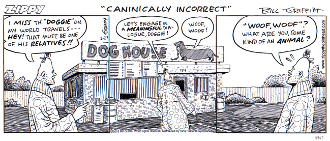
I live in Albuquerque, as does my wife, my sister and my daughter. At dinner recently, we realized that none of us watched “Breaking Bad”, which is a television program filmed in Albuquerque starring people who would be famous to us if we watched said television program. This leaves us all left out of some conversations, as apparently the actors sometimes visit favorite hot dog stands and make meth in well-known locations. But has not stopped my offspring from launching a new project in which she apparently makes shit up:

I’ve never actually seen Breaking Bad, but I’ve spent my whole sentient life living in Albuquerque, New Mexico, so I feel like I am an expert on the show. Ask me questions about it.


Stuff I wrote elsewhere: the giant rubber duck risk

OK, this was just fun:

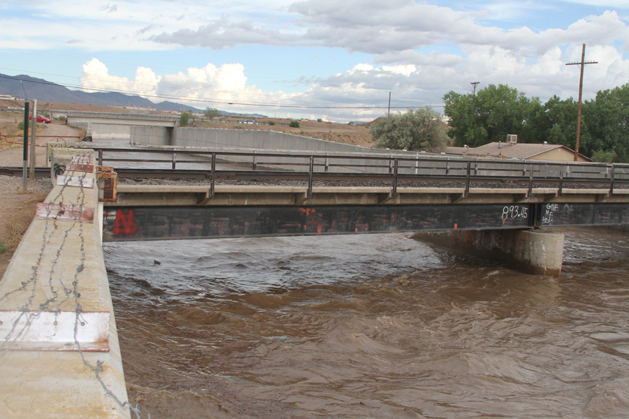
Absent a really giant floating rubber ducky, the Rail Runner bridge across Albuquerque’s main flood control channel appears to be safe.

“The thing about water that people don’t understand is that it is so powerful,” said Adrienne Martinez as she stood over water rushing beneath a scale model of the flood control channel and the Rail Runner bridge. The bridge held, intact, against a simulated flood flow larger than anything nature has yet provided since the Albuquerque system was built in the 1970s.

Until Martinez released the rubber duckies into the channel. Wham! The little toy Rail Runner train was in the drink.

“And that’s what would happen if we had really big ducks,” Martinez said with a smile.

Here’s a picture I took last July when the flood diversion channel beneath the railroad bridge was running high:

Water 10 feet deep beneath the Rail Runner bridge, July 19, 2013, by John Fleck

Water 10 feet deep beneath the Rail Runner bridge, July 19, 2013, by John Fleck

On drought and spreading risk

The anthropologist William Abruzzi wrote a fascinating essay some years ago explaining the success of early Mormon agriculture in the Little Colorado River Basin, one of the more bad-assed desert environments in which one might want to do one’s 19th century, pre-federal-irrigation-subsidy farming. Holbrook, which spans the Little Colorado, averages a bit more than 8 inches (20 cm) of rain per year, with nearly half of that falling during
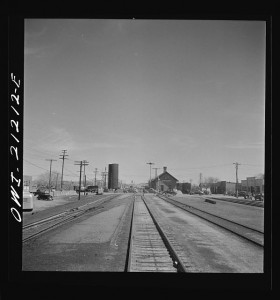
Holbrook, Arizona. Going through the town on the Atchison, Topeka and Santa Fe Railroad between Gallup, New Mexico and Winslow, Arizona. Photo by Jack Delano, courtesy Library of Congress

Holbrook, Arizona. Going through the town on the Atchison, Topeka and Santa Fe Railroad between Gallup, New Mexico and Winslow, Arizona. Photo by Jack Delano, courtesy Library of Congress

the chaotic summer thunderstorm season. But by spreading across multiple climatic zones, from the high country to the low country, and then sharing stuff among communities across the region, the early Mormons pooled their risk, according to Abruzzi:

Because the various Mormon towns were situated in widely dispersed river valleys, they generally experienced distinct schedules of variability; that is, while they all suffered the vagaries of environmental instability, they did not all experience the same instabilities simultaneously. Due to local differences in elevation, precipitation, temperature, growing season, soil quality and surface water availability, droughts, floods and other catastrophes occurred at different times and places. In addition, regional developments affected individual communities differently. For example, while higher temperatures threatened crops at Woodruff and St. Joseph by increasing evapotransporation rates throughout the lower valley, they raised the probability of a good harvest at Showlow and Alpine in the southern highlands by increasing the length of the growing season. Similarly, while cooler temperatures increased the likelihood of destructive early frosts in the southern highlands, they reduced the heat stress on crops at lower elevations and increased the prospects of a good harvest among the town in this sub-region.

This generalizes.

Consider Fitch’s recent bond rating for the Metropolitan Water District of Southern California:

Water is provided from two independent supply sources. Supply fluctuations occur on the in-state water supply, the State Water Project (SWP). The Colorado River supplies, banking arrangements, and Metropolitan’s substantial storage facilities help balance this risk. Consequently, Metropolitan has sufficient supplies to meet customer demands through at least 2014 despite statewide drought concerns.

While California’s in-state water system is suffering epic drought, Met has alternative supplies from the Colorado River Basin on which to draw, as Brett Walton recently explained in Circle of Blue:

Though it will not get much water from a state canal that moves supplies from the north to the south, Metropolitan will get a full allotment this year from the Colorado River.

Diversity of supply, from lots of different kinds of sources, reduces vulnerability to drought. Again Walton:

Many of Metropolitan’s customers are making significant investments in water treatment infrastructure that decreases its risk during drought by developing local supplies: groundwater, recycled wastewater, and capturing rainfall.

This cuts both ways. Back in 2003, when Met lost a substantial supply from the Colorado River, it was able to fall back on California’s in-state supplies.


Stuff I wrote elsewhere: New Mexico drought, Billy the Kid edition


Cracked mud for illustrative purposes only, it's only an irrigation ditch at the end of the season, but you get the idea, right?

Cracked mud for illustrative purposes only, it’s only an irrigation ditch at the end of the season, but you get the idea, right?

From the morning paper:

The last time New Mexico was (by at least one measure) this dry, Billy the Kid was shooting up the state and pueblo crops in the Rio Grande Valley were wilting.

The “one measure” in this case is consecutive dry years on the Rio Grande:

From 1873 to 1883, the Rio Grande experienced four straight dry years, had a break with an average year, then another six dry years in a row, according to University of Arizona professor Connie Woodhouse. Since that time, we haven’t had six dry years in a row until now.

Landscape, interrupted

Landscape, Interrupted I, by John Fleck

Landscape, Interrupted I, by John Fleck

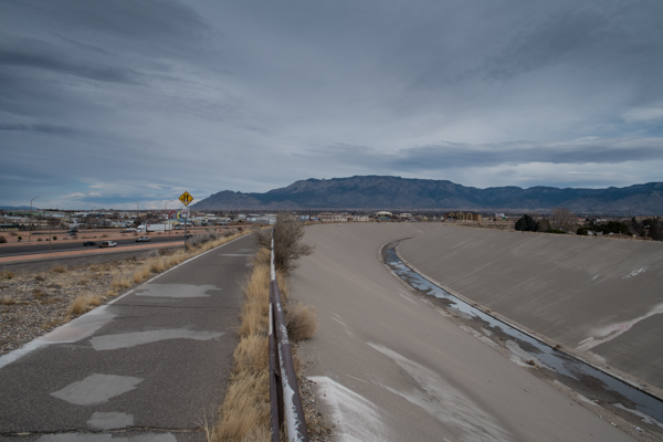
One of my favorite Albuquerque views is from the bike trail by what we call the “Big I”, the interchange of two interstates in the middle of town. The trail runs along the northwest bank of a flood control channel, and the geography is such that you’re at the highest point around, including (mostly) the freeways. The result is a nearly 360-degree horizon – the Manzano and Sandia mountains to the east, the Jemez to the north and Albuquerque’s volcanoes to the west.

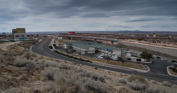
But when I stopped today to try to photograph it for this blog post instead of just enjoying it as I rolled by, I noticed something that I’d never seen before in the hundreds of times I’ve done that ride. There is a tremendous amount of city interrupting the view of the landscape. For years, my eye and brain have been clearing all that clutter away. The view of the volcanoes was the most striking example:

Landscape, Interrupted II, by John Fleck

Landscape, Interrupted II, by John Fleck

Those little bumps on the horizon, toward the right side of this picture. Those are the volcanoes. There’s a lot more city in the way than I realized.

vegetarianism, water and growth

From the Daily Herald in Provo, Utah:

“This is a very, very important issue and we are trying to offer some leadership in this regard and brought in people to give direction,” Freeze said of the summit. “We want what is best for our communities and families. We all realize that, like it or not, our region and state is going to grow. There is nothing we can do to stop that.”

Given the limited supplies of water, what ever are Utahns to do?

The experts said Utah County would have to learn to conserve water and even suggested residents might have to give up eating meat.