Stuff I Wrote Elsewhere: PCBs in the Rio Grande

Greetings from the not-so-wilds of Taos, New Mexico, where I picked up this morning’s Albuquerque Journal to find this (sub/ad req), on the surprising discovery of PCBs in the Rio Grande just downstream from the main Albuquerque storm water outfall:

If the nuclear weapons lab were responsible, dealing with this problem would be simpler. Attentive activists and state regulators are pushing hard to try to ensure the lab does not contaminate the Rio Grande, and the lab’s federal sponsors have deep pockets with which to respond.

But the Albuquerque PCB problem, which appears at this point to be far larger than any PCBs linked to Los Alamos, seems so far to be an orphan.

It’s the latest in a series of columns in which I attempt to move beyond the current discourse over environmental contamination in New Mexico, which seems to be skewed by political concerns regarding the source of contamination, rather than an assessment of where the greatest risks actually lie.

See here for the previous installment.

on blaming “drought”

A couple of stories recently caught my eye, in which “drought” is blamed for what is largely an issue of water overconsumption.

The first was a City News story on San Diego water supply. The reporter said this:

California and the Colorado River basin have been in a years-long drought, which has forced reductions in deliveries of water from the Colorado….

Wrong.

All Colorado River water contractors have received their full allotment over the past decade. As I’ve written before, despite the drought, Lake Mead (and therefore the Lower Basin) has received its full allotment of water each year of the drought.

I don’t want to be too hard on the CNS reporter who wrote this. The author was obviously just capturing what’s the conventional wisdom – which is to blame drought, rather than the fact that consumption exceeds supply.

Case study two is an AP story blaming drought for dropping levels in the Ogallala Aquifer:

Lingering drought during 2009 forced farmers to rely more on irrigation wells drilled into the Ogallala Aquifer and drew down the water at the steepest rate in a decade.

When you have to rely on overdrafting your aquifer to cope with the dry side of the natural range of variability, brother, you’ve got a consumption problem.

But it’s always easier to blame “drought.”

Stuff I Wrote Elsewhere: Kirtland Fuel Spill Update

From this morning’s paper, an update on the Kirtland Air Force Base jet fuel spill (sub/ad req.):

State regulators on Friday denied the Air Force a requested 45-day extension on a deadline to turn in plans to deal with a jet fuel spill threatening Albuquerque groundwater.

“Urgent action needs to be taken to address this threat to Albuquerque’s drinking water supply,” James Bearzi of the New Mexico Environment Department wrote in response to the request Friday afternoon.

As a compromise “in the interest of comity,” Bearzi’s letter granted Kirtland Air Force Base an extra 15 days to turn in plans for the next steps in dealing with the problem.

But in granting the extra time, Environment Secretary Ron Curry complained about repeated Air Force delays.

“We feel that there’s been sufficient time for them to respond,” Curry said in a telephone interview Friday afternoon.

California Über Alles

I had breakfast this morning with a bunch of California expats.

California Bear Flag

It’s a weird label. We don’t normally think of ourselves that way. But I’ve been feeling nostalgic about the land of my birth lately. Not sure why, but it probably has something to do with seeing palm trees, citrus groves and bougainvillea last month on my sojourn to the deserts along the Arizona-California border.

My grandma had an elegant bougainvillea that grew out of a planter box on her San Bernardino house, framing her front door. Mom’s a San Bernardino native, making my sister, Lisa, and I second generation Californians. Lisa and I grew up among citrus groves along what was then, in the 1960s, the suburban fringe of the slowly expanding Los Angeles metro area.
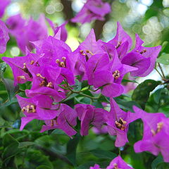
Bougainvillea, courtesy Wikipedia

Bougainvillea, courtesy Wikipedia

Like much about California, grandma’s bougainvillea seemed effortless to me. I realize now that was a mistake, that the southern California of my youth was very much an invention. But when you’re a kid, you don’t think that way. Stuff just is, and you take that for granted. In fact, the bougainvillea is a South American import, and even its lovely red “flowers” are fake. They’re really leaves which evolved the color as a sort of faux flower to attract pollinators to a tiny little flower that sits within colored leaf clusters.

The proximate cause of this morning’s musings was Emily Green’s post about the Rancho Santa Ana Botanical Gardens. It was just a few miles from my house, and Mom and Dad used to take my sister and I there all the time. I know now that Rancho Santa Ana is special, a haven for plants native to the semi-arid coast plain amid the wet climate imports that dominate the built environment of LA. But, as I said in a comment over at Emily’s, as a child I didn’t know that there was anything special about the place: “When I was a tyke, my sister and I used to shamble about gleefully in what we simply called ‘the botanic garden’. From the vantage point of childhood, there was no other.”
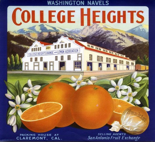
Claremont packing house orange crate label

As an adult, both when I lived there and especially now from the vantage point of 20 years away, I have come to view Southern California as one of humanity’s great creations. Gifted with tremendous natural bounty, it was then populated by people with what seems like a peculiarly self-selected inventive spirit. LA didn’t have a port, so they built one. It didn’t have water, so they built three great rivers. They grafted orange trees onto lemon root stocks and built an agricultural empire that gave way over time to one of the planet’s great supercities. I am a child of that. My grandfather drove a melon truck in the Imperial Valley in 1915 when he and grandma were first married, and went on to be the sort of real estate developing, water importing Republican who built the place.

This is, of course, nostalgia talking. It is not clear what the next steps in California’s invention might be. As Peter Raven points out in Emily’s LA Times piece:

“It makes sense that we’ll come to a point where we’re sustainable,” he said. “The question we must ask ourselves now is how long it will take and what we will lose in the process? What kind of a landing do we want to have? What kind of world do we want to live in? We need to put forth an enormous energy to keep the kind of world we really want.”

River Beat: It Could Be Worse

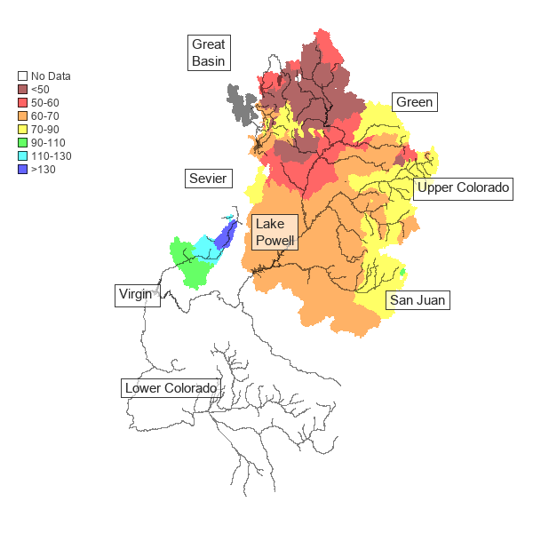
I guess the best you can say about the updated forecast for Colorado River flows for the rest of the 2010 water year is that it could have been worse.

Colorado Basin Forecast, CBRFC

Colorado Basin Forecast, CBRFC

A wet April in the northern reaches of the Colorado River basin has pushed the Lake Powell inflow forecast, out today from the Kevin Werner and the crew at the Colorado Basin River Forecast Center, to 66 percent of average. That may sound terrible (and it is), but it’s up from a 63 percent forecast a month ago.

Some other key points on the system:

  • Navajo Reservoir, in northwest New Mexico: 87 percent
  • San Juan River at Bluff: 77 percent
  • Green River at Flaming Gorge: 43 percent (yikes!)

A reminder that we’re already past the point of no return in terms of downstream releases from Lake Powell through the Grand Canyon into Lake Mead. The low inflow from the upper basin into Powell means that Mead is likely to continue to drop this year, and by the end of the year drop below Drought of the ’50s levels to reach the lowest its been since the reservoir was first filled in the 1930s.

Stuff I Wrote Elsewhere: Jet Fuel Leak

Which spill to cover?

Some environmental journalism tradecraft here. There is a nagging problem for reporters who cover contamination problems. As a society, we spill nasty shit all the time, in all sorts of places, from the sheen of oil and lead wheel weight residues on our streets to the nitrates beneath dairies to the old dry cleaners scattered across our cities to the PCBs running out municipal stormwater drains. The New Mexico Environment Department is currently monitoring 27 spills in the metro area that I know about in which hazardous contaminants have reached the groundwater.

People who work these problems for a living use a simple formula: risk equals probability times consequence. That is, what are the chances of the contaminant reaching a pathway via which it could threaten human or environmental health (probability) and how bad would it be should that happen (consequence)?

By that measure, the Kirtland Air Force Base jet fuel leak that I wrote about in yesterday’s newspaper pretty much tops the list right now in New Mexico, which is why I afforded it the treatment I did (sub/ad req):

A new estimate puts the volume of a Kirtland Air Force Base jet fuel leak at nearly 8 million gallons.

Those are Exxon Valdez-scale numbers, and the fuel is slowly creeping through the water table beneath an Albuquerque neighborhood toward municipal water wells. State officials say there are serious questions about whether the Air Force is acting quickly enough to deal with the problem.

“It’s probably the biggest groundwater contamination problem in the state right now,” said Bruce Thomson, head of the University of New Mexico’s Water Resources Program.

More than 10 years after the spill was discovered, the Air Force still does not know the full extent of the contamination, according to a sharply worded April letter from the New Mexico Environment Department to the Air Force.

The letter labels the spill “a significant threat to human health and the environment, particularly to well water in urban neighborhoods adjacent to Kirtland Air Force Base.”

There appears to be no danger to the people living on top of the spreading contamination. The real danger is to Albuquerque’s water supply. Two municipal water supply wells are in the fuel’s path. If it reaches them, the wells will have to be shut down.

On the subtleties of runoff

I took a quick dash out to see the Rio Grande yesterday at lunch. It’s easy to sit in my office and call and surf and think about water in the abstract, but it’s important to go out and see it as often as I can.

Rio Grande at Alameda, May 4, 2010

Rio Grande at Alameda, May 4, 2010

It’ s been up and down a bit over the last week because of day-by-day changes in releases from Cochiti Dam, but it’s really booming (at least for our little river) and it was fun to stand out on the bank and feel the water rushing past, all muddy and brown and looking like  a real river. This happens, of course, as warm weather melts off the snow. But there are nuances here.

Over at Ordinary High Water Mark, Coconino has a thoughtful riff on the subtleties, and how those subtleties make all the difference to the people who live on the water. The setup is a picture (click through to look) of snow on the mountains:

Mid to late March, looking west at the upper Sangre de Cristos. There was snow down to between 8-9K feet. It’s now between 9-10K feet, with bare stone showing on most of the high peaks. Most of the lower snow is now gone, and we’ve reached, essentially, the early low snow peak runoff. Many of the streams draining the Sangres have reached near bankfull. It’s hard to tell what the rest of spring will bring. A hard warm rain on the remaining snowpack will bring a rapid peak; a gradual rise in temp from now til June will slowly melt the remainder. All the folks I talk to prefer the latter. Better for towns with constrained streambanks, better for farmers dependent on acequias to water their fields, better for the riparian habitat to thrive through summer.

G.K. Gilbert and the changing Great Salt Lake

One of my favorite stories of early western water science is the clever way geologist G.K. Gilbert, in the 19th century, used the rise and fall of the Great Salt Lake as a proxy for decadal-scale climate variability. Here’s how I told the story in my book:

G.K. Gilbert, courtesy Wikipedia

G.K. Gilbert, courtesy Wikipedia

The lake has no outlent, and so the only way water leaves is by evaporation, leaving its minerals behind. When the weather is wetter, the lake’s level rises. When it’s dry, the level falls.

Gilbert gathered stories from the Mormon settlers who had lived around the lake for decades. For years at a time, he found, the lake would rise. Then for years at a time, the lake would drop. Gilbert had found the first evidence for the years-long wet spells and dry periods that would shape the lives of the European immigrants trying to make a life in the arid land.

Today things are different. The sort of hydrologic stationarity Powell and Gilbert believed in is no longer a reasonable assumption because of the effect of climate change on both evaporation rates and precipitation patterns. In addition, human consumption has altered the flow of water into the Great Salt Lake. The result, according to this Salt Lake Tribune editorial, is a changed lake:

The Great Salt Lake is shrinking, taking vital wetlands with it. While the lake level historically rises and falls dramatically, warming temperatures and dwindling snowpack could mean a permanently smaller lake. If that happens, millions of birds and other wildlife could lose vital food, shelter and nesting areas.

The average lake level is 4,200 feet above sea level. The lake now stands at 4,196.5 feet; its lowest level was 4,191.35 feet in 1963. Then the lake covered only 950 square miles, a dramatic drop from its average of about 1,700 square miles.

River Beat: Why Is Lake Mead Dropping?

Easy answer to the question asked in the title of this post, right? The last decade is the driest 10-year stretch since record keeping began on the Colorado River. Of course Lake Mead has dropped because of “drought”, right?

No.

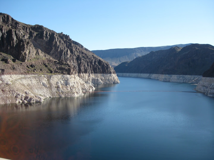
Lake Mead from Hoover Dam, April 2010

Lake Mead from Hoover Dam, April 2010

During that entire time, thanks to upstream storage and the fact that Upper Basin consumption is still relatively low, Lake Mead continued to get its entire allotment of water every year as required under the Colorado River Compact. Each and every year, 8.23 million acre feet was released from Lake Powell downstream through the Grand Canyon to Lake Mead. That’s the Upper Basin’s Compact-mandated delivery of 7.5 million acre feet, plus the Upper Basin’s share of the U.S. obligation to Mexico under the Treaty of 1944 (pdf). In fact in one of those years, 2008, Mead got extra.

Lake Powell, the upstream of the two great Colorado River reservoirs, responds to climate. Lake Mead responds to human management. Continue reading ‘River Beat: Why Is Lake Mead Dropping?’ »