Reverence or Pragmatism? The Upper Colorado River Basin’s Compact Dilemma

By Eric Kuhn and John Fleck

Unlike the Lower Colorado River Basin States, which have traditionally taken pragmatic and self-serving views of the 1922 Colorado River Compact, the Upper Basin States have largely shown the century-old document unwavering reverence.

The reverence comes from the way the agreement protected Wyoming, Colorado, Utah, and New Mexico against the avaricious impulses of fast-growing Lower Basin states, especially Arizona and California. The Compact promised water that has driven a century of development and dreaming in the Upper Basin.

Now, however, climate change-driven aridification has the Upper Basin in a vise-like squeeze.  Increasing regional temperatures are reducing the river’s natural flow while the compact imposes fixed delivery (or non-depletion) obligations on the four Upper Basin States.

The net difference between the amount of water flowing from the Upper Basin’s watersheds and the amount that must be passed to the Lower Basin at Lee Ferry is the amount that can be consumed.  As recent discussions about implications of “Alternative Management Paradigms for the Future of the Colorado and Green Rivers” by Kevin Wheeler, et al from the Colorado River Futures Project out of Utah State University have shown, state water officials from the upper river are beginning to understand that today’s law of the river places most of the future climate change risk on their states. But their fealty to the compact remains a major factor. (One of us, Eric Kuhn, is a co-author of the report. The other, John Fleck, serves on the project’s advisory committee.)

This dilemma raises the fundamental question facing the basin as it begins to negotiate the post-2026 river:

Can the law of the river, with the 1922 Compact as its cornerstone and designed for a stationary system, be interpreted in a manner that will allow the equitable sharing of the impacts of climate change among the many competing interests in the basin?

In recent months the paper’s authors have held briefings for state and federal water management agencies, water districts, and environmental NGOs. Most recently, they met (via Zoom) with representatives of the Upper Basin States under the umbrella of the Upper Colorado River Commission. Although the briefings varied in length and how deeply they got “into the weeds” concerning the modelling and science behind the study, the general messages and discussions were similar:

If future river flows are like those seen since 2000 and continue to decline due to climate change, as scientific projections suggest, the system is not sustainable through operational changes alone.

Planning for a shrinking Colorado River

Balancing the river system’s water budget will require deeper cuts in total system water use than now contemplated by the basin Drought Contingency Plans.  Further, future conservation targets and reservoir operations rules cannot be static. They will have to accommodate declining long-term average flows and increased variability.  There is a general agreement that the post-2026 guidelines should work effectively down to a mean natural flow of 11-12 million acre-feet per year. Nevada’s John Entsminger suggested 11 maf at the University of Colorado’s Getches-Wilkinson Center Conference in 2019 – one of the last and most meaningful public conversations among the basin leadership before the pandemic shut us all down. For comparison, the estimated natural flow at Lee Ferry for the current 2000-2021 period is about 12.4 maf/year.

Testing the effectiveness of new guidelines to flow levels below about 12.4 maf/year will quickly and squarely put the basin’s focus on Article III of the compact. The modeling conducted for White Paper No. 6 shows with an average flow of about 12.4 maf/year, and if the Upper Basin average annual consumptive uses do not increase (currently about 3.8 maf/year not counting CRSP evaporation), future combined storage in Lakes Mead and Powell will stabilize, but at a very low level – about 15 maf of total storage. At average flows below this level, unless Upper Basin uses or the flows at Lee Ferry are reduced (thus increasing Lower Basin shortages), total reservoir storage drops to near dead pool levels.  With an average Lee Ferry natural flow of 11 maf/year (a plausible future with aridification), and with a Lee Ferry flow target that averages 8.23 maf/year (the minimum objective release target under the 1970 long-range operating criteria and 2007 Interim Guidelines.), total Upper Basin uses would be limited to about 2.5 maf/year – about the same amount of water it was using in 1922, the year the compact was negotiated.

The only way post-2026 operating criteria work for future natural flows of 11 maf/year (and probably any flow below 12.4 maf/year), is for either the Upper Basin States to force large cuts on their existing users or to negotiate a long-term future Lee Ferry flow target well below 8.23 maf/year.

The graph under a climate change scenario with RCP4.5 emissions level – a mid-range estimate of future emissions that shows greenhouse gas emissions beginning to decline by mid-century – and a 6.5% reduction in natural flow per 1 degree C increase in temperature is shown below:

Utah State Colorado River Future Project

Either option, large cuts or a reduced flow target, will require negotiators to deal head-on with Article III of the 1922 Compact- the article that seemingly promises the Upper Basin it can use 7.5 million acre feet of water per year while simultaneously requiring the Upper Basin to send an average of 7.5 million acre feet or more of water downstream to the Lower Basin each year. In a future with a 12.4 million acre foot river, which we have now, or an 11 million acre foot river, which the best climate science suggests it would be prudent to prepare for, the math does not add up.

Some in the water community may argue that the states and Interior are only negotiating reservoir operating rules which have nothing to do with the compact. While it is true that Secretarial decisions normally include pages of legal disclaimer language stating that there is no interpretation of the Compact and most other elements of the law of the river, history tells us otherwise. One only needs to look at the history and plain language of Section 6 of the 1968 Colorado River Basin Act to understand that the 1922 Compact is front and center when the subject is the operation of Glen Canyon Dam, which sits just 15 miles upriver from Lee Ferry. Section 6 requires the Secretary to prepare long-range coordinated operating criteria and annual operating plans for Hoover Dam, Glen Canyon Dam, and the other CRSP storage reservoirs.  It also sets priorities for releases from Glen Canyon Dam. The first priority is to meet the obligation of the Upper Basin States under the Mexican Treaty, if any. This is Article III(c). The second priority is meeting the 75 maf every ten years non-depletion obligation, Article III(d), and the third priority is what we refer to as equalization, Article III(e).  Long-time Colorado Water Conservation Board Director Felix Sparks described it this way – section 6 was all about giving the Upper Basin certainty under the compact, and “we wrote every word of it.” Of course, in Felix’ day the belief was that the Colorado River at Lee Ferry was a 15 maf/year river, already not enough to meet future needs of the basin, even before climate change began taking its cut (see our book Science Be Dammed, Chapter 15).

Modifying or reinterpreting Article III of the compact to reduce long-term Glen Canyon Dam releases will require either a great deal of ingenuity, creativity, and negotiating skill (and luck) or a blunt-force legal victory in the Supreme Court. The most obvious legal approach is to challenge the Upper Basin’s assumed 750,000 af/year obligation to Mexico under Article III (c). This approach might include a claim that Lower Basin uses in excess of 8.5 maf/year, if any, are surplus waters that should be delivered to Mexico. Legal scholars have been writing about the disputed issues concerning the Upper Basin’s Mexican Treaty obligation for decades.  Many, but not all, have concluded that the Upper Basin would have an uphill fight, that such a case would quickly escalate into a broader dispute, and that the result could be that the Upper Basin must deliver more water; 750,000 af/year plus channel losses between Lee Ferry and Mexico. (See for example Jason Robison and colleagues from 2012.)

Any decision involving the future of the compact will be politically difficult. Within the Upper Basin States there are long held and deeply embedded views that the compact protects the Upper Basin from the evil water grabbers in the Lower Basin. After all, it was the upper river that opposed the Congressional authorization of the Boulder Canyon Project Act (Lake Mead) forcing the lower river to the negotiating table. The compact, mostly written by Colorado’s Delph Carpenter, preserves water for future use in the Upper Basin. Without the compact the lower basin states would command the river. When Arizona threatened the pact’s future, the Upper Basin States, led by Carpenter, devised a six-state ratification strategy. After Carpenter, Colorado’s Clifford Stone chaired the Committee of Fourteen that advised the State Department on the Mexican Treaty negotiations and led the fight for Senate ratification. When the Upper Basin states convened to negotiate their compact, Stone described their task as dividing up the waters apportioned to the Upper Basin while meeting their solemn obligations to the Lower Basin under the compact.

Contrast the Upper Basin’s history with that of Arizona and California. Arizona did not ratify the compact until 1944, only after it decided it was in its interest to do so.  Today, it boldly proclaims that its Colorado River tributaries (referred to as “in-state rivers”) are not even covered by the 1922 Compact. And, as a practical matter the river is operated that way! California today is a cooperative basin player, but it was not always so. After its major projects were completed in the 1940s, California spent much of the next 50 years opposing just about every Congressional authorization of projects that use Colorado River water in the other basin states, a blatant disregard of the intent and purposes of the compact as provided in Article I.

We must recognize that Upper Basin water officials are in a difficult situation.  They face pressures from state and local politicians who feel entitled to the supplies the Compact promised them, even if that water no longer exists – and may never have.

Thus, reconciling the various conflicting statements by Upper Basin water officials is challenging.  Some appear to both want a compact that more equitably allocates the impacts of climate change between each basin, but without changing the compact. Others acknowledge that climate change driven flow reductions and future shortages are the most challenging problems facing the basin but continue to insist that as individual states they can irrigate tens of thousands of acres of new lands in the future or develop hundreds of thousands of acre-feet of “unused entitlements.”  The political environment for addressing climate change in the individual states is quite different.

Our hope is that collectively, they will be open to a wide range of different future options and that they will pursue different options in parallel. We would also hope that one of those options is to recognize that we now have a fundamentally different river to manage than the one that their predecessors thought they had when the 1922 Compact, 1944 Treaty with Mexico, and 1948 Compacts were negotiated, therefore, managing today’s river may require breaking the chains that unnecessarily tie us to the past.

“This is climate change stealing your water.”

On a call this morning, Smart River Person made a really simple point that goes to the heart of my frustration about our current discussions about water shortfalls on the Rio Grande.

The discourse involves blaming – mostly downstream people, in this case Elephant Butte Reservoir users, blaming upstream people for mismanaging the river. You can see this really clearly in Theresa Davis’s recent Albuquerque Journal story on the Butte, but I’m hearing it all over.

SRP, with apologies for the paraphrase to broaden the context:

This isn’t upstream users stealing your water. This is climate change stealing your water.

What’s next on New Mexico’s Rio Grande – bearing witness to a drying river

Mary Harner, University of Nebraska at Kearney: field work on the Oxbow reach of the Rio Grande in Albuquerque, June 16, 2021

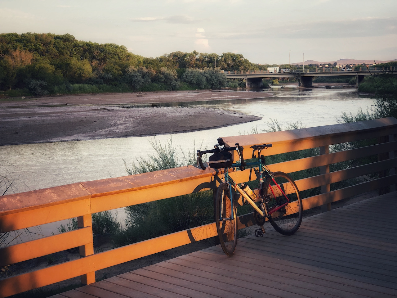
We’re having a moment right now on central New Mexico’s Rio Grande as we gird for a drying river through the Albuquerque reach for the first time since 1983. Expect drying to first start showing up below the Rio Bravo bridge sometime in July, between the bridge and the Albuquerque wastewater treatment plant, where the outfall re-wets the river down in the far south valley.

In recent years low flow-year drying has been routine in the stretch south of here, between the metro area and Elephant Butte Reservoir. But not here in town, at least since 1983.

UNM Water Resources Program student Annalise Porter has “adopted” the gauge at San Antonio, 90 miles south of here, which has been a painful but illuminating choice. Here it is last year at this time:

Last year the gauge first hit zero May 31. A bit of luck this year in the form of Memorial Day weekend rain, combined with (maybe) some clever river management by the humans (more research needed), has kept it from drying there so far. But luck and cleverness have just about run their course. We now expect drying down there soon.

I’m headed back out to the river this morning with my UNM Water Resources Program colleague Becky Bixby and our pal Mary Harner from the University of Nebraska. I first met Mary back in the late 1990s, when she was doing her doctorate at UNM studying the ecology of what we here call “the bosque” – the riverside woods through the city.

We’ve stumbled into a strategy for the bearing of witness, each picking spot on the river to watch – Annalise the San Antonio Bridge, Becky with another of our students the Los Chavez stretch near Los Lunas, my repeat photography at the Central Avenue Bridge. Becky, Mary, and I keep ending up out at the Oxbow, a bit of wetland sheltered by a bluff on the river’s west bank right in the middle of town.

Becky’s a wizard with the ecosystem at the tiniest of scales – the diatoms (a kind of algae – I call it “Becky goo”) that live in quiet waters on the edges of systems, life at the base of the food chain. As the water gets low, the Becky goo at the boundary between Oxbow wetland and river gets super interesting. (If you look closely at the picture of Mary above, you can see the bits of Becky goo clinging to the water’s edge.)

Mary’s leading us on a fascinating collaboration, and while she’s been here this week we’ve been brainstorming the paper that we hope to emerge diving into the human-river relationship, and the landscape change along its margins, over the last century. Mary and her collaborator Emma Brinley-Buckley (an amazing artist-scientist) have brought an incredible set of data visualization and communication skills to the effort (Albuquerque river nerds – OK, all river nerds – check out their work on the middle Rio Grande). But as much as we can accomplish with archives and digitized aerial imagery, there’s no substitute for getting out and getting our shoes muddy.


In a dry year, growing a new patch of Rio Grande Bosque

Baby cottonwood on a Rio Grande sandbar, Albuquerque, June 16, 2021

Mary Harner and I spent a good deal of time this morning trying to get our bearings walking along the west bank of Albuquerque’s Rio Grande near a place we call “the oxbow”.

Mary, a friend and colleague from the University of Nebraska at Kearney, has been working on a delightful river research project for the past few years, and had been popping back and forth between Kearney and Albuquerque quite a bit before The Thing shut our lives down for a year. In collaboration with my UNM biology/Water Resources colleague Becky Bixby, we’ve been thinking about how this river has changed over the last century.

Mary’s on her post-The Thing trip back this week, and we’ve been having a blast visiting sites and talking about the river.

In January 2020, during Mary’s last visit before The Thing, we walked down the concrete arroyo below Andalucia Park and out onto a big sand flat along the Rio Grande’s west bank. Repeating the walk this morning, we got a bit turned around – not lost exactly, but trying to figure out where it was that we’d walked 17 months ago was confusing.

We bushwhacked this morning through a thicket of young growth – willows, salt cedar, baby cottonwoods, and one of the nicest stands of feral alfalfa I think I’ve ever seen. We were looking for last year’s river bank and sand flat for a while before we realized the stand of new bosque we’d been bushwhacking through was the sand bar.

Because I’m a nerd that way, I was able to pull up the GPS I’d made with my sporty watch on that January 2020 walk, compare it today’s walk, and overlay it via Google Earth on old satellite photos to try to understand the progression – river->sand bar->nascent bosque.

A sandbar emerges

To the right is the path of sandbar in a Google Earth satellite image taken in February 2020, shortly after Mary and I trekked down there. The overlaid red line is our walk. (I’m sorry, I’m that guy who GPS’s his walks. But it came in handy for science!)

We were coming off of a very wet 2019, with peak flows the highest in this stretch of the river since 2005. It obviously moved a lot of sediment around, and we really need a geomorphologist or one of UNM’s river engineering people to help understand exactly what’s going on here. But whatever explains the sandbar’s emergence, it is clearly new.

Overlaying my trusty GPS walking path over past views of the river, it seems to have emerged in the wake of 2019’s high flows. This has happened before, notably in the mid-2000s during summer low flows. But it never seems to have stuck, to have developed enough vegetation to endure against the next high flows. Mostly you see a crazy GPS track that looks like John and Mary were wading in a river.

Wading in a river? Not. Satellite image from March 2004.

What’s interesting to me is what happens next. We’ve seen over the years that when vegetation establishes on these sand bars, they tend to become anchored and permanent little bits of our riverside woods. There’s an island I’ve been watching for the last 25 years up at the Alameda Bridge that has transitioned before my eyes from sand bar to lovely little forest. We like to say that without what we might call a “flood” regime – water up out of the channel during high spring flows – we won’t have cottonwood regeneration. But these sandbars and islands may be the exception?


Albuquerque to shut down river diversion, shift to groundwater

With flows in the Rio Grande dropping rapidly, Albuquerque will stop diverting drinking water from the river Friday, switching to its groundwater wells for municipal supply.

This is the second year in a row that dry conditions have so depleted the river’s flow that the Albuquerque Bernalillo County Water Utility Authority had to shut down its surface water diversion, a mix of imported Colorado River Basin water via the San Juan-Chama Project and native Rio Grande water.

Expect it to stay off, with the city using groundwater, through as late as November this year, I’m told.


Nervously watching New Mexico’s Middle Rio Grande

The Lane Lateral, left, and the Albuquerque Main running full through Albuquerque’s north valley, June 13, 2021

I got an email this morning from a friend watching as the bottom begins to drop out of the Rio Grande’s flow at a place called Otowi, north of Albuquerque. When Otowi drops, the river here in Albuquerque soon follows – one of those upstream/downstream things.

It’s been a weird year on our river – flows actually higher than all the pre-doom rhetoric about a drying Rio Grande would have suggested. But it’s deceptive.

The relative wet – “relative” because flows are still well below average, “wet” because not yet doomily low – is an artifact of water management rules. We’re at the place in the Rio Grande Compact’s tier of operating rules that mostly prevents New Mexicans from storing water in our upstream reservoirs. That means in the short term more water (because we’re not storing it behind El Vado Dam upstream on the Rio Chama) but in the medium term we’re screwed. Because once the snowmelt is gone, which it mostly is, we’ve got very little water in storage to bolster flows in the river and the irrigation system.

This is the bottom-dropping-out thing my friend was emailing about. It’s starting.

You can see it happening as the Rio Grande leaves the mountains up north in Colorado. At a place called Del Norte, the river’s flows have dropped from 4,000 cfs to 2,500 cfs in the last five days. Similarly the Rio Chama at La Puente, another gauge I watch, is dropping fast too. A lot of water management happens between those places and my river, but you can see the hurt coming.

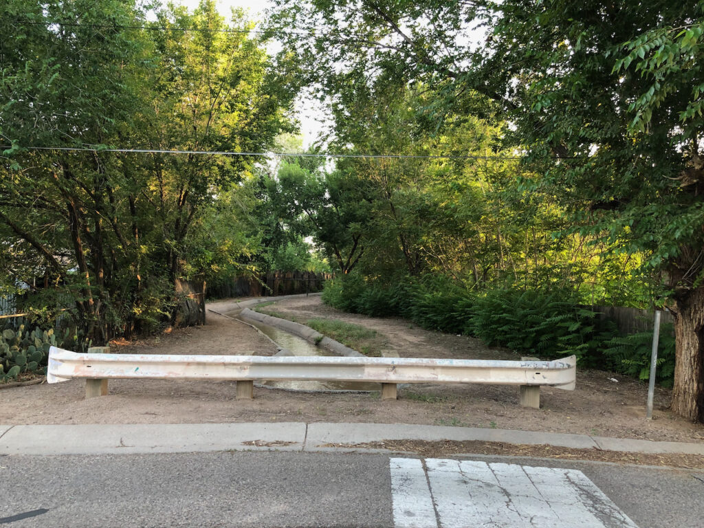
On my morning bike ride, I was talking to a guy out in his yard in Albuquerque’s far north valley, near the border with Sandia Pueblo. I’d ridden up through the empty lot next to his house to see the ditches in back, and he was out working with his horse. He wasn’t a water guy, but he knew. “They’re going to run out of irrigation water in the next couple of weeks, right?” he said. Out behind his house – and the reason I ended up prowling the empty lot where he and I found conversation – two ditches running parallel, the Lane Lateral and the Albuquerque Main, were running full. For now, folks irrigating out of those ditches can still water their yards with Rio Grande water – and it is mostly yards in that part of the city, literally categorized as “YD” on the irrigation district maps.

It’s hot today, so I was hunting shade, and these north valley neighborhoods are green with trees and cool with shade. It’s what we do with a lot our Rio Grande water – make green that’s lovely to live in (or ride my bike through).

The homes in this part of the valley are on what we call “city water” – the Albuquerque Bernalillo County Water Utility Authority – which also takes care of most of the area’s sewage. Many of the homes also have domestic wells, drilled into the shallow aquifer, to water their yards if they don’t have access to ditch water. That seems like free water in a drought when the ditches go dry, but the aquifer and the Rio Grande are closely connected. In the end, it’s all coming from the river. All this lovely green is not without tradeoffs.

Pilings from Albuquerque’s old Route 66 bridge emerge as the Rio Grande drops. June 13, 2021

In late May, I started a repeat photography project to document the Rio Grande in Albuquerque this year as we nervously await the great drying we expect. On my morning bike rides a few times a week, I take the same two pictures from the Central Avenue Bridge – one looking upstream, one across parallel to the road. You can follow it here on Twitter – I’m pretty sure you don’t have to have an actual Twitter account.

This morning for the first time, with the river at Central under 750 cubic feet per second, you could see the old bridge pilings near the river’s west bank.

“Burkholder’s Bible” – one of Albuquerque’s founding texts

The 1928 report they call “Burkholder’s Bible” – more formally “A Plan For Flood Control, Drainage and Irrigation of the Middle Rio Grande Conservancy Project” – must be treated as one of modern Albuquerque’s founding texts. Like any such text, it rewards careful reading. Also in the manner of such texts, the more you read it, the more confounding it becomes.

Burkholder’s bible

For the new book Bob Berrens and I are beginning to sketch out, we’ve been mucking our way through the question of what they were thinking back in 1928 as Albuquerque, on the brink of its charge into 20th century modernity, wrestled with the Rio Grande.

Human communities had lived comfortably with this river from “time immemorial” in the valley we now call Albuquerque – the indigenous communities tagged with the Spanish name “Pueblo”, then those self-same Spanish. Both built their villages on the high spots – near the river, but high enough to be relatively safer when the river spread across the valley floor during big spring runoffs.

As rivers do, the Rio Grande moved around. In our valley, it tended to pop back and forth between its current channel home and a corridor we now describe by its street names – “North Second, North Fourth”. In an earlier time it bore a more descriptive name – “the yazoo”. When the Rio Grande flooded in modern or near-modern times, it would temporarily reclaim the yazoo.

The early residents, the Pueblo and Spanish colonizers, used the river’s water to grow food – not a lot of it, but enough to mostly get by. To the extent agriculture was a commercially viable enterprise in our valley in the time before, it was sheep grazing in the uplands to the east and west – meat and wool. As a city grew, in the pre-refrigeration era dairies sprang up around Albuquerque’s edges.

But in Burkholder’s 1928, two inexorable forces were converging on the valley. The first was anglo-American modernity, which had started (as often did) with the arrival of a railroad, in our case the Atchison, Topeka, and Santa Fe in the 1880s. The railroad brought wage jobs and immigrants and population growth, and the homes began spilling off the high spots. You can probably see what comes next – the water.

As the human population was changing, so was the river. Perhaps because of increased sediment resulting from overgrazing, perhaps because of reduced flows because of farming upriver in the San Luis Valley of Colorado, the river’s bed was rising. With it rose the water table, and once-farmable land in the lowlands adjacent to the river became waterlogged.

North Fourth, Albuquerque, as the Rio Grande temporarily reclaims its old yazoo during the great flood year of 1929.

By the mid-1920s, surveyors reported more than half of the valley floor in the Albuquerque reach was waterlogged – water within two feet of the surface. They classified 16 percent of the valley’s floor as Some maps from the era we’ve been studying are pocked with amoeba-like outlines labeled “lake” cutting across old farm properties. “The need for drainage in the Middle Rio Grande,” Burkholder wrote, “is so self evident and so well known that little need be said in regard to.” Perhaps, but this did not slow Burkholder’s enthusiasm for the task, as his Plan laid out the elaborate scheme of a network of drains – low channels to carry off the groundwater – across the valley’s floor.

Without drainage this area will decrease year by year until the middle Rio Grande valley will become a vast swamp and the population will be forced to seek homes elsewhere.

Joseph Burkholder is an amazing character. A product of what historians call “the progressive era”, when science would be used by an elite to bring us a boundless future (see Samuel Hayes’ Conservation and the Gospel of Efficiency).

Burkholder was part of that elite. As General Superintendent of Construction and Assistant General Manager of the Metropolitan Water District of Southern California, he oversaw construction of Met’s Colorado River Aqueduct. He went on to serve as General Manager of the San Diego County Water Authority, where he went on to serve as one of San Diego’s first representatives on the Met board.

Albuquerque Journal, Feb. 6, 1933

But before all that, his first big project was here on central New Mexico’s Rio Grande, where he was chief engineer overseeing the creation of the Middle Rio Grande Conservancy District.

Today most Albuquerque discussion and discourse around the Conservancy District is about agricultural irrigation, something that did have a crucial place in Burkholder’s plan. “Urban values are dependent, to a great extent, upon the agricultural interests of the surrounding country,” Burkholder wrote. It was a moment of transition from being an agricultural nation to being an urban one, and it was hard for the progressives at that moment to see the unlinking of those two things that would follow. Cities, in their thinking, would be surrounded by farms.

This is the hard part of parsing Burkholder’s Bible. How clearly did he and his colleagues understand that they were building the foundations of an urban valley? Could they have foreseen the railroad bringing us all our food, and the falling away of commercial agriculture in the valley? Was drainage really to save waterlogged farm lands, or to pave the way for the tracts of homes that would soon pop up on the valley floor?

We treat drainage and flood control as solved problems today and don’t think about them much – “dogs that don’t bark”, to borrow from the great water policy thinker Sherlock Holmes. (The lack of a dog barking was the key to solving the mystery of the missing racehorse Silver Blaze. Holmes bids us pay attention to the dogs not barking.) Within a few years of the construction of Burkholder’s drains, the dogs of waterlogging barked no more. Flood control took longer – setting out the draglines to dig the valleys drains was easier than the dams and levees need to reduce what hey called then “the flood menace”. More things were broken in the process, some irreparably, most especially the historic Pueblo community of Cochiti.

But a quarter million people now live on that valley floor, and they don’t hear the bark of those dogs.

You can find copies of Burkholder’s Bible here.

Invest in Farm Water Conservation to Curtail Buy and Dry

Investing in land leveling – Creative Commons license CC PDM 1.0 by USDAgov.

A guest post by David Rosenberg.

David E. Rosenberg

Utah State University | david.rosenberg@usu.edu | @WaterModeler

The term buy-and-dry plays to the fears of farm and ranch communities. Wealthy urban water providers buy up water rights, dry out farms and ranches, encourage people to retire to Hawaii or other locales, and export the purchased water out of basin to growing cities. As more farmers and ranchers sell their water rights, local businesses—irrigation,  farm equipment, seed, and other agricultural firms—contract. Those contractions encourage more farmers and ranchers to sell their water rights and farms. And a negative feedback loop gains momentum and propels a tragedy where the commons—a functioning local agricultural community—disappears. Deep-pocketed public urban water providers can initiate the perverse cycle of buy and dry and so can private Wall Street investment bankers (Howe, 2021).

We can reverse the perverse cycle of buy and dry.

  1. Require farmers and ranchers that take payments for their water to invest some of that money in farm water conservation efforts, and
  2. Keep transactions temporary.

Temporary is already part of the Upper Colorado River Basin’s new conservation motto of temporary, voluntary, and compensated (Upper Colorado River Commission, 2019). Here, temporary means to lease agricultural water rights for a single year or part of a season. Next year, decide again whether to lease based on hydrologic conditions. Income from temporary water rentals can help farmers or ranchers bridge difficult years. Or they can use the lease period to upgrade equipment, level land, incorporate manure, or make other improvements that are difficult when crops are present. Temporary leases give farmers and ranchers flexibility.

When we require farmers to invest lease payments in farm water conservation, we keep the money in the local community. Farmers and ranchers will reach out to local business for help to monitor and meter flows, improve farm water delivery, purchase more drought tolerant seeds, switch to crops that increase yield with less water, or find technical assistance for conservation. Local businesses will invest proceeds from those sales in new agricultural and conservation products to serve their customers’ needs. There will be growth. Keeping payments in the local community turns the feedback loop positive. Keeping payments in the local community keeps farmers farming and ranchers ranching. A local community survives or maybe thrives.

Outside organizations that want to lease water plus the numerous canals, districts, states, and other entities that deliver water to farms and ranches have multiple reasons to require recipient farmers to invest in farm water conservation. When an outside organization requires a farmer or rancher to invest lease payments in farm water conservation, the outside organization empowers farmers or ranchers to make more water available to lease in future years. Canal companies, districts, and states that require recipient farmers to invest payments in farm water conservation keep lease payments for water within their service areas. These water management entities will also have an interest to oversee transactions, help aggregate numerous smaller transactions by their member agencies or individual users, and regulate water flows out of their service areas.

California’s 2003 Quantification Settlement Agreement (QSA) is an example of investing payments for water in agricultural water conservation. There were some good aspects of the agreement and undesired outcomes. One good aspect was that California’s Imperial and Coachella Irrigation Districts used some $1-2 billion in payments from San Diego County Water Authority and Metropolitan Water District of Southern California over 18 years to partially line the All-American canal and completely line the Coachella canal. Another good aspect was the irrigation districts used payments to recover tailwater, improve irrigation application uniformity, automate canals and farm turn outs, install soil moisture sensors, and more finely schedule water deliveries. In exchange, the urban water districts took delivery of up to 300,000 acre-feet per year of conserved water through the Colorado River aqueduct. The State of California and U.S. Federal Government also signed on to the deal. An undesired outcome was that deliveries to Imperial Irrigation District declined as did farm runoff and drainage and tailwater flows to the Salton Sea. The Salton Sea shrank. Problems of dust, outmigration, and ecosystem harm increased. The story of the 2003 Quantification Settlement Agreement is a cautionary tale to mind the system-wide effects to lease water to outside entities. Involve water organizations from the very local on up.

If individual farmers or ranchers complain that requiring them to invest in farm water conservation impacts their financial freedom, they should consider the alternatives. First, continue the status quo where there are few out-of-district compensated water transfers, temporary or permanent. Second, out-of-district transfers become more common as more and more neighbors permanently sell their farm and their water rights to cities or investment bankers.

Buy and dry sounds scary and is scary. But individual farmers and ranchers, outsider buyers, and the canals, districts, and states that manage water can work together to curtail buy and dry. These organizations can require their users or member agencies who lease water to invest some of the lease payments in farm water conservation. Investments in farm water conservation will keep money in local communities and encourage farmers and ranchers to start conserving now, build a conservation ethic, and grow conservation efforts over time.

Data Availability

No data, models, or code were generated for this blog post.

Acknowledgements

Niel Allen, Eric Kuhn, David Tarboton, and one other person who asked to remain anonymous provided comments that improved the blog post.

References

Howe, B. R. (2021). “Wall Street Eyes Billions in the Colorado’s Water.” New York Times, BU, Page 1.

Upper Colorado River Commission. (2019). “Request for Qualification-Based Proposals for Professional Services.” RFP #2019-01-UCRC.

Coming to terms with the reality of the Lower Colorado River Basin’s future water use

A guest post from Tom McCann, retired Deputy General Manager of the Central Arizona Project and a longtime leader of Arizona’s Colorado River governance. (This grew out of a comment from Tom on the blog and a subsequent email exchange.)

By Tom McCann

As we struggle with a long term management plan for water use in the Lower Colorado River Basin, we must recognize two important realities:

  • Most important, there needs to be a new “normal”—the U.S. lower basin states get something less than 7.5 maf each year (6.5? 6.8?), and only get 7.5 when reservoirs are high.
  • This problem can’t be solved on the back of Arizona’s junior status, by simply rolling back the amount of water permitted to flow down the Central Arizona Project canal. If there is any hope of consensus, then everyone will need to make reductions.

We’ve long known that the structural deficit in the Lower Basin is unsustainable. We didn’t pay much attention to it even as Lower Basin uses increased in the late 20th century because the river gave us many bountiful years. (Why worry about your annual budget when you keep winning the hydrologic lottery?) But the days of regular equalization releases are behind us now and it is time to adapt to the new reality–that there simply isn’t 9 MAF for the Lower Basin States and Mexico to expect to use each year. Neither the 2007 Guidelines nor DCP embrace that reality; both are premised on the Lower Basin using its full apportionment each year, with reductions occurring only after Lake Mead has fallen below certain levels. That approach dooms Lake Mead to perpetually hover around the 2007/DCP shortage elevations.

What is needed is a fundamental change in mindset: the Lower Basin must reduce the volume of water it uses in “normal” years to something well below 9 MAF, only taking more when and if the reservoirs fill again. The difficulty (obviously) is how to make the necessary reductions, or more precisely who is to reduce their use. Some think the entire reduction must fall on Arizona, and specifically the CAP, as the junior priority holder. As long as that opinion prevails, it is unlikely that the Lower Basin can reach agreement on a long-term solution to the structural deficit.

The structural deficit has been explained before. Three primary causes for the deficit are:  (1) the failure to account for evaporation losses at Lake Mead (around 600,000 AF per year);  (2) the failure to charge California and Arizona for the Lower Basin’s share of Mexican Treaty deliveries (750,000 AF per year) as required by section 4(a) of the Boulder Canyon Project Act; and (3) bypass flows to Mexico resulting from Reclamation’s failure to operate the Yuma Desalting Plant or to implement any other alternative (typically more than 100,000 AF per year).

Reservoir evaporation losses are the responsibility of all system users.  In the upper basin, such losses are attributed to each state in proportion to their apportionment. But the Supreme Court did not address evaporation losses in Arizona v. California so at present they are ignored in the lower basin, which means that CAP effectively bears the burden of all evaporation at Lake Mead.

Section 4(a) of the Boulder Canyon Project Act provides that when the Mexican Treaty obligation cannot be supplied out of surplus Colorado River water (and does anyone really believe there is surplus water anymore?) then California and Arizona will each provide one-half of the Lower Basin’s contribution—375,000 acre-feet each.  The legislative history of the Boulder Canyon Project Act makes clear that those contributions are to come from existing uses in each state, not from storage in Lake Mead.  Arizona Senator Carl Hayden worked hard to include that provision in the 1928 Act, but to date Reclamation has chosen to ignore it—just as it ignores the federal obligation to replace bypass flows to Mexico.

Equitable accounting for evaporative losses and Mexican Treaty deliveries would greatly improve the chances of a consensus solution to reduce consumptive uses and losses in the lower basin.

Taking climate change seriously on the Colorado River: a practical step

Preparing for climate change on the Colorado River is hard. But we will make it harder, and narrow the scope of our options for dealing with it, if we don’t incorporate realistic flow reduction scenarios in our planning efforts.

That’s the thrust of an editorial Brad Udall and I have in this week’s issue of the journal Science:

In the 1920s, E. C. LaRue, a hydrologist at the United States Geological Survey, did an analysis of the Colorado River Basin that revealed the river could not reliably meet future water demands. No one heeded his warning. One hundred years later, water flow through the Colorado River is down by 20% and the basin’s Lake Powell and Lake Mead—the nation’s two largest reservoirs—are projected to be only 29% full by 2023. This river system, upon which 40 million North Americans in the United States and Mexico depend, is in trouble. But there is an opportunity to manage this crisis. Water allocation agreements from 2007 and 2019, designed to deal with a shrinking river, will be renegotiated over the next 4 years. Will decision-makers and politicians follow the science?

The editorial draws on Brad’s work on Colorado River Basin climate change hydrology and my work, with Eric Kuhn, on the history of the use of science in decision making.

Brad and I see a risk that looks an awful lot like the situation a century ago that Eric and I sussed out in Science Be Dammed.

Then, it was the temptation to use overly optimistic flow estimates as the basis for the Colorado River Compact and the decisions that followed, creating the overallocation of the river that we struggled with now. Today, it is the risk that we will fall back on the already-low 20th century hydrology as a baseline for the modeling done in support of the renegotiation of the Colorado River management guidelines. That hydrology, as all of us know, is bad. But the latest climate science suggests we need to have plans in place to deal with worse:

As the basin’s water management community prepares for a new round of negotiations over the water allocation rules, how bad of a “worst case scenario” should be considered and who will get less water as a result? It is tempting to use today’s 20% flow decline as the new baseline—that is, modeling future reductions on the basis of what has already been observed. But only by planning for even greater declines can we manage the real economic, social, and environmental risks of running low on a critical resource upon which 40 million North Americans depend.

Our thanks to the editorial staff at Science for their interest and help with the piece.