borderlands

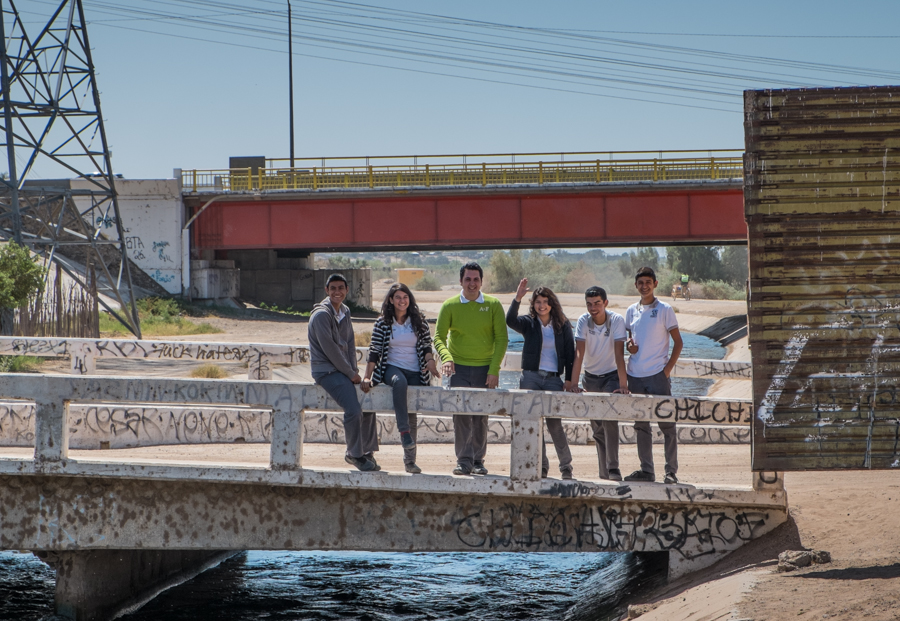
Kids on the Mexican side of the border, waving at delegation of Americans, San Luis Rio Colorado, March 28, 2014

Kids on the Mexican side of the border, waving at delegation of Americans, San Luis Rio Colorado, March 28, 2014

This is my favorite border picture from my trip last month to Arizona-California-Sonora-Baja.

You can see the old border fence on the right, one of those repurposed metal landing strip things, which as near as I can tell is where the actual border is. The big new fence is pulled back 50 yards or so from the real border, just out of the picture to the left, creating a no-man’s land in between where this magical invisible line separates those adorable preppy Mexican kids from me and the group of U.S. water managers I was tagging along with. We were all there to see the same thing (water flowing down the Colorado River, just out of the picture to the right) and we were all happy and smiling and loving it, but there was this invisible line between us.

I’ve been wanting to write about border issues, because they’re fascinating, but feeling a little sheepish because I’m such a newbie. Most of my energy in reporting on Minute 319 and the Colorado River environmental pulse flow has been focused on the Byzantine transboundary water law and policy questions, but there’s this whole other set of cultural issues associated with that invisible line, which I’m far from understanding, that are fascinating.

In the latest issue of Boom, Michael Dear writes about the feedback between lives on both sides that makes the borderlands uniquely separate, on either side, from their respective nations:

The communities along the line are far distant from the centers of political power in the nations’ capitals. They are staunchly independent and composed of many cultures with hybrid loyalties….

Mutual interdependence has always been the hallmark of cross-border lives. After the 1848 Treaty of Guadalupe Hidalgo settled the Mexican-American War, a series of binational “twin towns” sprang up along the line, developing identities that are sufficiently distinct as to warrant the collective title of a “third nation,” snugly slotted in the space between the two host countries.

Dear calls the western third of the U.S.-Mexican borderlands “Bajalta California”. William Vollman is talking about something different but conceptually overlapping when he draws the Imperial Valley in the United States and the Mexicali Valley in Mexico together into a region he calls simply “Imperial“, and then writes about with reckless abandon. For Vollman, it is all of a place, with “Northside” and “Southside” distinguishing location relative to the imaginary line. These kids, I think, live in Bajalta, or Southside Imperial, or both.

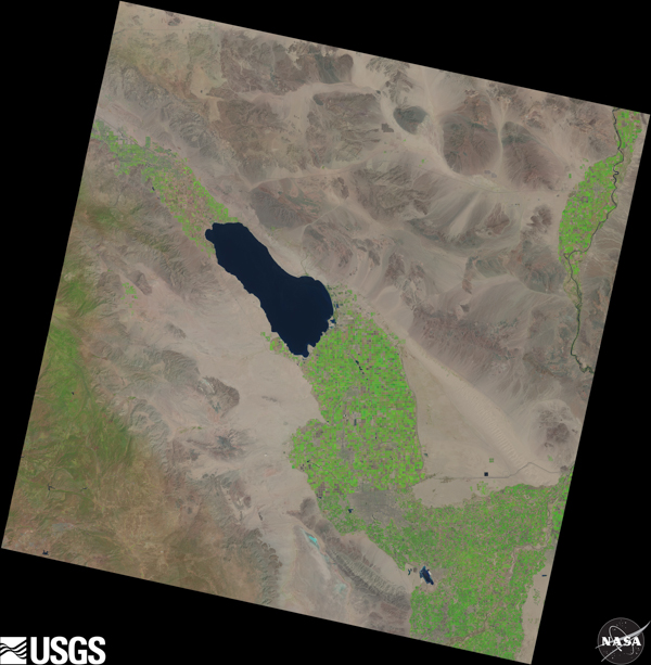
The grass does seem greener on the U.S. side of the border in this NASA Landsat image

The grass does seem greener on the U.S. side of the border in this NASA Landsat image, but Imperial and Mexicali are clearly one valley

It is impossible to understand the water piece of this story without understanding the borderness of the region – the way U.S. landowners led by Harrison Gray Otis, the publisher of the Los Angeles Times, became the largest landowners in the Mexicali Valley, and the interplay of water power politics across the imaginary line. It is impossible to understand the 21st century extension of the story without understanding the way the U.S. Endangered Species Act failed to protect critters in Mexico when the Colorado River delta was dried up, largely by human water use on the U.S. side of the border. But at least I know how to approach the problem of making sense of those historical, legal and policy questions.

Making sense of the human dimension of borderness is another thing entirely. Earlier in my week in Bajalta, I’d come up to this same spot the above picture was taken, with a helpful Border Patrol agent as tour guide. There was a Mexican family standing right about the same spot as the kids in this picture, parents and a little kid who had come out to see the water. The Border Patrol guy went up to talk to them, and they exchanged pleasantries, each on their respective sides of the invisible line. They all knew right where the line was and what it meant. It’s going to take a little more time to make sense of that.

electricity and crow

This is our 21st spring in the house on Aliso Drive, the longest (by a significant margin) that I’ve lived in the same place. The utility pole in the back corner of our yard has been at the fringe of my perception that whole time. I never completely ignored it, but I never thought much about it until the last few years when I started compiling bird lists and, more recently, taking pictures of the birds in my backyard.

Birds tend to sit on the pole and the lines attached to it. I’ve never given its functional details much thought, but today I counted 28 separate wires coming to and from the pole, which distributes electricity, telephone, cable television and Internet connectivity to three houses. Why so many?

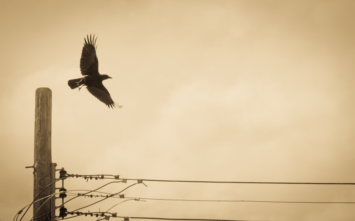
Here is a picture of an American crow, taking flight after a brief perch on the top of the pole:

Crow taking flight from perch on telephone pole, April 2014,  by John Fleck

Crow taking flight from perch on telephone pole, April 2014, by John Fleck

This might be the second in an accidental series of photos of electricity and things. I notice power lines far more in my pictures than I do directly. This has been an intriguing side effect of my new interest in photography – the things I didn’t notice that have been there all the time. Previously:

Down the Landsat rabbit hole, Albuquerque edition

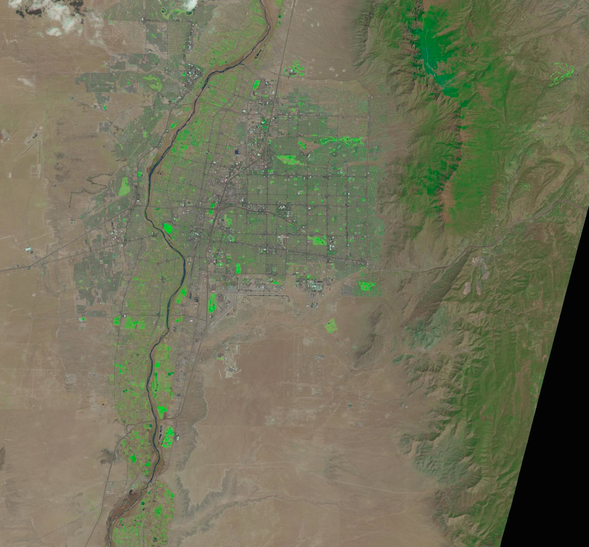
Now that I’ve figured out how to easily download NASA Landsat imagery, (thanks, USGS!) I don’t think I’m going to get much else done this weekend. It’s an amazing conceptual tool for helping to think about how water moves through western North America. Here’s Albuquerque on April 13, with the colors tweaked to highlight growing plants. Finding the metro area’s golf courses is left as an exercise for the reader:

Albuquerque as seen from space, April 13, 2014, via NASA Landsat. Colors enhanced.

Albuquerque as seen from space, April 13, 2014, via NASA Landsat. Colors enhanced.


Pulse flow, from outer space

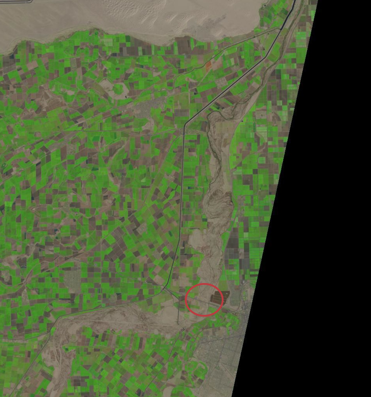
I’ve apparently got more time on my hands than skill, but I figured out, somewhat crudely, how to downland LANDSAT maps and make some pictures. Here’s the largely dry bed of the Colorado River on February 27. Apologies for the large file size, but it should have enough resolution to click and zoom if you’re able:

Colorado River, US-Mexico border, Feb. 27, 2014

Colorado River, US-Mexico border, Feb. 27, 2014

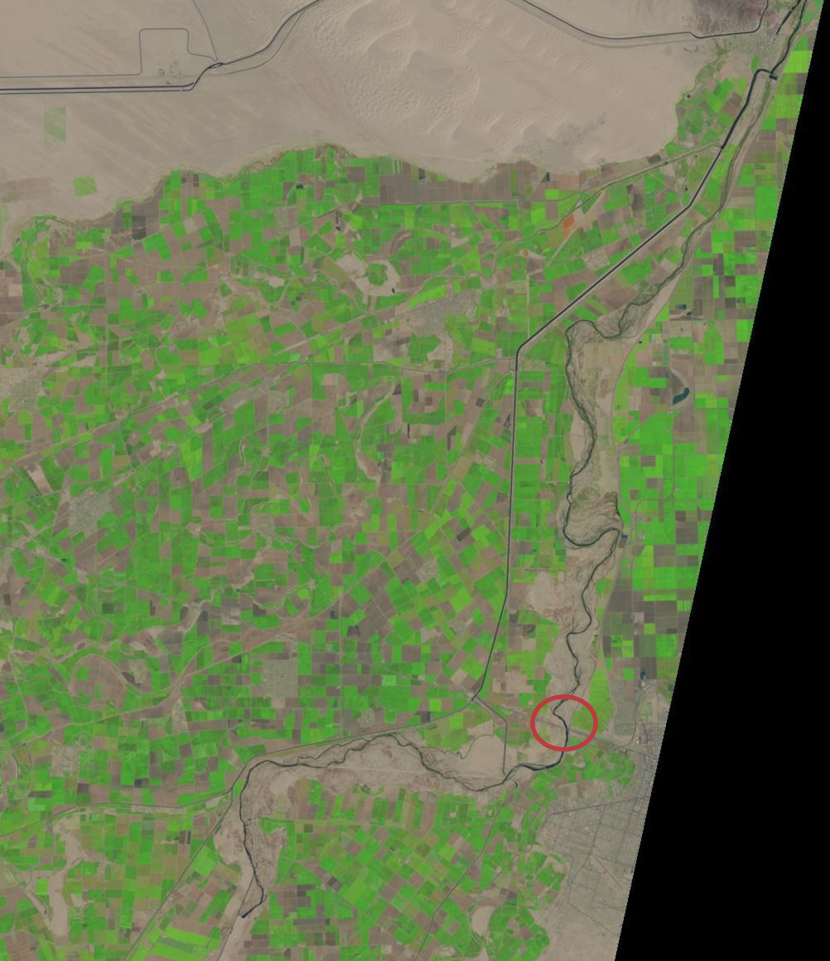
The circled bit is the San Luis bridge. Here’s roughly the same field of view on Wednesday:

Colorado River, US-Mexico border, April 16, 2014

Colorado River, US-Mexico border, April 16, 2014


Still looks like there’s water at the San Luis bridge.

Whose river is the Colorado?

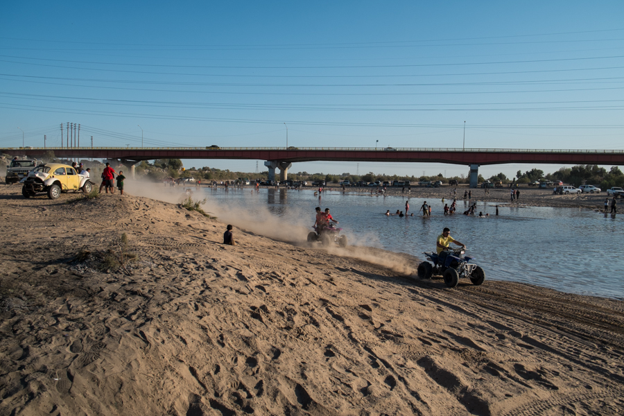
Party at San Luis as the Colorado River returns, March 25, 2014, by John Fleck

Party at San Luis as the Colorado River returns, March 25, 2014, by John Fleck

When I set up a Google News alert some years ago on the words “Colorado River”, I noticed a revealing pattern. In spring, as the weather warmed, the water management and drought news I was hoping for was increasingly mixed with stories of drunk people drowning in the river. In the fall the mix of drunks and other ill-advised recreationists tapered off.

When I was a kid growing up in the upper middle class suburbs of LA in the 1960s and ’70s, friends would take off in their campers, towing boats, for a weekend at “the river”. In his epic book A River No More, Philip Fradkin describes the “Parker Strip”, the stretch between Parker and Headgate dams on the Arizona-California border:

It is the river as theater, where each of the 125,000 weekend visitors compressed into the fourteen miles, and huddled as close as possible to the cool water, can act. To be a protagonist, rather than part of the supporting cast, one needs a sleek water-ski boat in the shape of a tapered arrowhead and powered by a jumble of chrome.

There was beer – “a million cans … can be consumed in one long holiday weekend” – and the throbbing of a disco beat at waterside taverns. “The Colorado is a charnel river at this point,” Fradkin wrote.

He tells the sad story of attempting a kayak trip with a friend from a place called Walter’s Camp, south of Blythe on the Lower Colorado, midway between the Parker Strip and the river’s end at Morelos Dam. Their attempt at a quiet paddle through exquisite desert (I know this, having paddled that stretch myself) was ruined by some three hundred motorboats in the Blythe Boat Club’s annual river regatta. It’s easy to feel sympathy for Fradkin and his friend when a water skier zooms close and sends a sheet of river water over the kayaking pair. But implicit in his argument is something that’s problematic in negotiating the terrain of Colorado River management in the 21st century.

Fradkin calls the Parker Strip “a charnel river” – a death house. But his description of the pulsing humanity is anything but. It’s alive, just with people doing things of which Fradkin disapproves. 125,000 people with their RV’s and motorboats and beer were embracing the river, just with a different set of values than Fradkin’s. This is a hard problem, because there is no a priori value for the Colorado or any river, but we get tangled up in groups who hold each set of values assuming theirs is the right one. We want it as a water supply for our farms and cities, and as a haven for motorboats, and as a place for a quiet kayak, and as a living river that is its own intrinsic value separate from the way humans might choose to use it. There’s conflict among those values, because we can’t have them all simultaneously, and Fradkin is pissy because his values have long been on the losing side.

As a child of the Sierra Club who paddled the river rather than motorboated as a youngster, my cultural sympathies long aligned with Fradkin’s. But here’s the thing I think he gets wrong. When I was a teenager, my Boy Scout troop canoed the same stretch of the river, past Walter’s Camp. It was 1973, around the same time as Fradkin’s ill-fated voyage. It was a quiet delight. But I understand now that the “river” we rode wasn’t really a river at all, but rather a water supply delivery system using the old river’s channel. The “thin veil of vegetation” along the riverside that Fradkin celebrates as he describes the river’s beauty there is really a vestige of the river’s management – what was left to grow after the spring floods were cut down by Hoover Dam to the north. It’s lovely, but ecologically and environmentally, it’s a mess. It’s not a river in any Platonic sense, but rather a human construct. Fradkin simply prefers his construct to theirs.

I took Fradkin along as my trip book last month when I went down to the delta to cover the release of the environmental pulse flow from Morelos Dam. The reason I’m so interested in the pulse flow experiment is because of the way Minute 319, the international agreement that made it possible, attempts to find some sort of common ground spanning the different value systems we have for the river. The deal has a complex mix of farm water and urban water and water for the environment, and nobody got all of what they wanted but the deal recognizes that no one set of values is right, and no one interest group can simply muscle its way to the front of the line.

And then at San Luis Río Colorado, as the border community saw substantial water flow through the usually dry river for which their town is named, I saw a remarkable spontaneous party emerge. There were environmentalists from the United States and Mexico, and scientists, and bureaucrats from the U.S. Bureau of Reclamation, and townsfolk drinking beer and tearing up and down the river’s edge in their four-wheelers. And everybody seemed happy to share the river. There was no one right way.