“practicably irrigable”

I’m on the hunt for the origins of the phrase “practicably irrigable”. If anyone has any insights, please jump in on the comments. Here’s what I know:

The concept is central to water law in the western United States. The first reference I’m able to find in the U.S. legal canon is in the 1960 recommendations of Simon Rifkind, special master to the U.S. Supreme Court, in the case of Arizona v. California. Rifkind was trying to find a path to the quantification of Native American water rights:

This brings us to the question of quantity. This is sharply debated, and many conflicting views have been advanced. I have concluded that the United States effectuated the intention to provide for the future needs of the Indians by reserving sufficient water to irrigate all of the practicably irrigable lands in a Reservation and to supply related stock and domestic uses. The magnitude of the water rights created by the United States is measured by the amount of irrigable land set aside within a Reservation, not by the number of Indians inhabiting it. (emphasis added)

The court (sort of) adopted Rifkind’s thinking:

We also agree with the Master’s conclusion as to the quantity of water intended to be reserved. He found that the water was intended to satisfy the future as well as the present needs of the Indian Reservations and ruled that enough water was reserved to irrigate all the practicably irrigable acreage on the reservations. Arizona, on the other hand, contends that the quantity of water reserved should be measured by the Indians’ “reasonably foreseeable needs,” which, in fact, means by the number of Indians. How many Indians there will be and what their future needs will be can only be guessed. We have concluded, as did the Master, that the only feasible and fair way by which reserved water for the reservations can be measured is irrigable acreage. (emphasis added)

I can find no earlier references for the explicit phrase in the U.S. legal literature. But I did find this (JSTOR gated), an article by someone named William H. Wynne about Australian land development published in 1927:

In the southeast, where practically all the scanty rivers of the continent lie, there are, within the 10-inch line, vast tracts of semiarid land. But even of this only a small proportion can ever be brought within the range of irrigation; the greater part can be slowly reclaimed only through the practice and improvement of dry-farming methods. Nevertheless, the territory which is practicably irrigable and which, in consequence, may be made to support eventually a closely settled rural population engaged in market gardening, fruit-growing, mixed or dairy farming, comprises several million acres. But irrigation is costly, and, with the burden of public debt already heavy, it must of necessity proceed slowly. (emphasis added)

It’s such a weird phrase tied to such a narrow concept that I’ve got to believe there’s some dotted line connecting Wynne and Rifkind, but I can’t find it. Can you help?

Another thing I know: “practicably” is the single most difficult to pronounce word in the English language. Really. Add “irrigable”, which ain’t easy in its own right, and you create a world of flustered law professors.

California’s drought: this is a test

California’s remarkable, looming drought conditions are a test, and via OtPR we’re seeing some clues as to who will pass:

Southern California prepared for this and has a sufficient buffer that it doesn’t need to ration this year.

And how did Southern California prepare? In part by being audacious enough and rich enough, but also clever enough, to build three different rivers from three different places. Spreading ecological risk, to borrow (I hope correctly?) from William Abruzzi’s work on the early Mormon settlements of the Little Colorado River Basin and the lessons they learned from the native communities that went before them. While California itself wilts, urbanized Southern California can count on a full supply from the Colorado River this year. Different basin, different plumbing, different risk.

This has one of the key characteristics of a wicked problem. The creation of a resilient water supply in a modern society has no clear stopping point. Our desires and needs keep changing, and our supply sources keep changing. But it will be useful this year, amid the suffering, to look around and see whose planning fell short, and whose planning paid off.

Vegas: It’s easier to conserve water if you’ve been wasting a lot to begin with

Lake Las Vegas

Lake Las Vegas, October 2010

Back in the 1980s, a researcher named Lawrence Hamilton (gated JSTOR paper here) studied water use and conservation behavior among the residents of 431 homes in Concord, New Hampshire. Concord’s a classic case – a slow, steady population increase putting pressure on supply that’s manageable during wet times but that became a problem in 1980, when the weather turned dry.

The Concord water department launched a “media blitz”, and water use dropped 15 percent:

The largest reductions in water use, in absolute terms, occurred in houses that had been using the most water to begin with.

Here’s how Janine Stone at Colorado State described it (pdf):

[I]ndividuals with pro-conservation beliefs generally had higher incomes and used more water than the general public. As a result, even though these individuals reduced their usage during drought, reductions were offset by these users’ high pre-shortage water consumption…. [W]ater savings depend not only upon consumers’ willingness to conserve, but also upon their ability to do so, given the amount of indoor and outdoor water already being used.

In his High Country News piece The Vegas Paradox (this might be gated, I’m not sure), Jonathan Thompson chronicles that desert metro area’s remarkable water conservation improvements:

Per capita water use has dropped to 219 gallons – 40 percent less than in 1989. Between 2002 and 2012, the Las Vegas Valley grew by more than 400,000 people and added 25,000 hotel rooms. Annual visitation rose by 5 million, and yet total annual water use dropped 29 billion gallons.

If you’ve been using a lot of water to begin with, conservation is an easier task.

Great Blue Heron

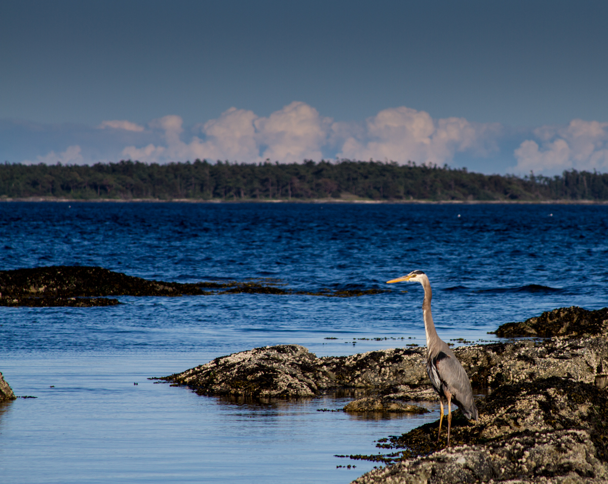
great blue heron, Victoria B.C., May 2013, by John Fleck

great blue heron, Victoria B.C., May 2013, by John Fleck

My friend Judy Liddell posted a lovely picture of a Rio Grande bosque great blue heron on her Facebook page yesterday, to which I had this comment:

I have a lot of birds for which I say “That’s my favorite bird!” But I think the great blue heron may really be my favorite, the first bird I ever got curious enough to pull out the old family bird book and figure out what it was. It was soon after Lissa and I got married, and we were in a campground on the lower Colorado River among all the RV snowbird set, and the heron was sitting on a snag in the river – seeming so regal and oblivious to the petty humans with their toys and short-term thinking. Of course that’s anthropomorphizing, but it’s my story and I’m sticking to it.

Southwest drought risk

One of the significant areas of climate research right for us in the southwestern United States involves work on modeling the large (spatially and temporally) droughts that are so significant in long term human and ecosystem dynamics. These are the ones that are not just one-year whammies, but linger for decades, like the drought of the 1950s. Such droughts drain big multi-year reservoirs and dry out the landscape in ways that are significant and lasting.

The problem, as Toby Ault and colleagues note in a new Journal of Climate paper, is that the models don’t get this right:

Instrumental and paleoclimate data indicate that natural hydroclimate fluctuations tend to be more energetic at low (multidecadal to multicentury) than at high (interannual) frequencies. State-of-the-art global climate models do not capture this characteristic of hydroclimate variability, suggesting that the models underestimate the risk of future persistent droughts.

Team Ault is developing new methodologies that integrate the model results with paleoclimate data to try to overcome this problem, and the results are not encouraging:

In the US Southwest, for instance, state-of-the-art climate model projections suggest the risk of a decade-scale megadrought in the coming century is less than 50%; our analysis suggests that the risk is at least 80%, and may be higher than 90% in certain areas. The likelihood of longer lived events (> 35 years) is between 20% and 50%, and the risk of an unprecedented 50 year megadrought is non-negligible under the most severe warming scenario (5-10%).

Stuff various people wrote elsewhere: Colorado’s ESA obligations on the Rio Grande

The status of the endangered Rio Grande silvery minnow raises some fascinating transboundary questions. As water moves across state boundaries, who bears responsibility when upstream actions affect an endangered species in a downstream state?

A nearly dry Rio Grande through Albuquerque, September 2013, by John Fleck

A nearly dry Rio Grande through Albuquerque, September 2013, by John Fleck

The fish, once found from the mountains of northern New Mexico to the Gulf of Mexico, is gone from all but the stretch of the Rio Grande between Cochiti Reservoir and Elephant Butte Reservoir in New Mexico (plus an experimental population in Big Bend National Park in Texas). Since the experimental population doesn’t really count for regulatory purposes, the real meat of the ESA action has always been in New Mexico. That’s where the remaining fish are, and therefore that’s where the legal responsibility for saving the fish lies.

The fish has already been extirpated from southern New Mexico and Texas, so those folks are off the hook. Because they’ve already killed off their minnows, they bear no responsibility for saving the rest. Upstream, Colorado has thus far borne no responsibility either. It could be argued that their water use, before the Rio Grande reaches the minnows’ current habitat, contributes to the stress on the little fish. But so far, all responsibility for maintaining the fish, and if necessary providing the water to do that, lies with water management agencies in central New Mexico.

But in an action filed this week, the environmental group WildEarth Guardians is pushing against that status quo:

Colorado’s use of Rio Grande water is depriving the river of spring flows needed to keep the endangered Rio Grande silvery minnow alive, an environmental group charged in a legal notice filed this week.

The notice by the Santa Fe-based group WildEarth Guardians opens a new legal front in the struggle over environmental flows in the Rio Grande, a struggle that until now had focused on tradeoffs among water interests within New Mexico.

UNM law professor Reed Benson lays out the key legal questions:

This would be an unusual case, but not a unique one. Most ESA cases involving harm to protected species are brought against federal agencies, under a different part of the law applicable only to them. There have been some similar cases to this one, however, where courts have held that state or local governments caused take. Notably, a federal court in Texas recently found that inadequate water management by the State of Texas took endangered whooping cranes by drying out their winter habitat. (That decision has been stayed and is now on appeal; watch this space for further developments.) These cases establish that state governments may violate section 9 if they allow private activities that result in take.

I encourage you to click through to Reed’s piece. My newspaper stories often rely on his analysis. Now you can just cut out the middleman and read him directly.

“running water which is salty”

In his book Border Oasis, Evan Ward tells the story of the transborder conflict between the United States and Mexico over salinity in the Colorado River. “Unfortunately,” Ward writes, “sometimes when one region solves its salinity problems, it creates new salinity problems for people downriver.” The conflict Ward describes began in 1961 when farmers on the U.S. side of the border began pumping water from their saline aquifer into the Gila River to create space to store fresh, clean imported Colorado River water. Needless to say, the Mexican farmers downstream, who began seeing their crops whither as a result, were none too pleased. Farmers on the U.S. side noted, correctly, that the treaty between the United States and Mexico merely specified the amount of Colorado River water we were required to deliver. The treaty, they noted, was silent on the question of whether it had to be actually usable water.  A fascinating international conflict ensued that ultimately resulted in the signing of Minute 242 to the Treaty for the Utilization of Waters of the Colorado and Tijuana Rivers and of the Rio Grande, which guaranteed minimum salinity standards for the water we deliver to our Mexican neighbors.
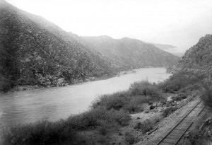
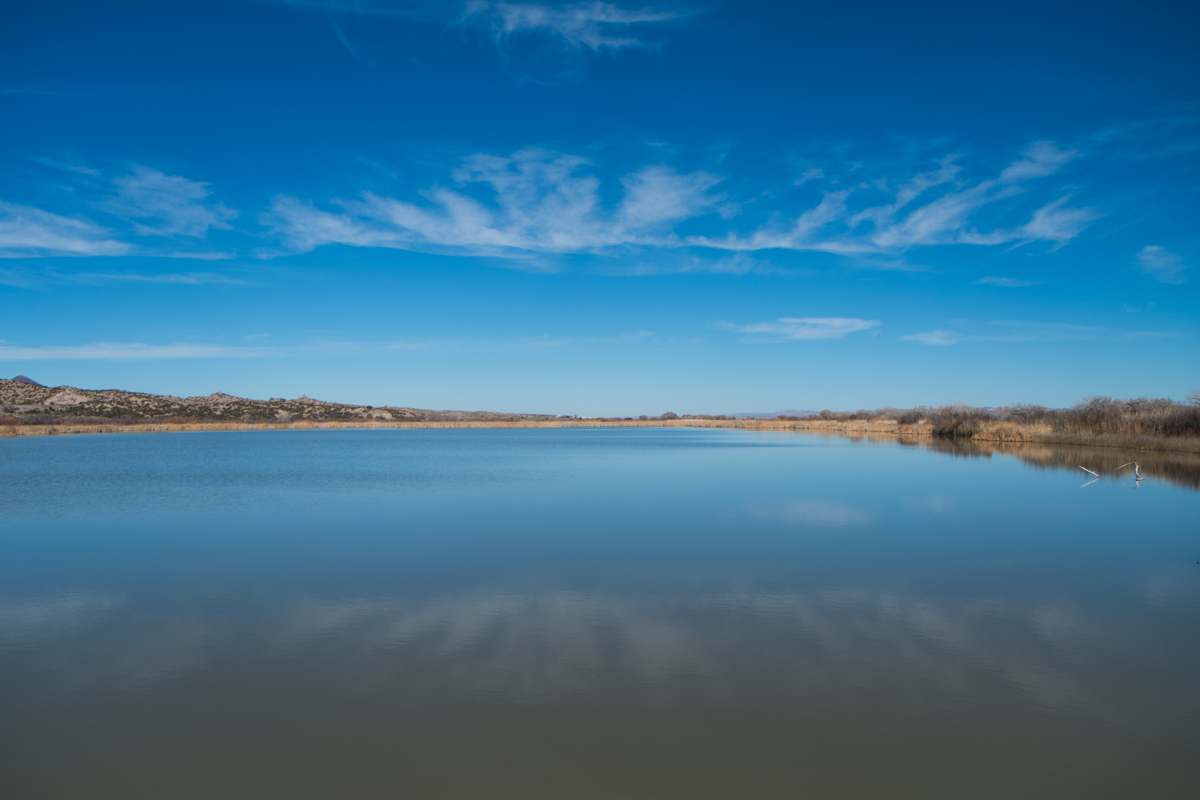
Gila River, swollen by rain, from the mouth of Mineral Creek; Photo by J.B. Umpleby. Pinal County, Arizona. 1910. courtesy USGS

Gila River, swollen by rain, from the mouth of Mineral Creek; Photo by J.B. Umpleby. Pinal County, Arizona. 1910. courtesy USGS

That’s a circuitous introduction to the point of this post, which is that the history suggests the Gila has always been a tad on the salty side. One of its main tributaries is named the “Salt River.” I’ve gotta think a river called “Salt” is up to no good.

The Gila, a desert river that rises in the mountains of southwestern New Mexico and drains a mostly desert watershed before dumping into the Colorado River just upstream from Yuma, has a longstanding reputation for icky:

What the Yumans called the stream was Hah-qua-sa-eel, with the accent on the final syllable. This can be translated as Running Water Which Is Salty.

The Spanish shortened it from the native Yuman pronunciation to Gila, pronounced “hee-la”, according to Edwin Corle’s Gila, River of the Southwest. I ran across this “running water which is salty” today in a number of references. Corle’s seems to be the earliest, and the others all seem to be quoting his words, though I’d love if anyone knows more about the origin of the name.

The snow goose problem

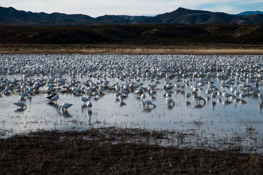
Snow geese, Bosque del Apache, New Mexico, January 2014, by John Fleck

Snow geese, Bosque del Apache, New Mexico, January 2014, by John Fleck

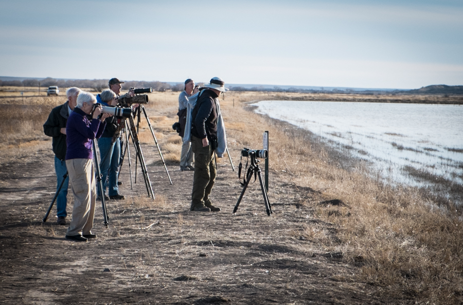
There’s no denying the spectacle of thousands of snow geese. The Jan. 17 Bosque del Apache bird count put the number at the central New Mexico refuge at 55,000. Lissa and I watched entranced this afternoon as some subset of that, many thousands strong, flew and landed and flew again in the north farm fields at the wildlife refuge along the Rio Grande south of Albuquerque.

The snow goose is a conservation success story that illustrates the difficulties of conservation success. In the early 20th century, population levels had dropped so far that hunting was restricted. Today, the problem is the opposite, as Felicity Barringer reported a couple of years ago:

Whether the cause of this population explosion is a warming trend in Northern breeding grounds, an increase in the food supply in their winter homes or a combination, few would dispute that there are too many birds in all five groups of snow geese that migrate along North America’s flyways. “Nationally, snow geese numbers are increasing exponentially,” said Dan Frisk, the manager of the Sacramento National Wildlife Refuge here. “They are destroying their own habitat.”

Their population explosion is causing problems on their summer tundra nesting grounds. Here in New Mexico, we see them up and down the Rio Grande, but especially at the Bosque del Apache, where they winter in numbers so large that they squeeze out other species. But when they gather, yowza it’s fun to watch:

photographers at Bosque del Apache north pond, January 2014, by John Fleck

photographers at Bosque del Apache north pond, January 2014, by John Fleck