Definers of Geography

Like much about New Mexico, the Rio Grande is modest, but it has its charms.

The bike is a great tool for the study of geography, because it allows you to cover sufficient ground to make generalizations, but at a sufficiently slow speed that you can get a feel for the thing.

Albuquerque started as just one of many river villages, some Anglo, some Hispanic and some Native American, strung along the Rio Grande through New Mexico’s midsection. Urban growth has mostly obliterated the rhythm of the old geography, but on two wheels and slowly, the shadows are still there.

Today I rode north with friends out of town past a string of those old villages, from Albuquerque to Alameda to Sandia Pueblo to Bernalillo, and finally up toward Algodones before we grudgingly looked at our watches and the wind direction and decided we needed to turn around.

The river once defined the place’s geography, until it was supplanted by the railroad. Today it’s the Interstate instead that serves as the anchoring feature on the landscape, and there’s a great stretch across Sandia Pueblo where there are farm fields and the river to the west, the train tracks to the east, then the Interstate up on the bluff.

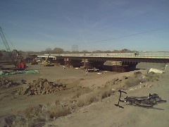
Late this afternoon, I took Mom and Dad out for a drive and we ended up back in Alameda, where there’s an old highway bridge that they left for horses, bikes and walkers when the built a modern bridge to the south. It was in the 50s, the warmest day we’ve had in a while, and the place was mobbed – people fishing in the ditches on the west side, a steady stream of bicyclists, walkers, a couple of bird people with binoculars like me, all drawn to the river on a faux spring afternoon.

The late afternoon light made the reds and yellows of the plants’ winter plumage that much redder and yellower. (Sorry for the mediocrity of the picture, all I had was the cell phone camera. It doesn’t do the scene justice.) It’s not the river’s functionality any more that defines its sense of place, the way it did when generations from prehistory built their villages here. It was just a nice place for a walk on a warm January afternoon.

updated 1/18/2010: added missing “not” to penultimate sentence

A Dry Few Months

Here in the southwestern United States, we’re gearing up for a big blast of El Nino weather, with some areas in California expecting a pounding. But as we desert dwellers dig through closets looking for our underused umbrellas, it’s worth remembering how dry it’s been. That’s percent of normal precip since Oct. 1, courtesy NOAA:

Percent Normal Precipitation, 2009-10 water year

Percent Normal Precipitation, 2009-10 water year

Chances of Extra Water for Mead Diminish

The folks at the U.S. Bureau of Reclamation have crunched the numbers on how the latest 2010 Colorado River runoff forecast will affect the river’s major storage reservoirs, and the news is not good for Lake Mead. At this point, according to the Bureau of Reclamation, there is just a one in five chance that there will be sufficient extra water upstream in Lake Powell to provide the extra supplies that would be needed to raise Mead from its near-record low levels.

The Arizona Republic’s indispensable water guy, Shawn McKinnon, explains:

Water levels at Powell aren’t expected to rise far enough during the spring runoff season to allow the government to release extra water down the Colorado into Mead, Bureau of Reclamation hydrologists said Wednesday. That will leave Mead dangerously close — within just over two feet — to the level used to trigger shortages.

Hoover Dam

Hoover Dam

Located east of Las Vegas, Nev., Mead is the holding pond for water to be used by farmers and cities in Arizona, Nevada and California. But there’s not so much water in it right now – the volume of water stored in the reservoir is roughly equal to the lowest that it’s been at this point in the year since they first filled it in the 1930s. (As of Sunday, Mead held 11.2 million acre feet of water, just 43 percent of capacity. It dropped to 11.1 maf in late December/early January 1964.) Between the amount of water consumed by those three states and the annual evaporation from the surface of the desert lake, Mead’s only hope to rise in the coming year would be a bounty of snow in the mountains that feed the Colorado.

The reason is the complex set of operating rules that govern what the Bureau calls “equalization” – the process by which excess water from Lake Powell upstream is released to help raise Mead’s levels and keep the two reservoirs roughly in balance. The Powell-Mead juggling act is needed to meet the terms of the Colorado River Compact, which splits the river’s water between upper and lower basin states. To meet the Compact’s water-sharing rules, the Bureau releases 8.23 maf from Powell each year. The problem is that all of that is used in the Lower Basin and Mexico and then some, thanks to the aforementioned evaporation.

Under the rules, Mead has a shot at some extra water. Under operating criteria adopted in 2007, if Powell’s surface looks like it will reach 3,642 feet by the end of the September 2010, that signifies “extra” water, and “equalization” – taking a little out of a fuller Powell and sending it downstream to an emptier Mead – would happen.

But at this point, according to numbers out today, there is just a 21 percent chance of that happening. That is down from the Bureau’s estimate a month ago that there was a 36 percent chance of triggering “equalization” rules in 2010.

A final decision on whether extra water will be released will be made in early April.

(picture courtesy U.S. Bureau of Reclamation)

Arizona Could See Colorado Shortage by 2012

Tony Davis reports in this morning’s Arizona Daily Star that the Central Arizona Project could see a shortage in its Colorado River allocation by 2012:

For decades, most water experts have expected the Central Arizona Project to eventually run short, as population growth outstripped the supply of the Colorado River that long ago was over-allocated among the seven states dependent on it.

Now, that day could be nearing. Officials are warning that the first CAP shortage could arrive in two years, due in part to a poor snowpack in Rocky Mountain states this winter, on top of the river basin’s worst 10-year drought on the historical record.

Colorado River: January Forecast

The January Colorado River forecast for 2009-10, out last Friday, is the lowest at this point in the year since 2002-03:

Forecast calls for low flows into Lake Powell

Forecast calls for low flows into Lake Powell

The range of uncertainty right now is enormous. In an average year, about 8 million acre feet flows into Lake Powell in the April-July period, which is the peak of the runoff season. This year’s forecast is for anywhere from 9.6 maf (the 90th percentile, the top red triangle in the graph above) to 3.2 maf (the bottom red triangle, the 10th percentile), with a median forecast of 6.2 maf (the red dot in the middle, which would be 78 percent of normal flow).

If the forecast stays low between now and April 1, that would trigger a minimum release this year from Lake Powell downstream into Lake Mead under current operating rules. That would likely mean a continued lowering of Lake Mead’s levels. Water storage in Lake Mead is currently the lowest it has been at this point in the year since the reservoir was first filled in the 1930s.

Other infobits:

  • December inflow into Lake Powell: 309 thousand acre feet, 71 percent of normal
  • January forecast inflow into Lake Powell: 330 kaf, 81 percent of normal
  • Colorado Basin snowpack: 76 percent of normal

Sources:

Water in the Desert: January Quiet


Tramway (Not So) Wetlands

Originally uploaded by heinemanfleck.

January’s a time of quiet and anticipation.

What water there is in our rivers is mostly what they call “base flow”, which is really just the surface manifestation of groundwater leaking into the river channel. Or they’re just dry.

The runoff to come is frozen in the mountains, slowly building up (or not) as winter storms move across the watersheds that, come spring, will feed the desert rivers.

If you’ve got some work to get done in a river bed, now’s a great time. My friend Andrew and I stopped at what we call “the Tramway wetlands” today when we were riding up north of town. (That’s Andrew’s bike in the right foreground of the picture.) The wetland, created by the outflow from Albuquerque’s storm water system, is a favorite of birders, a wide shallow channel where the water slows before it enters the Rio Grande. After a warm season storm, the water flows, and at the right time of year, it’s sandpiper city. Now, though, not so much. A construction crew has built a coffer dam to divert what small bits of water that come so they can rebuild the highway bridge.

To the north, the road cuts through Sandia Pueblo, where the farm fields are dormant, save some cattle subsisting on bales set aside for winter. The color palette is all soft browns, yellows and grays. It looked like even the cows were waiting for the next thing to happen, which is what January seems to be about.

Fact Check on Aisle 3

About five seconds with the google is enough to make one question the old alleged Twain chestnut:

“Whiskey’s for drinking, water’s for fighting about.”

Is that too much to ask, Mark Strassman? Especially given how not only factually wrong but conceptually misleading the reference is? Whiskey, yes, but water is frequently not for fighting about, a distinction that is critical.

(h/t Chance of Rain)

Southwest Hydrology to Close

Southwest Hydrology, the invaluable University of Arizona publication that is a frequent starting point when I’m researching an unfamiliar water topic, has lost its National Science Foundation funding and will be closed, Shaun McKinnon reports:

The magazine’s demise was announced in notes written by founding editor, Betsy Woodhouse and Gary Woodard, associate director of the UA’s SAHRA (Sustainability of semi-Arid Hydrology and Riparian Areas).

Woodard said the magazine, which has published 47 issues since its first in 2001, lost its funding from the National Science Foundation (not unexpectedly, Woodard noted) and couldn’t close the huge gap between the grants and advertising revenue.