A century ago in Colorado River Compact negotiations: Arizona, Mexico, and the afterthought of Tribal water rights

By Eric Kuhn and John Fleck

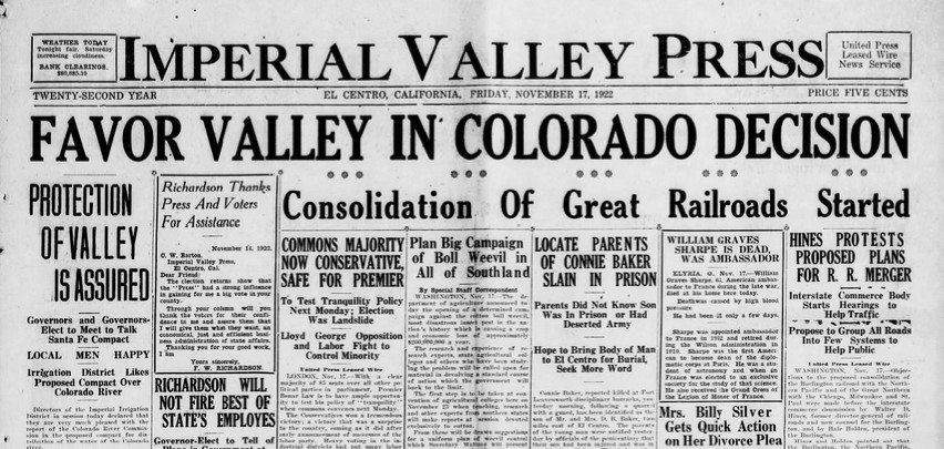
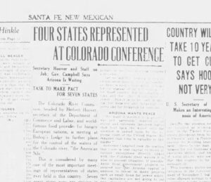
The Colorado River Basin’s eyes were on Santa Fe: Fort Collins Express, Nov. 19, 1922

After a two-day break to allow the drafters to do their work, the Colorado River Compact negotiators came back together a century ago, on Nov. 19, 1922, to wrestle with three unresolved questions:

  • water for Arizona – specifically its use of tributaries within Arizona
  • water Mexico
  • water for the basin’s Native American nations

When they returned for their Sunday morning meeting, it is apparent from the surviving Compact Commission minutes that on Saturday they either met in executive session or Hoover had met with the individual basin caucuses. Three days previously, the commissioners had agreed to 75 million acre-feet every ten years delivery at Lee’s Ferry, the provision that would make up the Compact’s Article III (d). The issue now facing the commission was how much consumptive use would be apportioned to each basin in this round and did these apportionments include uses on Arizona’s tributaries.

Arizona’s dilemma

Hoover began by reading the then-current draft version of Article III (a)

The water of the Colorado River System may be appropriated throughout the Colorado River Basin without restriction until appropriations in either the Upper Basin or the Lower Basin shall reach 7,500,000 acre-feet per annum, including present initiated rights. In that event a notice providing for a new apportionment may be issued under Article IV. If at the time of said notice the aggregate of such appropriations in either Basin shall exceed those in the other there is hereby vested in that Basin having the lesser amount a continuing and preferential right to make further appropriations until the total in each of the Basins shall be equal.  The unappropriated surplus of waters then remaining above 15,000,000 acre-feet shall be equitably apportioned under Article IV.

Hoover added that Arizona legal advisor Richard Sloan wanted additional language providing in the event the states could not agree on a new apportionment of the surplus waters, either basin could go to court to seek a judicial equitable apportionment.

Hoover then turned to Arizona’s Winfield Norviel and asked, “What do you think?”

Norviel responded, “Well, the thing don’t mean much to me. I don’t understand it at all.”

Norviel wanted more details on the 7,500,000 acre-feet and in particular “if this 7,500,000 acre-feet is to include the streams below Lee’s Ferry and things of that kind. Yesterday, we arrived at the point of excluding these. Mr. Carpenter made that statement that they were ours utterly to use as we saw fit.”

Carpenter interrupted: “No I didn’t, not for a minute.” New Mexico’s Steven Davis stepped in to support Carpenter, noting that even if Carpenter had agreed, “the Northern Sates had not.”

After restoring order, Hoover walked Norviel through his understanding of what they had agreed to, explaining that the proposed definition of the Colorado River System includes the “whole drainage basin of the Colorado River in the United States”, so yes Hoover emphasized, “the Gila and all other lower rivers are included” in the 7,500,000 acre-feet.

Norviel’ s basic problem was that he did not believe the deal on the table gave the Lower Basin enough water.  Arthur Powell Davis’s estimate for the Lower Basin was 7.45 million acre-feet – 5.1 million for the mainstem and 2.35 million for the tributaries. That left only 50,000 acre-feet for a cushion – what if Davis was wrong, what about reservoir evaporation, and what about the Lower Basin’s obligation to Mexico?

It’s easy to see why Norviel might have been confused. The Upper Basin’s offer to guarantee 65 million acre-feet every ten years at Lee Ferry did assume that the Lower Basin would have full use of its tributaries, as did Hoover’s suggestion of 82 million. What Norviel failed to recognize was that those offers were made when the commission was trying to divide the entire river two ways. Under the three-way split – Upper Basin water, Lower Basin water, and a surplus to be dealt with later – the key was limiting each Basin to a specific level of appropriations (7.5 million acre-feet of consumptive use). If Davis was wrong, then a new commission would deal with it in the future from the surplus “unapportioned” pool.

It’s also easy to see why Norviel was nervous. He now worked for a lame duck governor, Thomas Campbell. His successor, George W. P. Hunt had defeated Campbell by running against Arizona’s approval of a compact. Norviel knew that if Arizona was ever going to ratify a compact, he had to negotiate a compact with iron-clad protections for existing uses on the Gila River.

After a bit of further discussion, the Commission decided that they were at an impasse with Norviel on Article III (a) so, they decided to move onto other matters.  They spent much of the rest of the morning discussing the dispute resolution provision, now Article VI. At the end of the morning meeting, they begin to address one of their most delicate issues, water for Mexico.

Water for Mexico

Hoover opened the 20th meeting at 3:45 PM that Sunday. They began where they left off before lunch, discussing how to address water to Mexico under a future treaty. There had always been the framework of a consensus on how to address Mexico. In his compact proposal, Carpenter had suggested that each basin equally share a future Mexican burden.  Now that they had tentatively decided to set aside a surplus pool, the Commission agreed that any water for Mexico should first come from that pool but in the event the surplus was insufficient then each basin would equally share the deficiency. There was confusion among some of the Upper Basin commissioners over whether the Upper Basin’s 75 million acre-feet every ten years included water for Mexico.  With Carpenter’s help, Hoover cleared that up emphasizing that the Upper Basin’s 50% share of any deficiency would be additive to the 75 million acre-feet.

What Hoover wanted the Commission to avoid was putting something in writing in the compact that would give Mexico a future negotiating advantage when the two countries sat down to negotiate a treaty. He even suggested deleting any mention of their discussion of Mexico from the minutes – which did not happen.

After addressing Mexico, the commissioners turned their attention to addressing the priority of different uses.  Again, there was general agreement on how to proceed. Irrigation and domestic uses would be superior to power generation, and all would be superior to navigation, but getting the language right was not easy. Further, Hoover’s legal advisor Ottomar Hamele expressed concerns that Congress would not agree with them on navigation. They would come back to that issue (and Hamele was right).

Tribal water

Late in the 20th meeting Hoover raised the question the Colorado River Basin is struggling to come to grips with even today – the rights of the basin’s Native American communities. The U.S. Supreme Court had ruled 14 years earlier, in the case of Winters V. United States, that Tribes were legally entitled to significant amounts of water. And there were a significant number of Tribal communities in the Colorado Basin. But Hoover’s approach to the issue demonstrates the gap between the legal intentions of Winters and the political and cultural reality of the treatment of tribes.

In offering a proposed compact provision, Hoover referred to it as the “wild Indian Article”, demeaning language echoing a tone of superiority that was prevalent a century ago and would continue to characterize how the European settler-based water management community would address the water needs of the basin’s tribes for much of the century that followed. His language was simple: “Nothing in this compact shall be construed as effecting the rights of Indian Tribes.”  James Scrugham immediately asked. “Why include any provision in the compact?” Hoover responded “to protect the U.S. who have treaties with the Indians” adding “these treaty rights would probably exceed these rights anyway. We don’t want the question raised.” The vote on Hoover’s proposed Article failed when Wyoming’s Emerson says he wanted “to withhold his decision.”

The Commission then adjourned until 10 AM the next morning.  They had accomplished much during the two Sunday sessions, but the commissioners were not happy. They needed to find a way to address Norviel’s concerns with the apportionment Article, the primary purpose of the compact.


A century ago in Colorado River Compact Negotiations: “I wish to warn California…”

Enthusiasm in Imperial

By John Fleck and Eric Kuhn

The world outside of Bishop’s Lodge in New Mexico got its first glimpse of the nascent Colorado River Compact on in the days following the Nov. 16, 1922, meeting as Commerce Secretary Herbert Hoover briefed reporters on the barest details of what was transpiring behind closed doors.

For the first time, folks back home in the seven Colorado River Basin states saw the emergence of the idea of an “upper division” – Utah, Colorado, Wyoming, and New Mexico – and a “lower division” – Arizona, Nevada, and California.

“Definite allotment of an equal amount of the waters of the river was agreed upon between the two divisions,” wire stories out of Santa Fe reported, “and provision was made for the summoning of a second commission some years hence for the equitable division of the unallotted water, in light f the then increasing knowledge and increasing need.”

“Preference in rights for the use of water is to be established to agriculture,” reporters were told, “and none of the existing rights in the basin are disturbed.”

Enthusiasm in Imperial

For the Imperial Valley, vulnerable to flooding in the river’s southern reaches, the news was good. “The commission agreed upon the extreme agency for immediate erection of control work to protect the Imperial Valley from floods,” the wire dispatches continued.

The reaction in Imperial Valley was immediate.

“Protection of Valley is Assured”, the Imperial Valley Press headlined.

In Arizona, a lack of enthusiasm

But in addition to enthusiasm, there were warnings of the struggles to come.

“I wish to warn California right now,” Arizona Governor-elected George W.P. Hunt said in a telegram to the Arizona Republic, “and you can make it as strong as horse-radish that has just been ground, that while I am governor I am going to stick up for Arizona’s rights.”

Arizona, Hunt said, should be entitled to half of the Colorado River’s flow. “The center of the river is a state line,” Hunt said. “The center of the river is where the rights of one state cease and those of the other begin.”
The seeds of decades of conflict between Arizona and the other states of the basin were being sown, even as the Compact’s final drafting was not complete.

A century ago in Colorado River Compact negotiations: The central question is settled

By Eric Kuhn and John Fleck

On Nov. 16, 1922, the representatives of the seven Colorado River Basin states and federal lead negotiator Herbert Hoover settled what is, from today’s perspective, the most important element, of the Colorado River Compact.

Holed up a century ago at Bishop’s Lodge outside Santa Fe, New Mexico, they had come to agreement on dividing the river into “upper” and “lower” basins, with some water for each, a feature taken for granted in river management in the 21st century but new to their thinking a century ago. But they were at a stalemate on how much water the upper states would be obligated to send to the lower states.

Before adjourning the previous day’s meeting, Hoover had put a compromise proposal on the table – the Upper Basin would deliver 75 million acre-feet every consecutive ten years with a four million acre-feet minimum annual delivery. This was ten million more than the Upper basin’s 65 million acre-feet offer and seven million less than the 82 million acre-feet that the Lower Basin said they would accept.

During the 18th meeting the commissioners from both basins accepted Hoover’s offer and went far beyond that, agreeing to a set of broad principles that could be included in the compact.

The fantasy of a surplus

They also made one major change of direction. Through the end of the 17th meeting, the Commission had been focused on dividing the entire river. Carpenter had first suggested a 50/50 split at the Yuma gage (near the border with Mexico). In the most recent meetings, their focus had turned to dividing the river at Lee’s Ferry. But late Wednesday night, in executive session, or via discussions Hoover had with the individual caucuses, the commission decided to divide the river three ways – a piece for the Lower Basin, a piece for the Upper Basin, and a third surplus pool that would be apportioned at a future date.

Hoover put it this way – “In our discussions yesterday we got away from the point of view of a fifty-fifty division of the water. We set up an entirely new hypothesis. That we make, in effect, a preliminary division pending the revision of this compact. The seven and a half million acre-feet of flow rights are credited to the South, and seven and a half will be credited to the North, and at some future day a revision of the remaining water will be made or determined.”

The technical basis for a three-way split was as follows: The estimated water supply available from the river below Yuma was believed more than 20 million acre-feet annually. Arthur Powell Davis estimated that existing and future consumptive uses in the Upper Basin would total 6.5 million acre-feet annually. In the Lower Basin his estimate was 7.45 million acre-feet, 5.1 on the mainstem and 2.35 on the tributaries.

Allocating 7.5 million for each basin would cover their needs and leave a surplus of 5-6 million acre-feet to be doled out in the future. The language the Commission discussed showed that their intent was not to divide water, but rather to limit appropriations within each basin – “during the term of this compact appropriations may be made in either division with equality of right as between them up to a total of 7,500,000 acre-feet per annum for each division.”

Expanding “the basin”

The Commission discussed ten basic principles including defining the Colorado River Basin as the hydrologic drainage basin plus places within a basin states, but outside the drainage area where water could be legally used.  This made it clear that under a compact transbasin (transmountain) projects would be legal. This was crucial to negotiators forUtah, Colorado, and California. The Commission also agreed on the priority of uses. Domestic (broad definition) and agricultural uses would be superior to power generation and all superior to navigation purposes. It also agreed that the burden of a future treaty obligation would be equally shared between each basin.

The commissioners couldn’t agree on detailed language for all the principles, but still the 18th meeting ended on a euphoric note.  They all agreed that it was time to for Chairman Hoover to appoint a drafting committee.  Hoover appointed Carpenter, Steven B. Davis, Arizona Legal Advisor Richard Sloan, California Legal Advisor R.T. McKisick, and Reclamation Service Chief Counsel Attomar Hamele. Carpenter Asked that Hoover be an ex-officio member of the committee and Hoover accepted.

The drafting committee met on the afternoon of November 16th and most of the day on both November 17th and 18th.


A century ago in Colorado River Compact negotiations: How much water to send past Lee’s Ferry?

By Eric Kuhn and John Fleck

Colorado River Commission Chairman Herbert Hoover gathered the seven states’ representatives at opened at 11:00 a.m. Nov. 15, 1922, for the 17th meeting in their efforts to forge an agreement to share the Colorado River.

They had been holed up at Bishop’s Lodge outside Santa Fe for five days, wrestling with how to divide the river. By that point in the negotiations they had settled on a general framework, dividing the river into an “upper” and “lower” basin, but were stuck on the question of how much water the upper states would be required to send each year to the lower states.

Hoover intentionally set a later starting time that day to give the upper river states plenty of time to caucus among themselves to consider his proposal from the previous day that the Upper Basin deliver 82 million acre-feet every ten years plus a 4 and ½ million acre foot minimum annual flow.

Quibbling over the size of the Upper Basin’s obligation

New Mexico’s Steven B. Davis answered on behalf on the four upper states. His bottom line was that delivering 82 million put too much of the drought risk on the Upper Basin. He countered with a proposal to “guarantee” a flow of 65 million acre-feet every ten years. Davis noted that if the lower river would accept the 65 million, the upper states would negotiate an annual minimum flow.

Davis was likely chosen to be their spokesman to show that the upper river commissioners were united on this issue and their offer was not just Delph Carpenter’s, the Colorado representative who so far had monopolized the discussions.  New Mexico’s Davis went on to explain that the lowest ten-year flow at Lee’s Ferry was 155 million acre-feet, thus 82 million was more than 50% of the lowest ten-year period, which Davis put at 77 million. He acknowledged that 65 million was less than a 50-50 equal divide noting since they only had a short 20-year record, they had no idea how low future drought might go, thus even guaranteeing 65 million was risky.

Carpenter supplemented Davis by explained that moving the dividing point from Yuma to Lee’s Ferry effectively gave the lower river “all the flow of the lower streams to the territory in which they arrive.” He argued that a ten-year flow of 65 million at Lee’s Ferry plus the Lower Basin’s tributaries would be the equivalent of a fifty-fifty split. Nevada’s Scrugham added “Mr. Chairman, I suggest that we abandon the discussion of that six million five hundred-thousand-acre feet per annum which would be out of the question for the lower states to accept. We are so far apart it does not seem that we will get anywhere if this figure is not changed.” Steven Davis responded, “This is not a division, we are not dividing the waters, we are guaranteeing water.”

Arizona: allocation should be based on the needs of each basin, not an even split

Arizona’s Winfield Norviel simply reiterated his position that an equitable division should be based on the needs of each basin, not an arbitrary fifty-fifty split. He went on to say that the lower basin would accept 82 million plus a 4.5 million minimum annual flow as the basis for a compact, adding that he would accept a four million acre-feet minimum if the upper river changed its ten-year flow to a five-year flow (presumably 41 million every five years). The discussion dragged on with little give on either side. Finally, Hoover stated, “The business of the chairman is to find a medial ground. So, I am wondering if the northern states will make it seven million five hundred thousand?” Hoover suggested a ten-year delivery at Lee’s ferry of 75 million acre-feet with a 4 million acre foot annual minimum.

Before they broke for further caucusing, Wyoming’s Emerson asked about addressing the needs of Mexico. Norviel responded – “I don’t think we need to take that into consideration.” To which Carpenter countered “By eliminating the Gila and the Little Colorado and other streams, the factor of risk lies in the allocation of the Mexican Burden. We are willing to bear our share of the Mexican burden, but the sacrifice should be mutual.”  Norviel added one more compact option. He suggested the river be spilt on a equal basis at Lee’s Ferry on an annual basis based a reconstructed (AKA “natural” or “virgin” flow) river. Caldwell immediately responded that determining the river’s reconstructed flow annually would be “very difficult, impossible, practically.”

Hoover quickly adjourned the meeting so each basin could caucus. He knew that he had some challenging shuttle diplomacy ahead before they would meet again tomorrow morning.

Authors’ Note – One hundred years ago the commissioners were concerned with guaranteeing a flow based on incomplete data. We imagine that if the negotiation were being held today, the conversations would be very similar, but the risks would be due to climate change.

A century ago in Colorado River Compact negotiations: Storage, yes. But in the compact?

A 1920s-era Herbert Hoover, throwing a curve ball?

By Eric Kuhn and John Fleck

When the Colorado River Compact Commission’s members returned to negotiations on the morning of Nov. 14

, 1922, they were presented with three important questions – one which survived as language in the final compact and two which did not, but all three of which remain important to the river’s management today.

As they convened that morning at Bishop’s Lodge, outside Santa Fe, Commission Chairman Herbert Hoover laid out what he called “our three main propositions” –

  • a division of the use of the water between an upper and lower basin
  • the term of a multi-year upstream-to-downstrom flow commitment (flow at Lee’s Ferry)and a minimum delivery for any one year
  • the question of whether the compact should be made contingent on construction of large storage reservoirs on the river.

Storage, yes. But in the Compact?

The desire for dams for storage and flood control had always been one of the main drivers for the creation of a compact. The questions was whether the provisions of storage should be included in the compact itself.

Speaking that morning, Hoover observed that if the compact was made contingent on storage, “one would have more courage to arrive at quantities if they are surrounded by safeguards.” Hoover believed storage would be a safeguard and that further, with sufficient storage a minimum annual flow would not be necessary.

Hoover, using his engineering background, noted  that storage falls into two phases: storage to “equate the flow seasonally in the terms of flood control”, and second,” to equate the water over a term of years.” In the short run, in other words, they wanted a dam that could capture some of the high flood waters of spring to stretch the irrigation season later in the year. In the longer run, “over a term of years”, large storage could capture wet year flows for use in dry years.

Hoover believed the seasonal storage was probably somewhere between 5 or 6 million acre-feet and storage to equate over a term of years was probably 10 million acre-feet. He later suggested a total capacity of 18 million acre-feet in either basin.

The issue of how a compact would address storage had divided the Commission since its first meeting back in January. Carpenter, while not opposed to the construction of storage, in concept, was opposed to making a compact contingent on storage by including it as a requirement. He viewed the compact a legal document defining rights and obligations of the parties. He viewed storage as an operational detail. His position split the upper river commissioners. Utah’s R.E. Caldwell and Wyoming’s Frank C. Emerson were both open to including storage in the compact. In fact, in Caldwell made his compact proposal contingent upon six million acre-feet of storage above Lee’s Ferry.

Reminding the others of his position on storage, Carpenter noted “with a minimum flow, the whole question of storage is largely removed, is it not?”

For the remainder of the 15th meeting, the commission continued to discuss the three main propositions occasionally drifting back to issues related to storage. The two main antagonists, Carpenter and Arizona’s Winfield Norviel, remained at odds on most issues. Importantly Norviel noted that the location of storage did matter. In a prescient comment, he argued that the basin where the reservoir was located would be charged for the evaporation.

The Commission adjourned at noon to reconvene at 3 PM.

16th Meeting.

The 16th meeting began with a continued discussion of storage. While the commissioners continued their discussion, Arthur Powell Davis and Colorado Engineering Advisor R.I. Meeker were separately meeting to evaluate and report on the approximate flow at Lee’s Ferry. Davis and Meeker reported that their analysis of the river showed that on average the tributary inflows between Lee’s Ferry and Laguna Dam and the river’s natural losses in that stretch were nearly the same, therefore the flow at Lee’s Ferry was the same as the flow at Laguna Dam. The Fall Davis Report included a table of reconstructed flows at Laguna Dam showing the average flow over the period of 1899 to 1920 was 16.4 million acre-feet. Davis and Meeker went on to explain because system losses on the lower river were less during drier years (less overbank flooding which reduced evaporation), the flow at Lee’s Ferry could be up to 500,000 acre-feet more than the flow at Laguna, Likewise, during wetter years (and more overbank flooding) the flow would be 500,000 acre-feet less, but on average the flow over a period of years was the same.

The discussion turned to existing uses in the upper basin and on the Gila. Davis made it clear that Laguna Dam was upstream of the Gila River. Carpenter noted that for his compact proposal, he assumed that consumptive uses above Lee’s Ferry and on the Gila were about the same. Davis responded that upper basin depletions were more, about 2.3 million acre-feet per year, but Gila were probably less than 1.5 million acre-feet annually.

Hoover used the Davis/Meeker report to suggest a compact proposal. He suggested the upper basin deliver 82 million acre-feet every ten with a minimum annual flow of 4.5 million acre-feet per year. His proposal was based on splitting the estimated Lee’s Ferry flow (16.4 million acre-feet per year) on a fifty-fifty basis. Davis noted that 82 million acre-feet per year would be sufficient to meet the estimated lower basin mainstem uses plus provide a sufficient cushion to meet the upper basin’s share of a future delivery to Mexico. NOTE – today the ten-year obligation of Upper Division States under Articles III(c) and (d) could be as high as 82.5 million acre-feet per year.

Hoover asked the upper basin commissioners to caucus and consider his proposal, then report back tomorrow. The meeting was adjourned until Wednesday, November 14th at 11 AM.

A century ago in Colorado River compact negotiations: Where to draw the line?

Lee’s Ferry. Photo by John Fleck

By Eric Kuhn and John Fleck

As the Colorado River Compact Commission’s negotiators returned to their task on the morning of Nov. 13, 1922, the shape of the compact was beginning to emerge into view.

Colorado Compact Commission Chairman Herbert Hoover opened the meeting by returning to the unresolved question from the previous evening –  “whether we could accept a general principle of a division between the upper and lower states of the primary basis of compact?”

Arizona’s Winfield Norviel responded in the affirmative: “We in Arizona are perfectly willing to accept in principle the division of the basin into two divisions.” He went on to make it very clear that in accepting a two-basin compact, Arizona was not accepting a “fifty-fifty partition of the waters,”  adding that “I think the fifty-fifty proposition is infeasible and impossible as a matter of exactitude.”

Where to draw the line between an “upper” and “lower” basin

The discussion then turned to the point of division and the status of the Paria River. Carpenter explained that in his compact proposal, he had assumed the division would be the “old Lee’s Ferry.” Norviel the pointed out that Lee’s Ferry is just upstream of the confluence with the Paria and because of the steep canyon terrain, there were no practical gaging locations below the confluence. After a bit more discussion about gaging, Utah’s Caldwell concluded that from his perspective, the Paria River was an upper division tributary and that there was no problem with using two gages, one on the main Colorado River and a separate gage on the Paria (the situation we still have today). Hoover summarized the consensus as follows; the dividing point between the basins would be the proximate location of Lee’s Ferry, but include the Paria River, and the details would be left to a drafting committee.

But how much water should pass the chosen point?

Hoover then turned the Commission’s attention to the question of the upper river’s delivery at Lee’s Ferry. (Note that, at this point in the negotiations, the terms “Upper Basin” and “Lower Basin” were not being routinely used.  They used several similar terms interchangeably – upper and lower divisions, upper and lower territories, and upper and lower river or states.)

Hoover put it this way – “the question is whether there be a positive delivery every year, or whether there should be only a delivery of a total over ten years or over three years or over five years or any other period.”

The discussion that followed was largely a two-way dialogue between Norviel and Carpenter, interrupted occasionally by Hoover to summarize or refocus the discussion, and by Arthur Powell Davis and R.E. Caldwell to add or clarify technical points. Carpenter detailed why he picked ten years.  He thought it was the “sweet spot” – neither too short to be a problem for the upper river nor too long to be a problem for the lower river.

Carpenter explained that Norviel’s concern that a ten-year average would allow the upper river to deliver nothing for a year or more was not realistic and that development in the upper river would naturally flatten the hydrograph, a point the engineers in the room generally agreed with. Arizona’s Norviel remained skeptical, never agreeing to any period greater than three years The combination of a ten-year flow plus an annual minimum remained an attractive option for the others, especially Nevada’s James Scrugham and Wyoming’s Frank C. Emerson. Carpenter agreed in concept but opposed a suggestion the minimum be set at five million acre-feet per year.

Hoover recessed the meeting, suggesting they take a long lunch, noting it was hard to sit for two-and one-half hours. The Commission adjourned until 3 PM.

That “crackpot” Maxwell

The Commission reconvened at 3 PM. The meeting began with Secretary Stetson submitting a long letter to the record from George H. Maxwell, Executive Director of the National Reclamation Association (now the National Water Resources Association). Maxwell demanded that they delay negotiating a compact and instead turn their attention to the construction of flood control storage facilities to protect the Yuma and Imperial Valley projects. Maxwell, whom Hoover considered a “crackpot,” was one of the people he wanted to keep out of the negotiations. The Commission had adopted a policy of voting on who could join their meetings as advisors. After accepting the Maxwell letter for the record, they voted to admit L. Ward Bannister, a water attorney from Denver, as an advisor to Carpenter.

During the remainder of the afternoon, the Commission exchanged views on several topics, including the term of the compact, the status of the Gila River, and the concept of a minimum annual flow at Lee’s Ferry. Carpenter stressed his view that any minimum flow should be tied to drought in the upper river and “should result in the penalty of drought being equally distributed over the entire river system.” The meeting adjourned at 6 PM to be resumed on Tuesday morning at 10 AM.

A century ago in Colorado River Compact Negotiations: Turning to Murky Details

Delphus Carpenter. Picture courtesy Colorado State University library

By Eric Kuhn and John Fleck

As the Colorado River Compact Commission negotiators returned to their discussions for a short 8 p.m. Sunday evening meeting Nov. 12, 1922, they began trying to dive into the details of how to divide up the great river.

In trying to make the broad concept of dividing the river between a newly proposed “Upper Basin” and “Lower Basin”, they found devils in the details:

  • Where should the measurement be taken that formed the basis for the split?
  • How would a division cope with the inherent variability in the river’s annual flow?
  • Would an “Upper Basin” reservoir be needed in addition to the one being contemplated in Boulder Canyon?

Carving the Colorado River Basin in two

After Saturday’s long meeting where they heard various proposals for a compact, Sunday’s gathering was short.  The focus immediately turned to the Delph Carpenter’s two-basin proposal and most of the questions came from Arizona’s Winfield Norviel. Norviel first asked the basis for Carpenter’s proposed 50/50 split based on the river’s flow at Yuma. Carpenter, while acknowledging that it was somewhat arbitrary, said he chose Yuma to make sure the tributaries below Lee’s Ferry were included in the division and that that an equal division of the use of the river was an “equitable” division. He noted that he used the Yuma gage flows to determine how much water the upper river would have to deliver at Lee’s Ferry to achieve a 50/50 division.

How much water must pass from “upper” to “lower”?

Norviel then turned his attention to Carpenter’s proposed 62.64 million acre-feet every ten years delivery at Lee’s Ferry. He voiced concerns that the ten-year provision would not provide the lower river enough certainty – noting that the upper division would have complete control over how much water was delivered in any one year. Carpenter responded that if Norviel was concerned that they could deliver no water for seven straight years then delivering it all in three straight years, such a delivery was ‘not in the range of my thought.” Carpenter went on to note that a reservoir at (or just above) Lee’s Ferry would naturally be a “stabilizing influence for the lower territory,” but such a reservoir “would essentially be a lower division reservoir.”  At this point Nevada’s James Scrugham suggested “wouldn’t the possible objection be solved by including with the amount, a minimum flow in second feet?” Carpenter responded that he would have no objection “if you made it low enough.”

A future obligation to Mexico?

Concerning the proposal that each division deliver an equal 50% share of any future treaty delivery to Mexico, Norviel asks “is any estimate to be made of the loss by evaporation or percolation between Lee’s Ferry and the point of diversion to Mexico?”  Carpenter responded no – “it was thought that the power benefits and other benefits that would run to the lower country would offset the loss.”

The discussion of losses prompted Herbert Hoover, the Commerce Secretary and Commission chairman, to ask Carpenter if his plan “conceives a sort of fifty-fifty division of the river as it was before white man began to divert it?”  Carpenter, perhaps confused by the question, responded “it would probably result in that conclusion.”

Sorting out the numbers

Reclamation’s Arthur Powell Davis then took the opportunity to provide the commissioners with his Reclamation Service’s data on existing irrigation above Lee’s Ferry and in the Gila River drainage. According to Davis, about 1.53 million acres were being irrigated in the upper river and over 400,000 acres in the Gila, including the Salt River Project. Davis went on to conclude that at an average of 1.54 acre-feet of consumptive use, the total use above Lee’s Ferry was about 2.35 million acre-feet annually. He had no similar total for the Gila but noted that the average consumptive use per acre on the Gila was much higher than in the upper river.

Davis went on to point out that Carpenter’s estimate of 14% for the lower tributaries was too high because it included rivers that Davis thought would be in Carpenter’s upper division such as the Escalante, the Dirty Devil, and the Paria Rivers. He suggested Carpenter use 11%. Perhaps Davis was hoping that Carpenter would adjust then adjust his proposed ten-year delivery (the adjusted number would have been 67.86 million), but Carpenter remained silent.

Two-basin approach left unsettled

At the end of the meeting, Hoover asked for a vote on the concept of apportioning water between two basins. Six of the seven, all but Norviel, agreed to proceed with that approach.  Norviel said that he wanted to take more time to think about it. They adjourned until tomorrow morning at 10 AM.

A century ago in Colorado River Compact negotiations: seeds of a deal planted, but which will grow?

By Eric Kuhn and John Fleck

In the leadup to the final compact negotiations, the weather in Santa Fe had been dry. Santa Fe New Mexican, Nov. 11, 1922

With the arrival of all of the commissioners and their key advisors, the Commission got back together on Saturday morning. The purpose of this meeting had been agreed to back in early April. Each commissioner would be given the opportunity to suggest the form of a compact. Nevada’s James Scrugham suggested they go by state alphabetical order.

What followed represents a remarkable turning point in the history of the Colorado River Basin, with echoes still reverberating today.

How should the water be divided?

How should the basin be governed going forward?

How much water did they actually have to work with?

The seven states, in alphabetical order

Arizona’s Winfield Norviel went first. Norviel suggested a compact based on the application of prior appropriation on a basin-wide basis – for a limited, but unspecified period. He suggested existing rights would not be impacted, shortages should be shared on an equitable basis, and that exports out of the basin would be prohibited except for a specified amount for Colorado and Utah. Importantly Norviel suggested a three-member commission appointed by the president that would investigate disputes and determine if water was being wasted for non-economic purposes. This echoed a proposal Norviel had made at the commission’s first meeting back in January.

California’s McClure passed but suggested one of his associates might make a proposal later. It was then the turn of Delph Carpenter, Colorado’s representative.

The two-basin solution

Carpenter proposed that the beneficial consumptive use of the river be split between two basins – the moment when this monumental foundation of the river’s management, which had been first proposed by Reclamation’s Arthur Powell Davis, began to move from vague idea to concrete plan.

Carpenter referred to them as the Upper and Lower Regions, with the dividing line at Lee’s Ferry, Arizona. He proposed the split be based on the average annual flow of 17.4 million acre-feet per year from gage record at Yuma, Arizona, which is below the confluence of the Gila and Colorado Rivers. Using this gage record would give each basin 8.7 million acre-feet per year. Carpenter believed that 14% of the river’s total flow, or 2.436 million, came from tributaries below Lee’s Ferry, therefore the upper states would have to provide 62.64 million acre-feet every ten years at Lee Ferry (8.7- 2.436=6.264). Under Carpenter’s compact, each division (basin) would be responsible for 50% of a future treaty delivery obligation to Mexico. He proposed that power generation uses would be subservient to domestic and irrigation uses. Fundamental to his approach was that after a compact dividing the water between two regions was signed, the individual states in each region would get together and divide each region’s water among themselves.

Utah’s R.E Caldwell then presented his proposed compact. It was like Carpenter’s. It would divide the river into two basins at Lee’s Ferry. Prior Appropriation would generally control the river, except the Lower’ Basin’s “senior” rights at Lee’s Ferry would be limited to six million acre-feet per year (the ten-year obligation would be 60 million acre-feet, almost the same as Carpenter). Caldwell also suggested that the Upper Basin would need a reservoir of six million acre-feet above Lee’s Ferry to make his compact work.

After Caldwell presented his suggestion, Wyoming’s Emerson, Nevada’s Scrugham, and New Mexico’s Steven Davis weighed in. Scrugham indicated that he would be OK with a compact between two basins. Emerson was on the fence; he could live with either option. Davis, however, still preferred the Commission apportion water among the seven states.

California’s McClure then asked the Commission to listen to a suggestion made by advisor George Hoodenpyl, a water attorney from Long Beach, California. He suggested a compact based on dividing the use of the waters 50/50 at Lee’s Ferry, all present uses would be protected, and each basin would cede control of future development to the federal government. After clarifying that his suggestion was his and not California’s, he went on to explain that he believed the federal government was the one entity that could make decisions for the good of the region as a whole.

The commissioners then had a general discussion of what they had heard. Norviel and Carpenter dominated the discussion. Norviel believed that a 50/50 split at Lee’s Ferry would not provide enough water for the lower river. Carpenter indicated that he was now totally convinced a compact dividing water among seven states would be unworkable. He also indicated his strong opposition to the formation of a “super-agency.”

Locking in a fateful mistake – Reclamation’s overestimate of the river’s flow

Toward the end of the meeting, Reclamation’s Davis reviewed his agency’s data on water flows and water use in the basin. His main source was the Fall-Davis Report, which had been published in February. Davis told the commission that his estimate of the water available at Lee’s Ferry was 16.5 million acre-feet per year – crucially ignoring the work of the US Geological Survey’s E.C. LaRue, who (as we wrote in our book Science Be Dammed) since 1916 had been trying to warn the West’s leaders that the gage record was insufficient, ignoring known droughts in the 1800s.

LaRue had offered his services to Hoover, to attend and contribute to the Compact’s development. In a fateful decision that echoes through Colorado River history, LaRue’s offer was ignored.

Davis indicated that the losses between Lee’s Ferry and Laguna Dam were a little bit more than the inflows. The estimated flow at Laguna Dam was 16.4 million acre-feet per year, based on the Fall-Davis report. He estimated that present and future uses in the Upper Basin would total about 6.5 million acre-feet annually. In the Lower Basin, it was about 7.2-7.4 million acre-feet.

As the Commissioners ended their marathon meeting, they were still split over whether they should proceed with a two-basin or seven-state split. They decided to adjourn until 8 PM on Sunday evening.


.


A century ago in the Colorado River Compact: Converging on Santa Fe

By Eric Kuhn and John Fleck


Santa Fe New Mexican

Santa Fe, New Mexico, was off the beaten path in November 1922. That was the point.

After a logjam and a seven-month break, the Colorado River Commission finally reconvened in Santa Fe, New Mexico at the Bishops Lodge on Nov. 9, 1922, to try to find common ground for a seven-state compact to divide the waters of the Colorado River.

The Commission’s chairman, Commerce Secretary Herbert Hoover, chose to meet there because he wanted a secluded location where the commissioners and their advisors could roll up their sleeves and hammer out a compact.

The enthusiasm for a deal, and the optimism for what might follow, was palpable as leaders across the West descended on New Mexico. The obstacles were great, both technical and institutional, New Mexico’s Alamogordo Daily News reported in the days leading up to the gathering.

That all of the obstacles will be surmounted goes without saying, and doubtless in an incredible short time and during the lives of the most of the people now living a net work  (sic) of lines and irrigation ditches will run out from the Colorado river that will give rise to new industries and create thousands of acres of new areas that will support large populations.

The lodge is a few miles north of the city over what was then a very rough road. Time was short. The 1921 law authorizing the negotiations only gave the Compact Commission a year to finish its task. Only 53 days remained and as far as Hoover could tell, the commission was nowhere near an agreement.

The 10th meeting did not get off to a smooth start. First, the commissioners from California, Nevada, and Wyoming had travel problems. All seven state commissioners would not get to Santa Fe until late on Friday. Next, Hoover had a second goal in picking the smallish Bishops Lodge. He wanted to limit the size and attendance at the meeting.  In his view, the negotiations had too many camp followers, especially from California. Hearing that the lodge had booked as many as four to a room, he ordered Clarence Stetson, his aid and commission secretary, to direct the manager to reduce the guest list, limiting those staying at the lodge to two to a room. Although it upset those that were kicked out of the lodge, only a few departed Santa Fe. Instead, most decided to make the daily trek over the rough road and to Hoover’s annoyance, the state commissioners, especially California’s McClure, were reluctant to tell their state colleagues they were not welcome.

Hoover’s scheme to sequester the negotiations kept the press at bay. “The Associated Press dispatches from the conference have been meagre,” the Nevada State Journal reported as the proceedings rolled forward.

Without all the commissioners present, there was little of substance that could be accomplished pm the first day. The five commissioners decided to limit the attendance at executive sessions to the commissioners plus one legal and engineering advisor for each and any governor that might be in attendance. They then adjourned.

While the commission may not have met in seven months, they had kept in communications with each other and Stetson. Colorado’s Delph Carpenter, in many ways the Compact’s most important parent, had been especially active. He was still reeling from his state’s Supreme Court loss in the Laramie River case where the court decision applied the Doctrine of Prior Appropriation on an interstate basin. That loss in his view left the upper river states fully exposed to the big projects California already had in place or was actively planning. He and Utah’s Caldwell both had already decided they would give up on their insistence that Lower Basin projects never interfere with future water use on the upper river. Both had a new idea to share with their fellow commissioners based on dividing the use of the river’s waters between two basins and leave the dividing the water among the states to each basin.

Now they just needed to wait until everyone arrived.

a Colorado River hypothetical and an attention-getting cuss word

Lake Mead, October 2022. Photo by John Fleck

Colorado River political and policy discourse is tangled right now around an increasingly unhelpful set of questions. They involve process: Should the federal government step in and impose cuts? Should the Lower Basin states, especially Arizona and California, do more to save themselves? Should we pay farmers to fallow? How much? Should the Upper Basin contribute more cuts? What about environmental flows – will the cuts we need to make endanger our ESA coverage under the MSCP?

What about my water?

These are all worthy questions, but our entanglement with them avoids the largest and most important question: In a future with less water, what will this engineered hydraulic landscape of irrigated farms and cities look like? What do we want it to look like?

That was the point of my attention-getting quote to Grist’s Jake Bittle:

“Whether those cuts are imposed by a federal government action, or voluntary action by the states, or the fact that the reservoirs are fucking empty, they will happen,” (Fleck) told Grist.

If you’re in Las Vegas or Phoenix or Los Angeles or San Diego (or Albuquerque!), the details of which path we’re on matter, but the larger question is unchanged. You’ll have to learn to live with less Colorado River water, and you’ll succeed at that. Your city will be less green, but you’ll have enough for cooking and cleaning and brewing your morning coffee.

If you’re in Yuma or Imperial or Palo Verde, the details of which path we’re on matter, but the larger question is unchanged. We’ll still get all the yummy melons and lettuce we love (and are willing to pay for), and there will be a lot less alfalfa grown in the deserts of the Lower Colorado River.

I’ve got a far longer blog post brewing on the hard drive, as I begin to work through the details of what a “Colorado River system crash” might look like, which is the seed for the project occupying my thinking right now. We need some sense of what the alternative is to the process the Department of the Interior has launched, the process that triggered Jake Bittle’s call and my flamboyant quote, the attempt to get things back on the rails and create an orderly approach to envisioning our desired future and acting on it.

I may never post it.

“Reservoirs fucking empty” is bait to folks’ limbic systems. It wasn’t a slip. I chose my words with care. But “fight or flight” may not be what we need right now. We need to understand that we can do this – that the key to our future is not winning a fight with Arizona/California/the Feds/the Upper Basin/the farmers/the cities over who gets what’s left, but rather envisioning a future in which we all figure out how to survive and even thrive with less water.